|
Coalbrookdale Railway Station
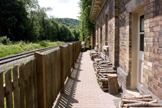
Coalbrookdale railway station is a disused station at Coalbrookdale in Shropshire, England. The station was situated on the now mothballed freight-only line between Buildwas Junction and Lightmoor Junction. The station buildings are now used by the Green Wood Centre. The Telford Steam Railway has aspirations to take possession of the up track passing through the station as part of its southern extension. The station building at Longville (another station on the Wenlock, Craven Arms and Lightmoor Extension railway) was a similar but reduced version of that at Coalbookdale. Coalbrookdale railway station is a waypoint on the South Telford Heritage Trail The South Telford Heritage Trail is a circular, waymarked walking route that passes by forty-nine heritage sites in the English town of Telford. The route The trail begins and ends in Telford Town Park and passes through the parishes of Stirc .... References Further reading * * Disused railway stations in S ... [...More Info...] [...Related Items...] OR: [Wikipedia] [Google] [Baidu] |
Coalbrookdale
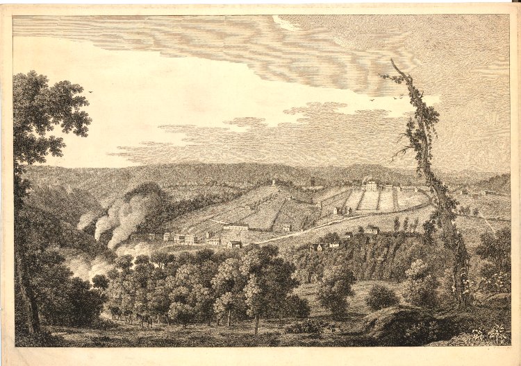
Coalbrookdale is a village in the Ironbridge Gorge in Shropshire, England, containing a settlement of great significance in the history of iron ore smelting. It lies within the civil parish called the Gorge. This is where iron ore was first smelted by Abraham Darby using easily mined "coking coal". The coal was drawn from drift mines in the sides of the valley. As it contained far fewer impurities than normal coal, the iron it produced was of a superior quality. Along with many other industrial developments that were going on in other parts of the country, this discovery was a major factor in the growing industrialisation of Britain, which was to become known as the Industrial Revolution. Today, Coalbrookdale is home to the Ironbridge Institute, a partnership between the University of Birmingham and the Ironbridge Gorge Museum Trust offering postgraduate and professional development courses in heritage. Before Abraham Darby Before the Dissolution of the Monasteries, Madeley ... [...More Info...] [...Related Items...] OR: [Wikipedia] [Google] [Baidu] |
Former Great Western Railway Stations
A former is an object, such as a template, gauge or cutting die, which is used to form something such as a boat's hull. Typically, a former gives shape to a structure that may have complex curvature. A former may become an integral part of the finished structure, as in an aircraft fuselage, or it may be removable, being using in the construction process and then discarded or re-used. Aircraft formers Formers are used in the construction of aircraft fuselage, of which a typical fuselage has a series from the nose to the empennage, typically perpendicular to the longitudinal axis of the aircraft. The primary purpose of formers is to establish the shape of the fuselage and reduce the column length of stringers to prevent instability. Formers are typically attached to longerons, which support the skin of the aircraft. The "former-and-longeron" technique (also called stations and stringers) was adopted from boat construction, and was typical of light aircraft built until the a ... [...More Info...] [...Related Items...] OR: [Wikipedia] [Google] [Baidu] |
Ironbridge Gorge
The Ironbridge Gorge is a deep gorge, containing the River Severn in Shropshire, England. It was first formed by a glacial overflow from the long drained away Lake Lapworth, at the end of the last ice age. The deep exposure of the rocks cut through by the gorge exposed commercial deposits of coal, iron ore, limestone and fireclay, which enabled the rapid economic development of the area during the early Industrial Revolution. Originally called the Severn Gorge, the gorge now takes its name from its famous Iron Bridge, the first iron bridge of its kind in the world, and a monument to the industry that began there. The bridge was built in 1779 to link the industrial town of Broseley with the smaller mining town of Madeley and the growing industrial centre of Coalbrookdale. There are two reasons the site was so useful to the early industrialists. The raw materials, coal, iron ore, limestone and clay, for the manufacture of iron, tiles and porcelain are exposed or easily mined ... [...More Info...] [...Related Items...] OR: [Wikipedia] [Google] [Baidu] |
Green Bank Halt Railway Station
Green Bank Halt railway station was a station in Coalbrookdale, Shropshire Shropshire (; alternatively Salop; abbreviated in print only as Shrops; demonym Salopian ) is a landlocked historic county in the West Midlands region of England. It is bordered by Wales to the west and the English counties of Cheshire to th ..., England. The station was opened in 1934 and closed in 1962. References Further reading * Disused railway stations in Shropshire Railway stations in Great Britain opened in 1934 Railway stations in Great Britain closed in 1962 Former Great Western Railway stations {{WestMidlands-railstation-stub ... [...More Info...] [...Related Items...] OR: [Wikipedia] [Google] [Baidu] |
Wellington To Craven Arms Railway
The Wellington to Craven Arms Railway was formed by a group of railway companies that eventually joined the Great Western Railway family, and connected Wellington, Shropshire and Shifnal, with Coalbrookdale, Buildwas, Much Wenlock and a junction near Craven Arms. Its objectives were dominated by the iron, colliery and limestone industries around Coalbrookdale. The route sections that together formed the network were * the Shrewsbury and Birmingham Railway Coalbrookdale branch from Madeley Junction (near Shifnal) to Lightmoor; * the Wellington and Severn Junction Railway from Ketley Junction (near Wellington) to Lightmoor; * the Great Western Railway Coalbrookdale extension from Lightmoor to Coalbrookdale; * the Wenlock Railway from Coalbrookdale to Buildwas; * the Much Wenlock and Severn Junction Railway from Buildwas to Much Wenlock; * the Wenlock Railway from Much Wenlock to Marsh Farm Junction, north of Craven Arms. The railways were opened in the period from 1854 to 1867. ... [...More Info...] [...Related Items...] OR: [Wikipedia] [Google] [Baidu] |
Buildwas Railway Station
Buildwas railway station was an isolated junction railway station on the Wellington to Craven Arms Railway and Severn Valley Railway. Opened on 1 February 1862. Although the station served both the Severn Valley Railway and Wellington to Craven Arms Railway, it was an interchange station in open countryside with no passenger access except by rail. The station had three platforms, with two platforms at a lower level serving the Severn Valley Railway and one at a higher level serving the Wellington to Craven Arms Railway. At its peak, the station had a total of eleven staff, including the station master. Up to 1923 the area was controlled by two signal boxes, the Station signal box controlling the station area and the Junction signal box controlling the junction between the Severn Valley line and the double track line across the Albert Edward Bridge towards Lightmoor Junction. These were replaced with a single signal box approximately midway between its predecessors in 1923. This ... [...More Info...] [...Related Items...] OR: [Wikipedia] [Google] [Baidu] |
South Telford Heritage Trail
The South Telford Heritage Trail is a circular, waymarked walking route that passes by forty-nine heritage sites in the English town of Telford. The route The trail begins and ends in Telford Town Park and passes through the parishes of Stirchley & Brookside, Madeley, Dawley Hamlets and the Ironbridge Gorge. The route follows the remains of a network of canals, tramways, railways, coal-mines, brickworks, potteries and ironworks that once flourished in the area. The trail can be walked in its entirety in 5–6 hours. History Telford was established as a new town in 1968. Within its boundaries it incorporated many old settlements and communities, some dating back to the Domesday Book. During the 18th and 19th centuries the area was noted for its coal mines, iron works, china factories and brickworks. By the beginning of the 20th century much of this industry had declined and by the 1960s, what remained was a legacy of uncapped mineshafts, derelict buildings, abandoned qua ... [...More Info...] [...Related Items...] OR: [Wikipedia] [Google] [Baidu] |
Longville Railway Station
Longville railway station was a station in Longville in the Dale, Shropshire Shropshire (; alternatively Salop; abbreviated in print only as Shrops; demonym Salopian ) is a landlocked historic county in the West Midlands region of England. It is bordered by Wales to the west and the English counties of Cheshire to th ..., England. The station was opened in 1867 and closed in 1951. The station is now in use as a private residence. References * * {{DEFAULTSORT:Longville railway station Disused railway stations in Shropshire Railway stations in Great Britain opened in 1867 Railway stations in Great Britain closed in 1951 Former Great Western Railway stations ... [...More Info...] [...Related Items...] OR: [Wikipedia] [Google] [Baidu] |
Shropshire
Shropshire (; alternatively Salop; abbreviated in print only as Shrops; demonym Salopian ) is a landlocked historic county in the West Midlands region of England. It is bordered by Wales to the west and the English counties of Cheshire to the north, Staffordshire to the east, Worcestershire to the southeast, and Herefordshire to the south. A unitary authority of the same name was created in 2009, taking over from the previous county council and five district councils, now governed by Shropshire Council. The borough of Telford and Wrekin has been a separate unitary authority since 1998, but remains part of the ceremonial county. The county's population and economy is centred on five towns: the county town of Shrewsbury, which is culturally and historically important and close to the centre of the county; Telford, which was founded as a new town in the east which was constructed around a number of older towns, most notably Wellington, Dawley and Madeley, which is today th ... [...More Info...] [...Related Items...] OR: [Wikipedia] [Google] [Baidu] |
Telford Steam Railway
The Telford Steam Railway (TSR) is a heritage railway located at Horsehay, Telford in Shropshire, England, formed in 1976. The railway is operated by volunteers on Sundays and Bank Holidays from Easter to the end of September, and at Christmas. Its official business name is the Telford Horsehay Steam Trust (THST), and it is a registered charity. History Telford Steam Railway operates over a portion of the Wellington and Severn Junction railway (W&SJR). The line to Lightmoor and beyond to Buildwas was constructed by the Wenlock, Craven Arms and Lightmoor Extension railway. Both of these became a part of the Wellington to Craven Arms Railway. For most of its working life the line was operated by the Great Western Railway and subsequently the Western Region of British Railways. The line directions between Buildwas and Lightmoor were counter-intuitive for a period when the line going down the hill was the Up Line (towards London), and the line going up the hill was the Down Li ... [...More Info...] [...Related Items...] OR: [Wikipedia] [Google] [Baidu] |


