|
Clermont Cemetery
Clermont Cemetery is a heritage-listed cemetery at Cemetery Road, Clermont, Isaac Region, Queensland, Australia. It was established in 1866. It was added to the Queensland Heritage Register on 6 August 2010. History Clermont Cemetery was established in 1866 to service the early Queensland mining town of Clermont in Central Queensland. The place has functioned as Clermont's only public cemetery since the town's inception in the 1860s and it contains graves dating to this period. In December 1916 Clermont experienced the greatest recorded loss of life during a flood in Queensland, and the Clermont Cemetery contains the graves of at least 36 of the flood victims. Establishment of Clermont Clermont, in the Peak Downs area of the former Leichhardt Pastoral District, was one of the earliest inland towns established in central Queensland. Pastoralists took up land in the area in the early 1850s but the town of Clermont owes its existence to the discovery of alluvial gold nea ... [...More Info...] [...Related Items...] OR: [Wikipedia] [Google] [Baidu] |
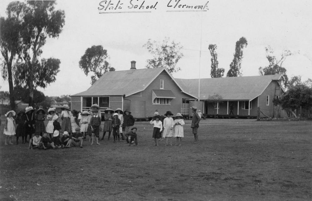
Clermont, Queensland
Clermont is a rural town and locality in the Isaac Region, Queensland, Australia. At the , the locality of Clermont had a population of 2952 people. Clermont is a major hub for the large coal mines in the region as well as serving agricultural properties. Geography Clermont is south-west of Mackay, at the junction of the Gregory and Peak Downs highways. The historic towns of North Copperfield () and South Copperfield (), often referred to collectively as Copperfield are along Christoe Street approximately south-west of the Clermont town centre. The Gregory Highway runs through the eastern end, and the Peak Downs Highway enters from the east. The Clermont Connection Road links the Gregory Highway to the CBD, and the Clermont-Alpha Road starts in the CBD and exits to the south-west. History '' Gangalu (Gangulu, Kangulu, Kanolu, Kaangooloo, Khangulu)'' is an Australian Aboriginal language spoken on Gangula country. The Gangula language region includes the towns of Clermo ... [...More Info...] [...Related Items...] OR: [Wikipedia] [Google] [Baidu] |
Toowoomba
Toowoomba ( , nicknamed 'The Garden City' and 'T-Bar') is a city in the Toowoomba Region of the Darling Downs, Queensland, Australia. It is west of Queensland's capital city Brisbane by road. The urban population of Toowoomba as of the 2021 Census was 142,163, having grown at an average annual rate of 1.45% over the previous two decades. Toowoomba is the second-most-populous inland city in the country after the national capital of Canberra and hence the largest city on the Darling Downs, and it is among the largest regional centres in Queensland. It is also referred to as the capital of the Darling Downs. The Toowoomba region is the home of two main Aboriginal language groups, the Giabal whose lands extend south of the city and Jarowair whose lands extend north of the city. The Jarowair lands include the site of one of Australia's most important sacred Bora ceremonial ground, the ‘Gummingurru stone arrangement’ dated to c.4000 BC. The site marked one of the major routes ... [...More Info...] [...Related Items...] OR: [Wikipedia] [Google] [Baidu] |
Emerald, Queensland
Emerald is a rural town and locality in the Central Highlands Region, Queensland, Australia. In the , Emerald had a population of 14,906 people. The town is the headquarters for the Central Highlands Regional Council. Geography Emerald lies on the Nogoa River, a tributary of the Fitzroy River. The town lies approximately from the Coral Sea coast and approximately 270 km west of the city of Rockhampton by road at the junction of the Capricorn and Gregory highways. Emerald sits approximately 10 km south of the Tropic of Capricorn. History The traditional owners include the Gayiri people who occupied the area for tens of thousands of years before European colonisation began in the nineteenth century. The Gayiri (Kairi, Khararya) language region takes in the landscape of the Central Highlands Region, including Emerald and the Nogoa River. The first European to explore the area was Ludwig Leichhardt between 1843 and 1845. The British Colony of Queensland was es ... [...More Info...] [...Related Items...] OR: [Wikipedia] [Google] [Baidu] |
Springsure, Queensland
Springsure is a town and a locality in the Central Highlands Region, Queensland, Australia. It is south of Emerald on the Gregory Highway. It is the southern terminus of the Gregory Highway and the northern terminus of the Dawson Highway. It is northwest of Brisbane. At the , Springsure had a population of 950 people. Geography Today, Springsure is a pastoral settlement serving cattle farms, and sunflower, sorghum, wheat and chickpea plantations. Springsure is the hub for several coal mines such as the Minerva Mine and the Rolleston Mine. Significant exploration is ongoing in the district. It is also a staging point for expeditions to Carnarvon National Park. History '' Gangalu (Gangulu, Kangulu, Kanolu, Kaangooloo, Khangulu)'' is an Australian Aboriginal language spoken on Gangula country. The Gangula language region includes the towns of Clermont and Springsure extending south towards the Dawson River. '' Wadja'' (also known as ''Wadjigu'', ''Wadya'', ''Wadjainngo'', '' ... [...More Info...] [...Related Items...] OR: [Wikipedia] [Google] [Baidu] |
Leyburn, Queensland
Leyburn (pronounced Lee-burn) is a rural town in the Southern Downs Region and a locality split between the South Downs Region and the Toowoomba Region in Queensland, Australia. In the , Leyburn had a population of 476 people. Geography The Toowoomba–Karara Road ( State Route 48) passes through the locality from north-east to south, running immediately to the east of the town. Tourist Drive 12 (the Sprint Route) follows Leyburn Cunningham Road to the outskirts of Warwick. Leyburn State Forest is a protected area in the east of the locality (). History Leyburn was named in the 1840s by William Gray, Snr., who came to the area by bullock dray from Pitt Town on the Hawkesbury River in New South Wales.From series of articles published under the title ''Queensland place names and obelisks'' by Sydney May (formerly Honorary Secretary of the Queensland Place Names Committee) in ''Local Government'', June 1957 – November 1964 The first name for the locality was Canal ... [...More Info...] [...Related Items...] OR: [Wikipedia] [Google] [Baidu] |
Allora, Queensland
Allora is a rural town and Suburbs and localities (Australia), locality in the Southern Downs Region, Queensland, Australia. In the , the locality of Allora had a population of 1,223 people. Geography Allora is on the Darling Downs in south-eastern Queensland, Australia, by road south-west of the state capital, Brisbane. The town is located on the New England Highway between Warwick, Queensland, Warwick and Toowoomba. History Giabal language, Giabal (also known as Paiamba, Gomaingguru) is an Australian Aboriginal language. The Giabal language region includes the landscape within the local government boundaries of the Toowoomba Regional Council, particularly Toowoomba south to Allora and west to Millmerran, Queensland, Millmerran. The region surrounding this small farming community was first explored by Europeans in the 1840s. In 1854 the first Presbyterian services were held in Allora. The town was surveyed in 1859. Its name is believed to derive from an Indigenous Aust ... [...More Info...] [...Related Items...] OR: [Wikipedia] [Google] [Baidu] |
Mackay, Queensland
} Mackay () is a city in the Mackay Region on the eastern or Coral Sea coast of Queensland, Australia. It is located about north of Brisbane, on the Pioneer River. Mackay is described as being in either Central Queensland or North Queensland, as these regions are not precisely defined. More generally, the area is known as the Mackay–Whitsunday Region. Mackay is nicknamed the sugar capital of Australia because its region produces more than a third of Australia's sugar. Name The city was named after John Mackay. In 1860, he was the leader of an expedition into the Pioneer Valley. Initially Mackay proposed to name the river Mackay River after his father George Mackay. Thomas Henry Fitzgerald surveyed the township and proposed it was called Alexandra after Princess Alexandra of Denmark, who married Prince Edward (later King Edward VII). However, in 1862 the river was renamed to be the Pioneer River, after in which Queensland Governor George Bowen travelled to the area, and t ... [...More Info...] [...Related Items...] OR: [Wikipedia] [Google] [Baidu] |
Townsville
Townsville is a city on the north-eastern coast of Queensland, Australia. With a population of 180,820 as of June 2018, it is the largest settlement in North Queensland; it is unofficially considered its capital. Estimated resident population, 30 June 2018. Townsville hosts a significant number of governmental, community and major business administrative offices for the northern half of the state. Part of the larger local government area of the City of Townsville, it is in the dry tropics region of Queensland, adjacent to the central section of the Great Barrier Reef. The city is also a major industrial centre, home to one of the world's largest zinc refineries, a nickel refinery and many other similar activities. As of December 2020, $30M operations to expand the Port of Townsville are underway, which involve channel widening and installation of a 70-tonne Liebherr Super Post Panamax Ship-to-Shore crane, to allow much larger cargo and passenger ships to utilise the port. It is ... [...More Info...] [...Related Items...] OR: [Wikipedia] [Google] [Baidu] |
Gladstone, Queensland
Gladstone () is a coastal city in the Gladstone Region, Queensland, Australia. Gladstone has an urban population of 34,703, and together with Boyne Island and Tannum Sands, had an estimated population of 50,317 at August 2021. This urban area covers . It is by road north-west of the state capital, Brisbane, and south-east of Rockhampton. Situated between the Calliope and Boyne Rivers, Gladstone is home to Queensland's largest multi-commodity shipping port, the Port of Gladstone. Gladstone is the largest town within the Gladstone Region and the headquarters of Gladstone Regional Council is located in Gladstone. The Gladstone Region was formed in 2008 through the amalgamation of three former local government areas.. hich areas? History Before European settlement, the Gladstone region was home of the Gooreng Gooreng, Toolooa (or Tulua), Meerooni and Baiali (or Byellee) Aboriginal tribes. In May 1770, , under the command of James Cook, sailed by the entrance to Gladston ... [...More Info...] [...Related Items...] OR: [Wikipedia] [Google] [Baidu] |
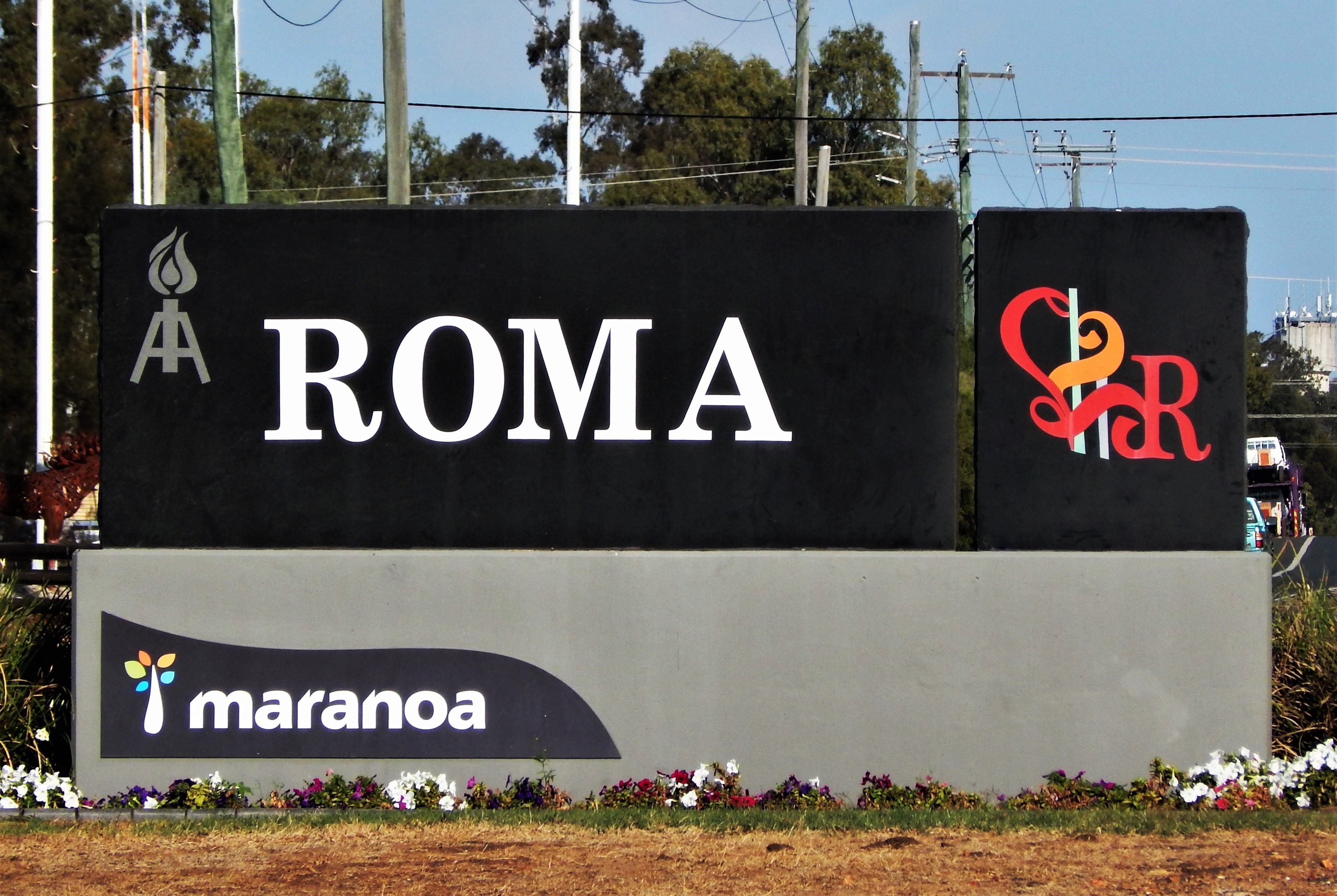
Roma, Queensland
Roma is a rural town and locality in the Maranoa Region, Queensland, Australia. It is the administrative centre of the Maranoa Region. The town was incorporated in 1867 and is named after Lady Diamantina Bowen (née di Roma), the wife of Sir George Bowen, the Governor of Queensland at the time. In the , the locality of Roma had a population of 6,848 people. Geography Roma is in the Maranoa district of South West Queensland, Australia, situated * by rail and road WNW of Brisbane * 355 km (221 mi) W of Toowoomba, * 269 km (167 mi) W of Dalby * 141 km (87.6 mi) W of Miles * 87 km (54 mi) E of Mitchell * 176.6 km (109.7 mi) E of Morven * 266 km (165 mi) E of Charleville It is situated at the junction of the Warrego and Carnarvon highways. It is the centre of a rich pastoral and wheat-growing district. It is also a major town on the Western Railway Line from Toowoomba and Brisbane. History Prior the European settlement the Aboriginal peoples of the Mandandanji Nation o ... [...More Info...] [...Related Items...] OR: [Wikipedia] [Google] [Baidu] |
Gayndah
Gayndah is a town and locality in the North Burnett Region, Queensland, Australia. In the , Gayndah had a population of 1,981 people. It is the administrative centre for the North Burnett Region. Geography Gayndah is on the Burnett River and the Burnett Highway passes through the town. Apart from the town in the western part of the locality, the land is used for cropping and grazing. The Gayndah railway station is located on the north side of the river and is on the Mungar Junction to Monto Branch railway line. Duchess Mountain is immediately to the south-west of the town () and at provides excellent views over the town ( above sea level). Gayndah is north of the state capital, Brisbane, and west of the regional city of Maryborough. Agriculture and grazing have been the dominant industries of the area. The town is the centre of Queensland's largest citrus-growing area. History The name Gayndah is of Aboriginal origin but the derivative is unclear. It may derive eithe ... [...More Info...] [...Related Items...] OR: [Wikipedia] [Google] [Baidu] |
Drayton, Queensland
Drayton is a rural locality in the Toowoomba Region, Queensland, Australia. In the , Drayton had a population of 1,710 people. Drayton is at the outer southwestern edge of Toowoomba. It was first substantial settlement on the Darling Downs, initially being established in 1842. The nearby township of Toowoomba expanded more rapidly than Drayton, and in the 1860s the centre of population shifted to Toowoomba, leaving Drayton as a southwestern suburb. Geography The South Western railway line forms the south-western boundary of the locality, which is served by Drayton railway station (). Mount Peel is in the north-west of the locality () rising to . To the west of Drayton, the southern part of ANZAC Avenue forms the axis of a growing industrial and commercial district extending west and north towards Glenvale. Drayton has a core of homes dating to the 19th century and a substantial number of homes and commercial premises dating from the mid years of the 20th century. More recen ... [...More Info...] [...Related Items...] OR: [Wikipedia] [Google] [Baidu] |


