|
Clayton West
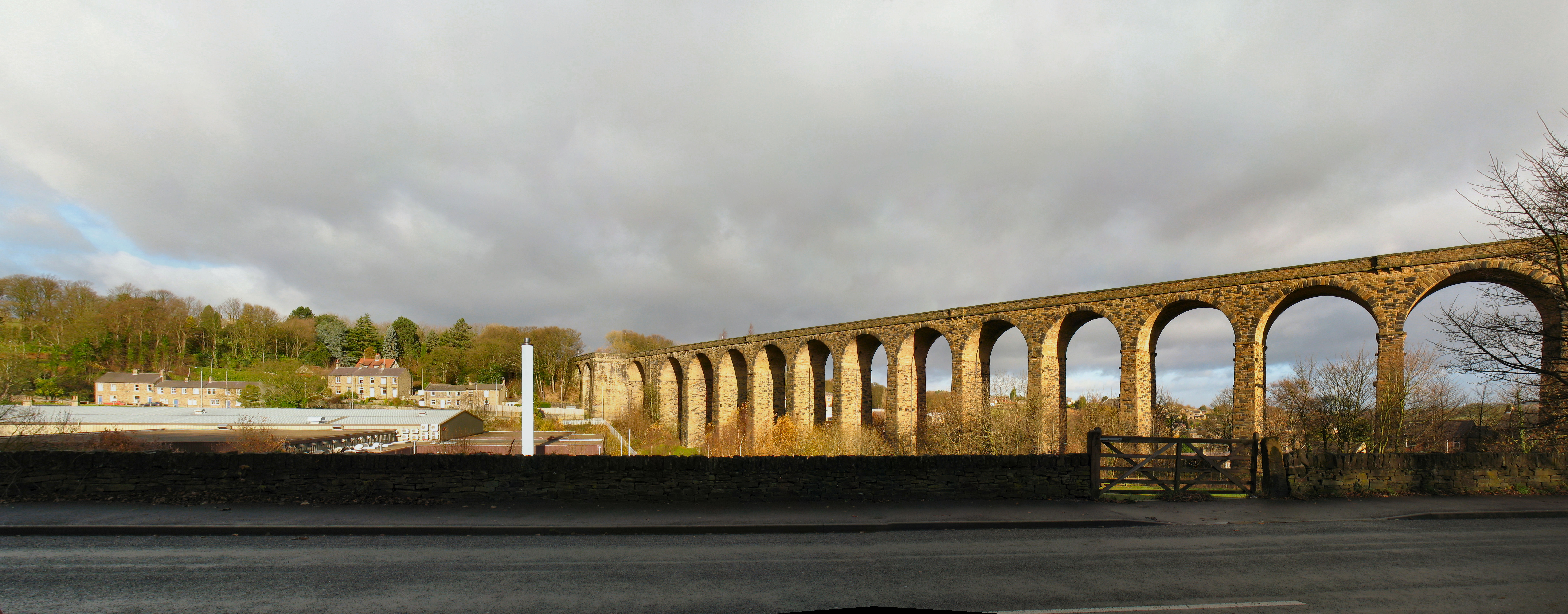
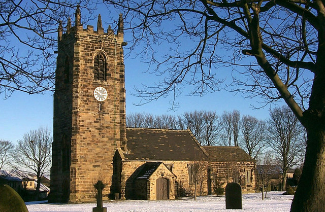
Clayton West is a village in Kirklees, West Yorkshire, England. It had a population of 2,648 (2001 census) and 2,704 in 2008. It is southeast of Huddersfield and northwest of Barnsley. History The Industrial Revolution was the transition to new manufacturing processes in the period from about 1760 to sometime between 1820 and 1840. The Industrial Revolution had brought a migration of the population to the Dearne Valley where abundant water was available for manufacturers, so people lived away from the church. Both Clayton West and Scissett had grown so rapidly that there were people still alive in 1873 that could remember the expansion. Although the parish of Scissett had been created in 1839, yet Clayton West remained as a part of High Hoyland. By 1865 eleven coal mines existed in the Dearne Valley. The Clayton West village coal mine (pit), "Park Mill", closed in 1989, having been somewhat bypassed by the events of the UK miners strike (1984–85)Park Mill Collieryoperated ... [...More Info...] [...Related Items...] OR: [Wikipedia] [Google] [Baidu] |
Denby Dale
Denby Dale is a village and civil parish in the metropolitan borough of Kirklees in West Yorkshire, England. It is 10 miles (17 km) to the south-east of Huddersfield and 9 miles (14 km) north-west of Barnsley. The village is the main village in the Denby Dale civil parish that also covers Lower Denby, Upper Denby, Upper Cumberworth, Lower Cumberworth, Skelmanthorpe, Emley, West Yorkshire, Emley, Emley Moor and Clayton West. The parish had a population of 14,982 according to the 2001 census, increasing to 16,365 at the 2011 census. The parish council gives the electorate of the village itself as 2,143. The River Dearne runs through the village; in the 2007 United Kingdom floods, floods of 2007 it burst its banks on two occasions and caused damage to Springfield Mill. History First recorded as Denby Dyke. Before the Industrial Revolution the village was sparsely-populated with a small textile industry at the crossroads of the Barnsley to Shepley Lane Head and the Wakefield ... [...More Info...] [...Related Items...] OR: [Wikipedia] [Google] [Baidu] |
Bretton Hall, West Yorkshire
Bretton Hall is a country house in West Bretton near Wakefield, West Yorkshire, England. It housed Bretton Hall College from 1949 until 2001 and was a campus of the University of Leeds (2001–2007). It is a Grade II* listed building. History In the 14th century the Bretton estate was owned by the Dronsfields and passed by marriage to the Wentworths in 1407. King Henry VIII spent three nights in the old hall and furnishings, draperies and panelling from his bedroom were moved to the new hall. A hall is marked on Christopher Saxton's 1577 map of Yorkshire. The present building was designed and built around 1720 by its owner, Sir William Wentworth assisted by James Moyser to replace the earlier hall. In 1792 it passed into the Beaumont family, (latterly Barons and Viscounts Allendale), and the library and dining room were remodelled by John Carr in 1793. Monumental stables designed by George Basevi were built between 1842 and 1852. The hall was sold to the West Riding County ... [...More Info...] [...Related Items...] OR: [Wikipedia] [Google] [Baidu] |
Listed Buildings In Denby Dale
Denby Dale is a civil parish in the metropolitan borough of Kirklees, West Yorkshire, England. It contains 82 listed buildings that are recorded in the National Heritage List for England. Of these, one is listed at Grade I, the highest of the three grades, three are at Grade II*, the middle grade, and the others are at Grade II, the lowest grade. The parish contains the villages of Denby Dale, Clayton West, Lower Cumberworth, Upper Cumberworth, Lower Denby, Upper Denby, Emley, Scissett, and Skelmanthorpe, and is otherwise rural. Most of the listed buildings are houses and cottages, farmhouses and farm buildings, and churches and chapels with associated structures. The other listed buildings include the base of a market cross, bridges, including a packhorse bridge, mill buildings, a milestone and mileposts, a set of stocks Stocks are feet restraining devices that were used as a form of corporal punishment and public humiliation. The use of stocks is seen ... [...More Info...] [...Related Items...] OR: [Wikipedia] [Google] [Baidu] |
2007 United Kingdom Floods
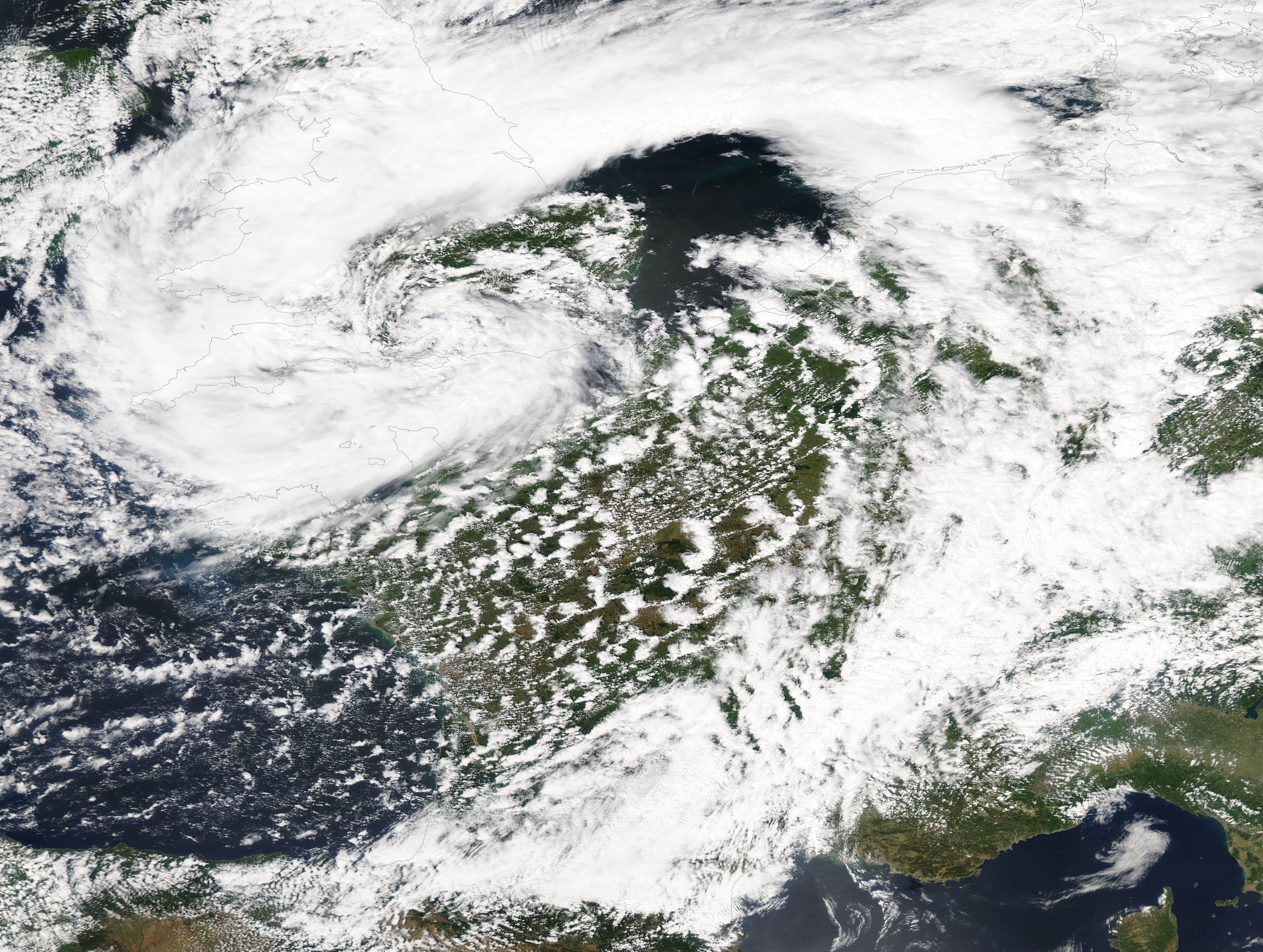
A series of large floods occurred in parts of the United Kingdom during the summer of 2007. The worst of the flooding occurred across Scotland on 14 June; East Yorkshire and the Midlands on 15 June; Yorkshire, the Midlands, Gloucestershire, Herefordshire and Worcestershire on 25 June; and Gloucestershire, Herefordshire, Worcestershire, Oxfordshire, Berkshire and South Wales on 28 July 2007. June was one of the wettest months on record in Britain (see List of weather records). Average rainfall across the country was ; more than double the June average. Some areas received a month's worth of precipitation in 24 hours. It was Britain's wettest May–July period since records began in 1776. July had unusually unsettled weather and above-average rainfall through the month, peaking on 20 July as an active frontal system dumped more than of rain in southern England. Civil and military authorities described the June and July rescue efforts as the biggest in peacetime Britain. The Envi ... [...More Info...] [...Related Items...] OR: [Wikipedia] [Google] [Baidu] |
River Dearne
The River Dearne South Yorkshire, England flows roughly east for more than , from its source just inside West Yorkshire. It flows through Denby Dale, Clayton West, Darton, Barnsley, Darfield, Wath upon Dearne, Bolton on Dearne, Adwick upon Dearne and Mexborough to its confluence with the River Don at Denaby Main. Its main tributary is the River Dove, which joins it at Darfield. The river was one of those affected by the 2007 United Kingdom floods. The course of the river is accessible to walkers as the Dearne Way, a long distance footpath from ''Dearne Head'' to the river's junction with the Don. Places of interest along the Dearne include the Yorkshire Sculpture Park at West Bretton, and Monk Bretton Priory. The Dearne Valley below Barnsley is a regeneration area. The river has been subject to channel engineering to ease the problem of flooding. A new channel was constructed near its mouth in the 1950s, as the old route had been affected by mining subsidence. Washlands, ... [...More Info...] [...Related Items...] OR: [Wikipedia] [Google] [Baidu] |
Skelmanthorpe
Skelmanthorpe is a clustered village 8 miles (13 km) south-east of Huddersfield, West Yorkshire, England. According to the 2011 census, the village has 4,549 inhabitants. The village sits on the south (right) bank of the first river-like flow, from three small headwaters (uniting in the northwest corner of the parish), of the Dearne. It is part of the civil parish of Denby Dale in the Kirklees Borough, the main local authority. Name The village was recorded as ''Scelmertorp'' in the Domesday Book in the year 1086 AD. The name itself derives from the Norse personal name ''Skjaldmarr'' and ''thorp''; thus having the meaning of an "outlying farmstead of a man called Skjaldmarr". Shat Locals know it as "Shat", which appears to be an abbreviation of "Shatterers", the name by which the locals are known. Local labour was taken on during construction of the railway to break or 'shatter' rocks as well as work on the excavations. These unskilled labourers were referred to as ... [...More Info...] [...Related Items...] OR: [Wikipedia] [Google] [Baidu] |
Scissett
Scissett is a village in West Yorkshire, England. It is south-east of Huddersfield and north-west of Barnsley. According to the 2001 census, the village had a population of 1,324. Scissett is halfway between the villages of Clayton West, Skelmanthorpe and Denby Dale on the A636 road to Wakefield. River Dearne runs through the village, which was affected by the 2007 United Kingdom floods. Scissett grew up around the woollen industry in the 19th century as mill owners built houses in the area for their workers. The nearby coalfields also provided employment. These industries are now gone and some of the mills are now retail units. The Scissett Baths (and leisure centre) is one of the main attractions for the surrounding area. Scissett has first and middle schools to provide education for children ages 4 to 13. Scissett Youth Band began life in the village in 1978 but moved to Shelley Methodist Hall in 1991. Sport Scissett is home to two sports clubs, Scissett Football C ... [...More Info...] [...Related Items...] OR: [Wikipedia] [Google] [Baidu] |
High Hoyland
High Hoyland is a village and civil parish in the Metropolitan Borough of Barnsley in South Yorkshire, England, on the border with West Yorkshire. It lies to the west of Kexbrough, and is located at approximately , at an elevation of around 200 metres above sea level. At the 2001 census it had a population of 142, reducing to 128 at the 2011 Census. There are many Hoylands in Barnsley - there is the village of Hoyland itself south east of Barnsley on the road to Sheffield, which includes the former hamlets of Hoyland Common, Upper Hoyland and Hoyland Nether (''nether'' being old English for "lower"). Hoylandswaine is located on the opposite side of the wide valley, and at almost 1000 feet above sea level has a wilder and bleaker feel than ''High Hoyland''. The word Hoyland is derived from Norse, and at its simplest means "farm on a hill". Despite there being countless farms on hills around England, the majority of the Hoylands are concentrated in Barnsley. History There is ... [...More Info...] [...Related Items...] OR: [Wikipedia] [Google] [Baidu] |
Samuel Lewis (publisher)
Samuel Lewis (c. 1782 – 1865) was the editor and publisher of topographical dictionaries and maps of the United Kingdom of Great Britain and Ireland. The aim of the texts was to give in 'a condensed form', a faithful and impartial description of each place. The firm of Samuel Lewis and Co. was based in London. Samuel Lewis the elder died in 1865. His son of the same name predeceased him in 1862. ''A Topographical Dictionary of England'' This work contains every fact of importance tending to illustrate the local history of England. Arranged alphabetically by place (village, parish, town, etc.), it provides a faithful description of all English localities as they existed at the time of first publication (1831), showing exactly where a particular civil parish was located in relation to the nearest town or towns, the barony, county, and province in which it was situated, its principal landowners, the diocese in which it was situated, and—of novel importance—the Roman Catholic ... [...More Info...] [...Related Items...] OR: [Wikipedia] [Google] [Baidu] |
Pontefract Castle
Pontefract (or Pomfret) Castle is a castle ruin in the town of Pontefract, in West Yorkshire, England. King Richard II is thought to have died there. It was the site of a series of famous sieges during the 17th-century English Civil War. History The castle, on a rock to the east of the town above All Saints' Church, was constructed in approximately 1070 by Ilbert de Lacy on land which had been granted to him by William the Conqueror as a reward for his support during the Norman Conquest. There is, however, evidence of earlier occupation of the site. Initially the castle was a wooden structure which was replaced with stone over time. The Domesday Survey of 1086 recorded "Ilbert's Castle" which probably referred to Pontefract Castle. Robert de Lacy failed to support King Henry I during his power struggle with his brother, and the King confiscated the castle from the family during the 12th century. Roger de Lacy paid King Richard I 3,000 marks for the Ho ... [...More Info...] [...Related Items...] OR: [Wikipedia] [Google] [Baidu] |
Wentworth Beaumont, 1st Baron Allendale
Wentworth Blackett Beaumont, 1st Baron Allendale (11 April 1829 – 13 February 1907), was a British industrialist and Liberal politician. Background and education Allendale was the eldest son of Thomas Beaumont and his wife Henrietta Jane Emma, daughter of John Atkinson, and was educated at Harrow and St John's College, Cambridge. Business and political career Allendale was the owner of major estates and mines in Northumberland and also sat as Member of Parliament for Northumberland South from 1852 to 1885 and for Tyneside from 1886 to 1892. In 1906 he was raised to the peerage as Baron Allendale, of Allendale and Hexham in the County of Northumberland. Family Lord Allendale married firstly Lady Margaret Anne, daughter of Ulick de Burgh, 1st Marquess of Clanricarde, and his wife the Honourable Harriet, daughter of George Canning, in 1856. They had three sons and three daughters. Their youngest son the Honourable Hubert Beaumont was Liberal Member of Parliament for Eastbo ... [...More Info...] [...Related Items...] OR: [Wikipedia] [Google] [Baidu] |
Last Of The Summer Wine
''Last of the Summer Wine'' is a British sitcom created and written by Roy Clarke and originally broadcast by the BBC from 1973 to 2010. It premiered as an episode of ''Comedy Playhouse'' on 4 January 1973, and the first series of episodes followed on 12 November 1973. From 1983 to 2010, Alan J. W. Bell produced and directed all episodes of the show. The BBC confirmed on 2 June 2010 that ''Last of the Summer Wine'' would no longer be produced and the 31st series would be its last. Subsequently, the final episode was broadcast on 29 August 2010. Since its original release, all 295 episodes, comprising thirty-one series—including the pilot and all films and specials—have been released on DVD. Repeats of the show are broadcast in the UK on BBC One (until 18 July 2010 when the 31st and final series started on 25 July of that year), Gold (UK TV channel), Gold, Yesterday (TV channel), Yesterday, and Drama (British TV channel), Drama. It is also seen in more than 25 countries, inclu ... [...More Info...] [...Related Items...] OR: [Wikipedia] [Google] [Baidu] |


