|
Claish Moss
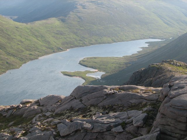
Claish Moss is an upland blanket bog on the south side of Loch Shiel, in the Sunart district of the west highlands of Scotland The Moss is designated as a Ramsar site of international importance (designated in 1981), a Special Area of Conservation (designated together with Kentra Moss), and a Site of Special Scientific Interest. The remote and difficult to access 568 ha reserve, at an elevation of 11 m - 55 m (average: 22 m), is home to a nationally important population of 9 different dragonfly species. The Moss is an example of a patterned raised mire system in good condition, which are rare in western Europe. Divided by several burns, the ground is very wet and the water quality is excellent. The reserve supports 14 different species of moss, as well as scarce higher plants. Red deer are culled annually to prevent overgrazing, as they lack natural predators with the extinction of the wolf in Scotland. Visitors are not encouraged to visit the reserve as it is dangerous to ... [...More Info...] [...Related Items...] OR: [Wikipedia] [Google] [Baidu] |
Ramsar Convention
The Ramsar Convention on Wetlands of International Importance Especially as Waterfowl Habitat is an international treaty for the conservation and sustainable use of Ramsar sites (wetlands). It is also known as the Convention on Wetlands. It is named after the city of Ramsar in Iran, where the convention was signed in 1971. Every three years, representatives of the contracting parties meet as the Conference of the Contracting Parties (COP), the policy-making organ of the convention which adopts decisions (resolutions and recommendations) to administer the work of the convention and improve the way in which the parties are able to implement its objectives. COP12 was held in Punta del Este, Uruguay, in 2015. COP13 was held in Dubai, United Arab Emirates, in October 2018. List of wetlands of international importance The list of wetlands of international importance included 2,331 Ramsar sites in May 2018 covering over . The countries with most sites are the United Kingdo ... [...More Info...] [...Related Items...] OR: [Wikipedia] [Google] [Baidu] |
Red Deer
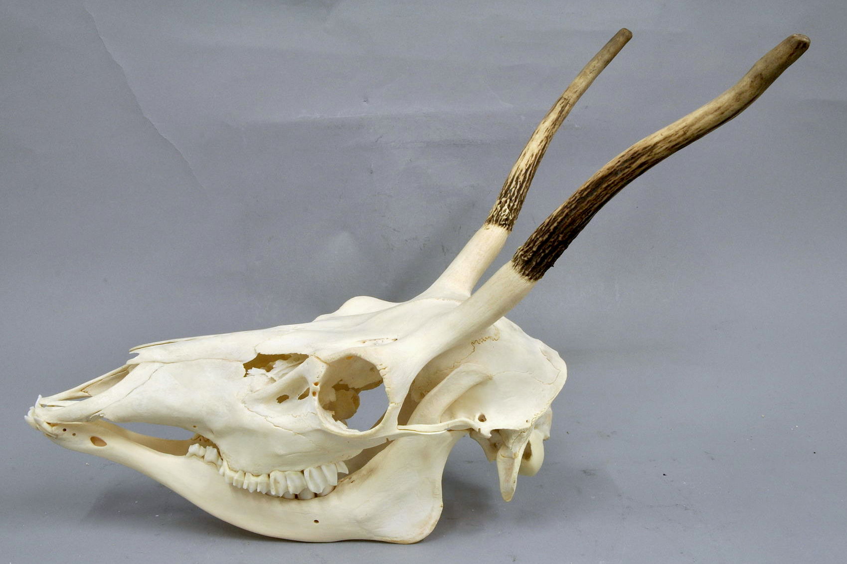
The red deer (''Cervus elaphus'') is one of the largest deer species. A male red deer is called a stag or hart, and a female is called a hind. The red deer inhabits most of Europe, the Caucasus Mountains region, Anatolia, Iran, and parts of western Asia. It also inhabits the Atlas Mountains of Northern Africa; its early ancestors are thought to have crossed over to Morocco, then to Algeria, Libya and Tunisia via the Strait of Gibraltar, becoming the only species of true deer (Cervidae) to inhabit Africa. Red deer have been introduced to other areas, including Australia, New Zealand, the United States, Canada, Peru, Uruguay, Chile and Argentina. In many parts of the world, the meat (venison) from red deer is used as a food source. Red deer are ruminants, characterized by a four-chambered stomach. Genetics, Genetic evidence indicates that the red deer, as traditionally defined, is a species group, rather than a single species, though exactly how many species the group includes rem ... [...More Info...] [...Related Items...] OR: [Wikipedia] [Google] [Baidu] |
Bogs Of Scotland
A bog or bogland is a wetland that accumulates peat as a deposit of dead plant materials often mosses, typically sphagnum moss. It is one of the four main types of wetlands. Other names for bogs include mire, mosses, quagmire, and muskeg; alkaline mires are called fens. A baygall is another type of bog found in the forest of the Gulf Coast states in the United States.Watson, Geraldine Ellis (2000) ''Big Thicket Plant Ecology: An Introduction'', Third Edition (Temple Big Thicket Series #5). University of North Texas Press. Denton, Texas. 152 pp. Texas Parks and Wildlife. Ecological Mapping systems of Texas: West Gulf Coastal Plain Seepage Swamp and Baygall'. Retrieved 7 July 2020 They are often covered in heath or heather shrubs rooted in the sphagnum moss and peat. The gradual accumulation of decayed plant material in a bog functions as a carbon sink. Bogs occur where the water at the ground surface is acidic and low in nutrients. In contrast to fens, they derive most of th ... [...More Info...] [...Related Items...] OR: [Wikipedia] [Google] [Baidu] |
Lochaber
Lochaber ( ; gd, Loch Abar) is a name applied to a part of the Scottish Highlands. Historically, it was a provincial lordship consisting of the parishes of Kilmallie and Kilmonivaig, as they were before being reduced in extent by the creation of ''Quoad Sacra'' parishes in the 19th century. Lochaber once extended from the Northern shore of Loch Leven, a district called Nether Lochaber, to beyond Spean Bridge and Roybridge, which area is known as Brae Lochaber or ''Braigh Loch Abar'' in Gaelic. Lochaber is now also used to refer to a much wider area, one of the 16 ward management areas of the Highland Council of Scotland and one of eight former local government districts of the two-tier Highland region. The main town of Lochaber is Fort William. According to legend, a glaistig, a ghostly woman-goat hybrid, once lived in the area. Name William Watson outlined two schools of thought on this topic. He favoured the idea that ''Abar'' came from the Pictish and Welsh for "river m ... [...More Info...] [...Related Items...] OR: [Wikipedia] [Google] [Baidu] |
Sites Of Special Scientific Interest In South Lochaber
The following is a list of Sites of Special Scientific Interest in the South Lochaber Area of Search; for North Lochaber see List of SSSIs in North Lochaber. For SSSIs elsewhere in Scotland, see List of SSSIs by Area of Search. * Ard Trilleachan * Ardgour Pinewoods * Ardnamurchan * Ardsheal Peninsula * Beinn Iadain and Beinn na H-Uamha * Callert De-notified (confirmed) on 22 March 2012 * Carnach Wood * Claish Moss * Doire Donn * Drimnin to Killundine Woods * Eas na Broige * Garbh Shlios * Glencoe * Inninmore Bay * Kentallen * Kentra Bay and Moss * Kingshouse * Leven Valley * Loch Aline * Loch Moidart * Loch Shiel * Onich Dry Gorge * Onich Shore * Rannoch Moor * River Moidart * Rudha Cuil - Cheanna * St John's Church * Strontian Mines * Strontian River * Sunart Sunart ( , Scottish Gaelic: ''Suaineart'') is a rural district and community in the south west of Lochaber in Highland, Scotland, on the shores of Loch Sunart, and part of the civil parish of Ardnamu ... [...More Info...] [...Related Items...] OR: [Wikipedia] [Google] [Baidu] |
Ramsar Sites In Scotland
This list includes all Ramsar sites in Scotland. Ramsar sites are internationally recognised wetland sites, protected under the terms of the Ramsar Convention, which was developed and adopted by participating nations at a meeting in Ramsar, Iran, on 2 February 1971. At the end of 2010, 160 states were contracting parties to the convention, and the worldwide total of sites was 1,920. The United Kingdom was one of 18 original signatories to the convention, and has since designated 168 Ramsar sites. 51 of these sites are within Scotland, including one site, the Upper Solway Flats and Marshes, which covers parts of both Scotland and England in the Solway Firth. The total area of all Ramsar sites in Scotland is approximately . All of Scotland's Ramsar sites form part of the European Natura 2000 network as either Special Protection Areas or Special Areas of Conservation, and many sites are further protected as Sites of Special Scientific Interest under UK legislation. List of Ramsar si ... [...More Info...] [...Related Items...] OR: [Wikipedia] [Google] [Baidu] |
Ardshealach
Ardshealach (Scottish Gaelic:) is a small hamlet located close to the south west shore of Loch Shiel in Sunart, Lochaber, Highland, less than southeast of Acharacle. It is in the Scottish council area of the Highland, Scotland. References See also *Claish Moss Claish Moss is an upland blanket bog on the south side of Loch Shiel, in the Sunart district of the west highlands of Scotland The Moss is designated as a Ramsar site of international importance (designated in 1981), a Special Area of Conservati ... Populated places in Lochaber {{Highland-geo-stub ... [...More Info...] [...Related Items...] OR: [Wikipedia] [Google] [Baidu] |
Eurasian Wolf
The Eurasian wolf (''Canis lupus lupus''), also known as the common wolf,Mech, L. David (1981), ''The Wolf: The Ecology and Behaviour of an Endangered Species'', University of Minnesota Press, p. 354, is a subspecies of grey wolf native to Europe and Asia. It was once widespread throughout Eurasia prior to the Middle Ages. Aside from an extensive paleontological record, Indo-European languages typically have several words for "wolf", thus attesting to the animal's abundance and cultural significance.Gamkrelidze, T. V. & Ivanov, V. V. (1995), ''Indo-European and the Indo-Europeans: A Reconstruction and Historical Analysis of a Proto-Language and Proto-Culture'', Walter de Gruyter, pp. 413-417, It was held in high regard in Baltic, Celtic, Slavic, Turkic, ancient Greek, Roman, and Thracian cultures, whilst having an ambivalent reputation in early Germanic cultures. It is the largest of Old World grey wolves, averaging in Europe; however, exceptionally large individuals have w ... [...More Info...] [...Related Items...] OR: [Wikipedia] [Google] [Baidu] |
Overgrazing
Overgrazing occurs when plants are exposed to intensive grazing for extended periods of time, or without sufficient recovery periods. It can be caused by either livestock in poorly managed agricultural applications, game reserves, or nature reserves. It can also be caused by immobile, travel restricted populations of native or non-native wild animals. Overgrazing reduces the usefulness, productivity, and biodiversity of the land and is one cause of desertification and erosion. Overgrazing is also seen as a cause of the spread of invasive species of non-native plants and of weeds. Degrading land, emissions from animal agriculture and reducing the biomass in a ecosystem contribute directly to climate change. Overgrazing can be reversed or prevented by removing grazers in order to give plants time to recover between grazing events. Successful planned grazing strategies have been support in the American bison of the Great Plains, or migratory Wildebeests of the African savann ... [...More Info...] [...Related Items...] OR: [Wikipedia] [Google] [Baidu] |
Culled
In biology, culling is the process of segregating organisms from a group according to desired or undesired characteristics. In animal breeding, it is the process of removing or segregating animals from a breeding stock based on a specific trait. This is done to exaggerate desirable characteristics, or to remove undesirable characteristics by altering the genetic diversity of the population. For livestock and wildlife, culling often refers to the act of killing removed animals based on their individual characteristics, such as their sex or species membership, or as a means of preventing infectious disease transmission. In fruits and vegetables, culling is the sorting or segregation of fresh harvested produce into marketable lots, with the non-marketable lots being discarded or diverted into food processing or non-food processing activities. This usually happens at collection centres located at, or close to farms. Etymology The word ''cull'' comes from the Latin verb '' coll ... [...More Info...] [...Related Items...] OR: [Wikipedia] [Google] [Baidu] |


