|
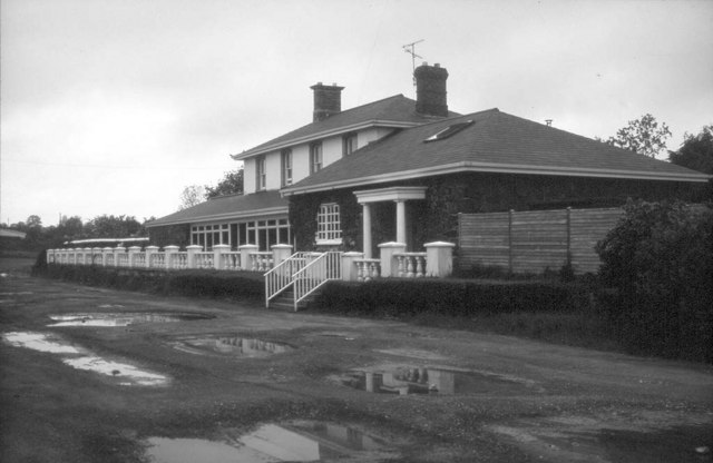
Clady Haliday , Co. Donegal, Ireland
{{disambig, geo ...
Clady may refer to: *Clady, County Londonderry, a village in Northern Ireland *Clady, County Tyrone, a small village in Northern Ireland * Clady, County Antrim, a townland in County Antrim, Northern Ireland * Clady, County Armagh, a rural area near Markethill *Clady Circuit, a former motor-cycle racing course in County Antrim, Northern Ireland *Clady River The River Clady is a mid-scale river in County Londonderry, Northern Ireland, a tributary of the Lower Bann. It forms from the confluence of the Grillagh River and Knockoneil River. Course The river flows through the flatlands outside C ... [...More Info...] [...Related Items...] OR: [Wikipedia] [Google] [Baidu] |
Clady, County Londonderry
Clady () is a small village in County Londonderry, Northern Ireland. It had a population of 562 people in the 2011 Census. This article contains quotations from this source, which is available under th Open Government Licence v3.0 © Crown copyright. It is within the Mid-Ulster District area. The village name comes from the Clady River, a major river in Northern Ireland. Schools Clady currently boasts two schools, a primary (St. Mary's) and a secondary (St. Conor’s College) (formerly St Mary’s before a merger with St Paul’s in Kilrea) Rivers And bridges The main river, also the towns namesake, is the Clady River which formally starts near Culnady when the Grillagh River and Knockoneil River both merge at a deep pool known locally as the Joinings Pool. Then the river flows on for about a mile and silently under the Eden Bridge which was built in 1959. At one point the river was natural and 2 to 3 times as wide until around the mid 20th century when the river underw ... [...More Info...] [...Related Items...] OR: [Wikipedia] [Google] [Baidu] |
Clady, County Tyrone
Clady () is a small village and townland in County Tyrone, Northern Ireland. It lies about 4 miles from Strabane on the River Finn and borders with the Republic of Ireland. In the 2011 Census it had a population of 538 people. This article contains quotations from this source, which is available under th Open Government Licence v3.0 © Crown copyright. It is within Urney civil parish and the former barony of Strabane Lower. In local government it is part of the Derry City and Strabane District Council. The townland covers an area of 173 acres. History The village is one of the oldest in the district. The village is referred to as Claudy in Samuel Lewis' Topographical Dictionary of Ireland, but early and later works attribute the name, Clady, distinguishing it from Claudy in County Londonderry. Next to the village is an important passage over the River Finn, one of the "passes", which controlled the access to Londonderry from the south and east in the times when the ferry ... [...More Info...] [...Related Items...] OR: [Wikipedia] [Google] [Baidu] |
Markethill
Markethill () is a village in County Armagh, Northern Ireland. It is beside Gosford Forest Park. It had a population of 1,647 people in the 2011 United Kingdom census, 2011 Census. This article contains quotations from this source, which is available under th Open Government Licence v3.0. © Crown copyright. A livestock market is held here three times a week and each summer the world's largest Lambeg drumming contest takes place in the village. It is home to Kilcluney Volunteers Flute Band, who host the largest band parade in Europe on the first Friday of each June. History The village sprang up within the townland of Coolmallish or Coolmillish ( gle, Cúil Mheallghuis), on the road between Armagh and Newry. It began to grow during the Plantation of Ulster as a town for Scottish and English migrants. The Troubles During the Troubles, there were a number of The Troubles in Markethill, incidents in Markethill, including a number which resulted in fatalities. *On 24 June 1979 an ... [...More Info...] [...Related Items...] OR: [Wikipedia] [Google] [Baidu] |
Clady Circuit
Clady Circuit situated in County Antrim, Northern Ireland describes a motor-cycle road racing street circuit used for the Ulster Grand Prix. The Clady Circuit was used between 1922 and 1939 and an amended shorter circuit between 1947 and 1952. History The Clady Circuit, ( ga, Clóidigh; i.e. ''Washing river'') first used in 1922 for the Ulster Grand Prix was in length in County Antrim. The original course start line was situated near Loanends Primary School on the secondary B39 Antrim to Belfast Road. The event held on public roads closed for racing including the secondary B39 ''Seven Mile Straight'' between Antrim and Clady Corner including ''Christy's Brae'', the primary A52 Belfast to Crumlin Road between Clady Corner and Thorn Cottage, a tertiary road north from Thorn Cottage to Greenmount near the town of Antrim (including a section of RAF Aldergrove) and from Greenmount to Muckamore Corner with the road junction of the B39 'Seven Mile Straight.' The Clady Circuit was ... [...More Info...] [...Related Items...] OR: [Wikipedia] [Google] [Baidu] |
