|
Clachan, Kintyre
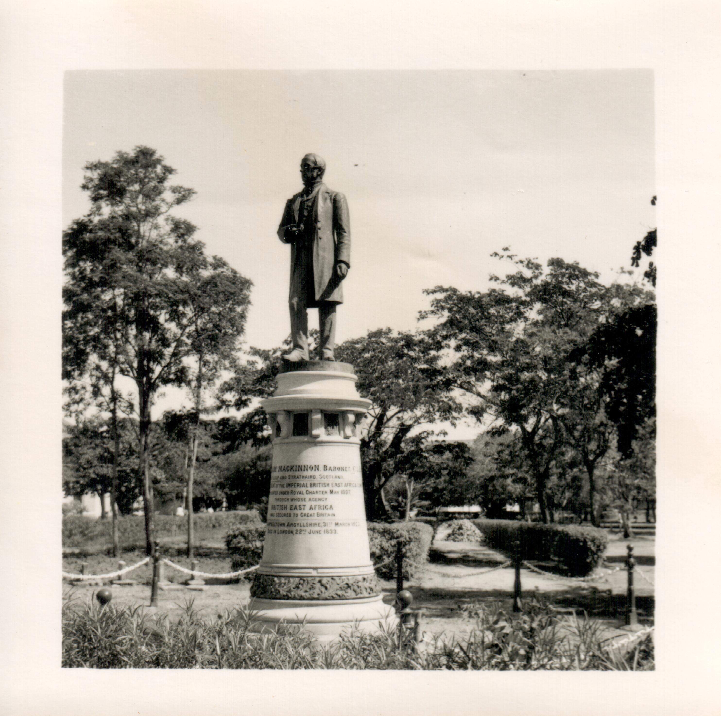
Clachan is a small village in North Kintyre, Argyll & Bute, Scotland. Clachan is the site of an old church, which was the principal church for the North Kintyre area. The church is surrounded by carved stone statues of the Chiefs of the Clan Alasdair. Another group of standing stones (the tallest of which is 3.4 metres), and a burial cist, are found to the south of Clachan, near Ballochroy Farm. In 1971 it had a population of 108. The last major battle to be fought in Kintyre took place on the steep slopes of Loup Hill in May 1689, when the local forces of MacDonald of Largie, McAlester of Loup and McNeill of Gallichoille, all strong supporters of King James VII, were defeated by a Government force. Clachan is also the site of Balinakill House. Once the home of Coll McAlester, who led the first large settlement of highlanders in North Carolina at Cross Creek in the Cape Fear River valley in 1739, and later the home of Sir William MacKinnon Sir William Mackinnon, 1st Baronet ... [...More Info...] [...Related Items...] OR: [Wikipedia] [Google] [Baidu] |
Argyll And Bute
Argyll and Bute ( sco, Argyll an Buit; gd, Earra-Ghàidheal agus Bòd, ) is one of 32 unitary authority council areas in Scotland and a lieutenancy area. The current lord-lieutenant for Argyll and Bute is Jane Margaret MacLeod (14 July 2020). The administrative centre for the council area is in Lochgilphead at Kilmory Castle, a 19th-century Gothic Revival building and estate. The current council leader is Robin Currie, a councillor for Kintyre and the Islands. Description Argyll and Bute covers the second-largest administrative area of any Scottish council. The council area adjoins those of Highland, Perth and Kinross, Stirling and West Dunbartonshire. Its border runs through Loch Lomond. The present council area was created in 1996, when it was carved out of the Strathclyde region, which was a two-tier local government region of 19 districts, created in 1975. Argyll and Bute merged the existing Argyll and Bute district and one ward of the Dumbarton district. The Dumbart ... [...More Info...] [...Related Items...] OR: [Wikipedia] [Google] [Baidu] |
Kintyre
Kintyre ( gd, Cinn Tìre, ) is a peninsula in western Scotland, in the southwest of Argyll and Bute. The peninsula stretches about , from the Mull of Kintyre in the south to East and West Loch Tarbert in the north. The region immediately north of Kintyre is known as Knapdale. Kintyre is long and narrow, at no point more than from west coast to east coast, and is less than wide where it connects to Knapdale. The east side of the Kintyre Peninsula is bounded by Kilbrannan Sound, with a number of coastal peaks such as Torr Mor. The central spine of the peninsula is mostly hilly moorland, the highest point being Beinn an Tuirc at .Ordnance Survey. Landranger 1:50,000 Map Sheet 68 (South Kintyre & Cambeltown) The coastal areas and hinterland, however, are rich and fertile. Kintyre has long been a prized area for settlers, including the early Scots who migrated from Ulster to western Scotland and the Vikings or Norsemen who conquered and settled the area just before the start of t ... [...More Info...] [...Related Items...] OR: [Wikipedia] [Google] [Baidu] |
Argyll & Bute
Argyll and Bute ( sco, Argyll an Buit; gd, Earra-Ghàidheal agus Bòd, ) is one of 32 unitary authority council areas in Scotland and a lieutenancy area. The current lord-lieutenant for Argyll and Bute is Jane Margaret MacLeod (14 July 2020). The administrative centre for the council area is in Lochgilphead at Kilmory Castle, a 19th-century Gothic Revival building and estate. The current council leader is Robin Currie, a councillor for Kintyre and the Islands. Description Argyll and Bute covers the second-largest administrative area of any Scottish council. The council area adjoins those of Highland, Perth and Kinross, Stirling and West Dunbartonshire. Its border runs through Loch Lomond. The present council area was created in 1996, when it was carved out of the Strathclyde region, which was a two-tier local government region of 19 districts, created in 1975. Argyll and Bute merged the existing Argyll and Bute district and one ward of the Dumbarton district. The Dumbarton ... [...More Info...] [...Related Items...] OR: [Wikipedia] [Google] [Baidu] |
Clan MacAlister
Clan MacAlister is a Scottish Clan. The clan is the earliest branch to have split off from Clan Donald, claiming descent from Alasdair Mòr, son of Domhnall founder of Clan Donald. From Alasdair Mòr the clans takes its surname ''MacAlister''; this surname is an Anglicisation of the Gaelic '' MacAlasdair'' meaning "son of Alasdair". In the 15th century the chief of the clan was seated in Kintyre, and the clan was centred there until the 18th century, when a chief sold the family estate in preference to an estate in the Scottish Lowlands. History of the clan Origins Clan MacAlister was originally a branch of Clan Donald—one of the largest Scottish clans. Newton 2007: p. 37. The eponymous ancestor of Clan Donald is Domhnall, son of Raghnall, son of Somhairle. Eyre-Todd 1923, 1: pp. 232–243. Traditional Clan Donald genealogies, created in the later Middle Ages, give the clan a descent from various legendary Irish figures. Modern historians, however, distrust these tradition ... [...More Info...] [...Related Items...] OR: [Wikipedia] [Google] [Baidu] |
Gazetteer For Scotland
The ''Gazetteer for Scotland'' is a gazetteer covering the geography, history and people of Scotland. It was conceived in 1995 by Bruce Gittings of the University of Edinburgh and David Munro of the Royal Scottish Geographical Society, and contains 25,870 entries as of July 2019. It claims to be "the largest dedicated Scottish resource created for the web". The Gazetteer for Scotland provides a carefully researched and editorially validated resource widely used by students, researchers, tourists and family historians with interests in Scotland. Following on from a strong Scottish tradition of geographical publishing, the ''Gazetteer for Scotland'' is the first comprehensive gazetteer to be produced for the country since Francis Groome's ''Ordnance Gazetteer of Scotland'' (1882-6) (the text of which is incorporated into relevant entries). The aim is not to produce a travel guide, of which there are many, but to write a substantive and thoroughly edited description of the count ... [...More Info...] [...Related Items...] OR: [Wikipedia] [Google] [Baidu] |
Battle Of Loup Hill
The Battle of Loup Hill took place near Loup Hill ( gd, Cruach na Luib) in Kintyre on 16 May 1689, during the Jacobite rising of 1689, a connected conflict of the Williamite War in Ireland. In early May, Jacobite sympathisers took control of northern Kintyre, and when government troops arrived to retake the peninsula, they ran into an ambush on the slopes of Loup Hill. Despite the advantage of height and surprise, the Jacobites fought ineffectively and quickly retreated; a few days later, they abandoned Kintyre. Losses on both sides were minimal and the battle itself was little more than a minor skirmish. However, the loss of Kintyre was a serious strategic setback for the Scottish rising, since it prevented them being easily re-supplied by their allies in Ulster. Background In February 1685, the Catholic James II & VII came to power with widespread support; the 1638 to 1651 Wars of the Three Kingdoms meant many in both England and Scotland feared the consequences of bypassing ... [...More Info...] [...Related Items...] OR: [Wikipedia] [Google] [Baidu] |
King James VII
James VII and II (14 October 1633 16 September 1701) was King of England and King of Ireland as James II, and King of Scotland as James VII from the death of his elder brother, Charles II, on 6 February 1685. He was deposed in the Glorious Revolution of 1688. He was the last Catholic monarch of England, Scotland, and Ireland. His reign is now remembered primarily for conflicts over religious tolerance, but it also involved struggles over the principles of absolutism and the divine right of kings. His deposition ended a century of political and civil strife in England by confirming the primacy of the English Parliament over the Crown. James succeeded to the thrones of England, Ireland, and Scotland following the death of his brother with widespread support in all three countries, largely because the principles of eligibility based on divine right and birth were widely accepted. Tolerance of his personal Catholicism did not extend to tolerance of Catholicism in general, and the ... [...More Info...] [...Related Items...] OR: [Wikipedia] [Google] [Baidu] |
North Carolina
North Carolina () is a state in the Southeastern region of the United States. The state is the 28th largest and 9th-most populous of the United States. It is bordered by Virginia to the north, the Atlantic Ocean to the east, Georgia and South Carolina to the south, and Tennessee to the west. In the 2020 census, the state had a population of 10,439,388. Raleigh is the state's capital and Charlotte is its largest city. The Charlotte metropolitan area, with a population of 2,595,027 in 2020, is the most-populous metropolitan area in North Carolina, the 21st-most populous in the United States, and the largest banking center in the nation after New York City. The Raleigh-Durham-Cary combined statistical area is the second-largest metropolitan area in the state and 32nd-most populous in the United States, with a population of 2,043,867 in 2020, and is home to the largest research park in the United States, Research Triangle Park. The earliest evidence of human occupation i ... [...More Info...] [...Related Items...] OR: [Wikipedia] [Google] [Baidu] |
Cape Fear River
The Cape Fear River is a long blackwater river in east central North Carolina. It flows into the Atlantic Ocean near Cape Fear, from which it takes its name. The river is formed at the confluence of the Haw River and the Deep River (North Carolina) in the town of Moncure, North Carolina. Its river basin is the largest in the state: 9,149 square miles. The river is the most industrialized river in North Carolina, lined with power plants, manufacturing plants, wastewater treatment plants, landfills, paper mills and industrial agriculture. Relatedly, the river is polluted by various substances, including suspended solids and runoff and manmade chemicals. These chemicals include per- and polyfluoroalkyl substances (PFAS), GenX, perfluorooctanesulfonic acid (PFOS), perfluorooctanoic acid (PFOA), byproducts of production of the fluoropolymer Nafion; and intermediates used to make other fluoropolymers (e.g. PPVE, PEVE and PMVE Perfluoroether). Industrial chemicals such as 1,4-Dioxane ... [...More Info...] [...Related Items...] OR: [Wikipedia] [Google] [Baidu] |
Sir William Mackinnon, 1st Baronet
Sir William Mackinnon, 1st Baronet, (13 March 1823 – 22 June 1893) was a Scottish ship-owner and businessman who built up substantial commercial interests in India and East Africa. He established the British-India Steam Navigation Company and the Imperial British East Africa Company. Biography Early life He was born in Campbeltown, Argyll, and after starting in the grocery trade there, went to Glasgow and worked for a merchant who had Asian trading interests. Career Mackinnon went to India in 1847 and joined an old schoolfriend, Robert Mackenzie (trader), Robert Mackenzie, in the coasting trade, carrying merchandise from port to port around the Bay of Bengal. Together they formed the firm of Inchcape plc, Mackinnon Mackenzie & Co and Mackinnon chose to make Cossipore the base for his own activities. In 1856 he founded the shipping company Calcutta and Burma Steam Navigation Company, which would become British India Steam Navigation Company in 1862. It grew into a huge busine ... [...More Info...] [...Related Items...] OR: [Wikipedia] [Google] [Baidu] |


.jpg)


