|
Chuluut River
Chuluut River ( mn, Чулуут гол, ''stony river'') is a river flowing through the valleys of the Khangai Mountains in central Mongolia Mongolia; Mongolian script: , , ; lit. "Mongol Nation" or "State of Mongolia" () is a landlocked country in East Asia, bordered by Russia to the north and China to the south. It covers an area of , with a population of just 3.3 million, ..., and a tributary of the Ider River. It is 415 km long, the width at the mouth into the Ider river is 80 m, the maximum depth is 3 m. It is usually frozen from November to April. References M.Nyamaa, ''Khövsgöl aimgiin lavlakh toli'', Ulaanbaatar 2001 Rivers of Mongolia Khövsgöl Province {{Mongolia-river-stub ... [...More Info...] [...Related Items...] OR: [Wikipedia] [Google] [Baidu] |
Mongolian Language
Mongolian is the official language of Mongolia and both the most widely spoken and best-known member of the Mongolic language family. The number of speakers across all its dialects may be 5.2 million, including the vast majority of the residents of Mongolia and many of the ethnic Mongol residents of the Inner Mongolia Autonomous Region of the People's Republic of China.Estimate from Svantesson ''et al.'' (2005): 141. In Mongolia, Khalkha Mongolian is predominant, and is currently written in both Cyrillic and traditional Mongolian script. In Inner Mongolia, the language is dialectally more diverse and is written in the traditional Mongolian script. However, Mongols in both countries often use the Latin script for convenience on the Internet. In the discussion of grammar to follow, the variety of Mongolian treated is the standard written Khalkha formalized in the writing conventions and in grammar as taught in schools, but much of what is to be said is also valid for vernacular ... [...More Info...] [...Related Items...] OR: [Wikipedia] [Google] [Baidu] |
Tariat
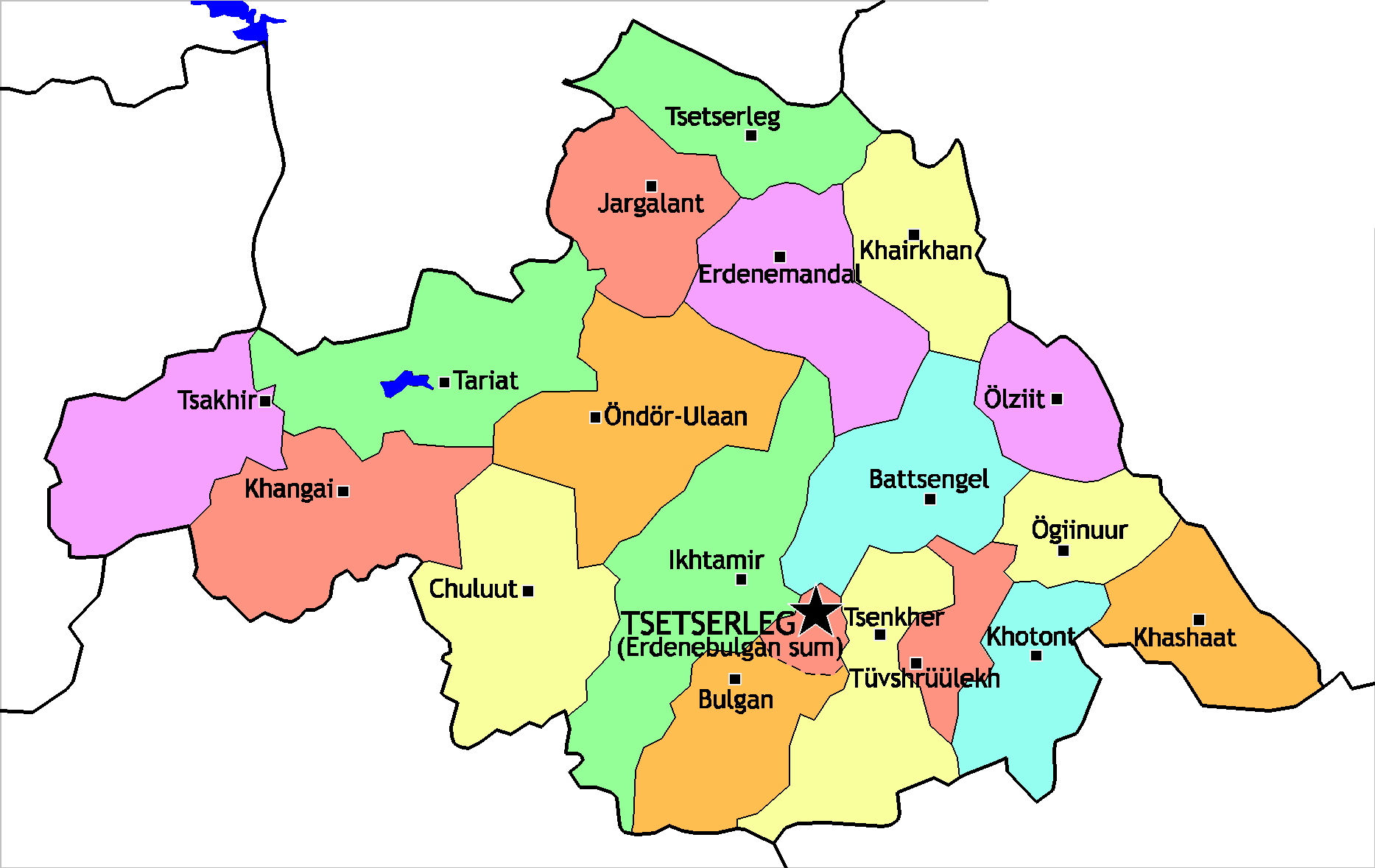
Tariat ( mn, Тариат, crop) is a sum (district) of Arkhangai Province in central Mongolia. As of 2009 it had a population of 5086 people (mainly Chalcha) in 2009, 644 of whom lived in the village of Tariat. Geography Tariat is located northwest of Tsetserleg, the capital of the province. To west of the town is Khorgo-Terkhiin Tsagaan Nuur National Park, noted for its striking crater Khorgo. The Chuluut River flows through the district. In 1977 the Soviet geologist Kavel discovered rock images along the river. Education The school in Tariat was attended by the Mongolian Social Democratic Party politician Radnaasümbereliin Gonchigdorj Radnaasümbereliin Gonchigdorj ( mn, Раднаасүмбэрэлийн Гончигдорж; born 1953) is Mongolian politician from the Mongolian Social Democratic Party and he has served twice as the Chairman of the legislature of Mongolia fr .... References Populated places in Mongolia Districts of Arkhangai Province ... [...More Info...] [...Related Items...] OR: [Wikipedia] [Google] [Baidu] |
Öndör-Ulaan
Öndör Ulaan ( mn, Өндөр-Улаан, ''high red'') is a sum (district) of Arkhangai Province in central Mongolia Mongolia; Mongolian script: , , ; lit. "Mongol Nation" or "State of Mongolia" () is a landlocked country in East Asia, bordered by Russia to the north and China to the south. It covers an area of , with a population of just 3.3 million, .... In 2009, its population was 5,798.Dec. 31 2009 estimation. Arkhangai Aimag Statistical Service References [...More Info...] [...Related Items...] OR: [Wikipedia] [Google] [Baidu] |
Arkhangai
The Arkhangai Province or Arkhangai Aimag ( mn, Архангай аймаг, Arhangai aimag, ; "North Khangai") is one of the 21 aimags of Mongolia. It is located slightly west of the country's center, on the northern slopes of the Khangai Mountains. It is composed of 19 soums. Geography The Arkhangai aimag is located in the interior of the country and borders to the following other aimags: Bulgan (north east), Övörkhangai (south east), Bayankhongor (south), Zavkhan (west), and Khövsgöl (north west). The highest point is Kharlagtai Peak at 3,529 m (11,578 ft), while the lowest point is the area on the confluence of the Orkhon and Tamir rivers at 1,290 m (4,232 ft). The most well-known mountain is the extinct volcano Khorgo, which is part of the Khorgo-Terkhiin Tsagaan Nuur National Park. Bodies of water The rivers Chuluut, Khanui, and Tamir have their origins in the valleys of the Khangai Mountains. Together with some smaller tributarie ... [...More Info...] [...Related Items...] OR: [Wikipedia] [Google] [Baidu] |
Mongolia
Mongolia; Mongolian script: , , ; lit. "Mongol Nation" or "State of Mongolia" () is a landlocked country in East Asia, bordered by Russia to the north and China to the south. It covers an area of , with a population of just 3.3 million, making it the world's most sparsely populated sovereign nation. Mongolia is the world's largest landlocked country that does not border a closed sea, and much of its area is covered by grassy steppe, with mountains to the north and west and the Gobi Desert to the south. Ulaanbaatar, the capital and largest city, is home to roughly half of the country's population. The territory of modern-day Mongolia has been ruled by various nomadic empires, including the Xiongnu, the Xianbei, the Rouran, the First Turkic Khaganate, and others. In 1206, Genghis Khan founded the Mongol Empire, which became the largest contiguous land empire in history. His grandson Kublai Khan conquered China proper and established the Yuan dynasty. After the co ... [...More Info...] [...Related Items...] OR: [Wikipedia] [Google] [Baidu] |
Aimags Of Mongolia
An aimag (, ; xal, әәмг, ), originally a Mongolian word meaning 'tribe', is an administrative subdivision in Mongolia, Russia, and in the Inner Mongolia region of China. Mongolia In Mongolia, an aimag is the first-level administrative subdivision. The country currently has 21 aimags. The capital Ulan Bator is administrated as an independent municipality. During the Qing dynasty, Khalkha was subdivided into four aimags ( Setsen Khan Aimag, Tüsheet Khan Aimag, Sain Noyon Khan Aimag and Zasagt Khan Aimag). An aimag was further subdivided into "banners" (''khoshuu''). Each aimag had an assembly of the local nobility, commonly named "league" in English (''chuulga'' in Mongolian). This administrative structure was kept until 1930, when the current structure with smaller aimags, subdivided into sums, was introduced. Inner Mongolia In Inner Mongolia, aimags (in the Inner Mongolian context, usually translated as "league", from ) are a prefecture-level subdivision, first ... [...More Info...] [...Related Items...] OR: [Wikipedia] [Google] [Baidu] |
Arkhangai Province
The Arkhangai Province or Arkhangai Aimag ( mn, Архангай аймаг, Arhangai aimag, ; "North Khangai") is one of the 21 aimags of Mongolia. It is located slightly west of the country's center, on the northern slopes of the Khangai Mountains. It is composed of 19 soums. Geography The Arkhangai aimag is located in the interior of the country and borders to the following other aimags: Bulgan (north east), Övörkhangai (south east), Bayankhongor (south), Zavkhan (west), and Khövsgöl (north west). The highest point is Kharlagtai Peak at 3,529 m (11,578 ft), while the lowest point is the area on the confluence of the Orkhon and Tamir rivers at 1,290 m (4,232 ft). The most well-known mountain is the extinct volcano Khorgo, which is part of the Khorgo-Terkhiin Tsagaan Nuur National Park. Bodies of water The rivers Chuluut, Khanui, and Tamir have their origins in the valleys of the Khangai Mountains. Together with some smaller tributaries t ... [...More Info...] [...Related Items...] OR: [Wikipedia] [Google] [Baidu] |
Khövsgöl Province
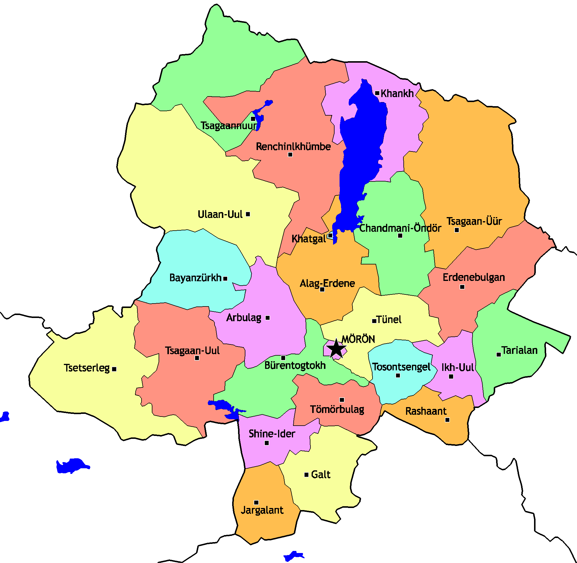
Khövsgöl ( mn, Хөвсгөл) is the northernmost of the 21 aimags (provinces) of Mongolia. The name is derived from Lake Khövsgöl. Geography and history The round-topped Tarvagatai, Bulnain and Erchim sub-ranges of the Khangai massif dominate the south and southwest of the largely mountainous province, and north and west of Lake Khövsgöl, lie the alpine Khoridol Saridag, Ulaan Taiga, and Mönkh Saridag mountains. The center and eastern parts of the province are less mountainous, but still hilly. The region is well known in Mongolia for its natural environment, and Lake Khövsgöl is one of the country's major tourist attractions. The largest forests of Mongolia are located around and to the north of the lake, extending the South Siberian taiga. The aimag was founded in 1931. Khatgal was the administrative center until 1933; since then it has been Mörön. Population The region is home to many ethnic minority groups: Darkhad, Khotgoid, Uriankhai, Buriad, and Tsaat ... [...More Info...] [...Related Items...] OR: [Wikipedia] [Google] [Baidu] |
Khangai Mountains
The Khangai Mountains ( mn, Хангайн нуруу, Hangain nuruu, ); form a mountain range, range in central Mongolia, some west of Ulaanbaatar. Name Two provinces of Mongolia are named after the Khangai mountains: Arkhangai (North Khangai) and Ovorkhangai (South Khangai). The mild climate area where the two provinces meet (in eastern Khangai) is known as the cradle of Mongolian and nomadic civilization. The plains at the foot of the eastern Khangai host the Orkhon Valley, Orkhon Valley World Heritage Site. The Xiongnu capital Luut Khot (Lungcheng), the Xianbei state, Xianbei capital Ordo and the Rouran capital Moomt (Mume) are said to have been located there. Later empires also established their capitals there: e.g. the Uyghur Khaganate (745–840) built their capital Ordu-Baliq in the region. Features The tallest mountain is Otgontenger ( "Youngest sky"), which is about 4,000 metres tall. It is revered by the Mongols and state ceremonies are held there. Suvraga Khairkha ... [...More Info...] [...Related Items...] OR: [Wikipedia] [Google] [Baidu] |
Ider River
, "young, youthful") , image = IderiinGol.JPG , image_size = , image_caption = Ider River near Jargalant, Khövsgöl , map = , map_size = , map_caption = , pushpin_map = , pushpin_map_size = , pushpin_map_caption= , subdivision_type1 = Country , subdivision_name1 = Mongolia , subdivision_type2 = Aimags , subdivision_name2 = Zavkhan, Khövsgöl , subdivision_type3 = , subdivision_name3 = , subdivision_type4 = , subdivision_name4 = , subdivision_type5 = , subdivision_name5 = , length = , width_min = , width_avg = , width_max = , depth_min = , depth_avg = , depth_max = , discharge1_location= , discharge1_min = , discharge1_avg = , discharge1_max = , source1 = , source1_location = Khangai Mountains , source1_coordinates= (approximately) , source1_elevati ... [...More Info...] [...Related Items...] OR: [Wikipedia] [Google] [Baidu] |
Suman River
The Suman gol ( mn, Суман гол) is a river in Arkhangai. It springs from the Terkhiin Tsagaan Nuur and is a tributary of the Chuluut River Chuluut River ( mn, Чулуут гол, ''stony river'') is a river flowing through the valleys of the Khangai Mountains in central Mongolia Mongolia; Mongolian script: , , ; lit. "Mongol Nation" or "State of Mongolia" () is a landlock .... The length is about 50 km. References Rivers of Mongolia {{Mongolia-river-stub ... [...More Info...] [...Related Items...] OR: [Wikipedia] [Google] [Baidu] |
Ider River
, "young, youthful") , image = IderiinGol.JPG , image_size = , image_caption = Ider River near Jargalant, Khövsgöl , map = , map_size = , map_caption = , pushpin_map = , pushpin_map_size = , pushpin_map_caption= , subdivision_type1 = Country , subdivision_name1 = Mongolia , subdivision_type2 = Aimags , subdivision_name2 = Zavkhan, Khövsgöl , subdivision_type3 = , subdivision_name3 = , subdivision_type4 = , subdivision_name4 = , subdivision_type5 = , subdivision_name5 = , length = , width_min = , width_avg = , width_max = , depth_min = , depth_avg = , depth_max = , discharge1_location= , discharge1_min = , discharge1_avg = , discharge1_max = , source1 = , source1_location = Khangai Mountains , source1_coordinates= (approximately) , source1_elevati ... [...More Info...] [...Related Items...] OR: [Wikipedia] [Google] [Baidu] |


