|
Chota, Peru
Chota is a town in Northern Peru, capital of the province Chota Province, Chota in the region Cajamarca Region, Cajamarca. The city is the seat of the Territorial Prelature of Chota. History In pre-Inca times, chotanos territories were occupied by various cultures, such as Los Huambos in the West and Cuismanco in the east, getting a strong influence of the Chavín culture, Chavin, Wari culture, Wari and Moche culture, Moche cultures of which there are archaeological remains of great importance as Pacopampa, Negropampa, Rejopampa and others. The foundation of the city of Chota took place on two dates: one in 1552 and another in 1559, it is not clear if it was on these two dates. During the War of the Pacific, after the Battle of San Pablo the Araucanian (from the city of Arauco, Chile, Arauco) entered Chota, to which the people decided to poison the waters of the river Colpamayo and by that the Chilean ordered the burning of the city. On August 29, 1882, Chota was burned by Chil ... [...More Info...] [...Related Items...] OR: [Wikipedia] [Google] [Baidu] |
Regions Of Peru
According to the ''Organic Law of Regional Governments'', the regions ( es, regiones) are, with the departments, the first-level administrative subdivisions of Peru. Since its Peruvian War of Independence, 1821 independence, Peru had been divided into departments of Peru, departments () but faced the problem of increasing centralization of political and economic power in its capital, Lima. After several unsuccessful regionalization attempts, the national government decided to temporarily provide the departments (including the Constitutional Province of Callao) with regional governments until the conformation of regions according to the ''Organic Law of Regional Governments'' which says that two or more departments should merge to conform a region. This situation turned the departments into ''de facto'' regional government circumscriptions. The first regional governments were elected on November 20, 2002. Under the new arrangement, the 24 Departments of Peru, departments plus the ... [...More Info...] [...Related Items...] OR: [Wikipedia] [Google] [Baidu] |
Pacopampa
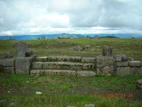
Pacopampa ( qu, paqu pampa) is an archaeological site located in the northern highlands of Peru, in the department of Cajamarca. It presents the remains of a monumental ceremonial center, made with cut and polished stone. It belongs to the Formative period, dating from 1200 to 500 BC. The land where the reservoir extends belongs to the National University of San Marcos, which through its ''Rural Andean History Seminar'' cares permanently for the monument. Geographical location It is within the village of Pacopampa at 2140 m in the Querocoto District of the province of Chota, Cajamarca Region. It is among the largest ceremonial centers of the northern highlands of Peru. At its surroundings a dozen of archaeological sites have been identified, which a couple have been studied. These are called Chapel and El Mirador, located one kilometer east. Further, 3 km southeast, is Pandanche another Formative period ceremonial center. Research In the 1930s Rafael Larco Hoyle visited ... [...More Info...] [...Related Items...] OR: [Wikipedia] [Google] [Baidu] |
El Niño
El Niño (; ; ) is the warm phase of the El Niño–Southern Oscillation (ENSO) and is associated with a band of warm ocean water that develops in the central and east-central equatorial Pacific (approximately between the International Date Line and 120°W), including the area off the Pacific coast of South America. The ENSO is the cycle of warm and cold sea surface temperature (SST) of the tropical central and eastern Pacific Ocean. El Niño is accompanied by high air pressure in the western Pacific and low air pressure in the eastern Pacific. El Niño phases are known to last close to four years; however, records demonstrate that the cycles have lasted between two and seven years. During the development of El Niño, rainfall develops between September–November. The cool phase of ENSO is es, La Niña, translation=The Girl, with SSTs in the eastern Pacific below average, and air pressure high in the eastern Pacific and low in the western Pacific. The ENSO cycle, including bo ... [...More Info...] [...Related Items...] OR: [Wikipedia] [Google] [Baidu] |
Amazon Basin
The Amazon basin is the part of South America drained by the Amazon River and its tributaries. The Amazon drainage basin covers an area of about , or about 35.5 percent of the South American continent. It is located in the countries of Bolivia, Brazil, Colombia, Ecuador, Guyana, Peru, Suriname, and Venezuela. Most of the basin is covered by the Amazon rainforest, also known as Amazonia. With a area of dense tropical forest, this is the largest rainforest in the world. Geography The Amazon River begins in the Andes Mountains at the west of the basin with its main tributary the Marañón River and Apurimac River in Peru. The highest point in the watershed of the Amazon is the second biggest peak of Yerupajá at . With a length of about before it drains into the Atlantic Ocean, it is one of the two longest rivers in the world. A team of scientists has claimed that the Amazon is longer than the Nile, but debate about its exact length continues. The Amazon system ... [...More Info...] [...Related Items...] OR: [Wikipedia] [Google] [Baidu] |
Chiclayo
Chiclayo (; qu, Chiklayu) is the principal city of the Lambayeque region in northern Peru. It is located inland from the Pacific coast and from the nation's capital, Lima. Founded by Spanish explorers as "Santa María de los Valles de Chiclayo" in the 16th century, it was declared a city on 15 April 1835 by president Felipe Santiago Salaverry. He named Chiclayo "the Heroic City" to recognize the courage of its citizens in the fight for independence, a title it still holds. Other nicknames for Chiclayo include "The Capital of Friendship" and the "Pearl of the North". Chiclayo is Peru's fourth-largest city, after Lima, Arequipa, and Trujillo, with a population of 738,000 as of 2011."Local Stats, Info, Weather" , ''TravelsRadiate'', ... [...More Info...] [...Related Items...] OR: [Wikipedia] [Google] [Baidu] |
Cajamarca
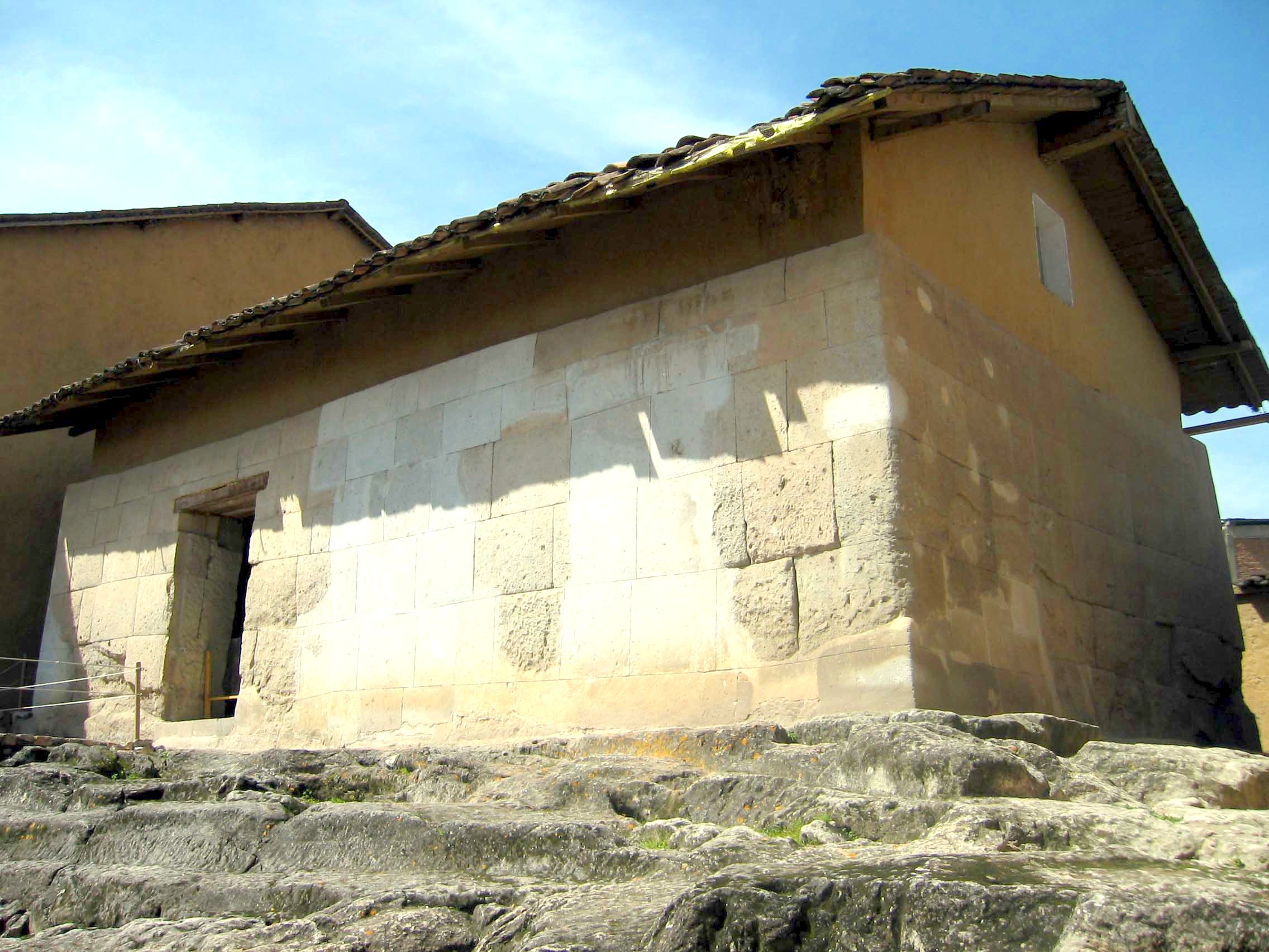
Cajamarca (), also known by the Quechua name, ''Kashamarka'', is the capital and largest city of the Cajamarca Region as well as an important cultural and commercial center in the northern Andes. It is located in the northern highlands of Peru at approximately 2,750 m (8,900 ft) above sea level in the valley of the Mashcon river. Cajamarca had an estimated population of about 226,031 inhabitants in 2015, making it the 13th largest city in Peru. Cajamarca has a mild highland climate, and the area has a very fertile soil. The city is well known for its dairy products and mining activity in the surroundings. Among its tourist attractions, Cajamarca has numerous examples of Spanish colonial religious architecture, beautiful landscapes, pre-Hispanic archeological sites and hot springs at the nearby town of Baños del Inca (Baths of the Inca). The history of the city is highlighted by the Battle of Cajamarca, which marked the defeat of the Inca Empire by Spanish invaders ... [...More Info...] [...Related Items...] OR: [Wikipedia] [Google] [Baidu] |
Arauco, Chile
Arauco is a city and commune ( es, comuna) in Chile, located in Arauco Province in the Bío Bío Region. The meaning of Arauco means Chalky Water in Mapudungun. The region was a Moluche aillarehue. The Spanish settlements founded here during the Conquest of Chile were destroyed on numerous occasions by the Mapuche during the Arauco War. History Old Arauco In 1552 Pedro de Valdivia the first governor of Chile, founded a fort, named ''San Felipe de Rauco'' or ''de Araucan''. It was east of the location of the modern city of Arauco in the part of the valley immediately on the South or left bank of the Carampangue River at the point where on the opposite bank it receives the riachuelo of Conumo. Valdivia planned it to be the base for a city he planned to found. The Mapuche destroyed the fort in 1554, after killing Valdivia's insane mother-in-law. It was raised again after the battle of Quiapo, by García Hurtado de Mendoza in 1559. Destroyed again in 1563 it was rebuilt again ... [...More Info...] [...Related Items...] OR: [Wikipedia] [Google] [Baidu] |
Battle Of San Pablo
A battle is an occurrence of combat in warfare between opposing military units of any number or size. A war usually consists of multiple battles. In general, a battle is a military engagement that is well defined in duration, area, and force commitment. An engagement with only limited commitment between the forces and without decisive results is sometimes called a skirmish. The word "battle" can also be used infrequently to refer to an entire operational campaign, although this usage greatly diverges from its conventional or customary meaning. Generally, the word "battle" is used for such campaigns if referring to a protracted combat encounter in which either one or both of the combatants had the same methods, resources, and strategic objectives throughout the encounter. Some prominent examples of this would be the Battle of the Atlantic, Battle of Britain, and Battle of Stalingrad, all in World War II. Wars and military campaigns are guided by military strategy, wherea ... [...More Info...] [...Related Items...] OR: [Wikipedia] [Google] [Baidu] |
War Of The Pacific
The War of the Pacific ( es, link=no, Guerra del Pacífico), also known as the Saltpeter War ( es, link=no, Guerra del salitre) and by multiple other names, was a war between Chile and a Bolivian–Peruvian alliance from 1879 to 1884. Fought over Chilean claims on coastal Bolivian territory in the Atacama Desert, the war ended with a Chilean victory, which gained for the country a significant amount of resource-rich territory from Peru and Bolivia. The war began over a nitrate taxation dispute between Bolivia and Chile, with Peru being drawn in due to its secret alliance with Bolivia. But historians have pointed to deeper origins of the war, such as the interest of Chile and Peru in the nitrate business, the long-standing rivalry between Chile and Peru, as well as political and economical disparities between Chile, Peru and Bolivia. On February 14, 1879, Chile's armed forces occupied the Bolivian port city of Antofagasta, subsequently war between Bolivia and Chile was declare ... [...More Info...] [...Related Items...] OR: [Wikipedia] [Google] [Baidu] |
Moche Culture
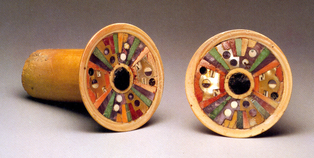
The Moche civilization (; alternatively, the Mochica culture or the Early, Pre- or Proto-Chimú) flourished in northern Peru with its capital near present-day Moche, Trujillo, Peru from about 100 to 700 AD during the Regional Development Epoch. While this issue is the subject of some debate, many scholars contend that the Moche were not politically organized as a monolithic empire or state. Rather, they were likely a group of autonomous polities that shared a common culture, as seen in the rich iconography and monumental architecture that survives today. Background Moche society was agriculturally based, with a significant level of investment in the construction of a sophisticated network of irrigation canals for the diversion of river water to supply their crops. Their artifacts express their lives, with detailed scenes of hunting, fishing, fighting, sacrifice, sexual encounters, and elaborate ceremonies. The Moche are particularly noted for their elaborately painted ceramics ... [...More Info...] [...Related Items...] OR: [Wikipedia] [Google] [Baidu] |
Cajamarca Region
Cajamarca (; qu, Kashamarka; ay, Qajamarka) is a department and region in Peru. The capital is the city of Cajamarca. It is located in the north part of the country and shares a border with Ecuador. The city has an elevation of above sea level in the Andes Mountain Range, the longest mountain range in the world. Part of its territory includes the Amazon Rainforest, the largest in the world. History The oldest known irrigation canals in the Americas are located in the Nanchoc District of Cajamarca Department. The canals in the Zaña Valley have been radiocarbon dated to 3400 BCE, and possibly date to 4700 BCE. From the 6th to the 10th century the people of the Wari culture ruled earlier cultures in the highlands. They established the administrative center of Wiraquchapampa. In the 15th century, the Incas conquered the territory, expanding their empire. They established their regional capital in what is now Cajamarca. The Incas in 1465 established a new province there to se ... [...More Info...] [...Related Items...] OR: [Wikipedia] [Google] [Baidu] |
Wari Culture
The Wari ( es, Huari) were a Middle Horizon civilization that flourished in the south-central Andes and coastal area of modern-day Peru, from about 500 to 1000 AD. Wari, as the former capital city was called, is located north-east of the modern city of Ayacucho, Peru. This city was the center of a civilization that covered much of the highlands and coast of modern Peru. The best-preserved remnants, beside the Wari Ruins, are the recently discovered Northern Wari ruins near the city of Chiclayo, and Cerro Baúl in Moquegua. Also well-known are the Wari ruins of Pikillaqta ("Flea Town"), a short distance south-east of Cuzco ''en route'' to Lake Titicaca. However, there is still a debate whether the Wari dominated the Central Coast or the polities on the Central Coast were commercial states capable of interacting with the Wari people without being politically dominated by them. History Archaeological evidence points toward the Wari empire taking control of a number of small ... [...More Info...] [...Related Items...] OR: [Wikipedia] [Google] [Baidu] |


