|
Chillingham, New South Wales
Chillingham is a small village approximately 14 km northwest of Murwillumbah in the Tweed Valley, New South Wales, Australia. The Rous River Rous River, a perennial river of the Tweed River catchment, is located in the Northern Rivers region of New South Wales, Australia. Course and features Rous River rises below Mount Hobwee on the southern slopes of the McPherson Range, near Nu ..., a tributary of the Tweed River, flows through the town. Chillingham Post Office opened on 28 May 1923. A Telegraph Office had been open since 1913, known for some months as ''Bean Tree''. References External linksTweed Tourism Inc - visitor information for the Tweed region (including Chillingham) Suburbs of Tweed Heads, New South Wales {{NorthernRivers-geo-stub ... [...More Info...] [...Related Items...] OR: [Wikipedia] [Google] [Baidu] |
Mount Warning
Mount Warning ( Bundjalung: ''Wollumbin''), a mountain in the Tweed Range in the Northern Rivers region of New South Wales, Australia, was formed from a volcanic plug of the now-gone Tweed Volcano. The mountain is located west-south-west of Murwillumbah, near the border between New South Wales and Queensland. Lieutenant James Cook saw the mountain from the sea and named it Mount Warning. Shield volcano Mount Warning is the central volcanic remnant of an ancient shield volcano, the Tweed Volcano, which would have been about above sea level or just under twice the height of the current mountain.The Caldera of the Mount Warning Shield Volcano. rochureNew South Wales National Parks and Wildlife Service. 1990. This volcano last erupted around 23 million years ago. As the mountain's central vent cooled it shrank, forming a depression at the top that has greatly eroded. Today the vast areas that were part of the volcano include many mountains and ranges at some distance ... [...More Info...] [...Related Items...] OR: [Wikipedia] [Google] [Baidu] |
Murwillumbah, New South Wales
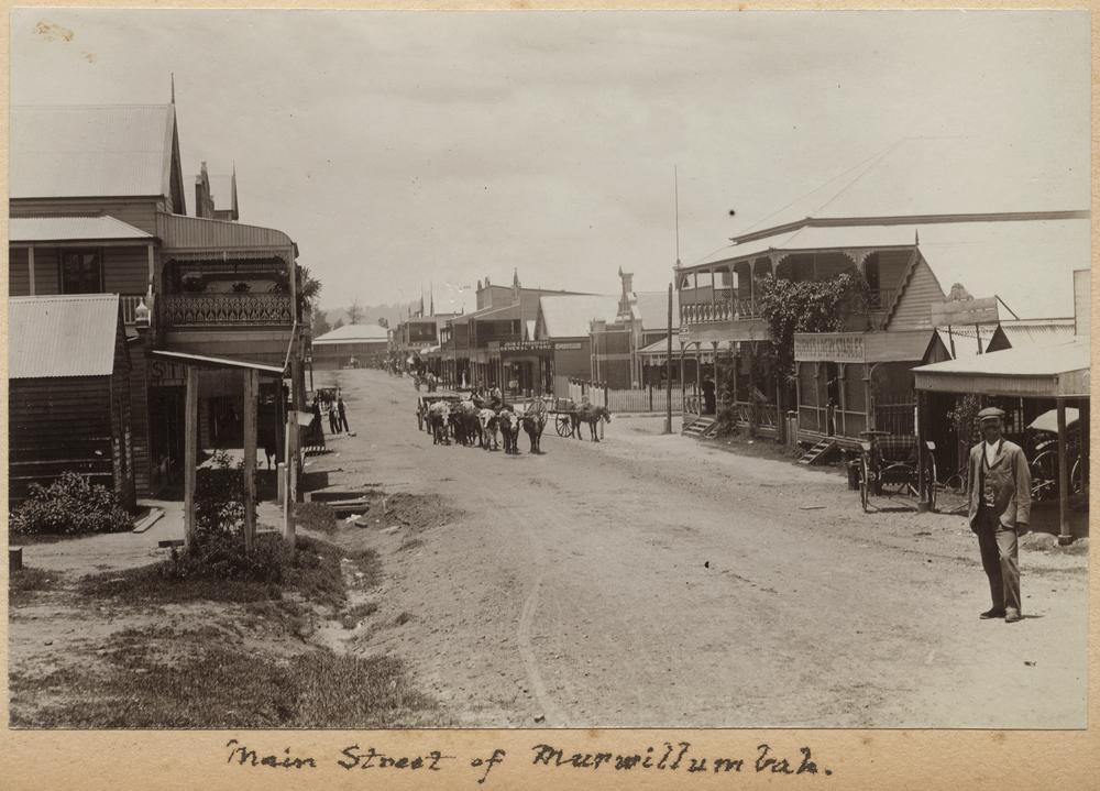
Murwillumbah ( ) is a town in far north-eastern New South Wales, Australia, in the Tweed Shire, on the Tweed River. Sitting on the south eastern foothills of the McPherson Range in the Tweed Volcano valley, Murwillumbah is 848 km north-east of Sydney, 13 km south of the Queensland border and 132 km south of Brisbane. The town's name is often abbreviated to M'bah or Murbah. At the 2016 census, Murwillumbah had a population of 9,245. Many of the buildings are Art Deco in style and there are cafes, clothes shops and antique shops in the town. History The first people to live in the area were Kalibai people. The name Murwillumbah may derive from an Aboriginal compound meaning either "camping place" – from ''murrie'', meaning "aboriginal people", ''wolli'', "a camp", and ''bah'', "place" – or alternatively from ''murra'', "big", ''willum'', "possum", and ''bah''. Nearby Mount Warning and its attendant national park are known as Wollumbin, meaning "Cloud Catc ... [...More Info...] [...Related Items...] OR: [Wikipedia] [Google] [Baidu] |
Electoral District Of Lismore
Lismore is an electoral district of the Legislative Assembly in the Australian state of New South Wales. It is represented by Janelle Saffin of the Labor Party. The electoral district includes all of the City of Lismore (including Lismore, Lindendale, Nimbin, Dunoon and Clunes), much of inland Tweed Shire (including Murwillumbah, Tyalgum and Uki), all of Kyogle Council (including Kyogle, Bonalbo, Tabulam and Woodenbong) and all of Tenterfield Shire. (including Tenterfield, Drake, Jennings, Liston, Legume, Torrington and Urbenville) History Lismore was first created with the end of multi-member districts in 1894, when it was split from Richmond. In 1904, it was abolished with the reduction in the size of the Legislative Assembly, after Federation. In 1913, Lismore was recreated, replacing Richmond. With the introduction of proportional representation in 1920, Lismore and Clarence were absorbed into Byron. With the end of proportional representation in 1927, ... [...More Info...] [...Related Items...] OR: [Wikipedia] [Google] [Baidu] |
Division Of Richmond
The Division of Richmond is an Australian electoral division in the state of New South Wales. History The division was proclaimed in 1900, and was one of the original 65 divisions to be contested at the first federal election. The division is named after the area in which it is located, namely the Richmond Valley and Richmond River, which was named in honour of Charles, the fifth Duke of Richmond. Historically, the division has been a rural seat and fairly safe for the National Party (formerly called the Country Party), which held it for all but six years from 1922 to 2004. For 55 of those years, it was held by three generations of the Anthony family—Hubert Lawrence Anthony (a minister in the Fadden and Menzies governments), Doug Anthony (leader of the National Party from 1971 to 1984 and Deputy Prime Minister in the Gorton, McMahon and Fraser governments) and Larry Anthony (a minister in the Howard government)—the first three-generation dynasty in the Australian Ho ... [...More Info...] [...Related Items...] OR: [Wikipedia] [Google] [Baidu] |
Tweed Valley
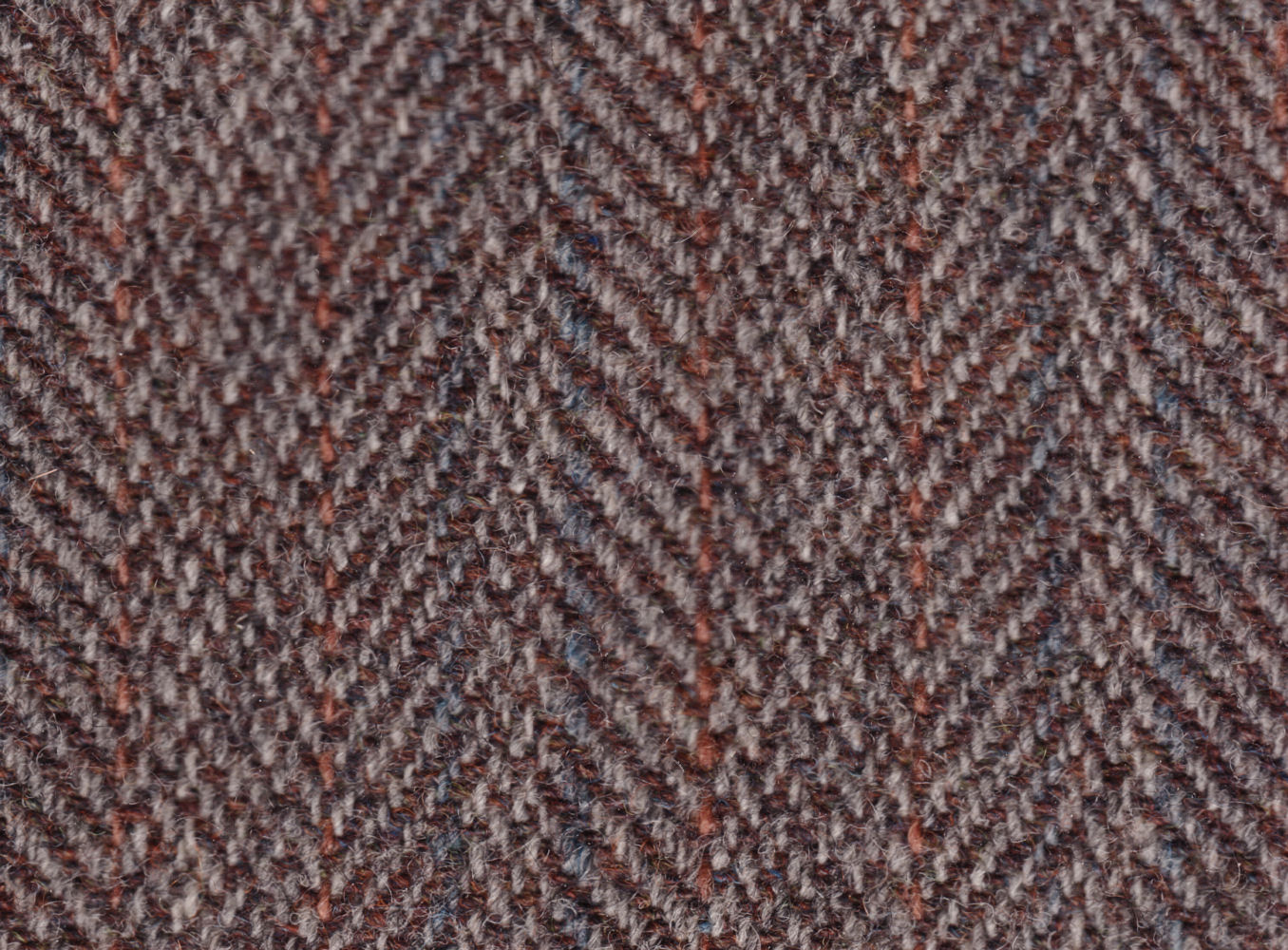
Tweed is a rough, woollen fabric, of a soft, open, flexible texture, resembling cheviot or homespun, but more closely woven. It is usually woven with a plain weave, twill or herringbone structure. Colour effects in the yarn may be obtained by mixing dyed wool before it is spun. Tweeds are an icon of traditional Scottish, Irish, Welsh and English clothing, being desirable for informal outerwear, due to the material being moisture-resistant and durable. Tweeds are made to withstand harsh climates and are commonly worn for outdoor activities such as shooting and hunting, in England, Wales, Ireland and Scotland. In Ireland, tweed manufacturing is now most associated with County Donegal but originally covered the whole country. In Scotland, tweed manufacturing is most associated with the Isle of Harris in the Hebrides. Etymology The original name of the cloth was ''tweel'', Scots for twill, the material being woven in a twilled rather than a plain pattern. A traditional story ... [...More Info...] [...Related Items...] OR: [Wikipedia] [Google] [Baidu] |
New South Wales
) , nickname = , image_map = New South Wales in Australia.svg , map_caption = Location of New South Wales in AustraliaCoordinates: , subdivision_type = Country , subdivision_name = Australia , established_title = Before federation , established_date = Colony of New South Wales , established_title2 = Establishment , established_date2 = 26 January 1788 , established_title3 = Responsible government , established_date3 = 6 June 1856 , established_title4 = Federation of Australia, Federation , established_date4 = 1 January 1901 , named_for = Wales , demonym = , capital = Sydney , largest_city = capital , coordinates = , admin_center = Local government areas of New South Wales, 128 local government areas , admin_center_type = Administration , leader_title1 = Monarchy of Australia, Monarch , leader_name1 = Charles III , leader_title2 = Governor of New South Wales, Governor , leader_name2 = Margaret Beazley , leader_title3 = Premier of New South Wales, Premie ... [...More Info...] [...Related Items...] OR: [Wikipedia] [Google] [Baidu] |
Australia
Australia, officially the Commonwealth of Australia, is a Sovereign state, sovereign country comprising the mainland of the Australia (continent), Australian continent, the island of Tasmania, and numerous List of islands of Australia, smaller islands. With an area of , Australia is the largest country by area in Oceania and the world's List of countries and dependencies by area, sixth-largest country. Australia is the oldest, flattest, and driest inhabited continent, with the least fertile soils. It is a Megadiverse countries, megadiverse country, and its size gives it a wide variety of landscapes and climates, with Deserts of Australia, deserts in the centre, tropical Forests of Australia, rainforests in the north-east, and List of mountains in Australia, mountain ranges in the south-east. The ancestors of Aboriginal Australians began arriving from south east Asia approximately Early human migrations#Nearby Oceania, 65,000 years ago, during the Last Glacial Period, last i ... [...More Info...] [...Related Items...] OR: [Wikipedia] [Google] [Baidu] |
Rous River
Rous River, a perennial river of the Tweed River catchment, is located in the Northern Rivers region of New South Wales, Australia. Course and features Rous River rises below Mount Hobwee on the southern slopes of the McPherson Range, near Numinbah on the New South Wales-Queensland border, and flows generally east by south, and then east, joined by four minor tributaries, before reaching its confluence with the Tweed River at Tumbulgum, northeast of Murwillumbah. The river descends over its course. In its upper reaches, Rous River is fed by a minor tributary, Hopkins Creek, on the southern slopes of the McPherson Range, south of Mount Merino; and downriver of Numinbah near the small villages of Chillingham, Jacksons Creek enters the river. In its lower reaches, Rous River is fed by two minor tributaries, Nobbys Creek and Crystal Creek that emerge from the Numinbah Nature Reserve, south of Springbrook. Adjustments to the natural flow of the river In January 2006, parti ... [...More Info...] [...Related Items...] OR: [Wikipedia] [Google] [Baidu] |
Tweed River (New South Wales)
The Tweed River is a river situated in the Northern Rivers district of New South Wales, Australia. From the middle reaches of its course, the state boundary between New South Wales and Queensland is located approximately north. The river rises on the eastern slopes of the Great Dividing Range; with its watershed bordered by the McPherson, Burringbar, Condong and Tweed ranges and containing a catchment area of . The river flows generally north east, joined by eight tributaries including the Oxley and Rous rivers before reaching its mouth at its confluence with the Coral Sea of the South Pacific Ocean, south of Point Danger; descending over its course. On its journey, it passes through the major urban centres of Murwillumbah and Tweed Heads. The river's drainage basin consists mostly of the erosion caldera of the Tweed Volcano, a huge extinct volcano of which Mount Warning is the volcanic plug. The Tweed River area has a fine subtropical climate, high rainfall and ferti ... [...More Info...] [...Related Items...] OR: [Wikipedia] [Google] [Baidu] |
NRMA
NRMA (formerly National Roads and Motorists' Association) is an Australian organisation offering roadside assistance, advocacy for motorists and road-users, motoring advice, car servicing, International Driving Permits, travel and other services in New South Wales and the Australian Capital Territory. It is a member-owned mutual company limited by guarantee. It was formed in 1920. The Headquarters is in Sydney Olympic Park, New South Wales, Australia Prior to 2000, the organisation offered mutual insurance but that business was demutualised and spun out as NRMA Insurance which is now part of Insurance Australia Group Limited (IAG). The NRMA and NRMA Insurance are independent companies with an agreement to use the same brand and name but both companies are responsible for distinguishing the difference between the two organisations. Early history National Roads Association The Australian National Roads Association, which would become the NRMA, was launched in 1920. Its ... [...More Info...] [...Related Items...] OR: [Wikipedia] [Google] [Baidu] |
Auslig
Geoscience Australia is an agency of the Australian Government. It carries out geoscientific research. The agency is the government's technical adviser on all aspects of geoscience, and custodian of the geographic and geological data and knowledge of the nation. On a user pays basis it produces geospatial products such as topographic maps and satellite imagery. It is also a major contributor to the Australian Government's free, open data collections such as data.gov.au. Strategic priorities The agency has six strategic priority areas: # building Australia's resource wealth in order to maximise benefits from Australia's minerals and energy resources, now and into the future; # ensuring Australia's community safety so that Australian communities are more resilient to natural hazards; # securing Australia's water resources in order to optimise and sustain the use of Australia's water resources; # managing Australia's marine jurisdictions in order to maximise benefits from the s ... [...More Info...] [...Related Items...] OR: [Wikipedia] [Google] [Baidu] |


