|
Cheyres-Châbles
Cheyres-Châbles () is a Municipalities of Switzerland, municipality in the district of Broye (district), Broye in the Cantons of Switzerland, canton of Fribourg (canton), Fribourg in Switzerland. On 1 January 2017 the former municipalities of Châbles and Cheyres merged into the new municipality of Cheyres-Châbles. History Cheyres Cheyres is first mentioned in 1230 as ''Cheres''. Geography Cheyres-Châbles has an area, , of . Demographics The new municipality has a population () of . Historic Population The historical population is given in the following chart: Colors= id:lightgrey value:gray(0.9) id:darkgrey value:gray(0.8) ImageSize = width:1100 height:500 PlotArea = height:350 left:100 bottom:90 right:100 Legend = columns:3 left:220 top:70 columnwidth:160 AlignBars = justify DateFormat = x.y Period = from:0 till:1200 TimeAxis = orientation:vertical AlignBars = justify ScaleMajor = gridcolor:darkgrey increment:200 start:0 ScaleMinor = gridcolor:lightgrey ... [...More Info...] [...Related Items...] OR: [Wikipedia] [Google] [Baidu] |
Broye (district)
Broye District (; frp, District de la Brouye ; german: Broyebezirk) is one of the seven districts of the Canton of Fribourg, Switzerland, lying in the vicinity of Lake Neuchâtel. Its territory is non-contiguous and Broye is fragmented into four parts, three of which exist as exclaves from the canton of Fribourg. It has a population of (as of ). Municipalities Broye consists of the following municipalities, of which Estavayer is the capital: Mergers and name changes *On 1 January 1981 the former municipalities of La Vounaise and Montborget merged into the municipality of Murist. *In 1991 the former municipality Les Friques merged into the municipality Saint-Aubin. *On 31 December 1991 the former municipality of Franex merged into the municipality Murist. *In 1994 the former municipality Chandon merged into the municipality Léchelles *On 1 January 2000 the former municipalities of Montagny-la-Ville and Montagny-les-Monts merged to form the new municipality of Montagny (FR). ... [...More Info...] [...Related Items...] OR: [Wikipedia] [Google] [Baidu] |
Bollion
Bollion is a village lying within the municipality of Lully, in the canton of Fribourg, Switzerland. It formerly existed as an autonomous municipality, but on 1 January 2006 was merged with Seiry Seiry is a village lying within the municipality of Lully, in the canton of Fribourg, Switzerland ). Swiss law does not designate a ''capital'' as such, but the federal parliament and government are installed in Bern, while other federal in ..., into the larger Lully. References Former municipalities of the canton of Fribourg Villages in the canton of Fribourg {{Fribourg-geo-stub ... [...More Info...] [...Related Items...] OR: [Wikipedia] [Google] [Baidu] |
Châbles
Châbles (; frp, Châbllos, locally ) is a former municipality in the district of Broye in the canton of Fribourg in Switzerland. On 1 January 2017 the former municipalities of Châbles and Cheyres merged into the new municipality of Cheyres-Châbles. Geography Châbles has an area, , of . Of this area, or 52.1% is used for agricultural purposes, while or 28.3% is forested. Of the rest of the land, or 9.5% is settled (buildings or roads), or 0.2% is either rivers or lakes and or 10.5% is unproductive land.Swiss Federal Statistical Office-Land Use Statistics 2009 data . Retrieved 25 March 2010 Of the built up area, housing and buildings made up 5.1% and transportation infrastructure made up 3.6%. Out of the forested land, 26.8% of the total la ... [...More Info...] [...Related Items...] OR: [Wikipedia] [Google] [Baidu] |
Cheyres
Cheyres ( frp, Chêres, locally or ''Tsàrè'') is a former municipality in the district of Broye in the canton of Fribourg in Switzerland. On 1 January 2017 the former municipalities of Cheyres and Châbles merged into the new municipality of Cheyres-Châbles. History Cheyres is first mentioned in 1230 as ''Cheres''. Geography Cheyres has an area, , of . Of this area, or 42.5% is used for agricultural purposes, while or 35.7% is forested. Of the rest of the land, or 14.2% is settled (buildings or roads), or 1.0% is either rivers or lakes and or 6.6% is unproductive land.Swiss Federal Statistical Office-Land Use Statistics 2009 data . Retrieved 25 March 2010 Of the built up area, housing and buildings made up 8.2% and transportation infrastruct ... [...More Info...] [...Related Items...] OR: [Wikipedia] [Google] [Baidu] |
Châtillon, Fribourg
Châtillon () is a municipality in the district of Broye in the canton of Fribourg in Switzerland. History Châtillon became an independent municipality in 1801. Geography Châtillon has an area, , of . Of this area, or 55.0% is used for agricultural purposes, while or 27.5% is forested. Of the rest of the land, or 16.8% is settled (buildings or roads).Swiss Federal Statistical Office-Land Use Statistics 2009 data . Retrieved 25 March 2010 Of the built up area, housing and buildings made up 13.7% and transportation infrastructure made up 1.5%. Out of the forested land, all of the forested land area is covered with heavy forests. Of the agricultural land, 36.6% is used for growing crops and 14.5% is pastures, while 3.8% is used for orchards or vin ... [...More Info...] [...Related Items...] OR: [Wikipedia] [Google] [Baidu] |
Concise
Concise is a municipality in the district of Jura-Nord Vaudois in the canton of Vaud in Switzerland. History Concise is first mentioned in 1179 as ''Concisa''. Geography Concise has an area, , of . Of this area, or 24.4% is used for agricultural purposes, while or 66.3% is forested. Of the rest of the land, or 8.8% is settled (buildings or roads), or 0.1% is either rivers or lakes and or 0.2% is unproductive land.Swiss Federal Statistical Office-Land Use Statistics 2009 data . Retrieved 25 March 2010 Of the built up area, housing and buildings made up 2.8% and transportation infrastructure made up 4.0%. Power and water infrastructure as well as other special developed areas made up 1.6% of the area Out of the forested land, 64.6% of the tot ... [...More Info...] [...Related Items...] OR: [Wikipedia] [Google] [Baidu] |
Font, Switzerland
Font is a former municipality in the district of Broye, in the canton of Fribourg, Switzerland. The municipality of Font merged on 1 January 2012 into the municipality of Estavayer-le-Lac.Amtliches Gemeindeverzeichnis der Schweiz published by the Swiss Federal Statistical Office accessed 17 February 2011 History Font is first mentioned in 1011.Geography Font has an area, , of . Of this area, or 52.0% is used for agricultural purposes, while or 26.8% is forested. Of the rest of the land, or 14.8% is settled (buildings or roads), or 0.4% is either rivers or lakes and or 6.4% is unproductive land.[...More Info...] [...Related Items...] OR: [Wikipedia] [Google] [Baidu] |
Murist
Murist (; frp, Muri ) is a former municipality in the district of Broye, in the canton of Fribourg, Switzerland. Its territory was enlarged in 1981 with the formerly independent municipalities La Vounaise and Montborget, and in 1992 with Franex.Nomenklaturen – Amtliches Gemeindeverzeichnis der Schweiz accessed 4 April 2011 On 1 January 2017 the former municipalities of Murist, Bussy, , |
Vaumarcus
Vaumarcus is a former municipality in the district of Boudry in the canton of Neuchâtel in Switzerland. On 1 January 2018 the former municipalities of Bevaix, Saint-Aubin-Sauges, Gorgier, Vaumarcus, Montalchez and Fresens merged into the new municipality of La Grande-Béroche. History Vaumarcus was first mentioned in 1227 as ''Valmarcuel''. It was created in 1875 as a merger of Vaumarcus and Vernéaz, and was called ''Vaumarcus-Vernéaz'' until 1966.Amtliches Gemeindeverzeichnis der Schweiz published by the Swiss Federal Statistical Office accessed 19 July 2011 Geography [...More Info...] [...Related Items...] OR: [Wikipedia] [Google] [Baidu] |
Municipalities Of Switzerland
Municipalities (german: Gemeinden, ' or '; french: communes; it , comuni; rm, vischnancas) are the lowest level of administrative division in Switzerland. Each municipality is part of one of the Swiss cantons, which form the Swiss Confederation. In most cantons, municipalities are also part of districts or other sub-cantonal administrative divisions. There are 2,136 municipalities . Their populations range between several hundred thousand (Zürich), and a few dozen people (Kammersrohr, Bister), and their territory between 0.32 km² (Rivaz) and 439 km² (Scuol). History The beginnings of the modern municipality system date back to the Helvetic Republic. Under the Old Swiss Confederacy, citizenship was granted by each town and village to only residents. These citizens enjoyed access to community property and in some cases additional protection under the law. Additionally, the urban towns and the rural villages had differing rights and laws. The creation of a uniform Swiss ... [...More Info...] [...Related Items...] OR: [Wikipedia] [Google] [Baidu] |
Cantons Of Switzerland
The 26 cantons of Switzerland (german: Kanton; french: canton ; it, cantone; Sursilvan and Surmiran: ; Vallader and Puter: ; Sutsilvan: ; Rumantsch Grischun: ) are the member states of the Swiss Confederation. The nucleus of the Swiss Confederacy in the form of the first three confederate allies used to be referred to as the . Two important periods in the development of the Old Swiss Confederacy are summarized by the terms ('Eight Cantons'; from 1353–1481) and ('Thirteen Cantons', from 1513–1798).rendered "the 'confederacy of eight'" and "the 'Thirteen-Canton Confederation'", respectively, in: Each canton of the Old Swiss Confederacy, formerly also ('lieu/locality', from before 1450), or ('estate', from ), was a fully sovereign state with its own border controls, army, and currency from at least the Treaty of Westphalia (1648) until the establishment of the Swiss federal state in 1848, with a brief period of centralised government during the Helvetic Republic ( ... [...More Info...] [...Related Items...] OR: [Wikipedia] [Google] [Baidu] |
Fribourg (canton)
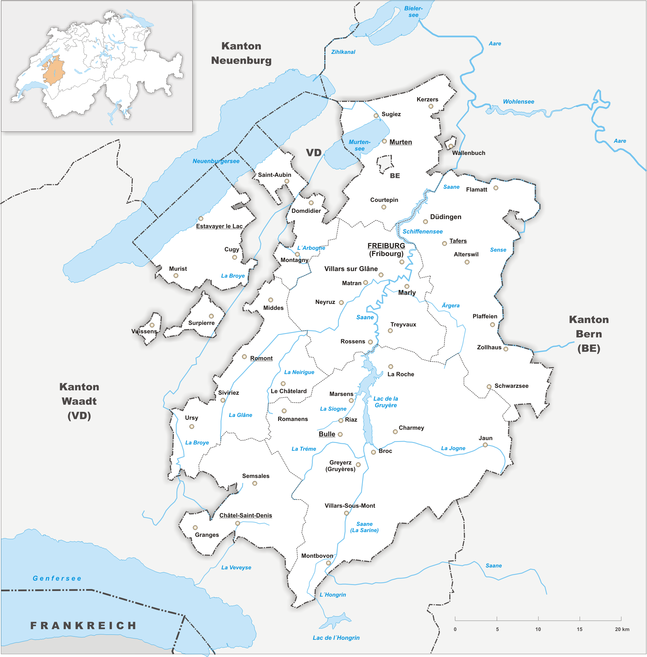
The canton of Fribourg, also canton of Freiburg (french: Canton de Fribourg ; german: Kanton Freiburg ; frp, Canton de Fribôrg rm, Chantun Friburg it, Canton Friburgo) is located in western Switzerland. The canton is bilingual, with French spoken by more than two thirds of the citizens and German by a little more than a quarter. Both are official languages in the canton. The canton takes its name from its capital city of Fribourg. History On the shores of Lake Neuchâtel and Lake Morat significant traces of prehistoric settlements have been unearthed. The canton of Fribourg joined the Swiss Confederation in 1481. The area is made up of lands acquired by the capital Fribourg. The present extent was reached in 1803 when Murten (Morat) was acquired. The canton of Fribourg joined the separatist league of Catholic cantons in 1846 (Sonderbund). The following year, its troops surrendered to the federal army. Geography The canton is bounded to the west by Lake Neuchâtel, to the ... [...More Info...] [...Related Items...] OR: [Wikipedia] [Google] [Baidu] |


