|
Chettisham Meadow
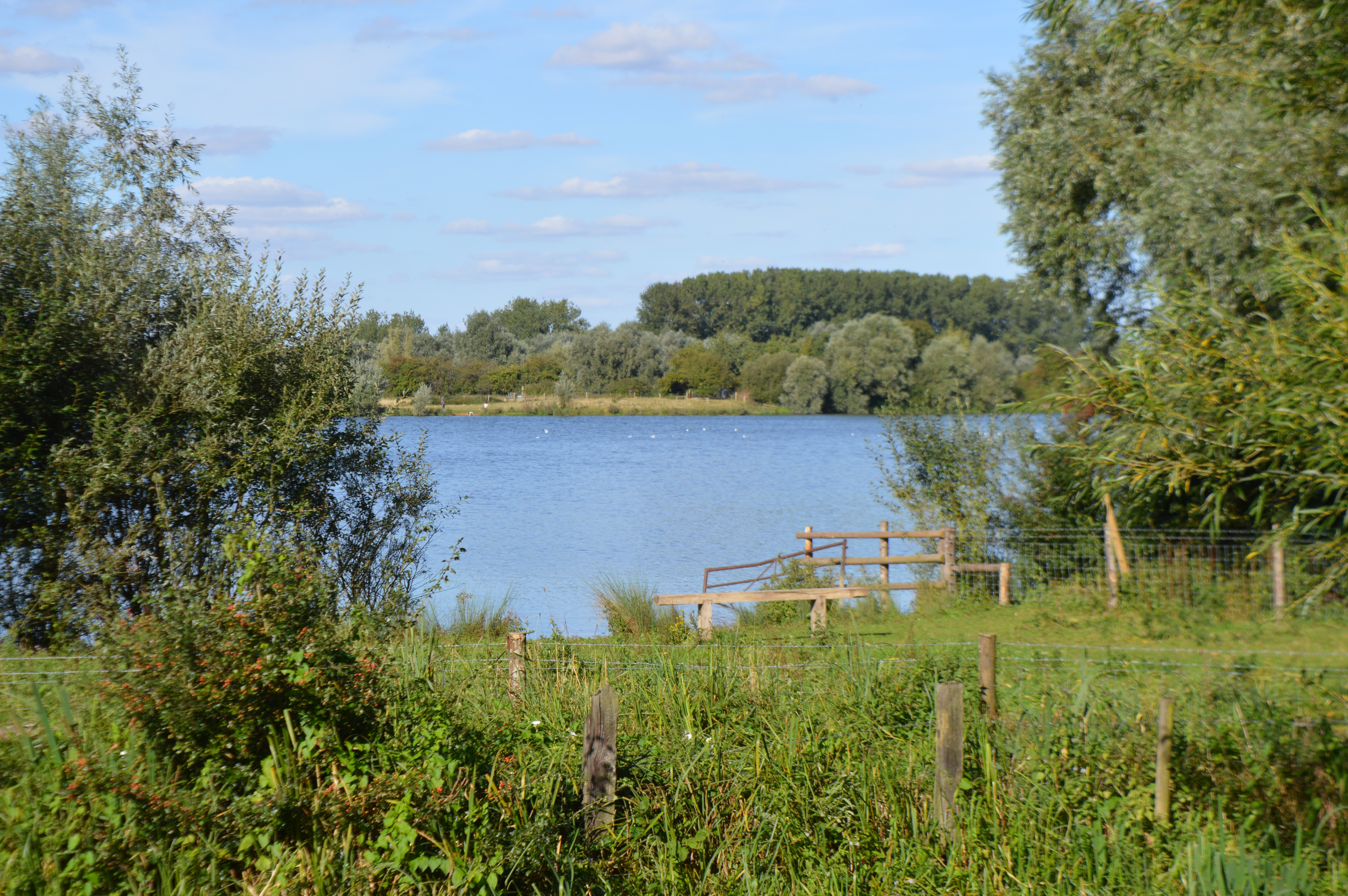
Chettisham Meadow is a biological Site of Special Scientific Interest west of Chettisham, north of Ely in Cambridgeshire. It is managed by the Wildlife Trust for Bedfordshire, Cambridgeshire and Northamptonshire. The site is grassland on calcareous clay, and evidence survives of ridge and furrow Ridge and furrow is an archaeological pattern of ridges (Medieval Latin: ''sliones'') and troughs created by a system of ploughing used in Europe during the Middle Ages, typical of the open-field system. It is also known as rig (or rigg) and f ... medieval farming. Flowering plants include adder's tongue, cowslip and the uncommon green-winged orchid. There is access from Church Farm on the road called The Hamlet, by a track which crosses the A10, and curves to meet the track called The Balk. A footpath from the point where the two tracks meet leads to the reserve entrance. References {{Wildlife Trust for Bedfordshire, Cambridgeshire and Northamptonshire Sites of Spec ... [...More Info...] [...Related Items...] OR: [Wikipedia] [Google] [Baidu] |
Site Of Special Scientific Interest
A Site of Special Scientific Interest (SSSI) in Great Britain or an Area of Special Scientific Interest (ASSI) in the Isle of Man and Northern Ireland is a conservation designation denoting a protected area in the United Kingdom and Isle of Man. SSSI/ASSIs are the basic building block of site-based nature conservation legislation and most other legal nature/geological conservation designations in the United Kingdom are based upon them, including national nature reserves, Ramsar sites, Special Protection Areas, and Special Areas of Conservation. The acronym "SSSI" is often pronounced "triple-S I". Selection and conservation Sites notified for their biological interest are known as Biological SSSIs (or ASSIs), and those notified for geological or physiographic interest are Geological SSSIs (or ASSIs). Sites may be divided into management units, with some areas including units that are noted for both biological and geological interest. Biological Biological SSSI/ASSIs may ... [...More Info...] [...Related Items...] OR: [Wikipedia] [Google] [Baidu] |
Chettisham
Chettisham is a pretty hamlet in East Cambridgeshire East Cambridgeshire (locally known as East Cambs) is a local government district in Cambridgeshire, England. Its council is based in Ely. The population of the District Council at the 2011 Census was 83,818. The district was formed on 1 April 19 ... between Ely and Littleport. The main claim to fame is the attractive St. Michael church. There are some pictures and a description of the church at the Cambridgeshire Churches website. References External links Villages in Cambridgeshire East Cambridgeshire District {{Cambridgeshire-geo-stub ... [...More Info...] [...Related Items...] OR: [Wikipedia] [Google] [Baidu] |
Ely, Cambridgeshire
Ely ( ) is a cathedral city in the East Cambridgeshire district of Cambridgeshire, England, about north-northeast of Cambridge and from London. Ely is built on a Kimmeridge Clay island which, at , is the highest land in the Fens. It was due to this topography that Ely was not waterlogged like the surrounding Fenland, and was an island separated from the mainland. Major rivers including the River Witham, Witham, River Welland, Welland, River Nene, Nene and River Great Ouse, Great Ouse feed into the Fens and, until draining commenced in the eighteenth century, formed freshwater marshes and Mere (lake), meres within which peat was laid down. Once the Fens were drained, this peat created a rich and fertile soil ideal for farming. The River Great Ouse was a significant means of transport until the Fens were drained and Ely ceased to be an island in the seventeenth century. The river is now a popular boating spot, and has a large marina. Although now surrounded by land, the city ... [...More Info...] [...Related Items...] OR: [Wikipedia] [Google] [Baidu] |
Cambridgeshire
Cambridgeshire (abbreviated Cambs.) is a Counties of England, county in the East of England, bordering Lincolnshire to the north, Norfolk to the north-east, Suffolk to the east, Essex and Hertfordshire to the south, and Bedfordshire and Northamptonshire to the west. The city of Cambridge is the county town. Following the Local Government Act 1972 restructuring, modern Cambridgeshire was formed in 1974 through the amalgamation of two administrative counties: Cambridgeshire and Isle of Ely, comprising the Historic counties of England, historic county of Cambridgeshire (including the Isle of Ely); and Huntingdon and Peterborough, comprising the historic county of Huntingdonshire and the Soke of Peterborough, historically part of Northamptonshire. Cambridgeshire contains most of the region known as Silicon Fen. The county is now divided between Cambridgeshire County Council and Peterborough City Council, which since 1998 has formed a separate Unitary authorities of England, unita ... [...More Info...] [...Related Items...] OR: [Wikipedia] [Google] [Baidu] |
Wildlife Trust For Bedfordshire, Cambridgeshire And Northamptonshire
The Wildlife Trust for Bedfordshire, Cambridgeshire and Northamptonshire (WTBCN) is a registered charity which manages 126 nature reserves covering . It has over 35,000 members, and 95% of people in Bedfordshire, Cambridgeshire and Northamptonshire live within five miles of a reserve. In the year to 31 March 2016 it employed 105 people and had an income of £5.1 million. It aims to conserve wildlife, inspire people to take action for wildlife, offer advice and share knowledge. The WTBCN is one of 36 wildlife trusts covering England, and 46 covering the whole of the United Kingdom. In 1912 Charles Rothschild formed the Society for the Promotion of Nature Reserves to protect sites considered "worthy of preservation". The society worked to secure statutory protection, and this began with the National Parks and Access to the Countryside Act 1949. In 1959 the society took on a coordinating role for local wildlife trusts, which covered the whole of Britain and Northern Ireland by 1 ... [...More Info...] [...Related Items...] OR: [Wikipedia] [Google] [Baidu] |
Calcareous
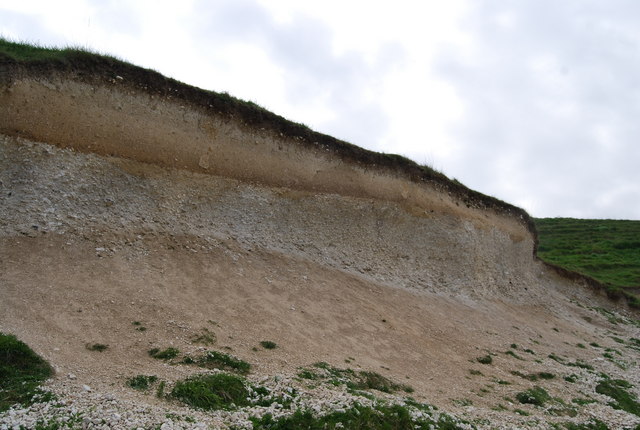
Calcareous () is an adjective meaning "mostly or partly composed of calcium carbonate", in other words, containing lime or being chalky. The term is used in a wide variety of scientific disciplines. In zoology ''Calcareous'' is used as an adjectival term applied to anatomical structures which are made primarily of calcium carbonate, in animals such as gastropods, i.e., snails, specifically about such structures as the operculum, the clausilium, and the love dart. The term also applies to the calcium carbonate tests of often more or less microscopic Foraminifera. Not all tests are calcareous; diatoms and radiolaria have siliceous tests. The molluscs are calcareous, as are calcareous sponges ( Porifera), that have spicules which are made of calcium carbonate. In botany ''Calcareous grassland'' is a form of grassland characteristic of soils containing much calcium carbonate from underlying chalk or limestone rock. In medicine The term is used in pathology, for example i ... [...More Info...] [...Related Items...] OR: [Wikipedia] [Google] [Baidu] |
Ridge And Furrow
Ridge and furrow is an archaeological pattern of ridges (Medieval Latin: ''sliones'') and troughs created by a system of ploughing used in Europe during the Middle Ages, typical of the open-field system. It is also known as rig (or rigg) and furrow, mostly in the North East of England and in Scotland. The earliest examples date to the immediate post-Roman period and the system was used until the 17th century in some areas, as long as the open field system survived. Surviving ridge and furrow topography is found in Great Britain, Ireland and elsewhere in Europe. The surviving ridges are parallel, ranging from apart and up to tall – they were much taller when in use. Older examples are often curved. Ridge and furrow topography was a result of ploughing with non-reversible ploughs on the same strip of land each year. It is visible on land that was ploughed in the Middle Ages, but which has not been ploughed since then. No actively ploughed ridge and furrow survives. The ri ... [...More Info...] [...Related Items...] OR: [Wikipedia] [Google] [Baidu] |
Ophioglossum Vulgatum
''Ophioglossum vulgatum'', commonly known as adder's-tongue, southern adders-tongue or adders-tongue fern, is a species of fern in the family ''Ophioglossaceae''. The adder’s tongue fern is generally believed to have the largest number of chromosomes wit1262 compared to the human’s 46. Distribution It is native to many regions with a wide scattered distribution: throughout temperate through tropical Africa and throughout the temperate Northern Hemisphere in Europe, northeastern North America, temperate Asia, and Eurasia. This small, hard-to-spot plant can occur singly in unimproved pastures, rock crevices and grassy path-sides, but also can occur in colonies of hundreds of plants in sand dunes. Description ''Ophioglossum vulgatum'' grows from a rhizome base to 10–20 cm tall (rarely to 30 cm). It consists of a two-part frond, separated into a rounded diamond-shaped sheath and narrow spore-bearing spike. The spike has around 10-40 segments on each side. It repro ... [...More Info...] [...Related Items...] OR: [Wikipedia] [Google] [Baidu] |
Primula Veris
''Primula veris'', the cowslip, common cowslip, or cowslip primrose ( syn. ''Primula officinalis'' ), is a herbaceous perennial flowering plant in the primrose family Primulaceae. The species is native throughout most of temperate Europe and western Asia, and although absent from more northerly areas including much of northwest Scotland, it reappears in northernmost Sutherland and Orkney and in Scandinavia. This species frequently hybridizes with other ''Primulas'' such as the common primrose ''Primula vulgaris'' to form false oxlip ( ''Primula'' × ''polyantha'') which is often confused with true oxlip (''Primula elatior''), a much rarer plant. Names The common name ''cowslip'' may derive from the old English for cow dung, probably because the plant was often found growing amongst the manure in cow pastures. An alternative derivation simply refers to slippery or boggy ground; again, a typical habitat for this plant. The name "cowslop" derived from Old English still exists in ... [...More Info...] [...Related Items...] OR: [Wikipedia] [Google] [Baidu] |
Green-winged Orchid
''Anacamptis morio'', the green-winged orchid or green-veined orchid ( synonym ''Orchis morio''), is a flowering plant of the orchid family, Orchidaceae. It usually has purple flowers, and is found in Europe and the Middle East. Description It flowers from late April to June in the British Isles, and as early as February in other countries, such as France. The inflorescence is of various colours, mainly purple but ranging from white, through pink, to deep purple. From 5 to 25 helmet-shaped flowers grow in a loose, linear bunch at the top of the single stalk. A pair of lateral sepals with prominent green, occasionally purple veins extend laterally like "wings", giving the orchid its name. The broad, three lobed, lower petal is pale in the center with dark spots. Leaves are lanceolate, or sometimes ovate, and grow in a rosette around the base of the plan, with some thinner leaves clasping the stem and sheathing almost up to the flowers. Leaves are green and unspotted. Plants grow ... [...More Info...] [...Related Items...] OR: [Wikipedia] [Google] [Baidu] |
A10 Road (England)
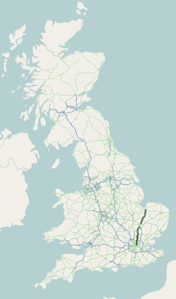
The A10 (in certain sections known as ''Great Cambridge Road'' or Old North Road) is a major road in England. Its southern end is at London Bridge in the London Borough of Southwark, and its northern end is the Norfolk port town of King's Lynn. From London to Royston it chiefly follows the line of Roman Ermine Street. The main route to Cambridge is now via the M11 motorway, however non-motorway traffic still uses the A10. Route Within the City of London, the route of the A10 comprises King William Street, Gracechurch Street, Bishopsgate and Norton Folgate. It then becomes Shoreditch High Street, Kingsland Road, Kingsland High Street and Stoke Newington Road. It runs through Stoke Newington as Stoke Newington High Street and then becomes Stamford Hill, through Stamford Hill until Tottenham. In July 2013, the Tottenham Hale gyratory was removed and the A10 now follows the route of Tottenham High Road in both directions. North of Tottenham, the A10 leaves its historic ... [...More Info...] [...Related Items...] OR: [Wikipedia] [Google] [Baidu] |
Sites Of Special Scientific Interest In Cambridgeshire
Site most often refers to: * Archaeological site * Campsite, a place used for overnight stay in an outdoor area * Construction site * Location, a point or an area on the Earth's surface or elsewhere * Website, a set of related web pages, typically with a common domain name It may also refer to: * Site, a National Register of Historic Places property type * SITE (originally known as ''Sculpture in the Environment''), an American architecture and design firm * Site (mathematics), a category C together with a Grothendieck topology on C * ''The Site'', a 1990s TV series that aired on MSNBC * SITE Intelligence Group, a for-profit organization tracking jihadist and white supremacist organizations * SITE Institute, a terrorism-tracking organization, precursor to the SITE Intelligence Group * Sindh Industrial and Trading Estate, a company in Sindh, Pakistan * SITE Centers, American commercial real estate company * SITE Town, a densely populated town in Karachi, Pakistan * S.I.T.E Indust ... [...More Info...] [...Related Items...] OR: [Wikipedia] [Google] [Baidu] |


