|
Charlestown, New Hampshire
Charlestown is a town in Sullivan County, New Hampshire, United States. The population was 4,806 at the 2020 census, down from 5,114 at the 2010 census. The town is home to Hubbard State Forest and the headquarters of the Student Conservation Association. The primary village in town, where 1,078 people resided at the 2020 census, is defined as the Charlestown census-designated place (CDP) and is located along New Hampshire Route 12. The town also includes the villages of North Charlestown, South Charlestown and Hemlock Center. History The area was first granted on December 31, 1735,Article i''Statistics and Gazetteer of New-Hampshire (1875)/ref> by colonial governor Jonathan Belcher of Massachusetts as "Plantation No. 4", the fourth in a line of townships on the Connecticut Rivers. Settled in 1740, it was the northernmost township, and its 1744 stockade now known as Fort at Number 4 became a strategic military site. On the evening of May 2, 1746, Seth Putnam joined Major Josi ... [...More Info...] [...Related Items...] OR: [Wikipedia] [Google] [Baidu] |
New Hampshire
New Hampshire is a U.S. state, state in the New England region of the northeastern United States. It is bordered by Massachusetts to the south, Vermont to the west, Maine and the Gulf of Maine to the east, and the Canadian province of Quebec to the north. Of the 50 U.S. states, New Hampshire is the List of U.S. states and territories by area, fifth smallest by area and the List of U.S. states and territories by population, tenth least populous, with slightly more than 1.3 million residents. Concord, New Hampshire, Concord is the state capital, while Manchester, New Hampshire, Manchester is the largest city. New Hampshire's List of U.S. state mottos, motto, "Live Free or Die", reflects its role in the American Revolutionary War; its state nickname, nickname, "The Granite State", refers to its extensive granite formations and quarries. It is well known nationwide for holding New Hampshire primary, the first primary (after the Iowa caucus) in the United States presidential election ... [...More Info...] [...Related Items...] OR: [Wikipedia] [Google] [Baidu] |
New Hampshire Route 12
New Hampshire Route 12 is a long north-south state highway in southwestern New Hampshire. Its southern terminus is at the Massachusetts state line in Fitzwilliam, where it continues south as Massachusetts Route 12. Its northern terminus is at the Vermont state line in Claremont (a terminus it shares with New Hampshire Route 103), where it continues north as Vermont Route 12. Most of the northern part of NH 12 runs along the Connecticut River. Its number is derived from its original 1922 designation as New England Interstate Route 12 (also known as the "Keene Way"). Present-day Vermont Route 12, New Hampshire Route 12, Massachusetts Route 12 and Connecticut Route 12 still mostly follow the original route. The four-state series of State Route 12s extend from Morrisville, Vermont, to Groton, Connecticut. Route description Fitzwilliam to Keene NH 12 begins in Fitzwilliam where it connects to Massachusetts Route 12 at the state line. The highway heads northwest into the town ce ... [...More Info...] [...Related Items...] OR: [Wikipedia] [Google] [Baidu] |
Siege Of Fort At Number 4
The siege of Fort at Number Four (7–9 April 1747) was a frontier action at present-day Charlestown, New Hampshire, during King George's War. The Fort at Number 4 (named so because it was located in the fourth of a series of recently surveyed township land parcels), was unsuccessfully besieged by a French and Native force under the command of Ensign Joseph Boucher de Niverville. The British defenders were alerted to the presence of the besiegers by their dogs, and were well-prepared to defend the fort. They successfully fought off attempts to burn the fort down, and turned down demands that they surrender. Some of Boucher de Niverville's Natives, short on provisions, attempted to bargain with the fort's defenders for supplies, but were rejected. Background In the 1720s, during Dummer's War, the Province of Massachusetts Bay had constructed Fort Dummer at present-day Brattleboro, Vermont. In the following years, settlers from Massachusetts, which laid claim to the territory, mo ... [...More Info...] [...Related Items...] OR: [Wikipedia] [Google] [Baidu] |
King George's War
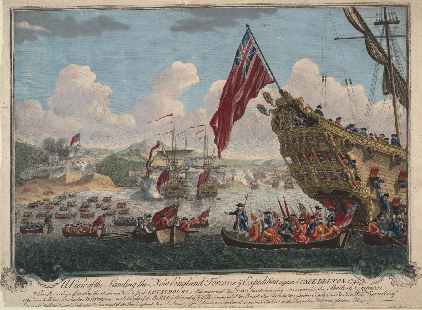
King George's War (1744–1748) is the name given to the military operations in North America that formed part of the War of the Austrian Succession (1740–1748). It was the third of the four French and Indian Wars. It took place primarily in the British provinces of New York, Massachusetts Bay (which included Maine as well as Massachusetts at the time), New Hampshire (which included Vermont at the time), and Nova Scotia. Its most significant action was an expedition organized by Massachusetts Governor William Shirley that besieged and ultimately captured the French fortress of Louisbourg, on Cape Breton Island in Nova Scotia, in 1745. In French, it is known as the ''Troisième Guerre Intercoloniale'' or Third Intercolonial War. The Treaty of Aix-la-Chapelle ended the war in 1748 and restored Louisbourg to France, but failed to resolve any outstanding territorial issues. Causes The War of Jenkins' Ear (named for a 1731 incident in which a Spanish commander sliced off the ea ... [...More Info...] [...Related Items...] OR: [Wikipedia] [Google] [Baidu] |
Native Americans In The United States
Native Americans, also known as American Indians, First Americans, Indigenous Americans, and other terms, are the Indigenous peoples of the mainland United States ( Indigenous peoples of Hawaii, Alaska and territories of the United States are generally known by other terms). There are 574 federally recognized tribes living within the US, about half of which are associated with Indian reservations. As defined by the United States Census, "Native Americans" are Indigenous tribes that are originally from the contiguous United States, along with Alaska Natives. Indigenous peoples of the United States who are not listed as American Indian or Alaska Native include Native Hawaiians, Samoan Americans, and the Chamorro people. The US Census groups these peoples as " Native Hawaiian and other Pacific Islanders". European colonization of the Americas, which began in 1492, resulted in a precipitous decline in Native American population because of new diseases, wars, ethni ... [...More Info...] [...Related Items...] OR: [Wikipedia] [Google] [Baidu] |
Fort At Number 4
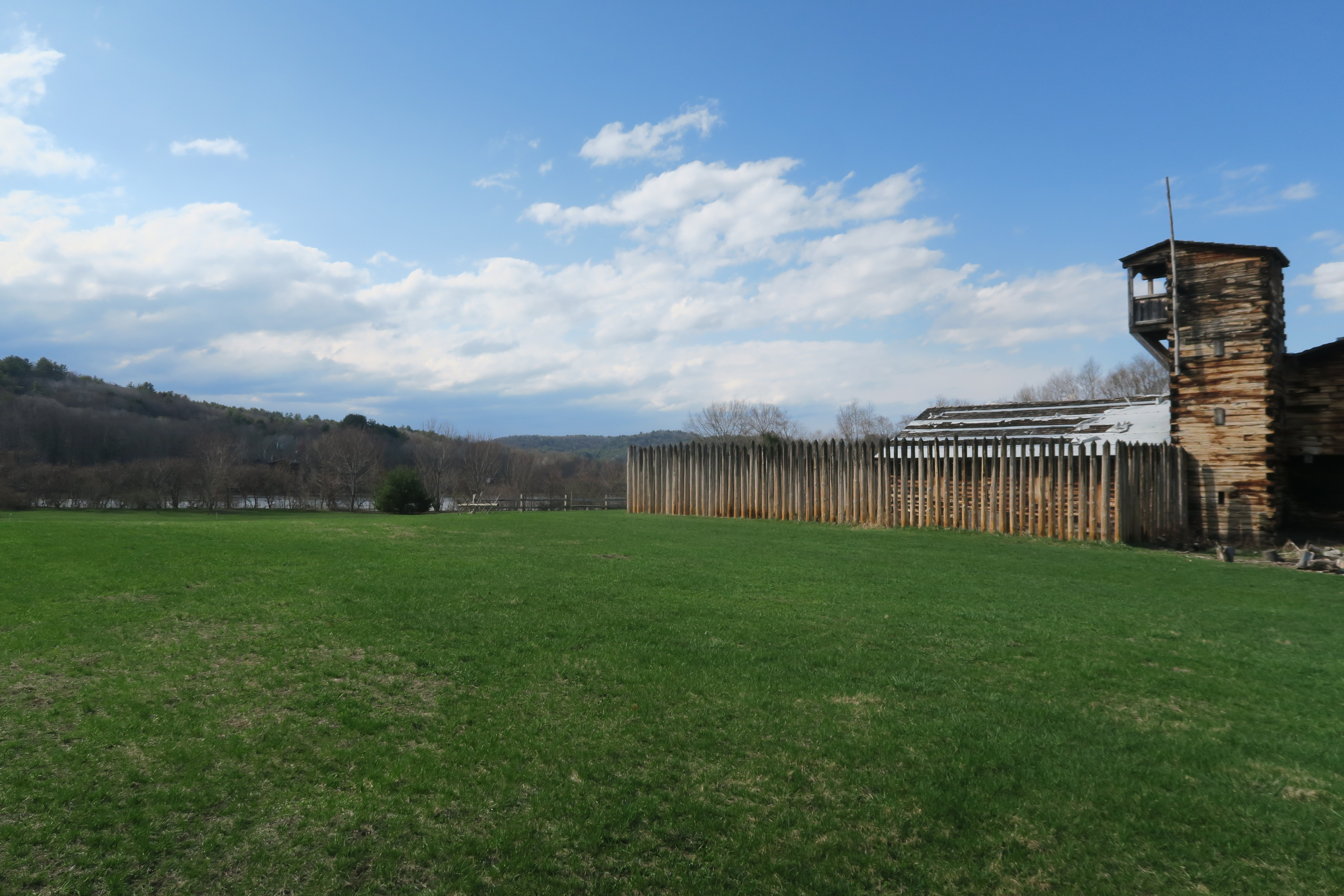
The Fort at Number 4 was a mid-18th century stockade fortification protecting Plantation Number 4, the northernmost British settlement along the Connecticut River in the Province of New Hampshire until after the French and Indian War. It was located in the present-day town of Charlestown, New Hampshire. A recreation of the fort, dating to 1960, now functions as an open-air museum, and was added to the New Hampshire State Register of Historic Places in July 2020. History Plantation Number 4 was one of several towns established in 1735–36 in the Massachusetts Bay Colony, more than from the nearest other British settlement at Fort Dummer. Settlement of the town began in 1740 by brothers Stephen, Samuel and David Farnsworth. By 1743, there were 10 families settled at Number 4. The fortification within Number 4 was established in 1744 when the people of the town voted to move several of their homes to created a fortified section of the town. The "fort" was a rectangle of six houses ... [...More Info...] [...Related Items...] OR: [Wikipedia] [Google] [Baidu] |
Stockade
A stockade is an enclosure of palisades and tall walls, made of logs placed side by side vertically, with the tops sharpened as a defensive wall. Etymology ''Stockade'' is derived from the French word ''estocade''. The French word was derived from the Spanish word ''estacada''. As a frontier outpost It was used as an outpost because it provided cover and was safe to look at things through. As a security fence The troops or settlers would build a stockade by clearing a space of woodland and using the trees whole or chopped in half, with one end sharpened on each. They would dig a narrow trench around the area, and stand the sharpened logs side-by-side inside it, encircling the perimeter. Sometimes they would add additional defence by placing sharpened sticks in a shallow secondary trench outside the stockade. In colder climates sometimes the stockade received a coating of clay or mud that would make the crude wall wind-proof. Builders could also place stones or thick mud la ... [...More Info...] [...Related Items...] OR: [Wikipedia] [Google] [Baidu] |
Brattleboro, Vermont
Brattleboro (), originally Brattleborough, is a town in Windham County, Vermont, United States. The most populous municipality abutting Vermont's eastern border with New Hampshire, which is the Connecticut River, Brattleboro is located about north of the Massachusetts state line, at the confluence of Vermont's West River and the Connecticut. As of the 2020 Census, the population was 12,184. There are satellite campuses of two colleges in Brattleboro: Community College of Vermont, and Vermont Technical College. Located in Brattleboro are the New England Center for Circus Arts, Vermont Jazz Center, and the Brattleboro Retreat, a mental health and addictions hospital. History Indigenous people This place was called "Wantastiquet" by the Abenaki people, which meant "lost river", "river that leads to the west", or "river of the lonely way". The Abenaki would transit this area annually between their summer hunting grounds near Swanton, and their winter settlement near Northfield, ... [...More Info...] [...Related Items...] OR: [Wikipedia] [Google] [Baidu] |
Brattleboro Reformer
The ''Brattleboro Reformer'' is the third-largest daily newspaper in the U.S. state of Vermont. With a weekday circulation of just over 10,000, it is behind the ''Burlington Free Press'' and the ''Rutland Herald'', respectively. It publishes six days a week, Monday through Saturday, with its ''Weekend Reformer'' having the largest readership; the offices of the paper are in Brattleboro, Vermont and it has a market penetration (weekday sales per 100 households) of 62.8 in its home zip code. The ''Reformer'' covers all of Windham County, Vermont, as well as some towns in neighboring Cheshire County, New Hampshire. It is owned by Vermont News and Media LLC. It is the only newspaper in the United States called "Reformer." History from 19th to mid-20th century The ''Reformer'' published its first issue, under the name ''Windham County Reformer'', in 1876. Publisher Charles N. Davenport, a prominent lawyer and supporter of the Democratic Party. Davenport founded the paper in part due t ... [...More Info...] [...Related Items...] OR: [Wikipedia] [Google] [Baidu] |
Walpole, New Hampshire
Walpole is a town in Cheshire County, New Hampshire, United States. The population was 3,633 at the 2020 census. The town's central village, where 573 people resided at the 2020 census, is defined as the Walpole census-designated place (CDP) and is east of New Hampshire Route 12. The town also includes the villages of North Walpole and Drewsville. History The town was first granted in 1736 by colonial Governor Jonathan Belcher of Massachusetts as "Number 3", third in a line of Connecticut River fort towns. It was settled as early as 1736, and called "Great Falls" or "Lunenburg". Colonel Benjamin Bellows, for whom Bellows Falls, Vermont, is named, built a large fort here for defense against Native attack. After the border between Massachusetts and New Hampshire was fixed (with Number 3 on the New Hampshire side of the line), the town was regranted by Governor Benning Wentworth as "Bellowstown", after its founder. It was incorporated in 1756. The grant was renewed in 1761, whe ... [...More Info...] [...Related Items...] OR: [Wikipedia] [Google] [Baidu] |
Westmoreland, New Hampshire
Westmoreland is a town in Cheshire County, New Hampshire, United States. The population was 1,706 at the 2020 census, down from 1,874 at the 2010 census. Westmoreland is historically an agricultural town, with much arable farmland. History Indigenous peoples Prior to European colonization, present-day Westmoreland was inhabited by numerous indigenous tribes. The upper Connecticut River valley was a popular region for short-term Indigenous villages mostly used for hunting and fishing. Tribes such as the Pennacook Confederation and the Abenaki were frequent visitors to the area. In the 1670s, King Philip's War led to the migration of most indigenous tribes to Canada. Indigenous peoples did not understand the concept of individual land ownership, which resulted in numerous misunderstandings and conflict between them and English settlers. The English settlers purchase of land and construction of permanent settlements disrupted the hunting and fishing traditions of the indigenous ... [...More Info...] [...Related Items...] OR: [Wikipedia] [Google] [Baidu] |
Chesterfield, New Hampshire
Chesterfield is a town in Cheshire County, New Hampshire, United States. The population was 3,552 at the 2020 census. It includes the villages of Spofford and West Chesterfield. Chesterfield is home to Spofford Lake, Chesterfield Gorge Natural Area, and parts of Pisgah State Park and Wantastiquet Mountain State Forest. History Granted in 1735 by Governor Jonathan Belcher of Massachusetts, this town was the site of Fort Number 1, first in the line of forts bordering the Connecticut River. After the border between Massachusetts and New Hampshire was fixed, the town was incorporated on February 11, 1752Article i''Statistics and Gazetteer of New-Hampshire'' (1875)/ref> by Governor Benning Wentworth as Chesterfield, named for Philip Stanhope, 4th Earl of Chesterfield. The first settlers were Moses Smith and William Thomas, who, with their families, came up the Connecticut in canoes, in the fall of 1761. Their chief subsistence through the winter and spring of their first year in th ... [...More Info...] [...Related Items...] OR: [Wikipedia] [Google] [Baidu] |


