|
Charles Goodnight
Charles Goodnight (March 5, 1836 – December 12, 1929), also known as Charlie Goodnight, was a rancher in the American West. In 1955, he was inducted into the Hall of Great Westerners of the National Cowboy & Western Heritage Museum. Early years Goodnight was born in Macoupin County, Illinois, northeast of St. Louis, the fourth child of Charles Goodnight and the former Charlotte Collier. Goodnight's father's grave is located in a pasture south of Bunker Hill, Illinois. Goodnight was descended from immigrant pioneer Hans Michael Gutknecht, from Mannheim, Germany, making him a distant relative of Harry S Truman. Goodnight moved to Texas in 1846 with his mother and stepfather, Hiram Daugherty. In 1856, he became a cowboy and served with the local militia, fighting against Comanche raiders. A year later, in 1857, Goodnight joined the Texas Rangers. Goodnight is also known for raising and leading a posse against the Comanche in 1860 that located the Indian camp where Cynthi ... [...More Info...] [...Related Items...] OR: [Wikipedia] [Google] [Baidu] |
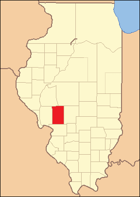
Macoupin County, Illinois
Macoupin County is located in the U.S. state of Illinois. According to the 2010 census, it had a population of 47,765. The county seat is Carlinville. The primary industry is agriculture, consisting of crops of corn (maize), soybeans, and some wheat. History The region was inhabited by Illinoisan Indians when the first white explorers arrived. Indeed, ' is an adaptation of the Miami-Illinois term for the American lotus, ''Nelumbo lutea''. None of the native Indians remain, although some descendants of the earliest European settlers claim partial ancestry. The first European contact was by French explorers in the seventeenth century, travelling southward down the major rivers. The main European settlement was from the southwest, as people moved inland from the established transportation route of the Mississippi River. Macoupin County was established on January 17, 1829. It was formed out of Greene and Madison Counties and was named after Macoupin Creek, which runs near ... [...More Info...] [...Related Items...] OR: [Wikipedia] [Google] [Baidu] |
Peta Nocona
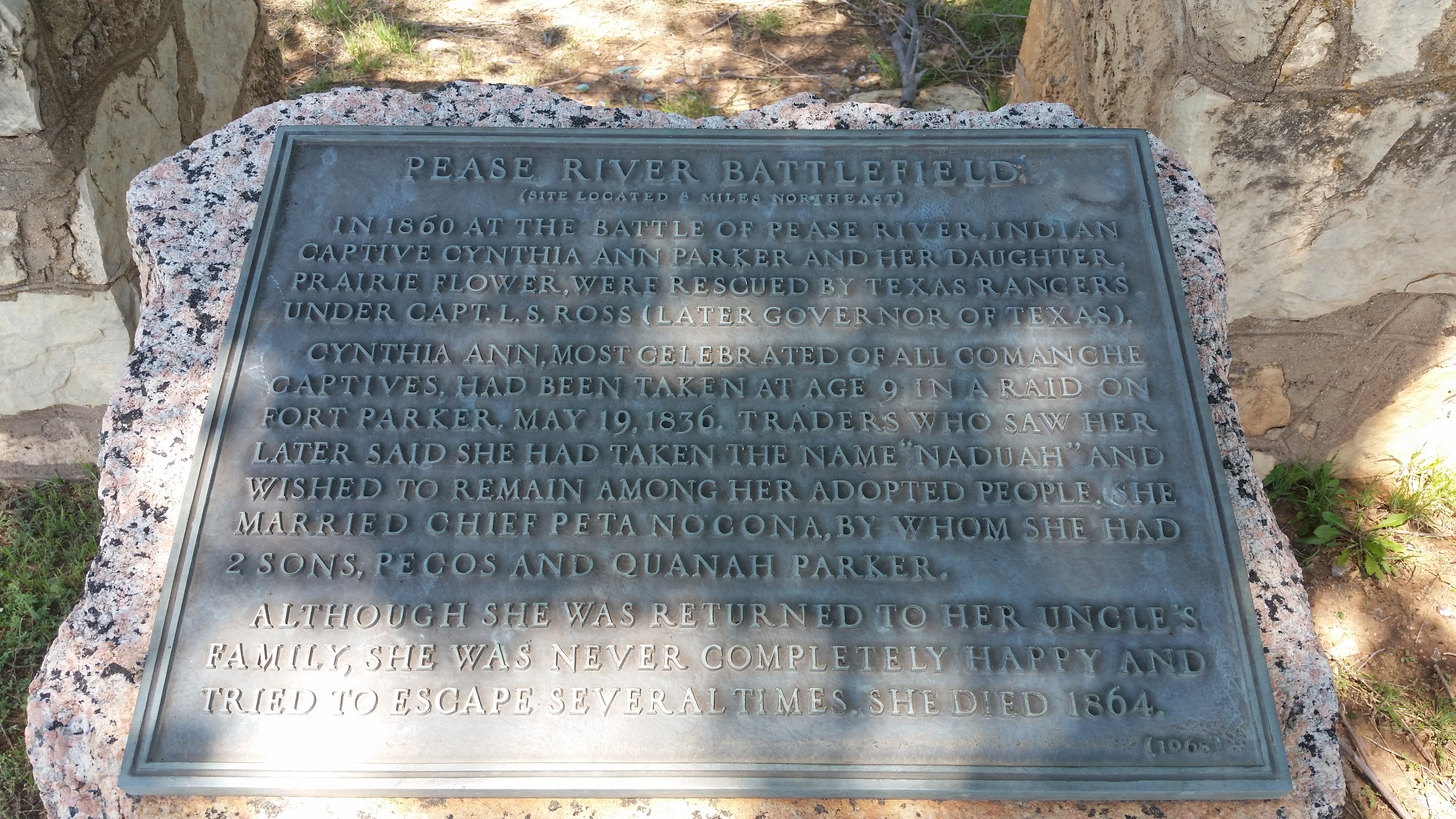
Peta Nocona (''circa'' 1820–1864), son to Iron Jacket, was a chief of the Comanche Kwahadi division. He married Cynthia Ann Parker, who had been taken as a captive in a raid and was adopted into the tribe by Tabby-nocca's family. Among their children was Quanah Parker, the last war chief of the Comanche. Peta Nocona chose his wife from among the members of the Nokoni band. He led his tribe during the extensive Indian Wars in Texas, from the late 1840s until the 1860s, as the United States tried to suppress his people. He was the son of the Quahadi Comanche chief Iron Jacket. He became so renowned that a legend said that his band, the Nokoni (or Wanderers, or Travellers) band, were named for him, but they had long antedated him. The city of Nocona, Texas is named after him. Despite Sul Ross's claim that Peta Nocona was killed at Pease River, his son insisted he was not present, and died several years later. This claim is supported by Texas historian John Henry Brown. Brown h ... [...More Info...] [...Related Items...] OR: [Wikipedia] [Google] [Baidu] |
Capulin Volcano National Monument
Capulin Volcano National Monument is a U.S. National Monument located in northeastern New Mexico that protects and interprets an extinct cinder cone volcano and is part of the Raton-Clayton volcanic field. A paved road spirals gradually around the volcano and visitors can drive up to a parking lot at the rim of the extinct volcano. Hiking trails circle the rim as well as lead down into the mouth of the volcano. The monument was designated on August 9, 1916, and is administered by the National Park Service. The volcano is located north of the village of Capulin. The visitor center features exhibits about the volcano and the area's geology, natural and cultural history, and offers educational programs about volcanoes. There is also a video presentation about the volcano. The name ''capulin'' comes from a type of choke cherry, ''Prunus virginiana'', that is native to southern North America. Apollo 16's John Young and Charlie Duke did some of their geologic training here in May ... [...More Info...] [...Related Items...] OR: [Wikipedia] [Google] [Baidu] |
Lubbock, Texas
Lubbock ( ) is the 10th-most populous city in the U.S. state of Texas and the seat of government of Lubbock County. With a population of 260,993 in 2021, the city is also the 85th-most populous in the United States. The city is in the northwestern part of the state, a region known historically and geographically as the Llano Estacado, and ecologically is part of the southern end of the High Plains, lying at the economic center of the Lubbock metropolitan area, which has an estimated population of 325,245 in 2021. Lubbock's nickname, "Hub City," derives from it being the economic, educational, and health-care hub of the multicounty region, north of the Permian Basin and south of the Texas Panhandle, commonly called the South Plains. The area is the largest contiguous cotton-growing region in the world and is heavily dependent on water from the Ogallala Aquifer for irrigation. Lubbock is home to Texas Tech University, the sixth-largest college by enrollment in the state. Hi ... [...More Info...] [...Related Items...] OR: [Wikipedia] [Google] [Baidu] |
Llano Estacado
The Llano Estacado (), sometimes translated into English as the Staked Plains, is a region in the Southwestern United States that encompasses parts of eastern New Mexico and northwestern Texas. One of the largest mesas or tablelands on the North American continent, the elevation rises from in the southeast to over in the northwest, sloping almost uniformly at about . Naming The Spanish name is often interpreted as meaning "Staked Plains", although "stockaded" or "palisaded plains" have also been proposed, in which case the name would derive from the steep escarpments on the eastern, northern, and western periphery of the plains. Leatherwood writes that Francisco Coronado and other European explorers described the Mescalero Ridge on the western boundary as resembling "palisades, ramparts, or stockades" of a fort, but does not present the original Spanish. In ''Beyond the Mississippi'' (1867), Albert D. Richardson, who traversed the region from east to west in October 1859, wrote ... [...More Info...] [...Related Items...] OR: [Wikipedia] [Google] [Baidu] |
Oliver Loving
Oliver Loving (December 4, 1812 – September 25, 1867) was an American rancher and cattle driver. Together with Charles Goodnight, he developed the Goodnight-Loving Trail. He was mortally wounded by Native Americans while on a cattle drive. Loving County, Texas, the second least-populous county in the United States and the least populated in the contiguous US, is named in his honor. Early life Oliver Loving was born on December 4, 1812 in Hopkins County, Kentucky.Richard DunhamToday in Texas History: Trailblazer Oliver Loving dies ''Houston Chronicle, September 25, 2010 His father was Joseph Loving and his mother, Susannah Mary Bourland. Career In 1833, he became a farmer in Muhlenberg County, Kentucky. Ten years later, with his brother and his brother-in-law, he moved to the Republic of Texas with their families. In Texas, Loving received 640 acres (2.6 km²) of land in three patents spread through three counties Collin, Dallas, and Parker. He farmed and, to feed hi ... [...More Info...] [...Related Items...] OR: [Wikipedia] [Google] [Baidu] |
West Texas
West Texas is a loosely defined region in the U.S. state of Texas, generally encompassing the arid and semiarid lands west of a line drawn between the cities of Wichita Falls, Abilene, and Del Rio. No consensus exists on the boundary between East Texas and West Texas. While most Texans understand these terms, no boundaries are officially recognized and any two individuals are likely to describe the boundaries of these regions differently. Walter Prescott Webb, American historian and geographer, suggested that the 98th meridian separates East and West Texas; Texas writer A.C. Greene proposed that West Texas extends west of the Brazos River. Use of a single line, though, seems to preclude the use of other separators, such as an area— Central Texas. Unlike East Texas, West Texas is not generally considered to be part of the American South, and the dry, desert climate is often more associated with the American Southwest. West Texas is often subdivided according to disti ... [...More Info...] [...Related Items...] OR: [Wikipedia] [Google] [Baidu] |
Texas Longhorn (cattle)
The Texas Longhorn is an American list of cattle breeds, breed of beef cattle, characterized by its long horns, which can span more than from tip to tip. It derives from cattle brought from the Iberian Peninsula to the Americas by Spanish conquistadores from the time of the Second Voyage of Columbus, Second Voyage of Christopher Columbus until about 1512. For hundreds of years the cattle lived a semi-feral existence on the rangelands; they have a higher tolerance of heat and drought than most European breeds. It can be of any color or mix of colors. In some 40% of the cattle it is some shade of red, often a light red; the only shade of red not seen is the deep color typical of the Hereford (cattle), Hereford. The Texas Longhorn has become a common symbol of Texas itself, especially the University of Texas at Austin, of which it is the mascot. History The Texas Longhorn derives from cattle brought to the Americas by Spanish conquistadores from the time of the Second Voya ... [...More Info...] [...Related Items...] OR: [Wikipedia] [Google] [Baidu] |
Charles Goodnight In Canyon IMG 0074
Charles is a masculine given name predominantly found in English and French speaking countries. It is from the French form ''Charles'' of the Proto-Germanic name (in runic alphabet) or ''*karilaz'' (in Latin alphabet), whose meaning was "free man". The Old English descendant of this word was '' Ċearl'' or ''Ċeorl'', as the name of King Cearl of Mercia, that disappeared after the Norman conquest of England. The name was notably borne by Charlemagne (Charles the Great), and was at the time Latinized as ''Karolus'' (as in ''Vita Karoli Magni''), later also as '' Carolus''. Some Germanic languages, for example Dutch and German, have retained the word in two separate senses. In the particular case of Dutch, ''Karel'' refers to the given name, whereas the noun ''kerel'' means "a bloke, fellow, man". Etymology The name's etymology is a Common Germanic noun ''*karilaz'' meaning "free man", which survives in English as churl (< Old English ''ċeorl''), which developed its depr ... [...More Info...] [...Related Items...] OR: [Wikipedia] [Google] [Baidu] |
Goodnight Trail Marker
Good Night or Goodnight may refer to: Film and television * ''Good Night'' (film), a 2008 short film from India * ''The Good Night'', a 2007 film * ''Good Night, and Good Luck'', a 2005 film * ''Good Night'', one of five mini-episodes from the ''Doctor Who'' shorts "Night and the Doctor" * "Good Night" (''Homeland''), 10th episode of season 3 of the TV series ''Homeland'' * "Good Night" (''The Simpsons'' short), a short from ''The Tracy Ullman Show'' featuring the debut of the main Simpsons family Music Albums * ''Goodnight'', by William Fitzsimmons Songs * "Goodnight" (Babybird song), 1996 * "Good Night" (Beatles song), 1968 * "Good Night" (Reece Mastin song), 2011 * "A Good Night" (John Legend song), 2018 * "Goodnight", by Air Supply from '' Across the Concrete Sky'' * "Goodnight", by Cher Lloyd from ''Sorry I'm Late'' * "Goodnight", by Cliff Eberhardt, covered by, ** Buffy Sainte-Marie from ''Coincidence and Likely Stories'' ** Erasure from ''Other People's Songs'' * ... [...More Info...] [...Related Items...] OR: [Wikipedia] [Google] [Baidu] |
Panhandle Plains Historical Museum
A salient (also known as a panhandle or bootheel) is an elongated protrusion of a geopolitical entity, such as a subnational entity or a sovereign state. While similar to a peninsula in shape, a salient is most often not surrounded by water on three sides. Instead, it has a land border on at least two sides and extends from the larger geographical body of the administrative unit. In American English, the term panhandle is often used to describe a relatively long and narrow salient, such as the westernmost extensions of Florida and Oklahoma. Another term is bootheel, used for the Missouri Bootheel and New Mexico Bootheel areas. Origin The term ''salient'' is derived from military salients. The term "panhandle" derives from the analogous part of a cooking pan, and its use is generally confined to North America. The salient shape can be the result of arbitrarily drawn international or subnational boundaries, though the location of administrative borders can also take into accoun ... [...More Info...] [...Related Items...] OR: [Wikipedia] [Google] [Baidu] |


