|
Chad–Libya Border
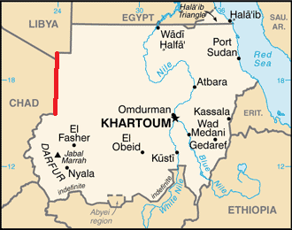
The Chad–Libya border is 1,050 km (652 mi) in length and runs from the tripoint with Niger in the west, to the tripoint with Sudan in the east. Description The border consists of two straight line segments. The first is a continuation of the Libya–Niger border; this section continues from the tripoint in a straight line for about 113 km (70 mi) up to the Tropic of Cancer. The border then turns to the southeast, running for 942 km (586 mi) to the tripoint with Sudan. The border lies wholly within the Sahara Desert, cutting through parts of the Tibesti Mountains in the far west. The remote Bikku Bitti mountain is located very close to the border on the Libyan side."Pic Bette, Libya" on Peakbagger Retrieved 28 September 2011 History The |
Pierre Savorgnan De Brazza
Pietro Paolo Savorgnan di Brazzà, later known as Pierre Paul François Camille Savorgnan de Brazza; 26 January 1852 – 14 September 1905), was an Italian-born, naturalized French explorer. With his family's financial help, he explored the Ogooué region of Central Africa, and later with the backing of the Société de Géographie de Paris, he reached far into the interior along the right bank of the Congo. He has often been depicted as a man of friendly manner, great charm and peaceful approach towards the Africans he met and worked with on his journeys, but recent research has revealed that he in fact alternated this kind of approach with more calculated deceit and at times relentless armed violence towards local populations. Under French colonial rule, the capital of the Republic of the Congo was named Brazzaville after him and the name was retained by the post-colonial rulers, one of the few African nations to do so. (Other exceptions are Pretoria, South Africa; Port Louis ... [...More Info...] [...Related Items...] OR: [Wikipedia] [Google] [Baidu] |
Italian Cyrenaica
Italian Cyrenaica (; ) was an Italian colony, located in present-day eastern Libya, that existed from 1911 to 1934. It was part of the territory conquered from the Ottoman Empire during the Italo-Turkish War of 1911, alongside Italian Tripolitania. The territory of the two colonies was sometimes referred to as "Italian Libya" or Italian North Africa (''Africa Settentrionale Italiana'', or ASI). Both names were also used after their unification, with Italian Libya becoming the official name of the newly combined colony. In 1923, indigenous rebels associated with the Senussi Order organized the Libyan resistance movement against Italian settlement in Libya. The rebellion was put down by Italian forces in 1932, after the so-called " pacification campaign", which resulted in the deaths of a quarter of Cyrenaica's local population. In 1934, it became part of Italian Libya. History Italian Cyrenaica and Italian Tripolitania were formed in 1911, during the conquest of O ... [...More Info...] [...Related Items...] OR: [Wikipedia] [Google] [Baidu] |
Mount Holyoke College
Mount Holyoke College is a private liberal arts women's college in South Hadley, Massachusetts. It is the oldest member of the historic Seven Sisters colleges, a group of elite historically women's colleges in the Northeastern United States. The college was founded in 1837 as the Mount Holyoke Female Seminary by Mary Lyon, a pioneer in education for women. A model upon which many other women's colleges were patterned, it is the oldest institution within the Seven Sisters schools, an alliance of East Coast liberal arts colleges that was originally created to provide women with an education equivalent to that provided in the then men-only Ivy League. Mount Holyoke is part of the region's Five College Consortium, along with Amherst College, Smith College, Hampshire College, and the University of Massachusetts Amherst: through this membership, students are allowed to take courses at any other member institution. Undergraduate admissions are restricted to female, transge ... [...More Info...] [...Related Items...] OR: [Wikipedia] [Google] [Baidu] |
Treaty Of Ouchy
The Italo-Turkish or Turco-Italian War ( tr, Trablusgarp Savaşı, "Tripolitanian War", it, Guerra di Libia, "War of Libya") was fought between the Kingdom of Italy and the Ottoman Empire from 29 September 1911, to 18 October 1912. As a result of this conflict, Italy captured the Ottoman Tripolitania Vilayet, of which the main sub-provinces were Fezzan, Cyrenaica, and Tripoli itself. These territories became the colonies of Italian Tripolitania and Cyrenaica, which would later merge into Italian Libya. During the conflict, Italian forces also occupied the Dodecanese islands in the Aegean Sea. Italy agreed to return the Dodecanese to the Ottoman Empire in the Treaty of Ouchy in 1912. However, the vagueness of the text, combined with subsequent adverse events unfavourable to the Ottoman Empire (the outbreak of the Balkan Wars and World War I), allowed a provisional Italian administration of the islands, and Turkey eventually renounced all claims on these islands in Article 15 of ... [...More Info...] [...Related Items...] OR: [Wikipedia] [Google] [Baidu] |
Italy
Italy ( it, Italia ), officially the Italian Republic, ) or the Republic of Italy, is a country in Southern Europe. It is located in the middle of the Mediterranean Sea, and its territory largely coincides with the homonymous geographical region. Italy is also considered part of Western Europe, and shares land borders with France, Switzerland, Austria, Slovenia and the enclaved microstates of Vatican City and San Marino. It has a territorial exclave in Switzerland, Campione. Italy covers an area of , with a population of over 60 million. It is the third-most populous member state of the European Union, the sixth-most populous country in Europe, and the tenth-largest country in the continent by land area. Italy's capital and largest city is Rome. Italy was the native place of many civilizations such as the Italic peoples and the Etruscans, while due to its central geographic location in Southern Europe and the Mediterranean, the country has also historically b ... [...More Info...] [...Related Items...] OR: [Wikipedia] [Google] [Baidu] |
24th Meridian East
The meridian 24° east of Greenwich is a line of longitude that extends from the North Pole across the Arctic Ocean, the Atlantic Ocean, Europe, Africa, the Indian Ocean, the Southern Ocean, and Antarctica to the South Pole. The 24th meridian east forms a great circle with the 156th meridian west. Part of the border between Libya and Sudan is defined by the meridian, as is a large section of the border between Chad and Sudan. The only capital located on 24th meridian east is Riga. From Pole to Pole Starting at the North Pole and heading south to the South Pole, the 24th meridian east passes through: : See also *23rd meridian east *25th meridian east The meridian 25° east of Greenwich is a line of longitude that extends from the North Pole across the Arctic Ocean, Europe, Africa, the Indian Ocean, the Southern Ocean, and Antarctica to the South Pole. The 25th meridian east forms ... *'' Measuring a Meridian: The Adventures of Three Englishmen and Three Rus ... [...More Info...] [...Related Items...] OR: [Wikipedia] [Google] [Baidu] |
16th Meridian East
The meridian 16° east of Greenwich is a line of longitude that extends from the North Pole across the Arctic Ocean, Europe, Africa, the Atlantic Ocean, the Southern Ocean, and Antarctica to the South Pole. The 16th meridian east forms a great circle with the 164th meridian west. From Pole to Pole Starting at the North Pole and heading south to the South Pole, the 16th meridian east passes through: : See also *15th meridian east The meridian 15° east of Greenwich is a line of longitude that extends from the North Pole across the Arctic Ocean, Europe, Africa, the Atlantic Ocean, the Southern Ocean, and Antarctica to the South Pole. The 15th meridian east forms a grea ... * 17th meridian east {{geographical coordinates, state=collapsed e016th meridian east ... [...More Info...] [...Related Items...] OR: [Wikipedia] [Google] [Baidu] |
United Kingdom
The United Kingdom of Great Britain and Northern Ireland, commonly known as the United Kingdom (UK) or Britain, is a country in Europe, off the north-western coast of the European mainland, continental mainland. It comprises England, Scotland, Wales and Northern Ireland. The United Kingdom includes the island of Great Britain, the north-eastern part of the island of Ireland, and many List of islands of the United Kingdom, smaller islands within the British Isles. Northern Ireland shares Republic of Ireland–United Kingdom border, a land border with the Republic of Ireland; otherwise, the United Kingdom is surrounded by the Atlantic Ocean, the North Sea, the English Channel, the Celtic Sea and the Irish Sea. The total area of the United Kingdom is , with an estimated 2020 population of more than 67 million people. The United Kingdom has evolved from a series of annexations, unions and separations of constituent countries over several hundred years. The Treaty of Union between ... [...More Info...] [...Related Items...] OR: [Wikipedia] [Google] [Baidu] |
French Equatorial Africa
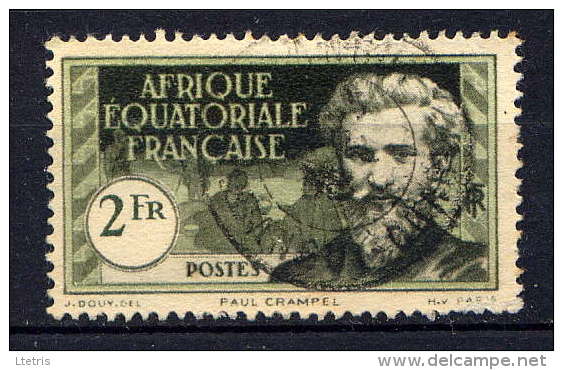
French Equatorial Africa (french: link=no, Afrique-Équatoriale française), or the AEF, was the federation of French colonial empire, French colonial possessions in Equatorial Africa, extending northwards from the Congo River into the Sahel, and comprising what are today the countries of Chad, the Central African Republic, the Republic of the Congo, and Gabon. History Established in 1910, the Federation contained four (later five) colonial possessions: French Gabon, French Congo, Ubangi-Shari and French Chad. The Governor-General was based in Brazzaville with deputies in each territory. In 1911, France ceded parts of the territory to German Kamerun as a result of the Agadir Crisis. The territory was returned after Germany's defeat in World War I, while most of French Cameroon, Cameroon proper became a French League of Nations mandate not integrated into the AEF. French Equatorial Africa, especially the region of Ubangi-Shari had a similar concession system as the Congo Free ... [...More Info...] [...Related Items...] OR: [Wikipedia] [Google] [Baidu] |
French West Africa
French West Africa (french: Afrique-Occidentale française, ) was a federation of eight French colonial territories in West Africa: Mauritania, Senegal, French Sudan (now Mali), French Guinea (now Guinea), Ivory Coast, Upper Volta (now Burkina Faso), Dahomey (now Benin) and Niger. The federation existed from 1895 until 1958. Its capital was Saint-Louis, Senegal until 1902, and then Dakar until the federation's collapse in 1960. History Until after World War II, almost none of the Africans living in the colonies of France were citizens of France. Rather, they were "French subjects", lacking rights before the law, property ownership rights, rights to travel, dissent, or vote. The exception was the Four Communes of Senegal: those areas had been towns of the tiny Senegal Colony in 1848 when, at the abolition of slavery by the French Second Republic, all residents of France were granted equal political rights. Anyone able to prove they were born in these towns was leg ... [...More Info...] [...Related Items...] OR: [Wikipedia] [Google] [Baidu] |
Cameroon
Cameroon (; french: Cameroun, ff, Kamerun), officially the Republic of Cameroon (french: République du Cameroun, links=no), is a country in west- central Africa. It is bordered by Nigeria to the west and north; Chad to the northeast; the Central African Republic to the east; and Equatorial Guinea, Gabon and the Republic of the Congo to the south. Its coastline lies on the Bight of Biafra, part of the Gulf of Guinea and the Atlantic Ocean. Due to its strategic position at the crossroads between West Africa and Central Africa, it has been categorized as being in both camps. Its nearly 27 million people speak 250 native languages. Early inhabitants of the territory included the Sao civilisation around Lake Chad, and the Baka hunter-gatherers in the southeastern rainforest. Portuguese explorers reached the coast in the 15th century and named the area ''Rio dos Camarões'' (''Shrimp River''), which became ''Cameroon'' in English. Fulani soldiers founded the Adamawa E ... [...More Info...] [...Related Items...] OR: [Wikipedia] [Google] [Baidu] |


.jpg)
