|
Cedar Island Wildlife Management Area
Cedar Island Wildlife Management Area is a Wildlife Management Area in Somerset County, Maryland near Crisfield. The area is almost in extent on Tangier Sound in Chesapeake Bay The Chesapeake Bay ( ) is the largest estuary in the United States. The Bay is located in the Mid-Atlantic (United States), Mid-Atlantic region and is primarily separated from the Atlantic Ocean by the Delmarva Peninsula (including the parts: the .... The area was primarily established to protect black duck habitat and is notable for its concentration of the species. References External links Cedar Island Wildlife Management Area Wildlife management areas of Maryland Protected areas of Somerset County, Maryland IUCN Category V {{Maryland-protected-area-stub ... [...More Info...] [...Related Items...] OR: [Wikipedia] [Google] [Baidu] |
Somerset County, Maryland
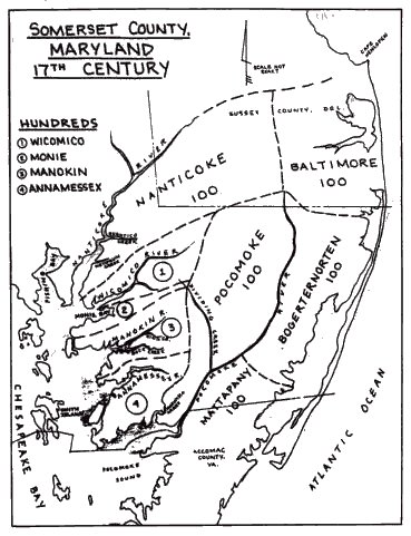
Somerset County is the southernmost county in the U.S. state of Maryland. As of the 2020 census, the population was 24,620, making it the second-least populous county in Maryland. The county seat is Princess Anne. The county was named for Mary, Lady Somerset, the wife of Sir John Somerset and daughter of Thomas Arundell, 1st Baron Arundell of Wardour (c. 1560–1639). She was also the sister of Anne Calvert, Baroness Baltimore (1615–1649), who later lent her name to Anne Arundel County, which was erected in 1650 as the Province of Maryland's third county. Somerset County is located on the state's Eastern Shore. It is included in the Salisbury, MD- DE Metropolitan Statistical Area. The University of Maryland Eastern Shore is located in Princess Anne. History Initial settlements Somerset County was settled and established by English colonists in part due to a response to the Province/Dominion of Virginia passing a law in 1659/1660 requiring Quakers in the colony to convert ... [...More Info...] [...Related Items...] OR: [Wikipedia] [Google] [Baidu] |
List Of Maryland Wildlife Management Areas
This is a list of Maryland wildlife management areas. , the state of Maryland owned and managed sixty-one wildlife management areas (WMAs) covering of land. Management Maryland wildlife management areass are managed by the Wildlife and Heritage Service of the Maryland Department of Natural Resources. Management focuses on developing wildlife habitat and providing publicly accessible space for hunting, fishing and trapping; low-impact non-hunting use is also permitted on many properties. List of Maryland wildlife management areas The following table lists all WMAs owned and managed by Maryland . It does not include Cooperative Wildlife Management Areas, which are managed by Maryland but owned by various other entities. See also *List of Maryland state forests * List of National Wildlife Refuges in Maryland *Natural Environment Area (Maryland) References External linksMaryland Wildlife Management Areas {{Authority control * Maryland Maryland ( ) is a state in the ... [...More Info...] [...Related Items...] OR: [Wikipedia] [Google] [Baidu] |
Crisfield, Maryland
Crisfield is a city in Somerset County, Maryland, United States, located on the Tangier Sound, an arm of the Chesapeake Bay. The population was 2,515 at the 2020 census. It is included in the Salisbury, Maryland-Delaware Metropolitan Statistical Area. Crisfield has the distinction of being the southernmost incorporated city in Maryland. The site of today's Crisfield was initially a small fishing village called Annemessex Neck. During European colonization, it was renamed Somers Cove, after Benjamin Summers. When the business potential for seafood was discovered, John W. Crisfield decided to bring the Pennsylvania Railroad to Crisfield, and the quiet fishing town grew. Crisfield is now known as the "Seafood Capital of the World". The city's success was so great that the train soot and oyster shells prompted the extension of the city's land into the marshes. City residents often claim that the downtown area is literally built atop oyster shells. Crisfield began to slip into ... [...More Info...] [...Related Items...] OR: [Wikipedia] [Google] [Baidu] |
Tangier Sound
Tangier Sound is a sound of the Chesapeake Bay bounded on the west by Tangier Island in Virginia, and Smith Island and South Marsh Island in Maryland, by Deal Island in Maryland on the north, and the mainland of the Eastern Shore of Maryland and Pocomoke Sound on the east. It stretches into Virginia as far south as Watts Island. The Manokin, Big Annemessex, and Little Annemessex Rivers all flow into Tangier Sound from Somerset County, Maryland. Crisfield, Maryland, located on Tangier Sound, is a center of the shellfish industry. Smith Island, Tangier Island and Deal Island also remain centers of the Chesapeake Bay seafood industry and outposts of Chesapeake culture and history. As in other parts of Chesapeake Bay, the seafood industry on Tangier Sound has declined markedly due to pollution, mismanagement and the growth of recreational fishing. However, the wild oyster industry has seen a strong reemergence in recent years due to shell planting and caretaking methods per ... [...More Info...] [...Related Items...] OR: [Wikipedia] [Google] [Baidu] |
Chesapeake Bay
The Chesapeake Bay ( ) is the largest estuary in the United States. The Bay is located in the Mid-Atlantic (United States), Mid-Atlantic region and is primarily separated from the Atlantic Ocean by the Delmarva Peninsula (including the parts: the Eastern Shore of Maryland / Eastern Shore of Virginia and the state of Delaware) with its mouth of the Bay at the south end located between Cape Henry and Cape Charles (headland), Cape Charles. With its northern portion in Maryland and the southern part in Virginia, the Chesapeake Bay is a very important feature for the ecology and economy of those two states, as well as others surrounding within its watershed. More than 150 major rivers and streams flow into the Bay's drainage basin, which covers parts of six states (New York, Pennsylvania, Delaware, Maryland, Virginia and West Virginia) and all of District of Columbia. The Bay is approximately long from its northern headwaters in the Susquehanna River to its outlet in the Atlantic Ocea ... [...More Info...] [...Related Items...] OR: [Wikipedia] [Google] [Baidu] |
American Black Duck
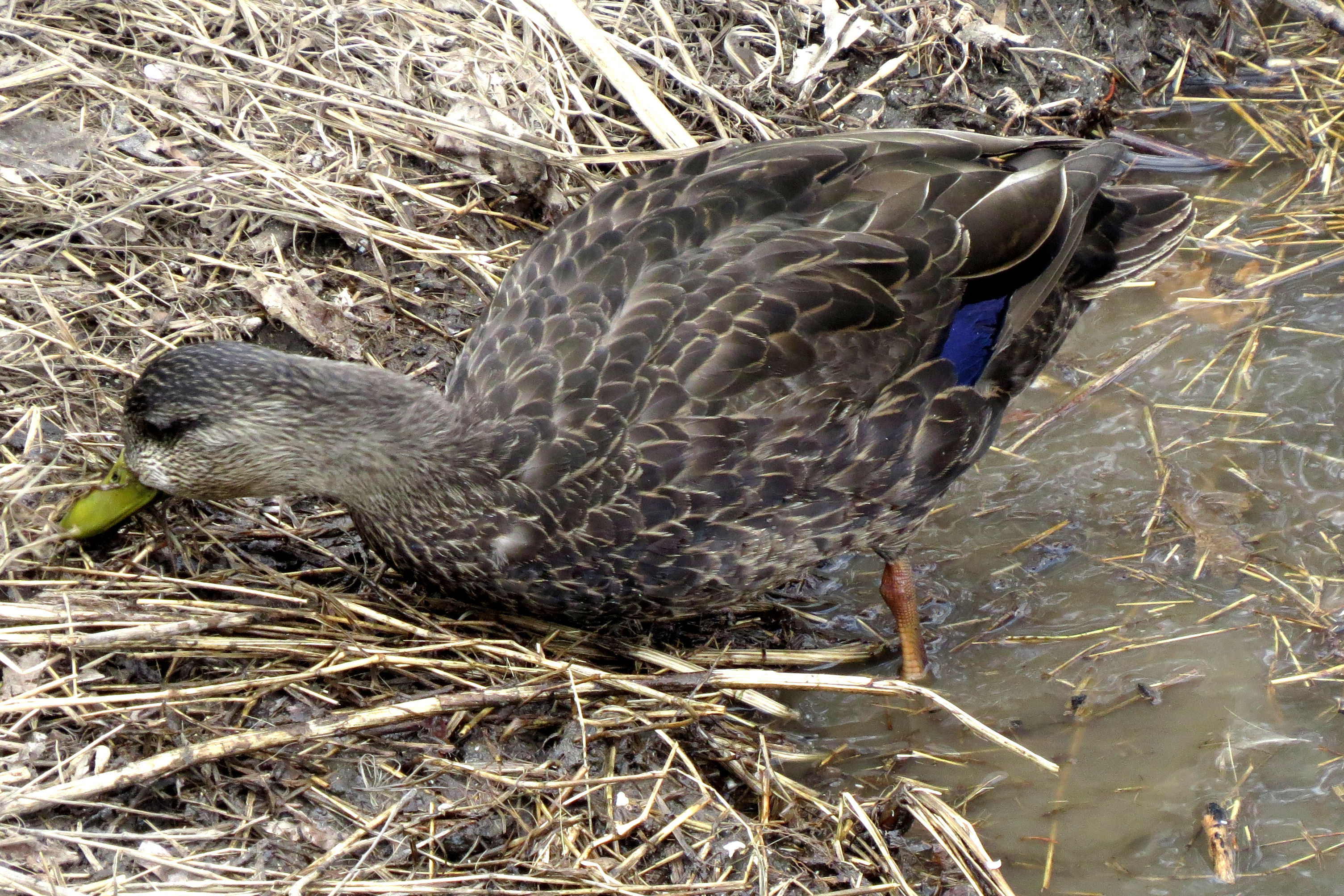
The American black duck (''Anas rubripes'') is a large dabbling duck in the family Anatidae. It was described by William Brewster in 1902. It is the heaviest species in the genus ''Anas'', weighing on average and measuring in length with an wingspan. It somewhat resembles the female and eclipse male mallard in coloration, but has a darker plumage. The male and female are generally similar in appearance, but the male's bill is yellow while the female's is dull green with dark marks on the . It is native to eastern North America. During the breeding season, it is usually found in coastal and freshwater wetlands from Saskatchewan to the Atlantic in Canada and the Great Lakes and the Adirondacks in the United States. It is a partially migratory species, mostly wintering in the east-central United States, especially in coastal areas. It interbreeds regularly and extensively with the mallard, to which it is closely related. The female lays six to fourteen oval eggs, which have ... [...More Info...] [...Related Items...] OR: [Wikipedia] [Google] [Baidu] |
Wildlife Management Areas Of Maryland
Wildlife refers to undomesticated animal species, but has come to include all organisms that grow or live wild in an area without being introduced by humans. Wildlife was also synonymous to game: those birds and mammals that were hunted for sport. Wildlife can be found in all ecosystems. Deserts, plains, grasslands, woodlands, forests, and other areas, including the most developed urban areas, all have distinct forms of wildlife. While the term in popular culture usually refers to animals that are untouched by human factors, most scientists agree that much wildlife is affected by human activities. Some wildlife threaten human safety, health, property, and quality of life. However, many wild animals, even the dangerous ones, have value to human beings. This value might be economic, educational, or emotional in nature. Humans have historically tended to separate civilization from wildlife in a number of ways, including the legal, social, and moral senses. Some animals, howev ... [...More Info...] [...Related Items...] OR: [Wikipedia] [Google] [Baidu] |
Protected Areas Of Somerset County, Maryland
Protection is any measure taken to guard a thing against damage caused by outside forces. Protection can be provided to physical objects, including organisms, to systems, and to intangible things like civil and political rights. Although the mechanisms for providing protection vary widely, the basic meaning of the term remains the same. This is illustrated by an explanation found in a manual on electrical wiring: Some kind of protection is a characteristic of all life, as living things have evolved at least some protective mechanisms to counter damaging environmental phenomena, such as ultraviolet light. Biological membranes such as bark on trees and skin on animals offer protection from various threats, with skin playing a key role in protecting organisms against pathogens and excessive water loss. Additional structures like scales and hair offer further protection from the elements and from predators, with some animals having features such as spines or camouflage serving ... [...More Info...] [...Related Items...] OR: [Wikipedia] [Google] [Baidu] |


.jpg)
