|
Cecil Thomas Madigan
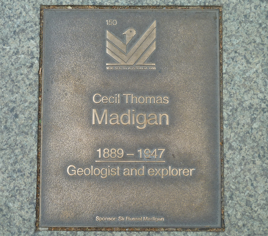
Cecil Thomas Madigan (15 October 1889 – 14 January 1947) was an Australian explorer and geologist, academic, aerial surveyor, meteorologist, author and officer of the British army. He was born in Renmark, South Australia. His family had associations with William Benjamin Chaffey. Biography Born to contractor and fruitgrower Thomas Madigan and Mary Dixie (née Finey) a teacher, Cecil Madigan was the oldest of two sons and two daughters. He was raised by his mother as his father had died in the Kalgoorlie, Western Australian Goldfields. He attended Prince Alfred College in Adelaide, the University of Adelaide, and the South Australian School of Mining and Industry. He won a Rhodes scholarship in 1911 to study geology at Magdalen College, Oxford, but deferred the appointment as he was invited by Sir Douglas Mawson to go as meteorologist on the Australasian Antarctic Expedition. In December 1911 the party left Hobart on board the SY Aurora. In January 1912 they reached Commonweal ... [...More Info...] [...Related Items...] OR: [Wikipedia] [Google] [Baidu] |
Cecil Madigan
Cecil Thomas Madigan (15 October 1889 – 14 January 1947) was an Australian explorer and geologist, academic, aerial surveyor, meteorologist, author and officer of the British army. He was born in Renmark, South Australia. His family had associations with William Benjamin Chaffey. Biography Born to contractor and fruitgrower Thomas Madigan and Mary Dixie (née Finey) a teacher, Cecil Madigan was the oldest of two sons and two daughters. He was raised by his mother as his father had died in the Kalgoorlie, Western Australian Goldfields. He attended Prince Alfred College in Adelaide, the University of Adelaide, and the South Australian School of Mining and Industry. He won a Rhodes scholarship in 1911 to study geology at Magdalen College, Oxford, but deferred the appointment as he was invited by Sir Douglas Mawson to go as meteorologist on the Australasian Antarctic Expedition. In December 1911 the party left Hobart on board the SY Aurora. In January 1912 they reached Commonweal ... [...More Info...] [...Related Items...] OR: [Wikipedia] [Google] [Baidu] |
King George V Land
George V Land is a segment of Antarctica part of the land claimed as part of the Australian Antarctic Territory, inland from the George V Coast. As with other segments of Antarctica, it is defined by two lines of longitude, 142°02' E and 153°45' E, and by the 60°S parallel. This region was first explored by members of the Main Base party of the Australasian Antarctic Expedition (1911–14) under Douglas Mawson, who named this feature for King George V of Australia. References External links * George V Landon USGS website George V Landon SCAR A scar (or scar tissue) is an area of fibrous tissue that replaces normal skin after an injury. Scars result from the biological process of wound repair in the skin, as well as in other organs, and tissues of the body. Thus, scarring is a na ... website Australian Antarctic Territory Lands of Antarctica {{GeorgeVLand-geo-stub ... [...More Info...] [...Related Items...] OR: [Wikipedia] [Google] [Baidu] |
Centre Points Of Australia
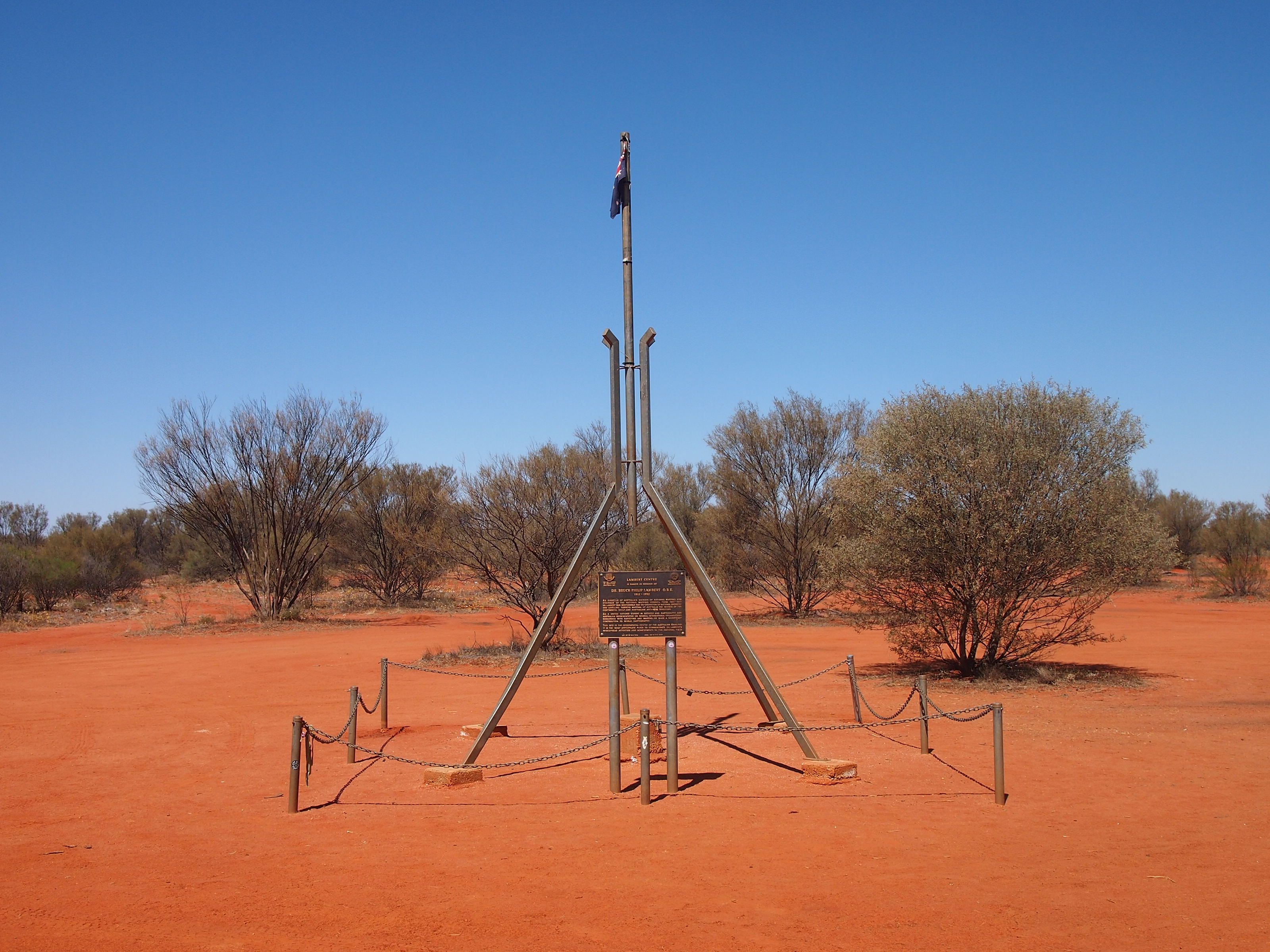
Centre points of Australia are those geographical locations that have been considered to be ''centre'' of Australia, as distinct from the extreme points of Australia. Finding the centre point John McDouall Stuart wrote "Sunday, 22 April 1860, Small Gum Creek, under Mount Stuart, Centre of Australia - today I find from my observations of the sun, 111° 00' 30", that I am now camped in the centre of Australia. I have marked a tree and planted the British flag there." Below are five methods which have been used to locate the centre point of Australia: Centre of gravity method 23 degrees 7 minutes south latitude, 132 degrees 8 minutes east longitude (); position on SF53-13 Hermannsburg 1:250 000 and 5351 Glen Helen 1:100 000 scale maps. Furthest point from the coastline (pole of inaccessibility) 23 degrees 2 minutes south latitude, 132 degrees 10 minutes east longitude (); position on SF53-13 Hermannsburg 1:250 000 and 5351 Glen Helen 1:100 000 scale maps. Median point The media ... [...More Info...] [...Related Items...] OR: [Wikipedia] [Google] [Baidu] |
Alice Giles
Alice Rosemary Giles (born c. 1961) is an Australian classical harpist. Early life and education She was born in Adelaide,Australian World Orchestra . Retrieved 25 February 2016 and trained with Jo Litson, "Heavenly gliss", '''', June 2001, p. 12 at the . In 1982, aged 21, she w ... [...More Info...] [...Related Items...] OR: [Wikipedia] [Google] [Baidu] |
Rosemary Madigan
Rosemary Wynnis Madigan (5 December 1926 – 12 February 2019) was an Australian sculptor, stonecarver and woodcarver who focused on the human figure. Born in Glenelg to the geologist Cecil Madigan, she decided on a career as a sculptor at the age of 12 and studied in schools in Adelaide and Sydney. Madigan won a three-year scholarship to study abroad from 1950 to 1953. She began teaching pottery, painting and sculpture at various schools between the 1950s and the 1960s. Madigan was in a working partnership with the constructivist sculptor Robert Klippel until the latter's death in 2001 and won the Wynne Prize for a carved sandstone torso in 1986. Early life Madigan was born on 5 December 1926 in Glenelg, South Australia. She was the youngest of five children of the geologist Cecil Madigan. She grew up in the Adelaide suburb of Blackwood and became interested in her father's small collection of Aboriginal artefacts and exhibited a preoccupation with the solid world, wanting t ... [...More Info...] [...Related Items...] OR: [Wikipedia] [Google] [Baidu] |
Adelaide, Australia
Adelaide ( ) is the capital city of South Australia, the state's largest city and the fifth-most populous city in Australia. "Adelaide" may refer to either Greater Adelaide (including the Adelaide Hills) or the Adelaide city centre. The demonym ''Adelaidean'' is used to denote the city and the residents of Adelaide. The Traditional Owners of the Adelaide region are the Kaurna people. The area of the city centre and surrounding parklands is called ' in the Kaurna language. Adelaide is situated on the Adelaide Plains north of the Fleurieu Peninsula, between the Gulf St Vincent in the west and the Mount Lofty Ranges in the east. Its metropolitan area extends from the coast to the foothills of the Mount Lofty Ranges, and stretches from Gawler in the north to Sellicks Beach in the south. Named in honour of Queen Adelaide, the city was founded in 1836 as the planned capital for the only freely-settled British province in Australia. Colonel William Light, one of Adelaide's foundi ... [...More Info...] [...Related Items...] OR: [Wikipedia] [Google] [Baidu] |
Cecil Madigan Plaque
Cecil may refer to: People with the name * Cecil (given name), a given name (including a list of people and fictional characters with the name) * Cecil (surname), a surname (including a list of people with the name) Places Canada *Cecil, Alberta, Canada United States *Cecil, Alabama *Cecil, Georgia *Cecil, Ohio *Cecil, Oregon *Cecil, Pennsylvania *Cecil, West Virginia *Cecil, Wisconsin *Cecil Airport, in Jacksonville, Florida *Cecil County, Maryland Computing and technology *Cecil (programming language), prototype-based programming language *Computer Supported Learning, a learning management system by the University of Auckland, New Zealand Music *Cecil (British band), a band from Liverpool, active 1993-2000 *Cecil (Japanese band), a band from Kajigaya, Japan, active 2000-2006 Other uses *Cecil (lion), a famed lion killed in Zimbabwe in 2015 * Cecil (''Passions''), a minor character from the NBC soap opera ''Passions'' *Cecil (soil), the dominant red clay soil in the American ... [...More Info...] [...Related Items...] OR: [Wikipedia] [Google] [Baidu] |
Boxhole Crater
Boxhole is a young impact crater located approximately 180 km (265 km by road) north-east of Alice Springs in the Northern Territory, Australia. It is 170 metres in diameter and its age is estimated to be 5,400 ± 1,500 years based on the cosmogenic 14C terrestrial age of the meteorite, placing it in the Holocene. The crater is exposed to the surface. Description In 1937 Joe Webb, a shearer at Boxhole sheep station, took geologist Cecil Madigan to examine the crater. Madigan discovered nickel-bearing metallic fragments and iron shale-balls similar to those found at Henbury to the south of Alice Springs. It was the second impact crater to be described in Australia, after Henbury. A later search found additional meteoritic metal including an iron mass of 181 pounds (82 kg) , now in the Natural History Museum, London. See also *List of impact craters in Australia This list includes all 27 confirmed impact craters in Australia as listed in the Earth Impact ... [...More Info...] [...Related Items...] OR: [Wikipedia] [Google] [Baidu] |
Alfred Allen Simpson
Alfred Allen Simpson (15 April 1875 – 27 November 1939) was an industrialist in South Australia and a partner in the firm A. Simpson & Son, founded by his grandfather Alfred Simpson. He was the mayor of Adelaide from 1913 to 1915. History Alfred Allen Simpson was a son of Alfred Muller Simpson (4 April 1843 – 28 September 1917) and his first wife Catherine Simpson, née Allen ( ? – 16 October 1887). Both Allen and his brother, Frederick Neighbour Simpson, learned the trade of tinsmith, much as their father and grandfather had done, except that they were not apprenticed; Allen learned the craft in the Gawler Place workshop and Fred in the stove factory in Pirie Street. Both also served in the retail shop where they later took on management tasks — Allen in the internal running of the business and Fred in charge of marketing and purchasing of raw materials: tinned and galvanized sheet metal, rivets and so forth. When their father took a trip to England in 1900 Allen ac ... [...More Info...] [...Related Items...] OR: [Wikipedia] [Google] [Baidu] |
Royal Geographical Society Of Australasia
On 22 June 1883, the Geographical Society of Australasia started at a meeting in Sydney, New South Wales, Australia. A branch was formed in Victoria in the same year. In July 1885, both the Queensland and the South Australian branches started. In July 1886 the society became the Royal Geographical Society of Australasia. The New South Wales branch's new constitution in 1886 widened its scope to encourage interest in scientific, commercial, educational and historical aspects of geography. The Society sponsored several important expeditions, notably the New Guinea Exploration Expedition in 1885, whose members included zoologist Wilhelm Haacke, erstwhile director of the South Australian Museum. The Victorian branch amalgamated with the Victorian Historical Society, while the New South Wales branch had ceased to function by the early 1920s. The South Australian and Queensland branches continue as the Royal Geographical Society of South Australia and Royal Geographical Society of Que ... [...More Info...] [...Related Items...] OR: [Wikipedia] [Google] [Baidu] |
Simpson Desert
The Simpson Desert is a large area of dry, red sandy plain and dunes in the Northern Territory, South Australia and Queensland in central Australia. It is the fourth-largest Deserts of Australia, Australian desert, with an area of . The desert is underlain by the Great Artesian Basin, one of the largest inland drainage areas in the world. Water from the basin rises to the surface at numerous natural springs, including Dalhousie Springs, and at Water well, bores drilled along stock routes, or during petroleum exploration. As a result of exploitation by such bores, the flow of water to springs has been steadily decreasing in recent years. It is also part of the Lake Eyre basin. The Simpson Desert is an erg (landform), erg that contains the world's longest parallel sand dunes. These north-south oriented dunes are static, held in position by vegetation. They vary in height from in the west to around on the eastern side. The largest dune, Nappanerica or Big Red, is in height. Hi ... [...More Info...] [...Related Items...] OR: [Wikipedia] [Google] [Baidu] |
Battle Of The Somme
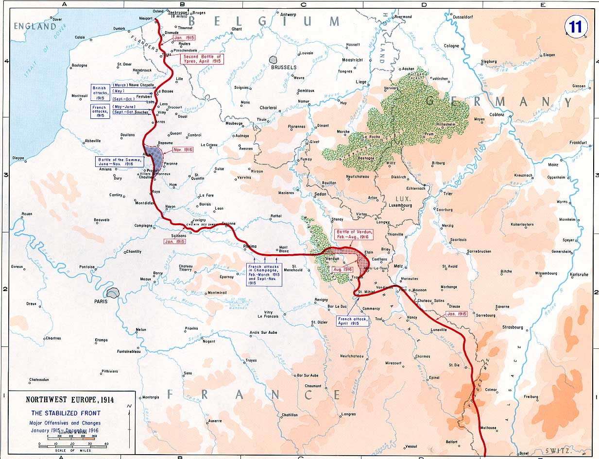
The Battle of the Somme ( French: Bataille de la Somme), also known as the Somme offensive, was a battle of the First World War fought by the armies of the British Empire and French Third Republic against the German Empire. It took place between 1 July and 18 November 1916 on both sides of the upper reaches of the Somme, a river in France. The battle was intended to hasten a victory for the Allies. More than three million men fought in the battle of whom one million were wounded or killed, making it one of the deadliest battles in human history. The French and British had committed themselves to an offensive on the Somme during the Chantilly Conference in December 1915. The Allies agreed upon a strategy of combined offensives against the Central Powers in 1916 by the French, Russian, British and Italian armies, with the Somme offensive as the Franco-British contribution. Initial plans called for the French army to undertake the main part of the Somme offensive, supported on ... [...More Info...] [...Related Items...] OR: [Wikipedia] [Google] [Baidu] |


