|
Caux (Pays De) Localization
Caux may refer to: Places * Caux, Hérault, southern France * Caux, Switzerland * Pays de Caux, Normandy * Caux or Kaw, French Guiana * Caus Castle Caus Castle is a ruin of a hill fort and medieval castle in the civil parish of Westbury in the English county of Shropshire. It is situated up on the eastern foothills of the Long Mountain guarding the route from Shrewsbury, Shropshire to Mon ..., near Westbury, Shropshire People * Caux (surname) {{disambiguation, geo ... [...More Info...] [...Related Items...] OR: [Wikipedia] [Google] [Baidu] |
Caux, Hérault
Caux (; oc, Cauç) is a Communes of France, commune in the Hérault Departments of France, department in southern France. Geography Caux is a Circulade village located near Pézenas Toponymy The origin of the name "Caux" has two possible explanations: #It can come from Occitan language, Occitan "caus" which means "lime". This is possible because limestone is very present on the territory, lime kilns are numerous; we find their remains at Sallèles and Maro Road. #The name can come from an expression of pre-Indo-European origin: "cal-so", that is to say rock, shelter. Indeed, on its base at 103 meters above sea level, Caux dominates the surroundings. History Population Education Sport Administration Personalities *Jean-Jacques Causse *Dom Bédos de Celles See also *Communes of the Hérault department References External links Official Web siteTourist office Web site Communes of Hérault {{Hérault-geo-stub ... [...More Info...] [...Related Items...] OR: [Wikipedia] [Google] [Baidu] |
Caux, Switzerland
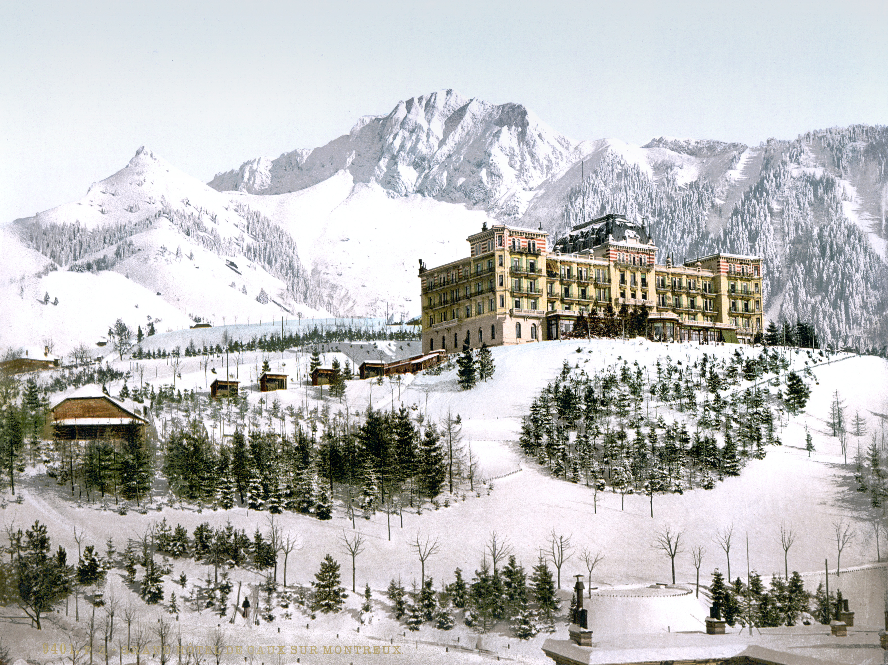
Caux (Montreux) is a small village in the Canton of Vaud, Switzerland which is part of the Montreux municipality. It looks out over Lake Geneva from an altitude of 1000 meters. Overlooked by the Rochers de Naye summit (2000 meters), the Caux area was traditionally used only by cattle farmers. Late in the 19th century, local riviera hotels owners from Montreux and Territet became aware of the touristic potential of the Caux Mount. Simples inns first, then the massive Caux Grand-Hôtel (1893), and finally, the spectacular Caux Palace Hotel (1902), masterpiece of Swiss architect Eugène Jost, gave Caux an international status, attracting the wealthiest and most famous guests: Empress Sissi of Austria-Hungary, Lord Robert Baden-Powell, Sacha Guitry, Edgar Wallace, prince Ibn Saud, future king of Saudi Arabia, John D. Rockefeller and the maharajah of Baroda, just to name a few.The informations in this section are drawn from Philippe Mottu’s historic book: Caux from Belle Epoque to M ... [...More Info...] [...Related Items...] OR: [Wikipedia] [Google] [Baidu] |
Pays De Caux
The Pays de Caux (, , literally ''Land of Caux'') is an area in Normandy occupying the greater part of the French ''département'' of Seine Maritime in Normandy. It is a chalk plateau to the north of the Seine Estuary and extending to the cliffs on the English Channel coast; its coastline is known as the Côte d'Albâtre. In the east, it borders on the Pays de Bray where the strata below the chalk show through. Cauchois is a notable dialect of the Norman language. The Pays de Caux is one of the remaining strongholds of the Norman language outside the Cotentin (or Cherbourg) peninsula. The principal communities are Le Havre, Dieppe, Fécamp, Yvetot, and Étretat. Etymology In the Norman language ''caux'' means lime, calcium carbonate. In French, for comparison, the word is ''chaux'' (the French 'ch' being pronounced as an English 'sh'. Example: Caux dialect ''candelle'', English ''candle'', French ''chandelle'' ). The name of the neighbouring ''Pays de Bray'' comes from an Ol ... [...More Info...] [...Related Items...] OR: [Wikipedia] [Google] [Baidu] |
Kaw, French Guiana
Kaw or Caux (meaning marsh in French) is a village in the commune of Régina, in north-east French Guiana, situated on the banks of Approuague river. This is also a very swampy area. Overview The name Cô, Caubonne and Caux has appeared on old maps since the early 16th century. In 1783, Jean Samuel Guisan started to polder the Approuage river right up to the then indigenous village. The establishment of the road to Roura, and ecotourism strengthened the economy of the village which was largely dependent on hunting and fishing. In 1998, the Kaw-Roura Marshland Nature Reserve The Kaw-Roura Marshland Nature Reserve ( French: ''Réserve naturelle nationale des marais de Kaw-Roura'') is a nature reserve in French Guiana, France. The reserve is a wetland, and can only be accessed by boat from Kaw. Overview The Kaw-Roura ... was established, and covers an area of 94,700 hectares between Roura and Régina, and is sometimes nicknamed "the Everglades of Guiana". The village has a ch ... [...More Info...] [...Related Items...] OR: [Wikipedia] [Google] [Baidu] |
Caus Castle
Caus Castle is a ruin of a hill fort and medieval castle in the civil parish of Westbury in the English county of Shropshire. It is situated up on the eastern foothills of the Long Mountain guarding the route from Shrewsbury, Shropshire to Montgomery, Powys on the border between England and Wales. It was destroyed during the English Civil War and has been in ruins since. History The early outer earthworks of the site are probably an Iron Age hillfort, while the later motte-and-bailey is of Norman construction. Roger le Corbet (or Fitz Corbet) was granted several manors in Shropshire in 1069 by William the Conqueror as the Barony of Caus for his role in the Norman conquest and invasion of England. They were named after his Normandy estate in the Pays de Caux, in France. The Corbets owed fealty to Roger de Montgomery, the first Earl of Shrewsbury to help control Welsh Marches with absolute control over their demesne. Caus Castle was built by Roger le Corbet in the late 11th ... [...More Info...] [...Related Items...] OR: [Wikipedia] [Google] [Baidu] |

_localization.jpg)

