|
Cathedral City, California
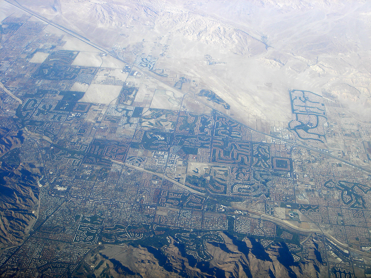
Cathedral City, colloquially known as "Cat City", is a desert resort city in Riverside County, California, United States, within the Colorado Desert's Coachella Valley. Situated between Palm Springs and Rancho Mirage, the city has the second largest population, after Indio, of the nine cities in the Coachella Valley. Its population was 51,493 at the 2020 census, a slight increase from 51,200 at the 2010 census. Prior to the arrival of European explorers and settlers, the land was part of the territory inhabited by the Cahuilla Indians. Today every other square mile of the city is part of the Agua Caliente Band of Cahuilla Indians reservation land. Development of a town began when a housing subdivision was built in 1925, although it was not incorporated until 1981. History Etymology The city's name is derived from Cathedral Canyon located to the south of the city in the foothills of the Santa Rosa and San Jacinto Mountains National Monument. The canyon is said to have r ... [...More Info...] [...Related Items...] OR: [Wikipedia] [Google] [Baidu] |
List Of Municipalities In California
California is a U.S. state, state located in the Western United States. It is the List of U.S. states and territories by population, most populous state and the List of U.S. states and territories by area, third largest by area after Alaska and Texas. According to the 2020 United States Census, California has 39,538,223 inhabitants and of land. California has been inhabited by numerous Indigenous peoples of California, Native American peoples since antiquity. The Spanish colonization of the Americas, Spanish, the Russian colonization of the Americas, Russians, and other Europeans began exploring and colonizing the area in the 16th and 17th centuries, with the Spanish establishing its first California Spanish missions in California, mission at what is now Presidio of San Diego, San Diego in 1769. After the Mexican Cession of 1848, the California Gold Rush brought worldwide attention to the area. The growth of the Cinema of the United States, movie industry in Los Angeles, high te ... [...More Info...] [...Related Items...] OR: [Wikipedia] [Google] [Baidu] |
North American Numbering Plan
The North American Numbering Plan (NANP) is a telephone numbering plan for twenty-five regions in twenty countries, primarily in North America and the Caribbean. This group is historically known as World Zone 1 and has the international calling code ''1''. Some North American countries, most notably Mexico, do not participate in the NANP. The NANP was originally devised in the 1940s by the American Telephone and Telegraph Company (AT&T) for the Bell System and the independent telephone operators in North America. The goal was to unify the diverse local numbering plans that had been established in the preceding decades and prepare the continent for direct-dialing of calls by customers without the involvement of telephone operators. AT&T continued to administer the numbering plan until the breakup of the Bell System, when administration was delegated to the North American Numbering Plan Administrator (NANPA), a service that has been procured from the private sector by the Fede ... [...More Info...] [...Related Items...] OR: [Wikipedia] [Google] [Baidu] |
Canyon
A canyon (from ; archaic British English spelling: ''cañon''), or gorge, is a deep cleft between escarpments or cliffs resulting from weathering and the erosion, erosive activity of a river over geologic time scales. Rivers have a natural tendency to cut through underlying surfaces, eventually wearing away rock layers as sediments are removed downstream. A river bed will gradually reach a baseline elevation, which is the same elevation as the body of water into which the river drains. The processes of weathering and erosion will form canyons when the river's River source, headwaters and estuary are at significantly different elevations, particularly through regions where softer rock layers are intermingled with harder layers more resistant to weathering. A canyon may also refer to a rift between two mountain peaks, such as those in ranges including the Rocky Mountains, the Alps, the Himalayas or the Andes. Usually, a river or stream carves out such splits between mountains. Examp ... [...More Info...] [...Related Items...] OR: [Wikipedia] [Google] [Baidu] |
Municipal Corporation
A municipal corporation is the legal term for a local governing body, including (but not necessarily limited to) cities, counties, towns, townships, charter townships, villages, and boroughs. The term can also be used to describe municipally owned corporations. Municipal corporation as local self-government Municipal incorporation occurs when such municipalities become self-governing entities under the laws of the state or province in which they are located. Often, this event is marked by the award or declaration of a municipal charter. A city charter or town charter or municipal charter is a legal document establishing a municipality, such as a city or town. Canada In Canada, charters are granted by provincial authorities. India The Corporation of Chennai is the oldest Municipal Corporation in the world outside the United Kingdom. Ireland The title "corporation" was used in boroughs from soon after the Norman conquest until the Local Government Act 2001. Under the 20 ... [...More Info...] [...Related Items...] OR: [Wikipedia] [Google] [Baidu] |
Subdivision (land)
Subdivisions are the act of dividing land into pieces that are easier to sell or otherwise develop, usually via a plat. The former single piece as a whole is then known as a subdivision. Subdivisions may be simple, involving only a single seller and buyer, or complex, involving large tracts of land divided into many smaller parcels. If it is used for housing it is typically known as a ''housing subdivision'' or ''housing development,'' although some developers tend to call these areas communities. Subdivisions may also be for the purpose of commercial or industrial development, and the results vary from retail shopping malls with independently owned ''out parcels'' to industrial parks. United States History In the United States, the creation of a subdivision was often the first step toward the creation of a new incorporated township or city. Contemporary notions of subdivisions rely on the Lot and Block survey system, which became widely used in the 19th century as a means ... [...More Info...] [...Related Items...] OR: [Wikipedia] [Google] [Baidu] |
Cahuilla
The Cahuilla , also known as ʔívil̃uqaletem or Ivilyuqaletem, are a Native American people of the various tribes of the Cahuilla Nation, living in the inland areas of southern California."California Indians and Their Reservations. ''SDSU Library and Information Access.'' Their original territory included an area of about . The traditional Cahuilla territory was near the geographic center of . It was bounded to the north by the , to the south by [...More Info...] [...Related Items...] OR: [Wikipedia] [Google] [Baidu] |
2010 United States Census
The United States census of 2010 was the twenty-third United States national census. National Census Day, the reference day used for the census, was April 1, 2010. The census was taken via mail-in citizen self-reporting, with enumerators serving to spot-check randomly selected neighborhoods and communities. As part of a drive to increase the count's accuracy, 635,000 temporary enumerators were hired. The population of the United States was counted as 308,745,538, a 9.7% increase from the 2000 census. This was the first census in which all states recorded a population of over half a million people as well as the first in which all 100 largest cities recorded populations of over 200,000. Introduction As required by the United States Constitution, the U.S. census has been conducted every 10 years since 1790. The 2000 U.S. census was the previous census completed. Participation in the U.S. census is required by law of persons living in the United States in Title 13 of the United ... [...More Info...] [...Related Items...] OR: [Wikipedia] [Google] [Baidu] |
Indio, California
Indio (Spanish language, Spanish for "Indian") is a city in Riverside County, California, Riverside County, California, United States, in the Coachella Valley of Southern California's Colorado Desert region. It lies east of Palm Springs, California, Palm Springs, east of Riverside, California, Riverside, east of Los Angeles, 148 miles (238 km) northeast of San Diego, and 250 miles (402 km) west of Phoenix, Arizona, Phoenix. The population was 89,137 in the 2020 United States Census, up from 76,036 at the 2010 United States Census, 2010 census, an increase of 17%. Indio is the most populous city in the Coachella Valley, and was formerly referred to as the Hub of the Valley after a Chamber of Commerce slogan used in the 1970s. It was later nicknamed the City of Festivals, a reference to the numerous cultural events held in the city, most notably the Coachella Valley Music and Arts Festival. History Indio was originally inhabited by the Torres Martinez Desert Cahuilla ... [...More Info...] [...Related Items...] OR: [Wikipedia] [Google] [Baidu] |
Rancho Mirage, California
Rancho Mirage is a city in Riverside County, California, United States. The population was 17,218 at the 2010 census, up from 13,249 at the 2000 census, but the seasonal (part-time) population can exceed 20,000. Incorporated in 1973 and located between Cathedral City and Palm Desert, it is one of the nine cities of the Coachella Valley (Palm Springs area). It is home to and has been home to a number of celebrities, including Don Sutton, Frank Sinatra, Dean Martin, Bing Crosby, Sammy Davis Jr., Lucille Ball, Bob Hope, Billie Dove and Gerald and Betty Ford. It is a low-density desert-resort community with resorts, golf courses, and country clubs in the Coachella Valley within the Colorado Desert section of the Sonoran Desert. It is nestled along the foothills of the Santa Rosa Mountains in the south and is located between the cities of Palm Springs and Palm Desert. It is adjacent to Cathedral City, Palm Desert, and Unincorporated Thousand Palms. It has been nicknamed "Playgroun ... [...More Info...] [...Related Items...] OR: [Wikipedia] [Google] [Baidu] |
Palm Springs, California
Palm Springs (Cahuilla: ''Séc-he'') is a desert resort city in Riverside County, California, United States, within the Colorado Desert's Coachella Valley. The city covers approximately , making it the largest city in Riverside County by land area. With multiple plots in checkerboard pattern, more than 10% of the city is part of the Agua Caliente Band of Cahuilla Indians reservation land and is the administrative capital of the most populated reservation in California. The population of Palm Springs was 44,575 as of the 2020 census, but because Palm Springs is a retirement location and a winter snowbird destination, the city's population triples between November and March. The city is noted for its mid-century modern architecture, design elements, arts and cultural scene, and recreational activities. History Founding Pre-colonial history The first humans to settle in the area were the Cahuilla people, who arrived 2,000 years ago.Baker, Christopher P. (2008). ''E ... [...More Info...] [...Related Items...] OR: [Wikipedia] [Google] [Baidu] |
Coachella Valley
, map_image = Wpdms shdrlfi020l coachella valley.jpg , map_caption = Coachella Valley , location = California, United States , coordinates = , width = , boundaries = Salton Sea (southeast), Santa Rosa Mountains (southwest), San Jacinto Mountains (west), Little San Bernardino Mountains (east), San Gorgonio Mountain (north) , towns = Indio, Palm Springs, Palm Desert , traversed = Interstate 10 The Coachella Valley ( ) is an arid rift valley in the Colorado Desert of Southern California's Riverside County. The valley may also be referred to as Greater Palm Springs due to the prominence of the city of Palm Springs. The valley extends approximately southeast from the San Gorgonio Pass to the northern shore of the Salton Sea and the neighboring Imperial Valley, and is approximately wide along most of its length. It is bounded on the northeast by the San Bernardino and Little San Bernardino Mountains, and on the southwest by the San Jacinto and Santa Rosa Mountains. ... [...More Info...] [...Related Items...] OR: [Wikipedia] [Google] [Baidu] |
Colorado Desert
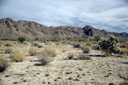
California's Colorado Desert is a part of the larger Sonoran Desert. It encompasses approximately , including the heavily irrigated Coachella and Imperial valleys. It is home to many unique flora and fauna. Geography and geology The Colorado Desert is a subdivision of the larger Sonoran Desert encompassing approximately . The desert encompasses Imperial County and includes parts of San Diego County, Riverside County, and a small part of San Bernardino County, California, United States. Most of the Colorado Desert lies at a relatively low elevation, below , with the lowest point of the desert floor at below sea level, at the Salton Sea. Although the highest peaks of the Peninsular Ranges reach elevations of nearly , most of the region's mountains do not exceed . In this region, the geology is dominated by the transition of the tectonic plate boundary from rift to fault. The southernmost strands of the San Andreas Fault connect to the northernmost extensions of the East Pacif ... [...More Info...] [...Related Items...] OR: [Wikipedia] [Google] [Baidu] |


