|
Caswell Hill, Saskatoon
Caswell Hill is a district in the city of Saskatoon, Saskatchewan, Canada. It derives its name from an early homesteader ''Robert Caswell'' one of the Temperance Colonists of 1883. It is an area of beautiful character homes first built ca. 1905, tiny war-time houses, and newer houses. Caswell is a thriving and diverse community nestled between two economic areas, the downtown core, and the stores lining 33rd Street West. Caswell Hill is bounded by 22nd Street to the south, H Avenue to the west, 33rd Street to the north, and Idylwyld Drive to the east. Layout Streets are laid out east and west, avenues are laid out running north and south. Streets increment in number as travel heads northward. Avenues increment alphabetically as travel proceeds west. The whole of the Caswell Hill community is also laid out in a grid pattern. Historic sites Saskatoon Railway Station (Canadian Pacific) is one of many Saskatoon buildings listed in the Canadian Register of Historic Places. It ... [...More Info...] [...Related Items...] OR: [Wikipedia] [Google] [Baidu] |
List Of Neighbourhoods In Saskatoon
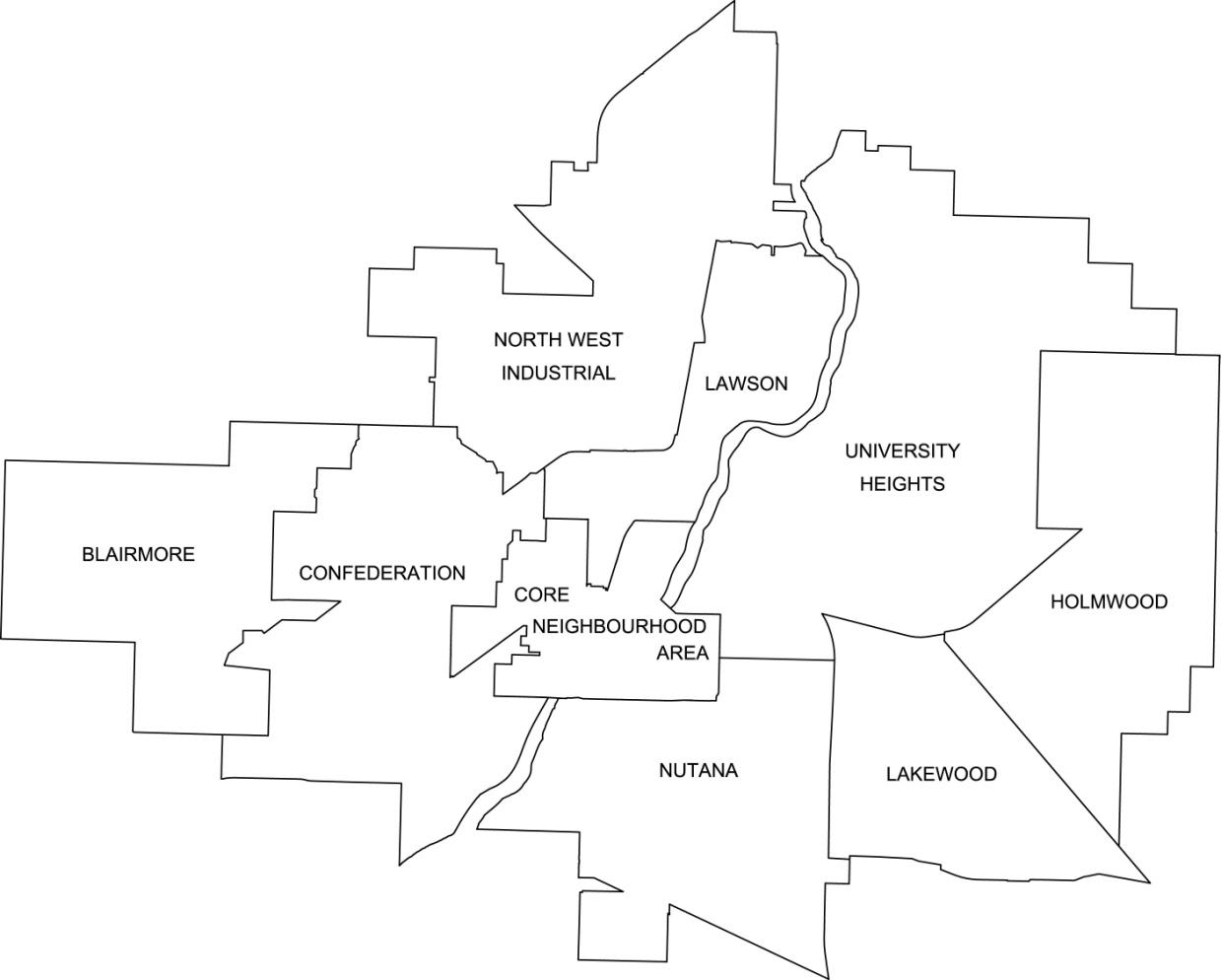
The city of Saskatoon, Saskatchewan, Canada currently has 65 neighbourhoods divided amongst 9 designated Suburban Development Areas (SDAs). Some neighbourhoods underwent boundary and name changes in the 1990s when the City of Saskatoon adjusted its community map. Definitions * Neighbourhood: the basic unit of residential development, comprehensively planned and maintained over the long term. Many older neighbourhoods were defined by elementary school catchment areas. The boundaries of some neighbourhoods were adjusted when the school boards no longer required students to live in their school catchment area. The boundaries of neighbourhoods are now defined by "natural" barriers such as major streets, railways, and bodies of water. * Suburban Development Area (SDA): a collection of neighbourhoods organized to facilitate long range planning for infrastructure and related community facilities. Each SDA has approximately ten neighbourhoods, 50,000 people, district and multi-district ... [...More Info...] [...Related Items...] OR: [Wikipedia] [Google] [Baidu] |
Betty Nippi-Albright (politician)
Betty Nippi-Albright is a Canadian politician, who was elected to the Legislative Assembly of Saskatchewan in the 2020 Saskatchewan general election. She represents the electoral district of Saskatoon Centre as a member of the Saskatchewan New Democratic Party. Hailing from the Kinistin First Nation, Nippi-Albright is of Saulteaux and Cree The Cree ( cr, néhinaw, script=Latn, , etc.; french: link=no, Cri) are a North American Indigenous people. They live primarily in Canada, where they form one of the country's largest First Nations. In Canada, over 350,000 people are Cree o ... ancestry and is a residential school survivor. She is one of two Indigenous MLAs currently serving from the NDP, alongside Doyle Vermette. Nippi-Albright raised concerns about first nations communities during the COVID-19 pandemic in Saskatchewan. References Living people 21st-century Canadian women politicians Saskatchewan New Democratic Party MLAs Women MLAs in Saskatchewan ... [...More Info...] [...Related Items...] OR: [Wikipedia] [Google] [Baidu] |
Asquith, Saskatchewan
Asquith is a town in south-central Saskatchewan, Canada, approximately west of Saskatoon. It became a village in December 1907. According to the 2011 Census, its population is 603. The site was largely the original lands settled by Ontario pioneers Andrew Mather and Jennet Mather, née Ainslie. Demographics In the 2021 Census of Population conducted by Statistics Canada, Asquith had a population of living in of its total private dwellings, a change of from its 2016 population of . With a land area of , it had a population density of in 2021. See also * List of communities in Saskatchewan * List of towns in Saskatchewan A town is a type of incorporated urban municipality in the Canadian province of Saskatchewan. A resort village or a village can be incorporated as a town by the Minister of Municipal Affairs via section 52 of ''The Municipalities Act'' if: *Req ... References External links * Towns in Saskatchewan Division No. 12, Saskatchewan {{SKD ... [...More Info...] [...Related Items...] OR: [Wikipedia] [Google] [Baidu] |
Saskatchewan Highway 7
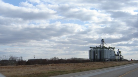
Saskatchewan Highway 7 is a major paved undivided provincial highway in the Canadian province of Saskatchewan, running from the Alberta border to Saskatoon. Highway 7 continues west into Alberta where it becomes Alberta Highway 9. Highway 7 is an important trade and travel route linking Saskatoon with several of its bedroom communities such as Delisle and Vanscoy, as well as larger centres farther afield such as Rosetown and Kindersley. Its primary use, however, is by travelers heading for Calgary, Alberta and the Canadian west coast. Despite being one of the most heavily used roads in the province, as of 2020, there is only approximately 36.5 km of the route that is divided highway; 34.5 km from Saskatoon to Delisle, including a recently completed bypass of Vanscoy, and 2 km just east of Rosetown at the Rosetown Airport and Cargill inland terminal. In 2020, the provincial government announced funding to install eight passing lanes east of Kindersley, as well as ... [...More Info...] [...Related Items...] OR: [Wikipedia] [Google] [Baidu] |
Saskatchewan Highway 14
Highway 14 is a highway in the Canadian province of Saskatchewan. It runs from the Alberta border where it becomes Highway 13 to intersection of Circle Drive and 22nd Street in Saskatoon. It is approximately long. Prior to 1976, Highway 14 ran the width of the province, continuing east from Saskatoon to the Manitoba border where it transitioned to PTH 4. In 1970, the portion of Highway 14 east of Saskatoon was made part of the Yellowhead Highway along with the section of Highway 5 running west of Saskatoon. Six years later, in 1976, these two sections were re-designated as Highway 16 so that the Yellowhead Highway would carry one number through the four Western provinces (Manitoba would follow suit the next year, redesignating PTH 4 to PTH 16). Though Highway 14 is one of the three major highways leading from Saskatoon to Alberta, it is less used than Highway 7 or Highway 16 as the other highways provide direct access to Calgary and Edmonton respectively. Major communitie ... [...More Info...] [...Related Items...] OR: [Wikipedia] [Google] [Baidu] |
Canada Dollar
The Canadian dollar ( symbol: $; code: CAD; french: dollar canadien) is the currency of Canada. It is abbreviated with the dollar sign $, there is no standard disambiguating form, but the abbreviation Can$ is often suggested by notable style guides for distinction from other dollar-denominated currencies. It is divided into 100 cents (¢). Owing to the image of a common loon on its reverse, the dollar coin, and sometimes the unit of currency itself, are sometimes referred to as the ''loonie'' by English-speaking Canadians and foreign exchange traders and analysts. Accounting for approximately 2% of all global reserves, the Canadian dollar is the fifth-most held reserve currency in the world, behind the U.S. dollar, the euro, the yen and sterling. The Canadian dollar is popular with central banks because of Canada's relative economic soundness, the Canadian government's strong sovereign position, and the stability of the country's legal and political systems. Histo ... [...More Info...] [...Related Items...] OR: [Wikipedia] [Google] [Baidu] |
Saskatoon Transit
Saskatoon Transit (formerly Saskatoon Municipal Railway) is the public transport arm of the City of Saskatoon, Saskatchewan, Canada. It operates a fleet of diesel buses. A total of 23 bus routes serve every area of the city, carrying approximately 11 million passengers in 2008.Saskatoon Transit Unveils New Smart Card System, Dec 2009 Saskatoon Transit is a member of the Canadian Urban Transit Association. The major bus terminal is located [...More Info...] [...Related Items...] OR: [Wikipedia] [Google] [Baidu] |
22nd Street (Saskatoon)
22nd Street is an arterial road in Saskatoon, Saskatchewan. It begins as 22nd Street East in the Central Business District. Going west it passes the Midtown Plaza and TCU Place. At the intersection with Idylwyld Drive, it becomes 22nd Street West. Through the inner city neighbourhoods of Caswell Hill, Riversdale, Westmount, and Pleasant Hill, it contains a mixture of commercial and residential development. It then connects with Circle Drive via an interchange. Next to the interchange is the Confederation Mall. Across from that is a Real Canadian Superstore. From there is passes by the neighbourhoods of Pacific Heights, Blairmore, and Kensington. The road then heads out of the city and continues on as Highway 14. Prior to 2005, 22nd Street used to turn southwest near the present-day Hart Road intersection and continue as Highway 7, while traffic had to leave the roadway to follow Highway 14. The roadway was removed to make way Blairmore Suburban Centre, ... [...More Info...] [...Related Items...] OR: [Wikipedia] [Google] [Baidu] |
Caswell School
Caswell Hill is a district in the city of Saskatoon, Saskatchewan, Canada. It derives its name from an early homesteader ''Robert Caswell'' one of the Temperance Colonists of 1883. It is an area of beautiful character homes first built ca. 1905, tiny war-time houses, and newer houses. Caswell is a thriving and diverse community nestled between two economic areas, the downtown core, and the stores lining 33rd Street West. Caswell Hill is bounded by 22nd Street to the south, H Avenue to the west, 33rd Street to the north, and Idylwyld Drive to the east. Layout Streets are laid out east and west, avenues are laid out running north and south. Streets increment in number as travel heads northward. Avenues increment alphabetically as travel proceeds west. The whole of the Caswell Hill community is also laid out in a grid pattern. Historic sites Saskatoon Railway Station (Canadian Pacific) is one of many Saskatoon buildings listed in the Canadian Register of Historic Places. It ... [...More Info...] [...Related Items...] OR: [Wikipedia] [Google] [Baidu] |
Bedford Road Collegiate
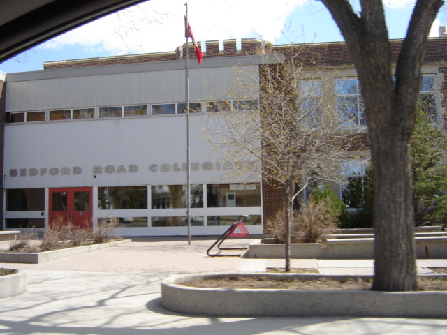
Bedford Road Collegiate is a public high school on the west side of the city of Saskatoon, Saskatchewan. It is Saskatoon's second oldest high school, opened on February 12, 1923. It is also known as BRCI (Bedford Road Collegiate Institute), or Bedford. Bedford Road Collegiate is part of the Saskatoon Public School Division. Currently its feeder schools are Caswell Community School, Henry Kelsey School, King George Community School, Mayfair Community School,and Westmount Community School. Campus The school is shaped in the form of 2 concentric squares on top of each other, with the lower floor containing the gymnasium, auditorium, offices, as well as the music department, shop classroom and general purpose classrooms. In the lower square's center, the library is located. The upper floor contains the science department, art department, computer labs and general purpose classrooms. The lower square also contains the office department and conference rooms. a large commons area is als ... [...More Info...] [...Related Items...] OR: [Wikipedia] [Google] [Baidu] |


