|
Caskey Monument
Caskey Monument is a heritage-listed memorial at the Toowong Cemetery, 124 Birdwood Terrace, Toowong, City of Brisbane, Queensland, Australia. It was designed and built by William Busby in 1902. It was added to the Queensland Heritage Register on 21 October 1992. History This monument was erected at Toowong Cemetery in May 1902 in memory of Lieutenant Lachlan John Caskey, who was killed in action at Makari Drift, Caledon River, South Africa on 27 September 1901. He was 31 years old. Caskey was a member of the 5th Queensland Imperial Bushmen and, like all Australian troops participating in the South African War (Boer War) of 1899-1902, was a volunteer. As a member of the QIB he was under British command, and his pay was issued by the colonial government at an English cavalryman's rate. The Caskey Monument is the first known South African War monument to be erected in Queensland. A design competition was won by prominent monumental mason William Busby, a public committee wa ... [...More Info...] [...Related Items...] OR: [Wikipedia] [Google] [Baidu] |
Toowong Cemetery
Toowong Cemetery is a heritage-listed cemetery on the corner of Frederick Street and Mt Coot-tha Road, Toowong, City of Brisbane, Queensland, Australia. It was established in 1866 and formally opened in 1875. It is Queensland's largest cemetery and is located on forty-four hectares of land at the corner of Frederick Street and Mount Coot-tha Road approximately four and a half kilometres west of Brisbane. It was previously known as Brisbane General Cemetery. It was added to the Queensland Heritage Register on 31 December 2002. Although still used as a cemetery, it is a popular place for joggers and dog walkers, with its over-hanging fig trees and winding pathways. The Friends of Toowong Cemetery is a volunteer group that discover and share the history and stories of Toowong Cemetery. They conduct tours and provide a series of self-guided walks through the cemetery. History Bureaucratic procrastination, manoeuvring and public discontent colour the early history of the Brisba ... [...More Info...] [...Related Items...] OR: [Wikipedia] [Google] [Baidu] |
Sherwood, Queensland
Sherwood is a suburb in the City of Brisbane, Queensland, Australia. In the , Sherwood had a population of 5,313 people. Geography Sherwood is south west of the Brisbane CBD and bounded by the median of the Brisbane River towards the west. Oxley Road is the main thoroughfare through the suburb, entering from the north ( Graceville) and exiting to the south (Corinda). The Ipswich railway line runs parallel to and west of Oxley Avenue, with the suburb served by Sherwood railway station (). The suburb is mostly low and medium-density housing with a retail strip centred along Sherwood Road. History West Oxley State School opened on 25 March 1867. It was renamed Sherwood State School in 1878. The first head teacher was Major William Jenyns Boyd. He was born in Paris in 1842 and migrated to Australia in 1862. In 1868, Oliver Radcliffe was the first name on the roll as a pupil teacher. He became a teacher, a headmaster and then a school inspector. By his retirement in 1932, h ... [...More Info...] [...Related Items...] OR: [Wikipedia] [Google] [Baidu] |
Toowong
Toowong is a riverside suburb in the City of Brisbane, Queensland, Australia. In the , Toowong had a population of 10,830 people. Geography Toowong is situated between Mount Coot-tha and the Brisbane River and is made up of rolling hills with little flat land. Since European settlement most of the land has been cleared for residential and commercial use with the exception of some park land and bushland near the Western Freeway. At the centre of Toowong is a commercial precinct including Toowong Village, and several other commercial and office buildings. The western side of the suburb is predominantly residential with a mix of medium density dwellings and detached Queenslander houses, extending to the foothills of Mount Coot-tha. Toowong borders the Brisbane River. Along the riverside are a number of transport links: Coronation Drive, the Regatta ferry wharf, and the Bicentennial Bike Path (a bike and walkway) to the Brisbane CBD. This section of the river is the Toowong ... [...More Info...] [...Related Items...] OR: [Wikipedia] [Google] [Baidu] |
History Of Brisbane
Brisbane's recorded history dates from 1799, when Matthew Flinders explored Moreton Bay on an expedition from Port Jackson, although the region had long been occupied by the Yugara and Turrbal aboriginal tribes. The town was conceived initially as a penal colony for British convicts sent from Sydney. Its suitability for fishing, farming, timbering, and other occupations, however, caused it to be opened to free settlement in 1838. The town became a municipality in 1859 and a consolidated metropolitan area in 1924. Brisbane encountered major flooding disasters in 1893, 1974, 2011 and 2022. Significant numbers of US troops were stationed in Brisbane during World War II. The city hosted the 1982 Commonwealth Games, World Expo 88, and the 2014 G20 Brisbane summit. Etymology The name Brisbane is named to honor Sir Thomas Brisbane (1773–1860) who was Governor of New South Wales from 1821–1825. When it was given its name and declared as a town in 1834, to replace its penal colo ... [...More Info...] [...Related Items...] OR: [Wikipedia] [Google] [Baidu] |
Column
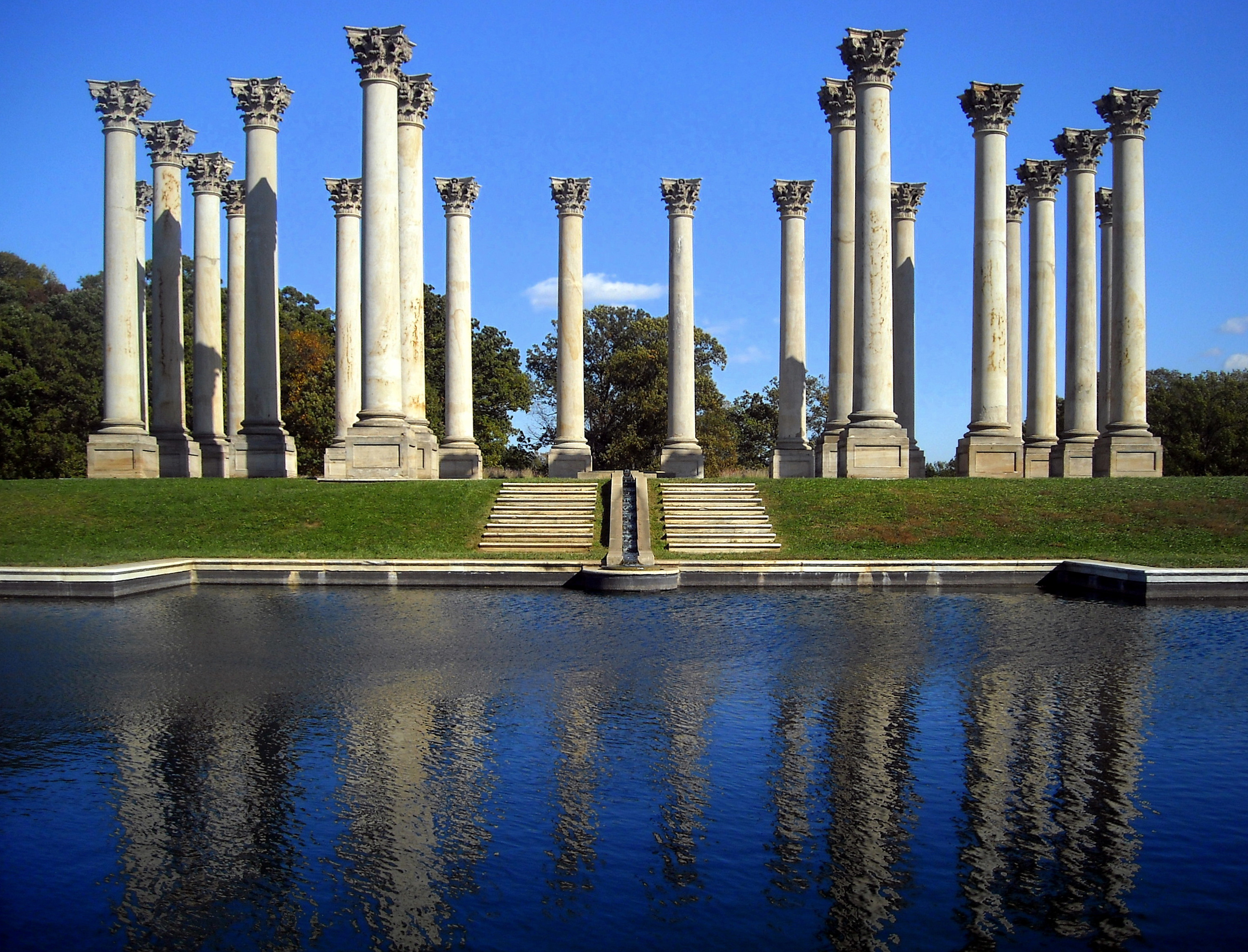
A column or pillar in architecture and structural engineering is a structural element that transmits, through compression, the weight of the structure above to other structural elements below. In other words, a column is a compression member. The term ''column'' applies especially to a large round support (the shaft of the column) with a capital and a base or pedestal, which is made of stone, or appearing to be so. A small wooden or metal support is typically called a ''post''. Supports with a rectangular or other non-round section are usually called ''piers''. For the purpose of wind or earthquake engineering, columns may be designed to resist lateral forces. Other compression members are often termed "columns" because of the similar stress conditions. Columns are frequently used to support beams or arches on which the upper parts of walls or ceilings rest. In architecture, "column" refers to such a structural element that also has certain proportional and decorative featur ... [...More Info...] [...Related Items...] OR: [Wikipedia] [Google] [Baidu] |
Helidon, Queensland
Helidon is a rural town and locality in the Lockyer Valley Region, Queensland, Australia. In the , the locality of Helidon had a population of 1,059 people. Helidon is known in Queensland for its high quality sandstone (also called freestone), used extensively in private and public buildings in the state and elsewhere, including Brisbane City Hall, Brisbane Treasury Building, University of Queensland, and sought after internationally for its quality, especially in China. Helidon is also the location of a natural mineral spring whose products were sold by the Helidon Spa Water Company, now known as Kirks. Geography Helidon is located on the Warrego Highway, west of the state capital, Brisbane, and east of Toowoomba. Parts of the hilly, undeveloped north of Helidon have been protected within Lockyer National Park. History The Helidon district is called by Aboriginal inhabitants "Yabarba", the name of the Curriejung, and the nearby spring is known as "Woonar-rajimmi", the pl ... [...More Info...] [...Related Items...] OR: [Wikipedia] [Google] [Baidu] |
Pedestal
A pedestal (from French ''piédestal'', Italian ''piedistallo'' 'foot of a stall') or plinth is a support at the bottom of a statue, vase, column, or certain altars. Smaller pedestals, especially if round in shape, may be called socles. In civil engineering, it is also called ''basement''. The minimum height of the plinth is usually kept as 45 cm (for buildings). It transmits loads from superstructure to the substructure and acts as the retaining wall for the filling inside the plinth or raised floor. In sculpting, the terms base, plinth, and pedestal are defined according to their subtle differences. A base is defined as a large mass that supports the sculpture from below. A plinth is defined as a flat and planar support which separates the sculpture from the environment. A pedestal, on the other hand, is defined as a shaft-like form that raises the sculpture and separates it from the base. An elevated pedestal or plinth that bears a statue, and which is raised from th ... [...More Info...] [...Related Items...] OR: [Wikipedia] [Google] [Baidu] |
Allora, Queensland
Allora is a rural town and Suburbs and localities (Australia), locality in the Southern Downs Region, Queensland, Australia. In the , the locality of Allora had a population of 1,223 people. Geography Allora is on the Darling Downs in south-eastern Queensland, Australia, by road south-west of the state capital, Brisbane. The town is located on the New England Highway between Warwick, Queensland, Warwick and Toowoomba. History Giabal language, Giabal (also known as Paiamba, Gomaingguru) is an Australian Aboriginal language. The Giabal language region includes the landscape within the local government boundaries of the Toowoomba Regional Council, particularly Toowoomba south to Allora and west to Millmerran, Queensland, Millmerran. The region surrounding this small farming community was first explored by Europeans in the 1840s. In 1854 the first Presbyterian services were held in Allora. The town was surveyed in 1859. Its name is believed to derive from an Indigenous Aust ... [...More Info...] [...Related Items...] OR: [Wikipedia] [Google] [Baidu] |
Brisbane Central Business District
Brisbane City is the central suburb and central business district of Brisbane, the state capital of Queensland, Australia. It is colloquially referred to as the "Brisbane CBD" or "the city". It is located on a point on the northern bank of the Brisbane River, historically known as ''Meanjin'', ''Mianjin'' or ''Meeanjin'' in the local Aboriginal Australian dialect. The triangular shaped area is bounded by the median of the Brisbane River to the east, south and west. The point, known at its tip as Gardens Point, slopes upward to the north-west where the city is bounded by parkland and the inner city suburb of Spring Hill to the north. The CBD is bounded to the north-east by the suburb of Fortitude Valley. To the west the CBD is bounded by Petrie Terrace, which in 2010 was reinstated as a suburb (after being made a locality of Brisbane City in the 1970s). In the the suburb of Brisbane City had a population of 9,460 people. Geography The Brisbane central business district is ... [...More Info...] [...Related Items...] OR: [Wikipedia] [Google] [Baidu] |
Anzac Square, Brisbane
ANZAC Square is a heritage-listed town square and war memorial located between Ann Street and Adelaide Street (opposite Post Office Square), in Brisbane, Queensland, Australia. It is a state memorial to the men and women who participated in overseas armed service and is named in honour of the Australian and New Zealand Army Corps. ANZAC Square is adjacent to ANZAC Square Arcade. ANZAC Square was opened on Armistice Day, 1930. It is also known as 9th Battalion Memorial and Queensland Women's War Memorial. ANZAC Square was registered on the (now inactive) Register of the National Estate in 1980 and added to the Queensland Heritage Register on 21 October 1992. ANZAC Square contains the Shrine of Remembrance and the 'Eternal Flame of Remembrance' held in a continuously lit bronze urn, dedicated on Tuesday, 11 November 1930. There is also the World War II Shrine of Memories. Daphne Mayo sculptured the Women's War Memorial that forms part of the memorial's wall. The exter ... [...More Info...] [...Related Items...] OR: [Wikipedia] [Google] [Baidu] |
South African War Memorial, Brisbane
South African War Memorial is a heritage-listed memorial at ANZAC Square, 228 Adelaide Street, Brisbane City, City of Brisbane, Queensland, Australia. It was sculpted by James Laurence Watts from 1912 to 1919. It is also known as Boer War Memorial and ''The Scout''. It was added to the Queensland Heritage Register on 21 October 1992. History The first overseas conflict in which colonial Queensland troops were involved occurred during Second Boer War (1899-1902) in South Africa. The Queensland Government despatched volunteer contingents of mounted infantrymen to the war to aid the forces of the British Commonwealth involved in the armed intervention. Eighty-nine Queenslanders died during the war. In the years after the war a public committee was established to erect a memorial to the fallen, but the funds raised were insufficient and the project lapsed. In 1912 James Laurence Watts, a Brisbane sculptor, was commissioned to provide ''"an equestrian statue in bronze"'' for ... [...More Info...] [...Related Items...] OR: [Wikipedia] [Google] [Baidu] |
Hemmant, Queensland
Hemmant is a suburb of the City of Brisbane, Queensland, Australia. In the , Hemmant had a population of 2,385 people. Geography Hemmant is by road east of the Brisbane CBD. Hemmant is bounded by the Brisbane River to the north and Bulimba Creek to the west. The Fishermans Islands freight railway line and the Cleveland railway line run parallel through the suburb from west (Murarrie) to east ( Wynnum West). The Hemmant railway station serves the suburb with passenger services on the Cleveland line (). The Port of Brisbane Motorway and Lytton Road both enter the suburb from the west (Murarrie) and exit to the north-west ( Lytton). The destination for both routes is ultimately the Port of Brisbane. The land north of the railway lines (where the major roads pass through) is principally used for industrial purposes influenced by the proximity of and access to the port, while south of the railway lines is mostly residential use. History In 1858 the land of Hemmant area was ... [...More Info...] [...Related Items...] OR: [Wikipedia] [Google] [Baidu] |

.jpg)


.jpg)


