|
Carúpano
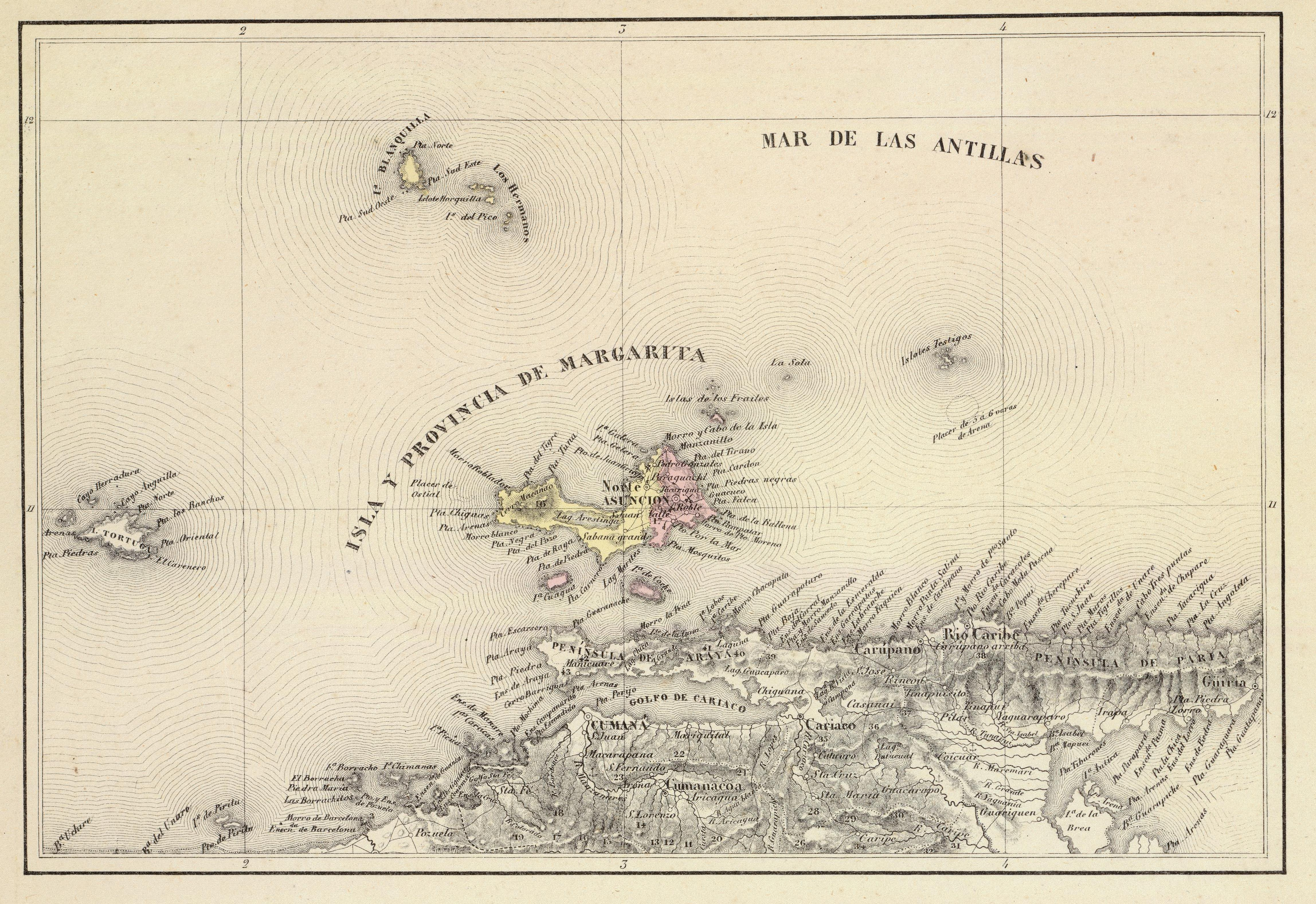
Carúpano is a city in the eastern Venezuelan state of Sucre. It is located on the Venezuelan Caribbean coast at the opening of two valleys, some 120 km east of the capital of Sucre, Cumaná.Gobernación Del Estado Sucre This city is the of the and, according to the 2010 Venezuelan , the municipality has a population of 173,877 inhabitants. [...More Info...] [...Related Items...] OR: [Wikipedia] [Google] [Baidu] |
Sucre (state)
The Sucre State ( es, Estado Sucre, ) is one of the 23 states of Venezuela. The state capital is Cumaná city. Sucre State covers a total surface area of and, as of the 2011 census, had a population of 896,921. The most important river in the state is the Manzanares River. History This Venezuelan State has great historical importance, because it was the first Venezuelan land that was touched by the European navigator, Christopher Columbus. The latter, impressed by the greenness of the flora, the coasts and the crystalline water of its beaches, called the place "Tierra de Gracia". Spanish colonization The capital of the state is Cumaná, which was founded by Gonzalo de Ocampo in 1521, although Franciscan missionaries began to populate it in 1515. In 1530 it was hit by an earthquake, so it had to be rebuilt. On July 2, 1591, King Philip II of Spain granted Cumaná the title of city. In 1639, conflicts appeared in the Cumanacoa Valley, as the well-known conqueror Juan de ... [...More Info...] [...Related Items...] OR: [Wikipedia] [Google] [Baidu] |
El Carupanazo
''El Carupanazo'' was a short-lived military rebellion against the government of Rómulo Betancourt, in which rebel military officers commanding the Third Marine Infantry Battalion and the 77th National Guard Detachment took over the city of Carúpano in May 1962. venezuelatuya.comEl Carupanazo y El Porteñazo/ref> The rebellion was followed a month later by another in Puerto Cabello, ''El Porteñazo''. Rebellion At around midnight on 4 May 1962, military officers in rebellion against the government of Rómulo Betancourt took over the city of Carúpano. The insurgents, under control of Captain Jesús Teodoro Molina Villegas, Major Pedro New Vegas, and Lieutenant Héctor Fleming Mendoza, occupied the city's streets and buildings, the airport, and the radio station, Radio Carúpano, which they used to broadcast their message, calling themselves the ''Movimiento de Recuperación Democrática'' (Movement of Democratic Recuperation). President Betancourt demanded that the rebe ... [...More Info...] [...Related Items...] OR: [Wikipedia] [Google] [Baidu] |
Bermúdez Municipality
The Bermúdez Municipality is one of the fifteen municipalities (municipios) that makes up the eastern Venezuelan state of Sucre and, according to a 2011 population estimate by the National Institute of Statistics of Venezuela, the municipality has a population of 165,675. The city of Carúpano is the administrative centre for the Bermúdez Municipality.http://www.ocei.gov.ve/secciones/division/Sucre.zip The municipality was named for Venezuelan independence hero José Francisco Bermúdez. History It was somewhere on the Paria Peninsula, near Carúpano, where Christopher Columbus first set foot on the American continent for the only time, during his third voyage (in all his other trips he only explored the Caribbean islands). Demographics The Bermúdez Municipality, according to a 2011 population estimate by the National Institute of Statistics of Venezuela, has a population of 165,675 (up from 128,123 in 2000). This amounts to 16.4% of the state's population.http://www.ocei.gov. ... [...More Info...] [...Related Items...] OR: [Wikipedia] [Google] [Baidu] |
Paria Peninsula
The Paria Peninsula () is a large peninsula on the Caribbean Sea, in the state of Sucre in northern Venezuela. Geography Separating the Caribbean Sea from the Gulf of Paria, the peninsula is part of the mountain range, in the Venezuelan Coastal Range portion of the northern Andes. Its tip is within sight of the naked eye from the island of Trinidad. ;National Park Península de Paria National Park The Península de Paria National Park ( es, link=no, Parque nacional ''Península de Paria''), or Peninsula of Paria National Park, Is a national park on Paria Peninsula in Venezuela. Geography The park is located between the Gulf of Paria and t ... protects a section of the peninsula. Paria Region As a political subdivision, the Paria Region of the Paria Peninsula is the aggregation of six municipalities within Sucre State: *Bermúdez Municipality – (capital: Carúpano), *Arismendi Municipality – (capital: Río Caribe), *Benítez Municipality – (capital: El Pilar), *L ... [...More Info...] [...Related Items...] OR: [Wikipedia] [Google] [Baidu] |
1997 Cariaco Earthquake
The 1997 Cariaco earthquake occurred on July 9 at with a moment magnitude of 6.9 and a maximum Mercalli intensity of VIII (''Severe''). With its epicenter near Cariaco, Venezuela, at least 81 people were killed and over 500 were injured. Disruption of power, telephone, and water services was reported. This earthquake was felt in much of northeastern Venezuela and could also be felt in Trinidad and Tobago. This earthquake was on the strike-slip El Pilar Fault. See also * List of earthquakes in Venezuela This is a list of significant earthquakes that either had their epicentres in Venezuela or had a significant impact in the country. Overall, the population in this region resides in structures that are vulnerable to earthquake shaking, though resi ... References Further reading * External links * {{Earthquakes in 1997 1997 earthquakes 1997 in Venezuela Earthquakes in Venezuela Carúpano July 1997 events in South America Sucre (state) ... [...More Info...] [...Related Items...] OR: [Wikipedia] [Google] [Baidu] |
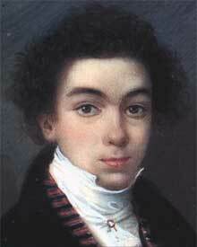
Simón Bolívar
Simón José Antonio de la Santísima Trinidad Bolívar y Palacios (24 July 1783 – 17 December 1830) was a Venezuelan military and political leader who led what are currently the countries of Colombia, Venezuela, Ecuador, Peru, Panama and Bolivia to independence from the Spanish Empire. He is known colloquially as '' El Libertador'', or the ''Liberator of America''. Simón Bolívar was born in Caracas in the Captaincy General of Venezuela into a wealthy criollo family. Before he turned ten, he lost both parents and lived in several households. Bolívar was educated abroad and lived in Spain, as was common for men of upper-class families in his day. While living in Madrid from 1800 to 1802, he was introduced to Enlightenment philosophy and met his future wife María Teresa Rodríguez del Toro y Alaysa. After returning to Venezuela, in 1803 del Toro contracted yellow fever and died. From 1803 to 1805, Bolívar embarked on a grand tour that ended in Rome, where he swore to end ... [...More Info...] [...Related Items...] OR: [Wikipedia] [Google] [Baidu] |
Municipalities Of Venezuela
Municipality, Municipalities of Venezuela are administrative divisions of Venezuela, subdivisions of the States of Venezuela. There are 335 municipalities dividing the 23 states and the Capital District (Venezuela), Capital District. Municipalities and their seats by federal entity Capital District #Libertador Bolivarian Municipality (Caracas Libertador covers about half of the city of Caracas, officially a metropolitan area; the rest of the city is covered by four adjacent municipalities in Miranda state: Baruta, Chacao, el Hatillo and Sucre) Amazonas Anzoátegui Apure Aragua Barinas Bolívar Carabobo Cojedes Delta Amacuro Falcón Guárico Lara Mérida Miranda Monagas Nueva Esparta Portuguesa Sucre Táchira Trujillo Vargas #Vargas Municipality, Vargas (La Guaira) Yaracuy Zulia {{DEFAULTSORT:Municipalities Of Venezuela Municipalities of Venezuela, Lists of administrative divisions, Venezuela, Municipalities Subdivisions of ... [...More Info...] [...Related Items...] OR: [Wikipedia] [Google] [Baidu] |
Venezuela
Venezuela (; ), officially the Bolivarian Republic of Venezuela ( es, link=no, República Bolivariana de Venezuela), is a country on the northern coast of South America, consisting of a continental landmass and many islands and islets in the Caribbean Sea. It has a territorial extension of , and its population was estimated at 29 million in 2022. The capital and largest urban agglomeration is the city of Caracas. The continental territory is bordered on the north by the Caribbean Sea and the Atlantic Ocean, on the west by Colombia, Brazil on the south, Trinidad and Tobago to the north-east and on the east by Guyana. The Venezuelan government maintains a claim against Guyana to Guayana Esequiba. Venezuela is a federal presidential republic consisting of 23 states, the Capital District and federal dependencies covering Venezuela's offshore islands. Venezuela is among the most urbanized countries in Latin America; the vast majority of Venezuelans live in the cities of the n ... [...More Info...] [...Related Items...] OR: [Wikipedia] [Google] [Baidu] |
Rómulo Betancourt
Rómulo Ernesto Betancourt Bello (22 February 1908 – 28 September 1981; ), known as "The Father of Venezuelan Democracy", was the president of Venezuela, serving from 1945 to 1948 and again from 1959 to 1964, as well as leader of Acción Democrática, Venezuela's dominant political party in the 20th century. Betancourt, one of Venezuela's most important political figures, led a tumultuous career in Latin American politics. Periods of exile brought Betancourt in contact with various Latin American countries as well as the United States, securing his legacy as one of the most prominent international leaders to emerge from 20th-century Latin America. Scholars credit Betancourt as the Founding Father of modern democratic Venezuela. Early years Betancourt was born in Guatire, a town near Caracas. His parents were Luis Betancourt Bello (of Canary origins) and Virginia Bello Milano. He attended a private school in Guatire, followed by high school at the ''Liceo Caracas'' in Ca ... [...More Info...] [...Related Items...] OR: [Wikipedia] [Google] [Baidu] |
Isla Margarita
Margarita Island (, ) is the largest island in the Venezuelan state of Nueva Esparta, situated off the northeastern coast of the country, in the Caribbean Sea. The capital city of Nueva Esparta, La Asunción, is located on the island. History Age of Exploration Christopher Columbus was the first European to arrive on Margarita Island in 1498. The local natives were the Guaiqueries people. The coast of the island was abundant in pearls, which represented almost a third of all New World tribute to the Spanish Crown. Margarita Island was fortified against the increasing threat of pirate attacks, and some fortifications remain today. It was the center of Spanish colonial Margarita Province, established in 1525. In 1561, the island was seized by Lope de Aguirre, a notoriously violent and rebellious conquistador. Around 1675, the island was captured again, this time by Red Legs Greaves, a pirate known for his humanity and morality. He captured a fleet of Spanish ships off por ... [...More Info...] [...Related Items...] OR: [Wikipedia] [Google] [Baidu] |
Plaza Colon De Carupano - Panoramio
A town square (or square, plaza, public square, city square, urban square, or ''piazza'') is an open public space, commonly found in the heart of a traditional town but not necessarily a true geometric square, used for community gatherings. Related concepts are the civic center, the market square and the village green. Most squares are hardscapes suitable for open markets, concerts, political rallies, and other events that require firm ground. Being centrally located, town squares are usually surrounded by small shops such as bakeries, meat markets, cheese stores, and clothing stores. At their center is often a well, monument, statue or other feature. Those with fountains are sometimes called fountain squares. By country Australia The city centre of Adelaide and the adjacent suburb of North Adelaide, in South Australia, were planned by Colonel William Light in 1837. The city streets were laid out in a grid plan, with the city centre including a central public square, ... [...More Info...] [...Related Items...] OR: [Wikipedia] [Google] [Baidu] |
Cariaco
Cariaco is a town in the state of Sucre, Venezuela Venezuela (; ), officially the Bolivarian Republic of Venezuela ( es, link=no, República Bolivariana de Venezuela), is a country on the northern coast of South America, consisting of a continental landmass and many islands and islets in th .... It is the capital of the Ribero Municipality. It stands a short distance up the Cariaco river and its port immediately on the coast is known as Puerto Sucre. It is at the head of the Gulf of Cariaco holding the Cariaco Basin. References Populated places in Sucre (state) {{SucreVE-geo-stub ... [...More Info...] [...Related Items...] OR: [Wikipedia] [Google] [Baidu] |


