|
Carrie Glacier
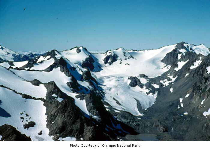
Carrie Glacier is located on Mount Carrie and Mount Fairchild in the Olympic Mountains of Olympic National Park. Starting at an elevation of about , the glacier descends northward, but the ice soon reaches a cliff. Part of the Carrie Glacier plunges over the steep rockwall, contributing ice to an adjacent glacier, while the other section flows north-northeast, avoiding the precipitous drop. This segment of ice is confined by an arête to the west and Mount Fairchild to the east in a chute. The glacier reaches as low as before terminating. There are several other patches of snow and glaciers located nearby, such as the Fairchild Glacier. Mount Carrie and Carrie Glacier were named by surveyor Theodore Rixon for his fiancée Caroline Jones whom he met on a trail in Soleduck Valley. See also *List of glaciers in the United States This is a list of glaciers existing in the United States, currently or in recent centuries. These glaciers are located in nine states, all in the Ro ... [...More Info...] [...Related Items...] OR: [Wikipedia] [Google] [Baidu] |
Mount Carrie
Mount Carrie is a mountain summit located within Olympic National Park in Clallam County of Washington state. Mt. Carrie is the highest point in the Bailey Range which is a subrange of the Olympic Mountains. With a good eye and clear weather, the mountain can be seen from the visitor center at Hurricane Ridge. Its nearest higher peak is Mount Mathias (7,156 ft) which is an outlier of Mount Olympus, to the south. Due to heavy winter snowfalls, Mount Carrie supports the Carrie Glacier in its northeast cirque, and Fairchild Glacier on the east slope. Precipitation runoff from the mountain drains into tributaries of the Elwha River and Hoh River. There is a scrambling route via the High Divide Trail and Cat Walk. History The Olympic Peninsula was largely unmapped until surveyors Arthur Dodwell and Theodore Rixon mapped most of its topography between 1898 and 1900, and what is now Mt. Carrie, was in 1899 one of the last remaining unnamed mountains in the Olympic range. The ... [...More Info...] [...Related Items...] OR: [Wikipedia] [Google] [Baidu] |
Mount Fairchild
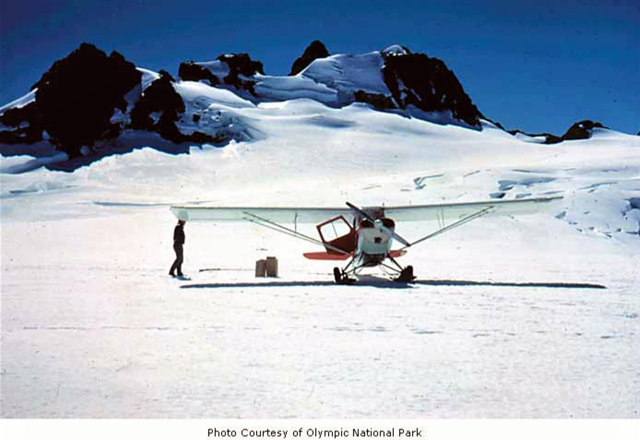
Mount Fairchild, also known as Mount William Fairchild, is a glaciated mountain summit located within Olympic National Park in Clallam County of Washington state. Mt. Fairchild is the second-highest peak in the Bailey Range, which is a subrange of the Olympic Mountains. Its nearest higher neighbor is Mount Carrie, to the southwest, and Ruth Peak is set to the south. In clear weather, the mountain can be seen from the visitor center at Hurricane Ridge. Precipitation runoff from the mountain drains into tributaries of the Elwha River. History Mount Fairchild is situated at the head of Fairchild Creek, which originates from the Fairchild Glacier, and each are named for pilot William R. Fairchild (1926–1969), who flew hundreds of photographic flights to support scientific studies of glaciers in the Olympic Mountains for the U. S. Geological Survey and U.S. National Park Service, as well as thousands of other glaciers in Western North America. Fairchild's method of taking of ... [...More Info...] [...Related Items...] OR: [Wikipedia] [Google] [Baidu] |
Olympic National Park
Olympic National Park is a United States national park located in the State of Washington, on the Olympic Peninsula. The park has four regions: the Pacific coastline, alpine areas, the west-side temperate rainforest, and the forests of the drier east side. Within the park there are three distinct ecosystems, including subalpine forest and wildflower meadow, temperate forest, and the rugged Pacific coast. President Theodore Roosevelt originally designated the park as Mount Olympus National Monument on March 2, 1909. The monument was re-designated a national park by Congress and President Franklin D. Roosevelt on June 29, 1938. In 1976, Olympic National Park was designated by UNESCO as an International Biosphere Reserve, and in 1981 as a World Heritage Site. In 1988, Congress designated 95 percent of the park () as the Olympic Wilderness, which was renamed Daniel J. Evans Wilderness in honor of Governor and U.S. Senator Daniel J. Evans in 2017. During his tenure in the Senate, Eva ... [...More Info...] [...Related Items...] OR: [Wikipedia] [Google] [Baidu] |
Clallam County, Washington
Clallam County is a County (United States), county in the U.S. state of Washington (state), Washington. As of the 2020 United States census, 2020 census, the population was 77,155, with an estimated population of 78,209 in 2021. The county seat and largest city is Port Angeles, Washington, Port Angeles; the county as a whole comprises the Port Angeles, WA Micropolitan Statistical Area. The name is a Klallam word for "the strong people". The county was formed on April 26, 1854. Located on the Olympic Peninsula, it is south from the Strait of Juan de Fuca, which forms the Canada–United States border, Canada–US border, as British Columbia's Vancouver Island is across the strait. Geography According to the United States Census Bureau, the county has a total area of , of which is land and (35%) is water. Located in Clallam County is Cape Alava, the List of extreme points of the United States#Westernmost points, westernmost point in both Washington and the contiguous United Stat ... [...More Info...] [...Related Items...] OR: [Wikipedia] [Google] [Baidu] |
United States
The United States of America (U.S.A. or USA), commonly known as the United States (U.S. or US) or America, is a country primarily located in North America. It consists of 50 states, a federal district, five major unincorporated territories, nine Minor Outlying Islands, and 326 Indian reservations. The United States is also in free association with three Pacific Island sovereign states: the Federated States of Micronesia, the Marshall Islands, and the Republic of Palau. It is the world's third-largest country by both land and total area. It shares land borders with Canada to its north and with Mexico to its south and has maritime borders with the Bahamas, Cuba, Russia, and other nations. With a population of over 333 million, it is the most populous country in the Americas and the third most populous in the world. The national capital of the United States is Washington, D.C. and its most populous city and principal financial center is New York City. Paleo-Americ ... [...More Info...] [...Related Items...] OR: [Wikipedia] [Google] [Baidu] |
Olympic Mountains
The Olympic Mountains are a mountain range on the Olympic Peninsula of the Pacific Northwest of the United States. The mountains, part of the Pacific Coast Ranges, are not especially high – Mount Olympus is the highest at ; however, the eastern slopes rise out of Puget Sound from sea level and the western slopes are separated from the Pacific Ocean by the low-lying wide Pacific Ocean coastal plain. The western slopes are the wettest place in the 48 contiguous states. Most of the mountains are protected within the bounds of Olympic National Park and adjoining segments of the Olympic National Forest. The mountains are located in western Washington in the United States, spread out across four counties: Clallam, Grays Harbor, Jefferson and Mason. Physiographically, they are a section of the larger Pacific Border province, which is in turn a part of the larger Pacific Mountain System. Geography The Olympics have the form of a cluster of steep-sided peaks surrounded by heavily ... [...More Info...] [...Related Items...] OR: [Wikipedia] [Google] [Baidu] |
Arête
An arête ( ) is a narrow ridge of rock which separates two valleys. It is typically formed when two glaciers erode parallel U-shaped valleys. Arêtes can also form when two glacial cirques erode headwards towards one another, although frequently this results in a saddle-shaped pass, called a col. The edge is then sharpened by freeze-thaw weathering, and the slope on either side of the arête steepened through mass wasting Mass wasting, also known as mass movement, is a general term for the movement of rock or soil down slopes under the force of gravity. It differs from other processes of erosion in that the debris transported by mass wasting is not entrained in ... events and the erosion of exposed, unstable rock. The word ''arête'' () is actually French for "edge" or "ridge"; similar features in the Alps are often described with the German language, German equivalent term ''Grat''. Where three or more cirques meet, a pyramidal peak is created. Cleaver A ''cleaver' ... [...More Info...] [...Related Items...] OR: [Wikipedia] [Google] [Baidu] |
Chute (gravity)
A chute is a vertical or inclined plane, channel, or passage through which objects are moved by means of gravity. Landform A chute, also known as a race, flume, cat, or river canyon, is a steep-sided passage through which water flows rapidly. Akin to these, man-made chutes, such as the timber slide and log flume, were used in the logging industry to facilitate the downstream transportation of timber along rivers. These are no longer in common use. Man-made chutes may also be a feature of spillways on some dams. Some types of water supply and irrigation systems are gravity fed, hence chutes. These include aqueducts, puquios, and acequias. Building chute Chutes are in common use in tall buildings to allow the rapid transport of items from the upper floors to a central location on one of the lower floors or basement. Chutes may be round, square or rectangular at the top and/or the bottom. * Laundry chutes in hotels are placed on each floor to allow the expedient transfer and col ... [...More Info...] [...Related Items...] OR: [Wikipedia] [Google] [Baidu] |
Fairchild Glacier
Fairchild Glacier is located in the U.S. state of Washington on Mount Fairchild and Mount Carrie in the Olympic Mountains of Olympic National Park. Beginning at an elevation of about along the Bailey Ridge, the glacier descends northeast and is northeast of Carrie Glacier. Like all the glaciers in Olympic National Park, Fairchild Glacier has been in a general retreat for over 100 years. The glacier is named for William R. Fairchild, who was a pilot that assisted scientific researchers in the region. See also *List of glaciers in the United States This is a list of glaciers existing in the United States, currently or in recent centuries. These glaciers are located in nine states, all in the Rocky Mountains or farther west. The southernmost named glacier among them is the Lilliput Glacier ... References Glaciers of Clallam County, Washington Glaciers of the Olympic Mountains Glaciers of Washington (state) {{Washington-glacier-stub ... [...More Info...] [...Related Items...] OR: [Wikipedia] [Google] [Baidu] |
List Of Glaciers In The United States
This is a list of glaciers existing in the United States, currently or in recent centuries. These glaciers are located in nine states, all in the Rocky Mountains or farther west. The southernmost named glacier among them is the Lilliput Glacier in Tulare County, east of the Central Valley of California. Glaciers of Alaska There are approximately 664 named glaciers in Alaska according to the Geographic Names Information System (GNIS). * Agassiz Glacier - Saint Elias Mountains * Aialik Glacier - Kenai Peninsula * Alsek Glacier - Glacier Bay * Aurora Glacier - Glacier Bay * Bacon Glacier *Barnard Glacier * Bear Glacier - Aialik Peninsula, Resurrection Bay *Bering Glacier * Black Rapids *Brady Glacier *Brooks Glacier - Alaska Range *Buckskin Glacier - Alaska Range * Burns Glacier (Alaska) - Kenai Mountains *Byron Glacier - Kenai Mountains * Caldwell Glacier - Alaska Range *Cantwell Glacier - Alaska Range *Carroll Glacier - Glacier Bay *Casement Glacier - Glacier Bay *Cast ... [...More Info...] [...Related Items...] OR: [Wikipedia] [Google] [Baidu] |
Glaciers Of Clallam County, Washington
A glacier (; ) is a persistent body of dense ice that is constantly moving under its own weight. A glacier forms where the accumulation of snow exceeds its ablation over many years, often centuries. It acquires distinguishing features, such as crevasses and seracs, as it slowly flows and deforms under stresses induced by its weight. As it moves, it abrades rock and debris from its substrate to create landforms such as cirques, moraines, or fjords. Although a glacier may flow into a body of water, it forms only on land and is distinct from the much thinner sea ice and lake ice that form on the surface of bodies of water. On Earth, 99% of glacial ice is contained within vast ice sheets (also known as "continental glaciers") in the polar regions, but glaciers may be found in mountain ranges on every continent other than the Australian mainland, including Oceania's high-latitude oceanic island countries such as New Zealand. Between latitudes 35°N and 35°S, glaciers occur only ... [...More Info...] [...Related Items...] OR: [Wikipedia] [Google] [Baidu] |
Glaciers Of The Olympic Mountains
A glacier (; ) is a persistent body of dense ice that is constantly moving under its own weight. A glacier forms where the accumulation of snow exceeds its ablation over many years, often centuries. It acquires distinguishing features, such as crevasses and seracs, as it slowly flows and deforms under stresses induced by its weight. As it moves, it abrades rock and debris from its substrate to create landforms such as cirques, moraines, or fjords. Although a glacier may flow into a body of water, it forms only on land and is distinct from the much thinner sea ice and lake ice that form on the surface of bodies of water. On Earth, 99% of glacial ice is contained within vast ice sheets (also known as "continental glaciers") in the polar regions, but glaciers may be found in mountain ranges on every continent other than the Australian mainland, including Oceania's high-latitude oceanic island countries such as New Zealand. Between latitudes 35°N and 35°S, glaciers occur only ... [...More Info...] [...Related Items...] OR: [Wikipedia] [Google] [Baidu] |


