|
Carrick Castle (village)
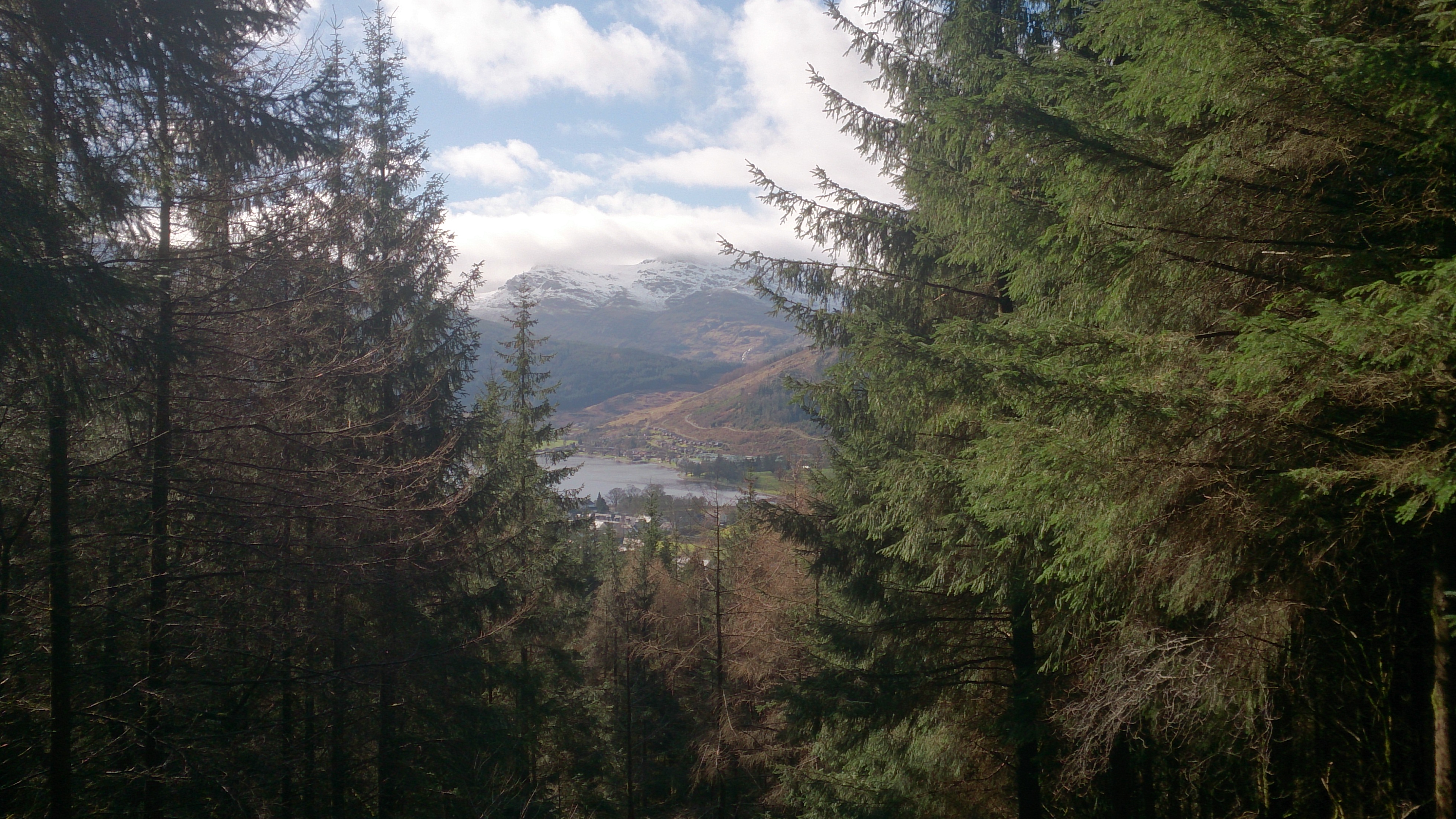
Carrick Castle is a village on the western shore of Loch Goil, 7 km south of Lochgoilhead by a minor road along the loch shore, on the Cowal peninsula in Argyll and Bute, Scotland. It is within the Argyll Forest Park, and also within the Loch Lomond and The Trossachs National Park. In 1877 a wooden pier was built at the castle, and a three-storey tenement building called Hillside Place was constructed inland from the castle, to provide apartments for visiting tourists. This was followed by several villas built along the shore road as accommodation for Glasgow merchants, developing what became a small village. The village church is listed on the buildings at risk register of Scotland. There is a path to Ardentinny from Carrick Castle village. Carrick Castle tower house Carrick Castle, a 15th-century castle built on a rock on the shoreline of Loch Goil, was originally a Clan Lamont Clan Lamont (; gd, Clann Laomainn ) is a Highland Scottish clan. The clan is said to ... [...More Info...] [...Related Items...] OR: [Wikipedia] [Google] [Baidu] |
Loch Goil
Loch Goil; ( gd, Loch Goil) is a small sea loch forming part of the coast of the Cowal peninsula in Argyll and Bute, Scotland. The sea loch is entirely within the Loch Lomond and The Trossachs National Park. It is an arm of Loch Long. The village of Lochgoilhead stands at its head. Located in the Loch Lomond and the Trossachs National Park, Lochgoilhead sits at the head of Loch Goil, a fjord type sea loch. Only an hour from the Erskine Bridge, Glasgow Airport the M8 and Glasgow. The village is accessed from the Rest & Be Thankful pass by way of a single-track road. The area is surrounded by hills and mountains, with loch views, and a range of accommodation, leisure activities and entertainment. Carrick Castle lies on the west shore 4 miles (6.4 km) south of Lochgoilhead. The landscape at Loch Goil shows its remoteness and Highland grandeur with the Arrochar Alps surrounding with conifers in the Highlands of Scotland. It is used for exercises by Trident submarines f ... [...More Info...] [...Related Items...] OR: [Wikipedia] [Google] [Baidu] |
Lochgoilhead
Lochgoilhead ( gd, Ceann Loch Goibhle, IPA: ˆkʰʲaun̴̪ˈɫ̪ɔxˈkɤilÉ™ is a village on the Cowal peninsula, in Argyll and Bute, Scottish Highlands. It is located within the Loch Lomond and The Trossachs National Park and is widely considered to be one of the most beautiful areas in Argyll and in Scotland as a whole. Location The village is surrounded by several Corbetts in the Arrochar Alps, including Benn Donich, The Brack and Cnoc Coinnich and local waterways are the River Goil and the Donich Water. The area has been inhabited for over 10,000 years, with the original name for the area being 'Kil nam brathairan' from the Gaelic for 'Church of the brothers'. There are Neolithic remains in the area, including nearby cup marks and a well-preserved corn kiln. The area is associated with the history of Clan Campbell, who drove the Lamonts from the area in the fourteenth century. Lochgoilhead used to be an important stop on the route between Glasgow and Inverary, as tra ... [...More Info...] [...Related Items...] OR: [Wikipedia] [Google] [Baidu] |
Cowal
Cowal ( gd, Còmhghall) is a peninsula in Argyll and Bute, in the west of Scotland, that extends into the Firth of Clyde. The northern part of the peninsula is covered by the Argyll Forest Park managed by Forestry and Land Scotland. The Arrochar Alps and Ardgoil peninsula in the north fringe the edges of the sea lochs whilst the forest park spreads out across the hillsides and mountain passes, making Cowal one of the remotest areas in the west of mainland Scotland. The Loch Lomond and The Trossachs National Park extends into Cowal. The peninsula is separated from Knapdale by Loch Fyne, and from Inverclyde and North Ayrshire to the east by the Firth of Clyde. Loch Long and its arm, Loch Goil are to the north-east. The south of the peninsula is split into three forks by Loch Striven and Loch Riddon (Loch Ruel). The Isle of Bute lies to the south separated by the narrow Kyles of Bute which connect the Firth of Clyde to Loch Riddon. Cowal's only burgh is Dunoon in the south-east, fro ... [...More Info...] [...Related Items...] OR: [Wikipedia] [Google] [Baidu] |


