|
Carondelet Reef
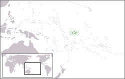
Carondelet Reef is a horseshoe-shaped reef of the Phoenix Islands, also known as the Rawaki Islands, in the Republic of Kiribati. It is located southeast of Nikumaroro, at , and has a least depth of . It is reported to be approximately in length. The sea occasionally breaks over it. History According to Admiral Adam Johann von Krusenstern, a Captain Kemin of an unidentified ship reported the discovery of a reef in position in 1824, and this may have been the first sighting of Carondelet Reef by a Westerner. The next Westerner to see it may have been Captain Obed Starbuck of the Nantucket whaler ''Loper'', who reported a "reef of rocks" at position on February 19, 1826. During a voyage from Puget Sound to Australia, Captain Wilder Farley Stetson (1849–1924) of the ship ''Carondelet'' sighted a reef on August 31, 1898, from position . He was within of it and considered it very dangerous. He named it Carondelet Reef, after his ship. The multiple positions of Winslow Reef ... [...More Info...] [...Related Items...] OR: [Wikipedia] [Google] [Baidu] |
Nantucket
Nantucket () is an island about south from Cape Cod. Together with the small islands of Tuckernuck and Muskeget, it constitutes the Town and County of Nantucket, a combined county/town government that is part of the U.S. state of Massachusetts. It is the only such consolidated town-county in Massachusetts. As of the 2020 census, the population was 14,255, making it the least populated county in Massachusetts. Part of the town is designated the Nantucket CDP, or census-designated place. The region of Surfside on Nantucket is the southernmost settlement in Massachusetts. The name "Nantucket" is adapted from similar Algonquian names for the island, but is very similar to the endonym of the native Nehantucket tribe that occupied the region at the time of European settlement. Nantucket is a tourist destination and summer colony. Due to tourists and seasonal residents, the population of the island increases to at least 50,000 during the summer months. The average sale price f ... [...More Info...] [...Related Items...] OR: [Wikipedia] [Google] [Baidu] |
Reefs Of Kiribati
A reef is a ridge or shoal of rock, coral or similar relatively stable material, lying beneath the surface of a natural body of water. Many reefs result from natural, abiotic processes— deposition of sand, wave erosion planing down rock outcrops, etc.—but there are also reefs such as the coral reefs of tropical waters formed by biotic processes dominated by corals and coralline algae, and artificial reefs such as shipwrecks and other anthropogenic underwater structures may occur intentionally or as the result of an accident, and sometimes have a designed role in enhancing the physical complexity of featureless sand bottoms, to attract a more diverse assemblage of organisms. Reefs are often quite near to the surface, but not all definitions require this. Earth's largest coral reef system is the Great Barrier Reef in Australia, at a length of over . Biotic There is a variety of biotic reef types, including oyster reefs and sponge reefs, but the most massive and widely ... [...More Info...] [...Related Items...] OR: [Wikipedia] [Google] [Baidu] |
List Of Guano Island Claims
The United States claimed a number of islands as insular areas under the Guano Islands Act of 1856. Only the eight administered as the US Minor Islands and the ones part of Hawaii and American Samoa remain under the jurisdiction of the United States. Any other unresolved claims, if they exist are dormant, and have not been contested by the United States in many years, with the exception of Navassa. Table Images Image:Jarvis Island Guano Tramway.jpg, Guano tramway on Jarvis Island Image:Baker Island Day Beacon content.jpg, Hermit crabs on Baker Island Image:NavassaLighthouse.jpg, Navassa Island Lighthouse See also * Guano * Insular area * Territories of the United States * Pacific Remote Islands Marine National Monument The Pacific Remote Islands Marine National Monument is a group of unorganized, mostly unincorporated United States Pacific Island territories managed by the United States Fish and Wildlife Service of the United States Department of the Int ... Ref ... [...More Info...] [...Related Items...] OR: [Wikipedia] [Google] [Baidu] |
Phoenix Islands Protected Area
The Phoenix Islands Protected Area (PIPA) is located in the Republic of Kiribati, an ocean nation in the central Pacific approximately midway between Australia and Hawaii. PIPA constitutes 11.34% of Kiribati's exclusive economic zone (EEZ), and with a size of , it is one of the largest marine protected areas (MPA) and one of the largest protected areas of any type (land or sea) on Earth. The PIPA was also designated as the world's largest and deepest UNESCO World Heritage Site in 2010. The PIPA conserves one of the world's largest intact oceanic coral archipelago ecosystems, includes 14 known underwater seamounts (presumed to be extinct volcanoes) and other deep-sea habitats. The area contains approximately 800 known species of fauna, including about 200 coral species, 500 fish species, 18 marine mammals and 44 bird species. In total it is equivalent to the size of the state of California in the US, though the total land area is only . To the north of the PIPA is the U.S. admi ... [...More Info...] [...Related Items...] OR: [Wikipedia] [Google] [Baidu] |
Robert Louis Stevenson
Robert Louis Stevenson (born Robert Lewis Balfour Stevenson; 13 November 1850 – 3 December 1894) was a Scottish novelist, essayist, poet and travel writer. He is best known for works such as ''Treasure Island'', ''Strange Case of Dr Jekyll and Mr Hyde'', '' Kidnapped'' and ''A Child's Garden of Verses''. Born and educated in Edinburgh, Stevenson suffered from serious bronchial trouble for much of his life, but continued to write prolifically and travel widely in defiance of his poor health. As a young man, he mixed in London literary circles, receiving encouragement from Andrew Lang, Edmund Gosse, Leslie Stephen and W. E. Henley, the last of whom may have provided the model for Long John Silver in ''Treasure Island''. In 1890, he settled in Samoa where, alarmed at increasing European and American influence in the South Sea islands, his writing turned away from romance and adventure fiction toward a darker realism. He died of a stroke in his island home in 1894 at ... [...More Info...] [...Related Items...] OR: [Wikipedia] [Google] [Baidu] |
Winslow Reef, Phoenix Islands
Winslow Reef is an underwater feature of the Phoenix Islands, Republic of Kiribati, located north-northwest of McKean Island at . It is the northernmost and westernmost feature of the Phoenix Islands, not counting the outlying Baker and Howland Islands. It has a least depth of . The reef is about long east–west, and about half that wide. The bottom is pink coral and red sand. History Winslow Reef is mentioned by Robert Louis Stevenson, who sailed over an area thought to be Winslow Reef in late 1889, but did not find it. For long it had been thought that a Perry Winslow (1815-1890), Capt. of the Nantucket whaler ''Phoenix'', was its discoverer in 1851 and that the name of his ship also became attached to the entire group of islands. Entry November 9, 1840, of the log of whaler “Gideon Howland” of New Bedford, Capt. Michael Baker (1802-1860)], however, might suffice as evidence to an even earlier sighting, an entire decade earlier: "Monday 9th, fine weather ligh ... [...More Info...] [...Related Items...] OR: [Wikipedia] [Google] [Baidu] |
Australia
Australia, officially the Commonwealth of Australia, is a Sovereign state, sovereign country comprising the mainland of the Australia (continent), Australian continent, the island of Tasmania, and numerous List of islands of Australia, smaller islands. With an area of , Australia is the largest country by area in Oceania and the world's List of countries and dependencies by area, sixth-largest country. Australia is the oldest, flattest, and driest inhabited continent, with the least fertile soils. It is a Megadiverse countries, megadiverse country, and its size gives it a wide variety of landscapes and climates, with Deserts of Australia, deserts in the centre, tropical Forests of Australia, rainforests in the north-east, and List of mountains in Australia, mountain ranges in the south-east. The ancestors of Aboriginal Australians began arriving from south east Asia approximately Early human migrations#Nearby Oceania, 65,000 years ago, during the Last Glacial Period, last i ... [...More Info...] [...Related Items...] OR: [Wikipedia] [Google] [Baidu] |
Puget Sound
Puget Sound ( ) is a sound of the Pacific Northwest, an inlet of the Pacific Ocean, and part of the Salish Sea. It is located along the northwestern coast of the U.S. state of Washington. It is a complex estuarine system of interconnected marine waterways and basins, with one major and two minor connections to the open Pacific Ocean via the Strait of Juan de Fuca—Admiralty Inlet being the major connection and Deception Pass and Swinomish Channel being the minor. Water flow through Deception Pass is approximately equal to 2% of the total tidal exchange between Puget Sound and the Strait of Juan de Fuca. Puget Sound extends approximately from Deception Pass in the north to Olympia in the south. Its average depth is and its maximum depth, off Jefferson Point between Indianola and Kingston, is . The depth of the main basin, between the southern tip of Whidbey Island and Tacoma, is approximately . In 2009, the term Salish Sea was established by the United States Board o ... [...More Info...] [...Related Items...] OR: [Wikipedia] [Google] [Baidu] |
Whaler
A whaler or whaling ship is a specialized vessel, designed or adapted for whaling: the catching or processing of whales. Terminology The term ''whaler'' is mostly historic. A handful of nations continue with industrial whaling, and one, Japan, still dedicates a single factory ship for the industry. The vessels used by aboriginal whaling communities are much smaller and are used for various purposes over the course of the year. The ''whale catcher'' was developed during the age of steam, and then driven by diesel engines throughout much of the twentieth century. It was designed with a harpoon gun mounted at its bow and was fast enough to chase and catch rorquals such as the fin whale. At first, whale catchers either brought the whales they killed to a whaling station, a settlement ashore where the carcasses could be processed, or to its factory ship anchored in a sheltered bay or inlet. With the later development of the slipway at the ship's stern, whale catchers were able ... [...More Info...] [...Related Items...] OR: [Wikipedia] [Google] [Baidu] |
Western World
The Western world, also known as the West, primarily refers to the various nations and state (polity), states in the regions of Europe, North America, and Oceania.Western Civilization Our Tradition; James Kurth; accessed 30 August 2011 The Western world is also known as the Occident (from the Latin word ''occidēns'' "setting down, sunset, west") in contrast to the Eastern world known as the Orient (from the Latin word ''oriēns'' "origin, sunrise, east"). Following the Discovery of America in 1492, the West came to be known as the "world of business" and trade; and might also mean the Northern half of the North–South divide, the countries of the ''Global North'' (often equated with capitalist Developed country, developed countries). [...More Info...] [...Related Items...] OR: [Wikipedia] [Google] [Baidu] |
Pacific Ocean
The Pacific Ocean is the largest and deepest of Earth's five oceanic divisions. It extends from the Arctic Ocean in the north to the Southern Ocean (or, depending on definition, to Antarctica) in the south, and is bounded by the continents of Asia and Oceania in the west and the Americas in the east. At in area (as defined with a southern Antarctic border), this largest division of the World Ocean—and, in turn, the hydrosphere—covers about 46% of Earth's water surface and about 32% of its total surface area, larger than Earth's entire land area combined .Pacific Ocean . '' Britannica Concise.'' 2008: Encyclopædia Britannica, Inc. The centers of both the |


.jpg)


.jpg)