|
Cape Fourcroy
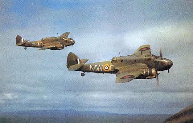
Cape Fourcroy is located at the western tip of Bathurst Island. Cyclone Tracy passed through here in December 1974. It is the location of Cape Fourcroy Light, an active lighthouse. It is believed that the cape was named after Antoine François, comte de Fourcroy, on 26 July 1803 by Louis de Freycinet, on his journey on the '' Géographe'', in Baudin's expedition to Australia. On the 31 December 1942, a 31 Squadron Bristol Beaufighter The Bristol Type 156 Beaufighter (often called the Beau) is a British multi-role aircraft developed during the Second World War by the Bristol Aeroplane Company. It was originally conceived as a heavy fighter variant of the Bristol Beaufort ... crashed near the Cape, but both crew members were able to bale out and were rescued. References Landforms of the Northern Territory Headlands of Australia {{NorthernTerritory-geo-stub ... [...More Info...] [...Related Items...] OR: [Wikipedia] [Google] [Baidu] |
Bathurst Island, Northern Territory
Bathurst Island ( Iwaidja: ''Nguyu'') (, ) is one of the Tiwi Islands in the Northern Territory off the northern coast of Australia along with Melville Island. __TOC__ Description The largest settlement on Bathurst is Wurrumiyanga (known as Nguiu until 2010), in the south-east, with a population of around 1,560. Located on the south east corner of Bathurst Island, Wurrumiyanga is approximately north of Darwin. The second largest settlement is Wurakuwu, with a population of 50, located northwest of Wurrumiyanga. The third settlement on the island is a small family outstation called ''4 Mile Camp'', about west of Wurrumiyanga. History Aboriginal Australians have occupied the area that became the Tiwi Islands for at least 40,000 years. On 5 May 1623, Willem Jootszoon Van Colster (or Coolsteerdt), in the ship ''Arnhem'' named the island De Speult Eylandt, in honour of Herman van Speult, Governor of Ambon, who had commissioned the voyage of exploration. In 1828, the ... [...More Info...] [...Related Items...] OR: [Wikipedia] [Google] [Baidu] |
Cyclone Tracy
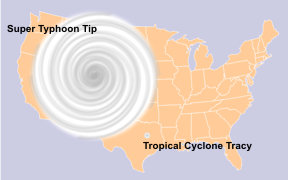
Cyclone Tracy was a tropical cyclone that devastated the city of Darwin, Northern Territory, Australia, from 24 to 26 December 1974. The small, developing easterly storm had been observed passing clear of the city initially, but then turned towards it early on 24 December. After 10:00 p.m. ACST, damage became severe, and wind gusts reached before instruments failed. The anemometer in Darwin Airport control tower had its needle bent in half by the strength of the gusts. Residents of Darwin were celebrating Christmas, and did not immediately acknowledge the emergency, partly because they had been alerted to an earlier cyclone ( Selma) that passed west of the city, and did not affect it in any way. Additionally, news outlets had only a skeleton crew on duty over the holiday. Tracy killed 71 people, caused A$837 million in damage (1974 dollars), or approximately A$7.2 billion (2022 dollars), or US$5.2 billion (2022 dollars). It destroyed more than 70 percent of D ... [...More Info...] [...Related Items...] OR: [Wikipedia] [Google] [Baidu] |
Cape Fourcroy Light
Cape Fourcroy Light is an active lighthouse located on Cape Fourcroy, on the southwestern tip of Bathurst Island, Northern Territory, Australia. The lighthouse marks the beginning of the route from the Timor Sea to Darwin. The lighthouse was constructed by the Commonwealth Lighthouse Service during the "Golden Age of Australian Lighthouses", between 1913 and 1920. The light characteristic shown is three white flashes, one every two seconds, repeating every 15 seconds (Fl.(3)W. 15s). It is visible for . The site is open to the public, and tours are available from Darwin, but the tower is closed. It is operated by the Australian Maritime Safety Authority. See also * List of lighthouses in Australia This is a list of lighthouses and lightvessels in Australia. Australia has a coastline of , with over 350 lighthouses and navigational aids around the Australian coastline, and a single inland lighthouse, the Point Malcolm lighthouse. The firs ... References External link ... [...More Info...] [...Related Items...] OR: [Wikipedia] [Google] [Baidu] |
Lighthouse
A lighthouse is a tower, building, or other type of physical structure designed to emit light from a system of lamps and lenses and to serve as a beacon for navigational aid, for maritime pilots at sea or on inland waterways. Lighthouses mark dangerous coastlines, hazardous shoals, reefs, rocks, and safe entries to harbors; they also assist in aerial navigation. Once widely used, the number of operational lighthouses has declined due to the expense of maintenance and has become uneconomical since the advent of much cheaper, more sophisticated and effective electronic navigational systems. History Ancient lighthouses Before the development of clearly defined ports, mariners were guided by fires built on hilltops. Since elevating the fire would improve the visibility, placing the fire on a platform became a practice that led to the development of the lighthouse. In antiquity, the lighthouse functioned more as an entrance marker to ports than as a warning signal for reefs a ... [...More Info...] [...Related Items...] OR: [Wikipedia] [Google] [Baidu] |
Antoine François, Comte De Fourcroy
Antoine is a French given name (from the Latin ''Antonius'' meaning 'highly praise-worthy') that is a variant of Danton, Titouan, D'Anton and Antonin. The name is used in France, Switzerland, Belgium, Canada, West Greenland, Haiti, French Guiana, Madagascar, Benin, Niger, Burkina Faso, Ivory Coast, Guinea, Senegal, Mauritania, Western Sahara, Morocco, Algeria, Tunisia, Chad, Central African Republic, Cameroon, Equatorial Guinea, Gabon, Republic of the Congo, Democratic Republic of the Congo, Burundi, and Rwanda. It is a cognate of the masculine given name Anthony. Similar names include Antaine, Anthoine, Antoan, Antoin, Antton, Antuan, Antwain, Antwan, Antwaun, Antwoine, Antwone, Antwon and Antwuan. Feminine forms include Antonia, Antoinette, and (more rarely) Antionette. As a first name *Antoine Alexandre Barbier (1765–1825), a French librarian and bibliographer *Antoine Arbogast (1759–1803), a French mathematician *Antoine Arnauld (1612–1694), a French theologian, phi ... [...More Info...] [...Related Items...] OR: [Wikipedia] [Google] [Baidu] |
Louis De Freycinet
Louis Claude de Saulces de Freycinet (7 August 1779 – 18 August 1841) was a French Navy officer. He circumnavigated the earth, and in 1811 published the first map to show a full outline of the coastline of Australia. Biography He was born at Montélimar, Drôme. Louis-Claude de Saulces de Freycinet was his full name (many calling him Louis de Freycinet). He had three brothers, Louis-Henri de Saulces de Freycinet, André-Charles de Saulces de Freycinet and the youngest, Frédéric-Casimir de Saulces de Freycinet (father of Charles de Freycinet). Louis-Claude was the second oldest. In 1793 he joined the French Navy as a midshipman, and took in several engagements against the British. In 1800, Freycinet was appointed to an exploration expedition to Southern and South-Western coasts of Australia under Nicolas Baudin, on ''Naturaliste'' and ''Géographe''. Freycinet's brother, Louis-Henri de Freycinet, was also part of the expedition. Between September 1802 and August 1803, Fre ... [...More Info...] [...Related Items...] OR: [Wikipedia] [Google] [Baidu] |
French Corvette Géographe
''Géographe'' was a 20-gun ''Serpente''-class corvette of the French Navy. She was named ''Uranie'' in 1797, and renamed ''Galatée'' in 1799, still on her building site. Her builder refused to launch her, as he had not been paid to that time. Finally launched in June 1800, she was renamed ''Géographe'' on 23 August 1800. On 19 October 1800, under captain Nicolas Baudin, she departed Le Havre with ''Naturaliste'' for an exploration of Australia. She carried a number of scholars, painters, and designers, as well as Anselme Riedlé, the gardener, who had already accompanied Baudin on a previous expedition, and Charles Alexander Lesueur, an artist.Barrey (1907), p.60. The two vessels reached Tenerife on 13 November. They then crossed the equator on 11 December and arrived at Isle de France (Mauritius), on 16 March 1801. For some 18 months ''Naturaliste'' and ''Géographe'' explored the less-known regions of New Holland (Australia), and Van Diemen's Land. On 30 May Baudin made ... [...More Info...] [...Related Items...] OR: [Wikipedia] [Google] [Baidu] |
Baudin Expedition To Australia
The Baudin expedition of 1800 to 1803 was a French expedition to map the coast of New Holland (now Australia). Nicolas Baudin was selected as leader in October 1800. The expedition started with two ships, '' Géographe'', captained by Baudin, and ''Naturaliste'' captained by Jacques Hamelin, and was accompanied by nine zoologists and botanists, including Jean-Baptiste Leschenault de la Tour, François Péron and Charles-Alexandre Lesueur as well as the geographer Pierre Faure. Expedition Napoléon Bonaparte, as First Consul, formally approved the expedition "to the coasts of New Holland", after receiving a delegation consisting of Baudin and eminent members of thInstitut National des Sciences et Artson 25 March 1800. The explicit purpose of the voyage was to be "observation and research relating to Geography and Natural History." The Baudin expedition departed Le Havre, France, on 19 October 1800. Because of delays in receiving his instructions and problems encountered in Is ... [...More Info...] [...Related Items...] OR: [Wikipedia] [Google] [Baidu] |
Bristol Beaufighter
The Bristol Type 156 Beaufighter (often called the Beau) is a British multi-role aircraft developed during the Second World War by the Bristol Aeroplane Company. It was originally conceived as a heavy fighter variant of the Bristol Beaufort torpedo bomber. The Beaufighter proved to be an effective night fighter, which came into service with the Royal Air Force (RAF) during the Battle of Britain, its large size allowing it to carry heavy armament and early airborne interception radar without major performance penalties. The Beaufighter was used in many roles; receiving the nicknames ''Rockbeau'' for its use as a rocket-armed ground attack aircraft and ''Torbeau'' as a torpedo bomber against Axis shipping, in which it replaced the Beaufort. In later operations, it served mainly as a maritime strike/ground attack aircraft, RAF Coastal Command having operated the largest number of Beaufighters amongst all other commands at one point. The Royal Australian Air Force (RAAF) also m ... [...More Info...] [...Related Items...] OR: [Wikipedia] [Google] [Baidu] |
Landforms Of The Northern Territory
A landform is a natural or anthropogenic land feature on the solid surface of the Earth or other planetary body. Landforms together make up a given terrain, and their arrangement in the landscape is known as topography. Landforms include hills, mountains, canyons, and valleys, as well as shoreline features such as bays, peninsulas, and seas, including submerged features such as mid-ocean ridges, volcanoes, and the great ocean basins. Physical characteristics Landforms are categorized by characteristic physical attributes such as elevation, slope, orientation, stratification, rock exposure and soil type. Gross physical features or landforms include intuitive elements such as berms, mounds, hills, ridges, cliffs, valleys, rivers, peninsulas, volcanoes, and numerous other structural and size-scaled (e.g. ponds vs. lakes, hills vs. mountains) elements including various kinds of inland and oceanic waterbodies and sub-surface features. Mountains, hills, plateaux, and plains are the fou ... [...More Info...] [...Related Items...] OR: [Wikipedia] [Google] [Baidu] |


.jpg)