|
Camden County, North Carolina
Camden County is a county located in the U.S. State of North Carolina. As of the 2020 census, the population was 10,335, making it the fourth-least populous county in North Carolina. Its county seat is Camden. Camden County is part of the Elizabeth City, NC Micropolitan Statistical Area, which is also included in the Virginia Beach-Norfolk, VA-NC Combined Statistical Area. History The county was formed in 1777 from the northeastern part of Pasquotank County. It was named for Charles Pratt, 1st Lord Camden, who had opposed the Stamp Act. The county is the site of the southern terminus of the Dismal Swamp Canal. It was the site of the Battle of South Mills on April 19, 1862, during the American Civil War, which was a minor victory to the Confederacy. Shiloh Baptist Church, founded around 1727 by Paul Palmer, is the oldest Baptist church in North Carolina. It is located in the Shiloh township. Though technically there are (or were) no incorporated municipalities in Camden ... [...More Info...] [...Related Items...] OR: [Wikipedia] [Google] [Baidu] |
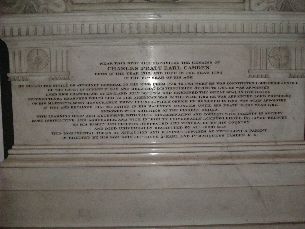
Charles Pratt, 1st Earl Camden
Charles Pratt, 1st Earl Camden, PC (baptised 21 March 1714 – 18 April 1794) was an English lawyer, judge and Whig politician who was first to hold the title of Earl Camden. As a lawyer and judge he was a leading proponent of civil liberties, championing the rights of the jury, and limiting the powers of the State in leading cases such as '' Entick v Carrington''. He held the offices of Chief Justice of the Common Pleas, Attorney-General and Lord High Chancellor of Great Britain, and was a confidant of Pitt the Elder, supporting Pitt in the controversies over John Wilkes and American independence. However, he clung to office himself, even when Pitt was out of power, serving in the cabinet for fifteen years and under five different prime ministers. During his life, Pratt played a leading role in opposing perpetual copyright, resolving the regency crisis of 1788 and championing Fox's Libel Bill. He started the development of the settlement that was later to become Camden Tow ... [...More Info...] [...Related Items...] OR: [Wikipedia] [Google] [Baidu] |
Battle Of South Mills
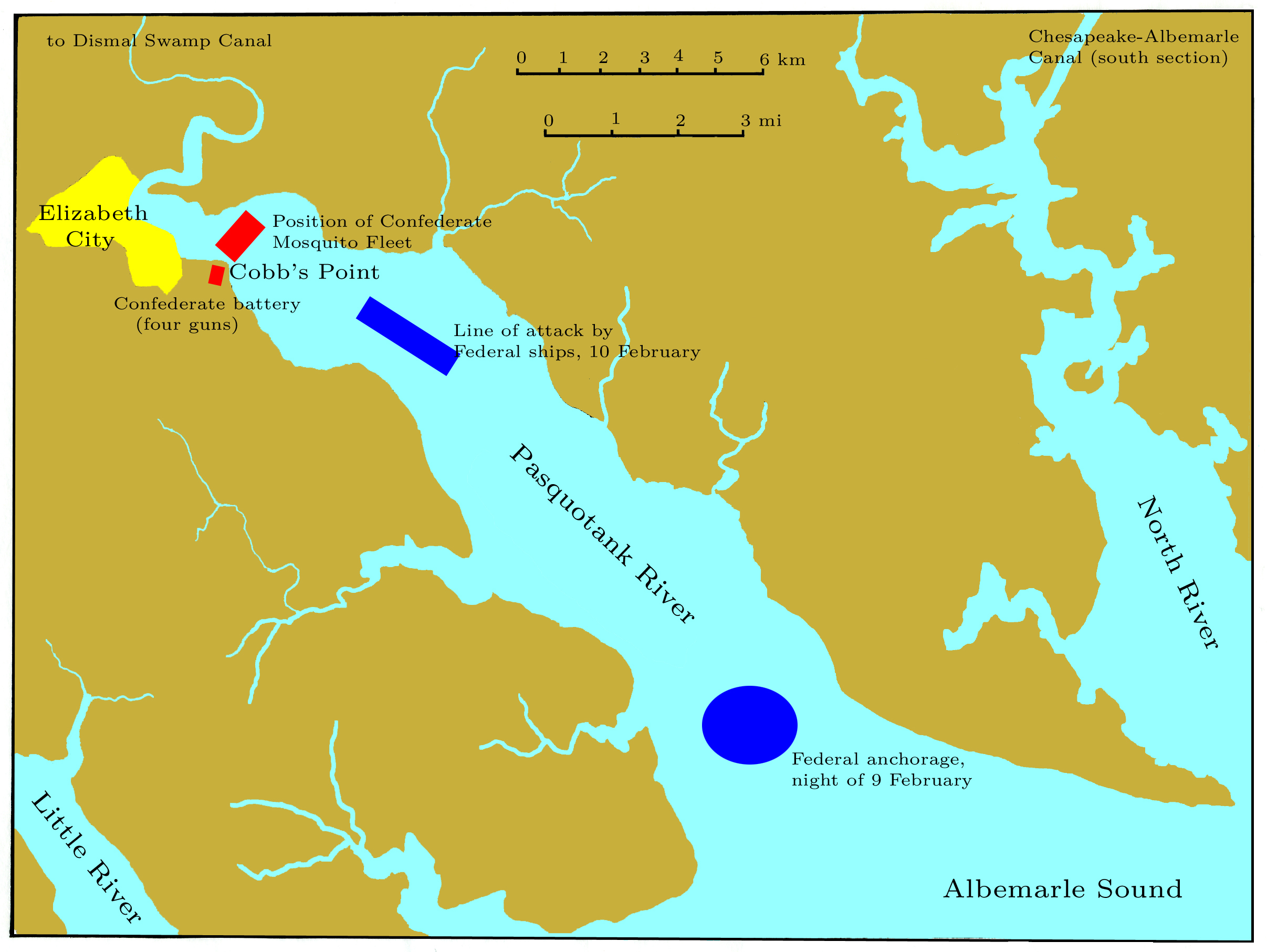
The Battle of South Mills, also known as the Battle of Camden, took place on April 19, 1862 in Camden County, North Carolina as part of Union Army Maj. Gen. Ambrose E. Burnside's North Carolina expedition during the American Civil War. Learning that the Confederates were building ironclads at Norfolk, Burnside planned an expedition to destroy the Dismal Swamp Canal locks to prevent transfer of the ships to Albemarle Sound. He entrusted the operation to Brig. Gen. Jesse L. Reno's command, which embarked on transports from Roanoke Island on April 18. By midnight, the convoy reached Elizabeth City and began disembarking troops. On the morning of April 19, Reno marched north on the road to South Mills. At the crossroads a few miles below South Mills, elements of Col. Ambrose R. Wright's command delayed the Federals until dark. Reno abandoned the expedition and withdrew during the night to the transports at Elizabeth City. The transports carried Reno's troops to New Bern where the ... [...More Info...] [...Related Items...] OR: [Wikipedia] [Google] [Baidu] |
Pasquotank River
The Pasquotank River , from the North Carolina Collection's website at the . Retrieved 2012-09-18. is a coastal water-body in Northeastern in the . Located between Camden and [...More Info...] [...Related Items...] OR: [Wikipedia] [Google] [Baidu] |
North River (North Carolina)
The North River is a tidal river, approximately 18 miles (29 km) long, in eastern North Carolina, the United States. It forms the boundary between Currituck and Camden counties. The river rises in the ''Great Swamp'', 10 miles east of Elizabeth City, North Carolina at the juncture of ''Indiantown Creek''. The river's mouth, where it is approximately four miles wide, is in Albemarle Sound, midway between the mouth of the Pasquotank River to the west and the south end of Currituck Sound to the east. The lower two-thirds of the river is part of the Intracoastal Waterway The Intracoastal Waterway (ICW) is a inland waterway along the Atlantic and Gulf of Mexico coasts of the United States, running from Massachusetts southward along the Atlantic Seaboard and around the southern tip of Florida, then following t .... A reservation was established for the Weapemeoc (Yeopim) tribe in 1704 along the North River. A total of 10, 240 acres were set aside for this tribe. Howeve ... [...More Info...] [...Related Items...] OR: [Wikipedia] [Google] [Baidu] |
Intracoastal Waterway
The Intracoastal Waterway (ICW) is a inland waterway along the Atlantic and Gulf of Mexico coasts of the United States, running from Massachusetts southward along the Atlantic Seaboard and around the southern tip of Florida, then following the Gulf Coast to Brownsville, Texas. Some sections of the waterway consist of natural inlets, saltwater rivers, bays, and sounds, while others are artificial canals. It provides a navigable route along its length without many of the hazards of travel on the open sea. Context and early history Since the coastline represented the national border, and commerce of the time was chiefly by water, the fledgling United States government established a degree of national control over it. Inland transportation to supply the coasting trade at the time was less known and virtually undeveloped, but when new lands and their favorable river systems were added with the Northwest Territory in 1787, the Northwest Ordinance established a radically new and f ... [...More Info...] [...Related Items...] OR: [Wikipedia] [Google] [Baidu] |
Albemarle Sound
Albemarle Sound () is a large estuary on the coast of North Carolina in the United States located at the confluence of a group of rivers, including the Chowan and Roanoke. It is separated from the Atlantic Ocean by the Currituck Banks, a barrier peninsula upon which the town of Kitty Hawk is located, at the eastern edge of the sound, and part of the greater Outer Banks region. Roanoke Island is situated at the southeastern corner of the sound, where it connects to Pamlico Sound. Much of the water in the Albemarle Sound is brackish or fresh, as opposed to the saltwater of the ocean, as a result of river water pouring into the sound. Some small portions of the Albemarle have been given their own "sound" names to distinguish these bodies of water from other parts of the large estuary. The Croatan Sound, for instance, lies between mainland Dare County and Roanoke Island. The water bordering the eastern shore of the island to the Outer Banks is commonly referred to as Roanoke ... [...More Info...] [...Related Items...] OR: [Wikipedia] [Google] [Baidu] |
North River Game Land
The North River Game Land is a North Carolina state game land located north of the Albemarle Sound, in Camden and Currituck counties in the state of North Carolina North Carolina () is a state in the Southeastern region of the United States. The state is the 28th largest and 9th-most populous of the United States. It is bordered by Virginia to the north, the Atlantic Ocean to the east, Georgia and ..., United States. External linksMap from the North Carolina Wildlife Resources Commission Protected areas of North Carolina Protected ... [...More Info...] [...Related Items...] OR: [Wikipedia] [Google] [Baidu] |
Dismal Swamp State Park
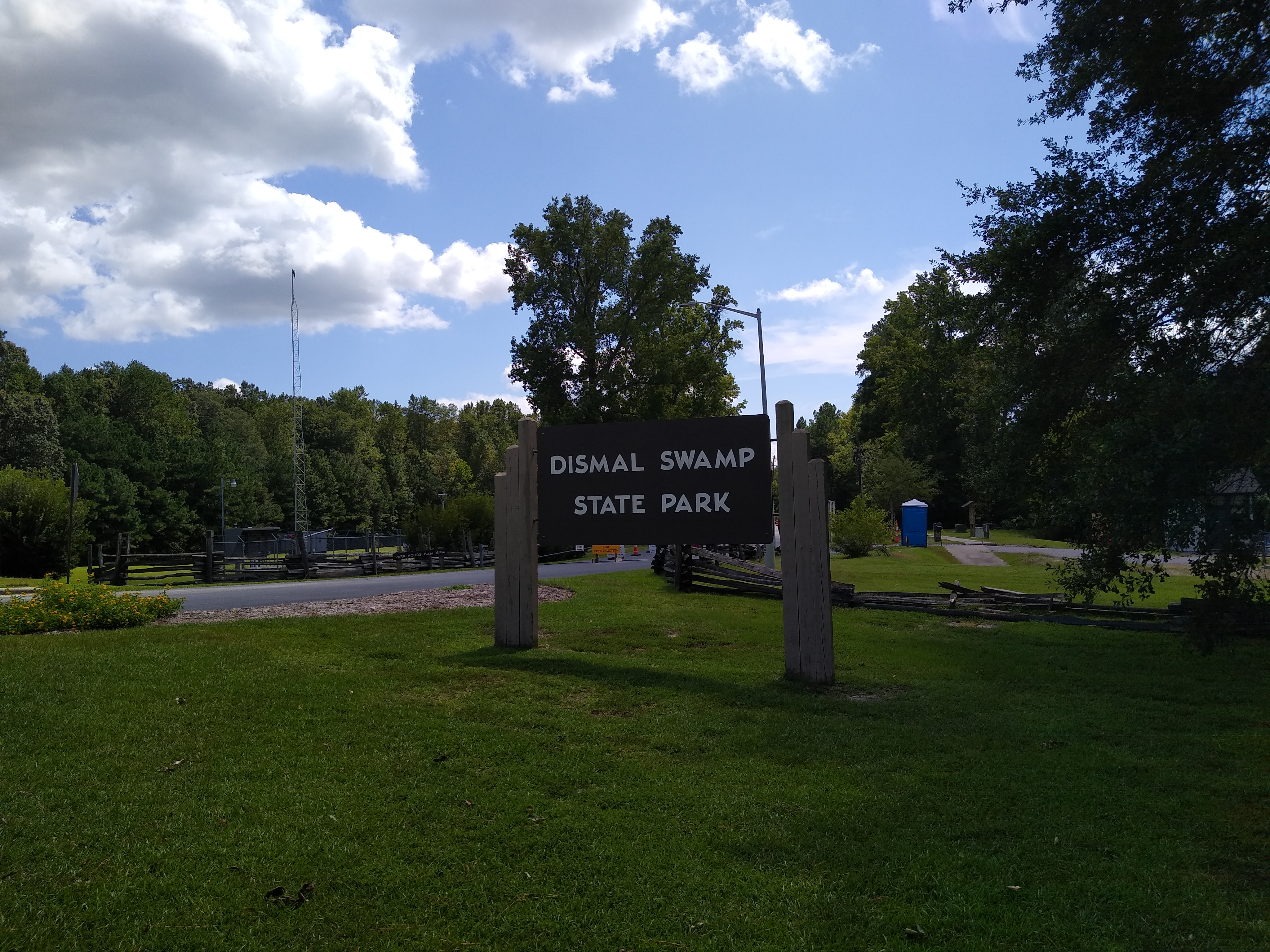
Dismal Swamp State Park is a North Carolina state park in Camden County, North Carolina, in the United States. The park was created as a state natural area in 1974 with the help of The Nature Conservancy, and on July 28, 2007, the North Carolina General Assembly re-designated it as a state park. It opened to the public in 2008. This marked the first time that public access to Great Dismal Swamp was made possible in North Carolina. The park covers of protected land on the North Carolina/Virginia border. Park offices are south of the border on U.S. Route 17 near South Mills. Features of the park include the canal which is used regularly by boaters using the Intracoastal Waterway and several miles of hiking and biking trails. History By 1650, few American Indians remained in the Great Dismal Swamp area, and European settlers showed little interest in the swamp. In 1665, William Drummond, future governor of North Carolina, was the first European to explore the lake which now ... [...More Info...] [...Related Items...] OR: [Wikipedia] [Google] [Baidu] |
Great Dismal Swamp National Wildlife Refuge
The Great Dismal Swamp National Wildlife Refuge was created in 1974 to help protect and preserve a portion of the Great Dismal Swamp, a marshy region on the Coastal Plain of southeastern Virginia and northeastern North Carolina between Norfolk, Virginia, and Elizabeth City, North Carolina in the United States. It is located in parts of the independent cities of Chesapeake and Suffolk in Virginia, and the counties of Camden, Gates, and Pasquotank in North Carolina. Description The Great Dismal Swamp is a southern swamp, the northernmost of many swamps along the Atlantic Ocean's coast, including the Everglades and the Big Cypress in Florida, the Okefenokee of Georgia, the Congress and Four Holes swamps of South Carolina, and some of the Carolina Bays. Essential to the swamp ecosystem are its water resources, native vegetative communities, and varied wildlife species. The Great Dismal Swamp's ecological significance and its wealth of history and lore make it a unique wildern ... [...More Info...] [...Related Items...] OR: [Wikipedia] [Google] [Baidu] |
Blackwater Lodge And Training Center
Blackwater or Black Water may refer to: Health and ecology * Blackwater (coal), liquid waste from coal preparation * Blackwater (waste), wastewater containing feces, urine, and flushwater from flush toilets * Blackwater fever, an acute kidney disease * Blackwater river, a classification of river with dark-colored waters Places * Blackwater, Queensland, a coal mining area in Australia * Blackwater, Ontario, a community in the Township of Brock, Ontario, Canada * Blackwater, County Wexford, a rural village in Ireland United Kingdom * Blackwater, Cornwall, a village * Blackwater, Dorset, a small hamlet * Blackwater, Hampshire, a small town ** Blackwater railway station * Blackwater, Isle of Wight, a village ** Blackwater railway station (Isle of Wight), a former station * Blackwater Reservoir, a reservoir in the Scottish Highlands United States * Blackwater, Arizona, a census-designated place in Pinal County * Blackwater National Wildlife Refuge, a waterfowl sanctuary in Mary ... [...More Info...] [...Related Items...] OR: [Wikipedia] [Google] [Baidu] |
Academi
Blackwater was an American private military company founded on December 26, 1996 by former Navy SEAL officer Erik Prince. It was renamed Xe Services in 2009 and known as Academi since 2011 after it was acquired by a group of private investors. In 2014, Academi merged with Triple Canopy, a subsidiary of Constellis Group. Later Academi was fully integrated into parent company and therefore now operates under the name Constellis. Constellis and its predecessors provide contract security services to the United States federal government. Since 2003, it has provided services to the Central Intelligence Agency. In 2013, its subsidiary, International Development Solutions, received an approximately $92 million contract for U.S. State Department security guards. In 2007, Blackwater received widespread notoriety for the Nisour Square massacre in Baghdad, when a group of its employees killed 17 Iraqi civilians and injured 20, for which four guards were convicted in the United Stat ... [...More Info...] [...Related Items...] OR: [Wikipedia] [Google] [Baidu] |
Consolidated City-county
In United States local government, a consolidated city-county is formed when one or more cities and their surrounding county ( parish in Louisiana, borough in Alaska) merge into one unified jurisdiction. As such it has the governmental powers of both a municipal corporation and an administrative division of a state. A consolidated city-county is different from an independent city, although the latter may result from consolidation of a city and a county and may also have the same powers as a consolidated city-county. An independent city is a city not deemed by its state to be located within the boundary of any county and considered a primary administrative division of its state. A consolidated city-county differs from an independent city in that the city and county both nominally exist, although they have a consolidated government, whereas in an independent city, the county does not even nominally exist. Furthermore, a consolidated city-county may still contain independent munici ... [...More Info...] [...Related Items...] OR: [Wikipedia] [Google] [Baidu] |


