|
Calstone Wellington
Calstone Wellington is a small village and former parish in Wiltshire, England, about south-east of Calne and now part of the civil parish of Calne Without. The village has a 15th-century church. Geography Anciently, there was a distinction between Calstone (which was a tithing of Calne parish and had no central settlement or church) and the small Calstone Wellington parish (which had a village and St Mary's church). In 1890, both were absorbed into the newly created Calne Without parish. Today, Calstone Wellington has two farms, the church and a few houses. The hamlet of Theobald's Green, which had been in the north of Calstone Wellington parish, remains a small settlement. The southern boundary of Calstone Wellington was a Roman road. The eastern boundary followed a prehistoric ditch, while in the north the boundary with Cherhill passed through Oldbury Camp, the site of an Iron Age hillfort. In the west the boundary followed the minor road from Quemerford to Bishops Canni ... [...More Info...] [...Related Items...] OR: [Wikipedia] [Google] [Baidu] |
Calne Without
Calne Without is a civil parish in Wiltshire, England. It is a rural parish surrounding the town of Calne, extending west to the Avon and south to the Roman road from London to Bath. Settlements in the parish are the village of Derry Hill; the small villages of Calstone Wellington, Sandy Lane, Stockley and Studley; the dispersed settlement of Stock; the hamlets of Blackland, Broad's Green, Buck Hill, Mile Elm, Pewsham and Theobald's Green; and part of the hamlet of Ratford. The parish also encompasses the former tithing of Calstone, and the country house estates of Bowood and Whetham. The parish was created in 1890 when the large Calne parish was divided. The municipal area became Calne Within parish and the remainder formed Calne Without, together with the land of the abolished Blackland and Calstone Wellington parishes and the liberty of Bowood, and a small area of Bremhill parish. In 1934, Calne Without was reduced in size by transferring to Calne Within an area with ... [...More Info...] [...Related Items...] OR: [Wikipedia] [Google] [Baidu] |
Biological SSSI
A Site of Special Scientific Interest (SSSI) in Great Britain or an Area of Special Scientific Interest (ASSI) in the Isle of Man and Northern Ireland is a conservation designation denoting a protected area in the United Kingdom and Isle of Man. SSSI/ASSIs are the basic building block of site-based nature conservation legislation and most other legal nature/geological conservation designations in the United Kingdom are based upon them, including national nature reserve (United Kingdom), national nature reserves, Ramsar Convention, Ramsar sites, Special Protection Areas, and Special Area of Conservation, Special Areas of Conservation. The acronym "SSSI" is often pronounced "triple-S I". Selection and conservation Sites notified for their biological interest are known as Biological SSSIs (or ASSIs), and those notified for geological or physiographic interest are Geological SSSIs (or ASSIs). Sites may be divided into management units, with some areas including units that are ... [...More Info...] [...Related Items...] OR: [Wikipedia] [Google] [Baidu] |
Ernulf De Hesdin
Ernulf de Hesdin (died 1097), also transcribed as ''Arnulf'' and ''Ernulphe'', was a French knight who took part in the Norman conquest of England and became a major landholder under William the Conqueror and William Rufus, featuring prominently in the Domesday Book. He was disgraced as a suspected rebel and died while taking part in the First Crusade as part of the army of Robert Curthose. Origins As his sobriquet implies, Ernulf was probably born in the first half of the 11th century in the County of Hesdin, historically part of Picardy or Artois and centred at that time on Vieil-Hesdin, then a flourishing fortified town known as Hesdin on the bank of the Canche river, about 6 km from modern Hesdin. His family were minor landholders, vassals of the Counts of Hesdin, whose overlord was the Count of Flanders, through acquisition by marriage of the County of Artois circa 898. The first Count of Hesdin who is definitely known through chronicles was Alulf I, who flourished a ... [...More Info...] [...Related Items...] OR: [Wikipedia] [Google] [Baidu] |
Blackland, Wiltshire
Blackland (sometimes Blacklands) is a hamlet and former civil parish in Calne Without parish, just south-east of the town of Calne in Wiltshire, England. There is a 13th-century church and an 18th-century country house, Blackland House. Geography The former parish is south of the A4 road Calne-Wiltshire, opposite Quemerford, an outlying area of Calne. The road was at one time the main route from London to Bath. The hamlet is about from the centre of Calne, dispersed around a crossroads; one minor road leads east to Calstone Wellington, another south over higher ground to Bishops Cannings and Devizes. The older settlement, now only the church, grand house and farm, lies further north. The River Marden flows north-westwards across the tithing. History The Blackland area was probably part of the king's large Calne estate in the 10th century or earlier. By the late 12th century Blackland was a separate manor, with its own church. The name was also adopted for a tithing which ... [...More Info...] [...Related Items...] OR: [Wikipedia] [Google] [Baidu] |
Domesday Book
Domesday Book () – the Middle English spelling of "Doomsday Book" – is a manuscript record of the "Great Survey" of much of England and parts of Wales completed in 1086 by order of King William I, known as William the Conqueror. The manuscript was originally known by the Latin name ''Liber de Wintonia'', meaning "Book of Winchester", where it was originally kept in the royal treasury. The '' Anglo-Saxon Chronicle'' states that in 1085 the king sent his agents to survey every shire in England, to list his holdings and dues owed to him. Written in Medieval Latin, it was highly abbreviated and included some vernacular native terms without Latin equivalents. The survey's main purpose was to record the annual value of every piece of landed property to its lord, and the resources in land, manpower, and livestock from which the value derived. The name "Domesday Book" came into use in the 12th century. Richard FitzNeal wrote in the ''Dialogus de Scaccario'' ( 1179) that the book ... [...More Info...] [...Related Items...] OR: [Wikipedia] [Google] [Baidu] |
The Crown
The Crown is the state in all its aspects within the jurisprudence of the Commonwealth realms and their subdivisions (such as the Crown Dependencies, overseas territories, provinces, or states). Legally ill-defined, the term has different meanings depending on context. It is used to designate the monarch in either a personal capacity, as Head of the Commonwealth, or as the king or queen of their realms (whereas the monarchy of the United Kingdom and the monarchy of Canada, for example, are distinct although they are in personal union). It can also refer to the rule of law; however, in common parlance 'The Crown' refers to the functions of government and the civil service. Thus, in the United Kingdom (one of the Commonwealth realms), the government of the United Kingdom can be distinguished from the Crown and the state, in precise usage, although the distinction is not always relevant in broad or casual usage. A corporation sole, the Crown is the legal embodiment of execut ... [...More Info...] [...Related Items...] OR: [Wikipedia] [Google] [Baidu] |
Norman Conquest Of England
The Norman Conquest (or the Conquest) was the 11th-century invasion and occupation of England by an army made up of thousands of Normans, Norman, Duchy of Brittany, Breton, County of Flanders, Flemish, and Kingdom of France, French troops, all led by the Duke of Normandy, later styled William the Conqueror. William's claim to the English throne derived from his familial relationship with the childless Anglo-Saxon king Edward the Confessor, who may have encouraged William's hopes for the throne. Edward died in January 1066 and was succeeded by his brother-in-law Harold Godwinson. The Norwegian king Harald Hardrada invaded northern England in September 1066 and was victorious at the Battle of Fulford on 20 September, but Godwinson's army defeated and killed Hardrada at the Battle of Stamford Bridge on 25 September. Three days later on 28 September, William's invasion force of thousands of men and hundreds of ships landed at Pevensey in Sussex in southern England. Harold march ... [...More Info...] [...Related Items...] OR: [Wikipedia] [Google] [Baidu] |
List Of English Monarchs
This list of kings and reigning queens of the Kingdom of England begins with Alfred the Great, who initially ruled Kingdom of Wessex, Wessex, one of the heptarchy, seven Anglo-Saxon kingdoms which later made up modern England. Alfred styled himself King of the Anglo-Saxons from about 886, and while he was not the first king to claim to rule all of the English people, English, his rule represents the start of the first unbroken line of kings to rule the whole of England, the House of Wessex. Arguments are made for a few different kings thought to have controlled enough Anglo-Saxon kingdoms to be deemed the first king of England. For example, Offa of Mercia and Egbert of Wessex are sometimes described as kings of England by popular writers, but it is no longer the majority view of historians that their wide dominions are part of a process leading to a unified England. Historian Simon Keynes states, for example, that "Offa was driven by a lust for power, not a vision of English ... [...More Info...] [...Related Items...] OR: [Wikipedia] [Google] [Baidu] |
Wansdyke (earthwork)
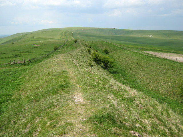
Wansdyke (from ''Woden's Dyke'') is a series of early medieval defensive linear earthworks in the West Country of England, consisting of a ditch and a running embankment from the ditch spoil, with the ditching facing north. There are two main parts: an eastern dyke which runs between Savernake Forest, West Woods and Morgan's Hill in Wiltshire, and a western dyke which runs from Monkton Combe to the ancient hill fort of Maes Knoll in historic Somerset. Between these two dykes there is a middle section formed by the remains of the London to Bath Roman road. There is also some evidence in charters that it extended west from Maes Knoll to the coast of the Severn Estuary but this is uncertain. It may possibly define a post-Roman boundary. Usage Wansdyke consists of two sections, long with some gaps in between. East Wansdyke is an impressive linear earthwork, consisting of a ditch and bank running approximately east–west, between Savernake Forest and Morgan's Hill. West Wansd ... [...More Info...] [...Related Items...] OR: [Wikipedia] [Google] [Baidu] |
Early Middle Ages
The Early Middle Ages (or early medieval period), sometimes controversially referred to as the Dark Ages, is typically regarded by historians as lasting from the late 5th or early 6th century to the 10th century. They marked the start of the Middle Ages of European history, following the decline of the Western Roman Empire, and preceding the High Middle Ages ( 11th to 13th centuries). The alternative term ''late antiquity'', for the early part of the period, emphasizes elements of continuity with the Roman Empire, while ''Early Middle Ages'' is used to emphasize developments characteristic of the earlier medieval period. The period saw a continuation of trends evident since late classical antiquity, including population decline, especially in urban centres, a decline of trade, a small rise in average temperatures in the North Atlantic region and increased migration. In the 19th century the Early Middle Ages were often labelled the ''Dark Ages'', a characterization based on t ... [...More Info...] [...Related Items...] OR: [Wikipedia] [Google] [Baidu] |
Bronze Age
The Bronze Age is a historic period, lasting approximately from 3300 BC to 1200 BC, characterized by the use of bronze, the presence of writing in some areas, and other early features of urban civilization. The Bronze Age is the second principal period of the three-age system proposed in 1836 by Christian Jürgensen Thomsen for classifying and studying ancient societies and history. An ancient civilization is deemed to be part of the Bronze Age because it either produced bronze by smelting its own copper and alloying it with tin, arsenic, or other metals, or traded other items for bronze from production areas elsewhere. Bronze is harder and more durable than the other metals available at the time, allowing Bronze Age civilizations to gain a technological advantage. While terrestrial iron is naturally abundant, the higher temperature required for smelting, , in addition to the greater difficulty of working with the metal, placed it out of reach of common use until the end o ... [...More Info...] [...Related Items...] OR: [Wikipedia] [Google] [Baidu] |
The Ridgeway
The ancient tree-lined path winds over the downs countryside The Ridgeway is a ridgeway or ancient trackway described as Britain's oldest road. The section clearly identified as an ancient trackway extends from Wiltshire along the chalk ridge of the Berkshire Downs to the River Thames at the Goring Gap, part of the Icknield Way which ran, not always on the ridge, from Salisbury Plain to East Anglia. The route was adapted and extended as a National Trail, created in 1972. The Ridgeway National Trail follows the ancient Ridgeway from Overton Hill, near Avebury, to Streatley, then follows footpaths and parts of the ancient Icknield Way through the Chiltern Hills to Ivinghoe Beacon in Buckinghamshire. The National Trail is long. History For at least 5,000 years travellers have used the Ridgeway. The Ridgeway provided a reliable trading route to the Dorset coast and to the Wash in Norfolk. The high dry ground made travel easy and provided a measure of protection by givin ... [...More Info...] [...Related Items...] OR: [Wikipedia] [Google] [Baidu] |


.jpg)


