|
California Interior Chaparral And Woodlands
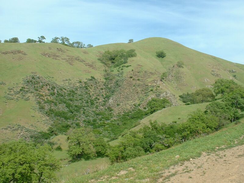
The California interior chaparral and woodlands ecoregion covers in an elliptical ring around the California Central Valley. It occurs on hills and mountains ranging from to . It is part of the Mediterranean forests, woodlands, and scrub biome, with cool, wet winters and hot, dry summers. Temperatures within the coast can range from 53° to 65 °F and 32° to 60 °F within the mountains. Many plant and animal species in this ecoregion are adapted to periodic fire. Geography The California interior chaparral and woodlands ecoregion extends from as far north as Shasta Lake in Northern California to as far south as the Santa Barbara Channel in Southern California. Despite being termed as "inland", this ecoregion features extensive coastline between the Central Coast towns of Goleta and San Simeon, as well as within the Monterey and San Francisco Bay areas. These coastal regions are broken up by isolated patches of Northern California coastal forests and California mont ... [...More Info...] [...Related Items...] OR: [Wikipedia] [Google] [Baidu] |
Sunol Regional Wilderness
The Sunol Regional Wilderness is a regional park in Alameda County, the eastern San Francisco Bay Area, Northern California. It is located near the town of Sunol, south of Pleasanton and east of Fremont. The park was established in 1962, and is administered by the East Bay Regional Park District. The park is subject to either closure or fire restriction during the wildfire season from June through October. Natural history The park is in the inner California Coast Ranges. It originally was inhabited by Native Americans, and was subsequently primarily ranch land, with chaparral, oak woodland, and grassland habitats. Grazing rights within the park are still leased, so cattle may be encountered. Flora Common trees in the park include Coast live oak (''Quercus agrifolia''), Valley oak (''Quercus lobata''), Blue oak (''Quercus douglasii''), Mexican elderberry (''Sambucus cerulea''), Pacific Madrone (''Arbutus menziesii'') and Gray pine (''Pinus sabiniana''). Along A ... [...More Info...] [...Related Items...] OR: [Wikipedia] [Google] [Baidu] |
Southern California
Southern California (commonly shortened to SoCal) is a geographic and cultural region that generally comprises the southern portion of the U.S. state of California. It includes the Los Angeles metropolitan area, the second most populous urban agglomeration in the United States. The region generally contains ten of California's 58 counties: Imperial, Kern, Los Angeles, Orange, Riverside, San Bernardino, San Diego, Santa Barbara, San Luis Obispo and Ventura counties. The Colorado Desert and the Colorado River are located on Southern California's eastern border with Arizona, and San Bernardino County shares a border with Nevada to the northeast. Southern California's southern border with Baja California is part of the Mexico–United States border. Constituent metropolitan areas Southern California includes the heavily built-up urban area which stretches along the Pacific coast from Ventura through Greater Los Angeles down to Greater San Diego (the contiguous urban ar ... [...More Info...] [...Related Items...] OR: [Wikipedia] [Google] [Baidu] |
San Francisco
San Francisco (; Spanish for " Saint Francis"), officially the City and County of San Francisco, is the commercial, financial, and cultural center of Northern California. The city proper is the fourth most populous in California and 17th most populous in the United States, with 815,201 residents as of 2021. It covers a land area of , at the end of the San Francisco Peninsula, making it the second most densely populated large U.S. city after New York City, and the fifth most densely populated U.S. county, behind only four of the five New York City boroughs. Among the 91 U.S. cities proper with over 250,000 residents, San Francisco was ranked first by per capita income (at $160,749) and sixth by aggregate income as of 2021. Colloquial nicknames for San Francisco include ''SF'', ''San Fran'', ''The '', ''Frisco'', and ''Baghdad by the Bay''. San Francisco and the surrounding San Francisco Bay Area are a global center of economic activity and the arts and sciences, spurred ... [...More Info...] [...Related Items...] OR: [Wikipedia] [Google] [Baidu] |
San Jose, California
San Jose, officially San José (; ; ), is a major city in the U.S. state of California that is the cultural, financial, and political center of Silicon Valley and largest city in Northern California by both population and area. With a 2020 population of 1,013,240, it is the most populous city in both the Bay Area and the San Jose-San Francisco-Oakland Combined Statistical Area, which contain 7.7 million and 9.7 million people respectively, the third-most populous city in California (after Los Angeles and San Diego and ahead of San Francisco), and the tenth-most populous in the United States. Located in the center of the Santa Clara Valley on the southern shore of San Francisco Bay, San Jose covers an area of . San Jose is the county seat of Santa Clara County and the main component of the San Jose–Sunnyvale–Santa Clara Metropolitan Statistical Area, with an estimated population of around two million residents in 2018. San Jose is notable for its innovation, cultural div ... [...More Info...] [...Related Items...] OR: [Wikipedia] [Google] [Baidu] |
Santa Cruz, California
Santa Cruz ( Spanish for "Holy Cross") is the county seat and largest city of Santa Cruz County, in Northern California. As of the 2020 census, the city population was 62,956. Situated on the northern edge of Monterey Bay, Santa Cruz is a popular tourist destination, owing to its beaches, surf culture, and historic landmarks. Santa Cruz was founded by the Spanish in 1791, when Fermín de Lasuén established Mission Santa Cruz. Soon after, a settlement grew up near the mission called Branciforte, which came to be known across Alta California for its lawlessness. With the Mexican secularization of the Californian missions in 1833, the former mission was divided and granted as rancho grants. Following the American Conquest of California, Santa Cruz eventually incorporated as a city in 1866. The creation of the Santa Cruz Beach Boardwalk in 1907 solidified the city's status as a seaside resort community, while the establishment of the University of California, Santa Cruz in ... [...More Info...] [...Related Items...] OR: [Wikipedia] [Google] [Baidu] |
Salinas, California
Salinas (; Spanish for "Salt Marsh or Salt Flats") is a city in California and the county seat of Monterey County. With a population of 163,542 in the 2020 Census, Salinas is the most populous city in Monterey County. Salinas is an urban area located along the northern limits of the Monterey Bay Area, lying just south of the San Francisco Bay Area and southeast of the mouth of the Salinas River. The city is located at the mouth of the Salinas Valley, about from the Pacific Ocean, and it has a climate more influenced by the ocean than the interior. Salinas serves as the main business, governmental, and industrial center of the region. The marine climate is ideal for the floral industry, grape vineyards, and vegetable growers. Salinas is known as the "Salad Bowl of the World" for its large, vibrant agriculture industry. It was the hometown of writer and Nobel laureate John Steinbeck (1902–68), who set many of his stories in the Salinas Valley and Monterey. Salinas has a ... [...More Info...] [...Related Items...] OR: [Wikipedia] [Google] [Baidu] |
San Luis Obispo, California
San Luis Obispo (; Spanish for " St. Louis the Bishop", ; Chumash: ''tiłhini'') is a city and county seat of San Luis Obispo County, in the U.S. state of California. Located on the Central Coast of California, San Luis Obispo is roughly halfway between the San Francisco Bay Area in the north and Greater Los Angeles in the south. The population was 47,063 at the 2020 census. San Luis Obispo was founded by the Spanish in 1772, when Saint Junípero Serra established Mission San Luis Obispo de Tolosa. The town grew steadily through the Mexican period before a rapid expansion of San Luis Obispo following the American Conquest of California. San Luis Obispo is a popular tourist destination, known for its historic architecture, vineyards, and hospitality, as well as for being home to California Polytechnic State University, San Luis Obispo. History The earliest human inhabitants of the local area were the Chumash people. One of the earliest villages lies south of San Luis O ... [...More Info...] [...Related Items...] OR: [Wikipedia] [Google] [Baidu] |
Santa Maria, California
Santa Maria (Spanish for "St. Mary") is a city near the Central Coast of California in northern Santa Barbara County. It is approximately northwest of Santa Barbara and northwest of downtown Los Angeles. Its population was 109,707 at the 2020 census, making it the most populous city in the county and the Santa Maria-Santa Barbara, CA Metro Area. The city is notable for its wine industry and Santa Maria-style barbecue. History The Santa Maria Valley, stretching from the Santa Lucia Mountains toward the Pacific Ocean, was the homeland of the Chumash people for several thousand years. The Native Americans made their homes on the slopes of the surrounding hills among the oaks, on the banks of the Santa Maria River among the sycamores, and along the coast. They had unique plank-built boats, called Tomol, which they used for ocean fishing. In 1769, the Portolá Expedition passed through the Santa Maria Valley during the first Spanish land exploration up the coast of Las Cali ... [...More Info...] [...Related Items...] OR: [Wikipedia] [Google] [Baidu] |
Santa Lucia Range
The Santa Lucia Mountains (sæntə luˈsiːə) or Santa Lucia Range is a rugged mountain range in coastal central California, running from Carmel southeast for to the Cuyama River in San Luis Obispo County. The range is never more than from the coast.''Big Sur: Images of America'', Jeff Norman, Big Sur Historical Society, Arcadia Publishing (2004), 128 pages, The range forms the steepest coastal slope in the contiguous United States. Cone Peak at tall and three miles (5 km) from the coast, is the highest peak in proximity to the ocean in the lower 48 United States. The range was a barrier to exploring the coast of central California for early Spanish explorers. Geography The Santa Lucia Mountains are part of the Outer South California Coast Ranges, in the Pacific Coast Ranges System. The coastal side of the range rises directly from the shoreline, with oceanfront ridges rising directly to the crest of the coastal range. The crest of the range is never more than ... [...More Info...] [...Related Items...] OR: [Wikipedia] [Google] [Baidu] |
Santa Cruz Mountains
The Santa Cruz Mountains, part of the Pacific Coast Ranges, are a mountain range in central and Northern California, United States. They form a ridge down the San Francisco Peninsula, south of San Francisco. They separate the Pacific Ocean from the San Francisco Bay and the Santa Clara Valley, and continue south to the Central Coast, bordering Monterey Bay and ending at the Salinas Valley. The range passes through the counties of San Mateo, Santa Clara, Santa Cruz, San Benito and Monterey, with the Pajaro River forming the southern boundary. Geography The northernmost portion of the Santa Cruz Mountains, north of Half Moon Bay Road ( SR 92), is known as Montara Mountain; the middle portion is the Sierra Morena, which includes a summit called Sierra Morena, and extends south to a gap at Lexington Reservoir; south of the gap, the mountain range is known as the Sierra Azul. The highest point in the range is Loma Prieta Peak, west of Morgan Hill, with a height of ... [...More Info...] [...Related Items...] OR: [Wikipedia] [Google] [Baidu] |
San Francisco Bay
San Francisco Bay is a large tidal estuary in the U.S. state of California, and gives its name to the San Francisco Bay Area. It is dominated by the big cities of San Francisco, San Jose, and Oakland. San Francisco Bay drains water from approximately 40 percent of California. Water from the Sacramento and San Joaquin rivers, and from the Sierra Nevada mountains, flow into Suisun Bay, which then travels through the Carquinez Strait to meet with the Napa River at the entrance to San Pablo Bay, which connects at its south end to San Francisco Bay. It then connects to the Pacific Ocean via the Golden Gate strait. However, this entire group of interconnected bays is often called the ''San Francisco Bay''. The bay was designated a Ramsar Wetland of International Importance on February 2, 2017. Size The bay covers somewhere between , depending on which sub-bays (such as San Pablo Bay), estuaries, wetlands, and so on are included in the measurement. The main part of the b ... [...More Info...] [...Related Items...] OR: [Wikipedia] [Google] [Baidu] |
Monterey Bay
Monterey Bay is a bay of the Pacific Ocean located on the coast of the U.S. state of California, south of the San Francisco Bay Area and its major city at the south of the bay, San Jose. San Francisco itself is further north along the coast, by about 75 miles, accessible via Highway 1 and Highway 280. Santa Cruz is located at the north end of the bay, and Monterey is on the Monterey Peninsula at the south end. The "Monterey Bay Area" is a local colloquialism sometimes used to describe the whole of the Central Coast communities of Santa Cruz and Monterey counties. Toponymy The first European to discover Monterey Bay was Juan Rodríguez Cabrillo on November 16, 1542, while sailing northward along the coast on a Spanish naval expedition. He named the bay ''Bahía de los Pinos'', probably because of the forest of pine trees first encountered while rounding the peninsula at the southern end of the bay. Cabrillo's name for the bay was lost, but the westernmost point of the peni ... [...More Info...] [...Related Items...] OR: [Wikipedia] [Google] [Baidu] |


.jpg)

.jpg)


