|
California Gubernatorial Election, 1982
The 1982 California gubernatorial election occurred on November 2, 1982. The Republican nominee, Attorney General George Deukmejian, narrowly defeated the Democratic nominee, Los Angeles Mayor Tom Bradley. Incumbent Governor Jerry Brown did not seek reelection to a third term (although he was elected again much later in 2010 and 2014). Primary election summary In the Democratic primary, Los Angeles Mayor Tom Bradley easily defeated State Senator John Garamendi and Mario G. Obledo. On the Republican side, it was a two-man race between Lieutenant Governor Mike Curb and Attorney General George Deukmejian. Deukmejian won the primary with nearly 55% of the vote. General election Early indications were that it would be a close race but as the campaign went on, Bradley slowly increased his lead in the polls. Despite this, the outcome was still in doubt as election night wore on. A large late surge of absentee ballots (many from conservative Orange County and Deukmejian's home ... [...More Info...] [...Related Items...] OR: [Wikipedia] [Google] [Baidu] |
George Deukmejian Official Portrait Crop (3x4c)
George may refer to: People * George (given name) * George (surname) * George (singer), American-Canadian singer George Nozuka, known by the mononym George * George Washington, First President of the United States * George W. Bush, 43rd President of the United States * George H. W. Bush, 41st President of the United States * George V, King of Great Britain, Ireland, the British Dominions and Emperor of India from 1910-1936 * George VI, King of Great Britain, Ireland, the British Dominions and Emperor of India from 1936-1952 * Prince George of Wales * George Papagheorghe also known as Jorge / GEØRGE * George, stage name of Giorgio Moroder * George Harrison, an English musician and singer-songwriter Places South Africa * George, Western Cape ** George Airport United States * George, Iowa * George, Missouri * George, Washington * George County, Mississippi * George Air Force Base, a former U.S. Air Force base located in California Characters * George (Peppa Pig), a 2-year-old pig ... [...More Info...] [...Related Items...] OR: [Wikipedia] [Google] [Baidu] |
Orange County, California
Orange County is located in the Los Angeles metropolitan area in Southern California. As of the 2020 census, the population was 3,186,989, making it the third-most-populous county in California, the sixth-most-populous in the United States, and more populous than 19 American states and Washington, D.C. Although largely suburban, it is the second-most-densely-populated county in the state behind San Francisco County. The county's three most-populous cities are Anaheim, Santa Ana, and Irvine, each of which has a population exceeding 300,000. Santa Ana is also the county seat. Six cities in Orange County are on the Pacific coast: Seal Beach, Huntington Beach, Newport Beach, Laguna Beach, Dana Point, and San Clemente. Orange County is included in the Los Angeles-Long Beach- Anaheim Metropolitan Statistical Area. The county has 34 incorporated cities. Older cities like Old Town Tustin, Santa Ana, Anaheim, Orange, and Fullerton have traditional downtowns dating back to the 19th ... [...More Info...] [...Related Items...] OR: [Wikipedia] [Google] [Baidu] |
El Dorado County, California
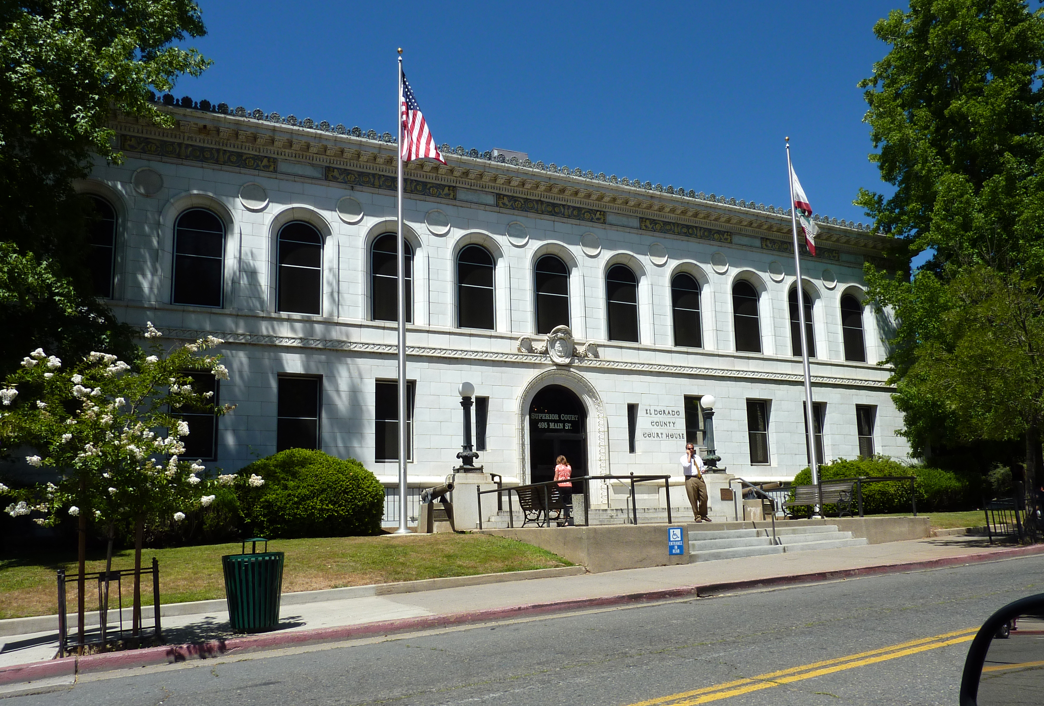
El Dorado County (), officially the County of El Dorado, is a county located in the U.S. state of California. As of the 2020 census, the population was 191,185. The county seat is Placerville. The County is part of the Sacramento- Roseville-Arden-Arcade, CA Metropolitan Statistical Area. It is located entirely in the Sierra Nevada, from the historic Gold Country in the western foothills to the High Sierra in the east. El Dorado County's population has grown as Greater Sacramento has expanded into the region. Where the county line crosses US 50 at Clarksville, the distance to Sacramento is 15 miles. In the county's high altitude eastern end at Lake Tahoe, environmental awareness and environmental protection initiatives have grown along with the population since the 1960 Winter Olympics, hosted at the former Squaw Valley Ski Resort in neighboring Placer County. History What is now known as El Dorado County has been home to the Maidu, Nisenan, Washoe, and Miwok Indigenous A ... [...More Info...] [...Related Items...] OR: [Wikipedia] [Google] [Baidu] |
Mono County, California
Mono County ( ) is a county located in the east central portion of the U.S. state of California. As of the 2020 census, the population was 13,195, making it the fourth-least populous county in California. The county seat is Bridgeport. The county is located east of the Sierra Nevada between Yosemite National Park and Nevada. The only incorporated town in the county is Mammoth Lakes, which is located at the foot of Mammoth Mountain. Other locations, such as June Lake, are also famous as skiing and fishing resorts. Located in the middle of the county is Mono Lake, a vital habitat for millions of migratory and nesting birds. The lake is located in a wild natural setting, with pinnacles of tufa arising out of the salty and alkaline lake. Also located in Mono County is Bodie, the official state gold rush ghost town, which is now a California State Historic Park. History Mono County was formed in 1861 from parts of Calaveras, Fresno and Mariposa counties. A portion of norther ... [...More Info...] [...Related Items...] OR: [Wikipedia] [Google] [Baidu] |
San Joaquin County, California
San Joaquin County (; Spanish: ''San Joaquín'', meaning " St. Joachim"), officially the County of San Joaquin, is a county in the U.S. state of California. As of the 2020 census, the population was 779,233. The county seat is Stockton. San Joaquin County comprises the Stockton– Lodi– Tracy metropolitan statistical area within the regional San Jose–San Francisco– Oakland combined statistical area. The county is located in Northern California's Central Valley just east of the very highly populated nine-county San Francisco Bay Area region and is separated from the Bay Area by the Diablo Range of low mountains with its Altamont Pass. One of the smaller counties by area in California, it has a high population density and is growing rapidly due to overflow from the Bay Area's need for housing. The City of San Joaquin, despite sharing its name with the county, is located in Fresno County. History San Joaquin County was one of the original United States counties of Ca ... [...More Info...] [...Related Items...] OR: [Wikipedia] [Google] [Baidu] |
Amador County, California
Amador County () is a County (United States), county located in the U.S. state of California, in the Sierra Nevada. As of the 2020 United States Census, 2020 census, the population was 40,474. The county seat is Jackson, California, Jackson. Amador County, located within California's Gold Country, is known as "The Heart of the Mother Lode". There is a substantial Viticulture, viticultural industry in the county. History Amador County was created by the California Legislature on May 11, 1854, from parts of Calaveras County, California, Calaveras and El Dorado County, California, El Dorado counties. (historical marker placed by Board of Supervisors and Amador County Historical Society, 1954) It was organized on July 3, 1854. In 1864, part of the county's territory was given to Alpine County, California, Alpine County. The county is named for José María Amador, a soldier, rancher, and miner, born in San Francisco in 1794, the son of Sergeant Pedro Amador (soldier), Pedro A ... [...More Info...] [...Related Items...] OR: [Wikipedia] [Google] [Baidu] |
Calaveras County, California
Calaveras County (), officially the County of Calaveras, is a county in both the Gold Country and High Sierra regions of the U.S. state of California. As of the 2010 census, the population was 45,292. The county seat is San Andreas. Angels Camp is the county's only incorporated city. ''Calaveras'' is Spanish for "skulls"; the county was reportedly named for the remains of Native Americans discovered by the Spanish explorer Captain Gabriel Moraga. Calaveras Big Trees State Park, a preserve of giant sequoia trees, is in the county several miles east of the town of Arnold on State Highway 4. Credit for the discovery of giant sequoias there is given to Augustus T. Dowd, a trapper who made the discovery in 1852 while tracking a bear. When the bark from the "Discovery Tree" was removed and taken on tour around the world, the trees became a worldwide sensation and one of the county's first tourist attractions. The uncommon gold telluride mineral calaverite was discovered in the ... [...More Info...] [...Related Items...] OR: [Wikipedia] [Google] [Baidu] |
Colusa County, California
Colusa County () is a county located in the U.S. state of California. As of the 2020 census, the population was 21,839. The county seat is Colusa. It is in the North Valley of California, northwest of the state capital, Sacramento. History Colusa County is one of the original counties of California, created in 1850 at the time of statehood. Parts of the county's territory were given to Tehama County in 1856 and to Glenn County in 1891. The county was named after the 1844 Rancho Colus Mexican land grant to John Bidwell. The name of the county in the original state legislative act of 1850 was spelled ''Colusi'', and often in newspapers was spelled ''Coluse''. The word is derived from the name of a Patwin village known as ''Ko'-roo'' or ''Korusi'' located on the west side of the Sacramento River on the site of the present-day city of Colusa. The name was established as ''Colusa'' by 1855. Early history Present-day Colusa County was originally home to the Patwin band of the W ... [...More Info...] [...Related Items...] OR: [Wikipedia] [Google] [Baidu] |
Sutter County, California
Sutter County is a county located in the U.S. state of California. As of the 2020 census, the population was 99,633. The county seat is Yuba City. Sutter County is included in the Yuba City, CA Metropolitan Statistical Area as well as the Sacramento- Roseville, CA Combined Statistical Area. The county is located along the Sacramento River in the Sacramento Valley. History The Maidu were the people living in the area of Sutter County when European settlers arrived. Sutter County was one of the original counties of California, created in 1850 at the time of statehood. Parts of the county were given to Placer County in 1852. Sutter County is named after John Augustus Sutter, a German native born to Swiss parents. He was one of the first Europeans to recognize the Sacramento Valley for its potential in agriculture. His Hock Farm, established in 1841 on the Feather River just south of present-day Yuba City, was the site of the first major farm in the Central Valley, and used extens ... [...More Info...] [...Related Items...] OR: [Wikipedia] [Google] [Baidu] |
Inyo County, California
Inyo County () is a county in the eastern central part of the U.S. state of California, located between the Sierra Nevada and the state of Nevada. In the 2020 census, the population was 19,016. The county seat is Independence. Inyo County is on the east side of the Sierra Nevada and southeast of Yosemite National Park in Central California. It contains the Owens River Valley; it is flanked to the west by the Sierra Nevada and to the east by the White Mountains and the Inyo Mountains. With an area of 10,192 square miles (26,397 km2), Inyo County is the second-largest county by area in California, after San Bernardino County. Almost one-half of that area is within Death Valley National Park. However, with a population density of 1.8 people per square mile, it also has the second-lowest population density in California, after Alpine County. History Present-day Inyo county has been the historic homeland for thousands of years of the Mono, Timbisha, Kawaiisu, and Nort ... [...More Info...] [...Related Items...] OR: [Wikipedia] [Google] [Baidu] |
Glenn County, California
Glenn County is a county located in the U.S. state of California. As of the 2020 United States Census, 2020 census, the population was 28,917. The county seat is Willows, California, Willows. It is located in the Sacramento Valley, in the northern part of the California Central Valley. The Grindstone Rancheria, reservation of the Grindstone Indian Rancheria of Wintun-Wailaki Indians, is located in Glenn County. History Glenn County split from Colusa County, California, Colusi County in 1891, from parts of Colusa County. It was named for Dr. Hugh J. Glenn, who purchased in the northest end of Rancho Jacinto in 1867. He became the largest wheat farmer in the state during his lifetime and a man of great prominence in political and commercial life in California. Sheriffs *Peter Herman Clark (1 Mar 1891- 7 Nov 1894) *William H. Sale (7 Nov 1894- 7 Nov 1900) *Jack A. Bailey (7 Nov 1900- 7 Nov 1918) *Newt Collins (7 Nov 1918- 7 Nov 1922) *Roy D. Heard (7 Nov 1922- 7 Nov 1934) *Lawre ... [...More Info...] [...Related Items...] OR: [Wikipedia] [Google] [Baidu] |
Modoc County, California
Modoc County () is a county in the far northeast corner of the U.S. state of California. Its population is 8,700 as of the 2020 census, down from 9,686 from the 2010 census. This makes it California's third-least populous county. The county seat and only incorporated city is Alturas. Previous county seats include Lake City and Centerville. The county borders Nevada and Oregon. Much of Modoc County is federal land. Several federal agencies, including the United States Forest Service, Bureau of Land Management, National Park Service, Bureau of Indian Affairs, and the United States Fish and Wildlife Service, have employees assigned to the area, and their operations are a significant part of its economy and services. The county's official slogans include "The last best place" and "Where the West still lives". History Prior to the arrival of Europeans in the region, varying cultures of Native Americans inhabited the county for thousands of years. At the time of European encounter ... [...More Info...] [...Related Items...] OR: [Wikipedia] [Google] [Baidu] |
.jpg)


.jpg)


