|
Cairu
Cairu is a municipality in the state of Bahia in the North-East region of Brazil. The municipality has a population of 18,427 with a population density of 33.3 inhabitants per square kilometer. The municipality consists of three islands: the Island of Cairu, which is only separated from the mainland by a narrow river; Tinharé Island, which has the dense tourist settlement of Morro de São Paulo to the north; and Boipeba Island. The municipality contains part of the of the Caminhos Ecológicos da Boa Esperança Environmental Protection Area, created in 2003. History The Cairu region was home to a large population of Aimoré people. The Portuguese arrived in the area early in the 16th century and soon established a sugarcane plantation. Francisco Romeo, administrator of the Captaincy of São Jorge dos Ilhéus founded a small settlement in Cairu based on its mild climate. The settlers displaced the Aimoré and the settlement, known as the Vila de Nossa Senhora do Rosário do Ca ... [...More Info...] [...Related Items...] OR: [Wikipedia] [Google] [Baidu] |
Convent And Church Of Saint Anthony (Cairu)
The Church and Convent of Saint Antony ( pt, Igreja e Convento de Santo António) is a 17th-century Roman Catholic church located in Cairu, Bahia, Brazil. It was consecrated in 1650, but construction on the complex probably began at the beginning of the century. It is dedicated to is dedicated to Saint Anthony. The church building is noted for its elaborate façade and numerous Franciscan architectural elements. It covers . The church was listed as a historic structure by the National Historic and Artistic Heritage Institute in 1941. The architect Mário Mendonça de Oliveira calls the convent and church "one of the most outstanding existing examples of Brazilian religious architecture and Franciscan architecture." History The Convent and Church of Saint Antony of Cairu was built on the site of a small chapel, also named after Saint Antony. It was built by Daniel de São Francisco, a Franciscan friar born in Penafiel, Portugal. He arrived in Brazil, initially in Pernambuco, earl ... [...More Info...] [...Related Items...] OR: [Wikipedia] [Google] [Baidu] |
Boipeba Island
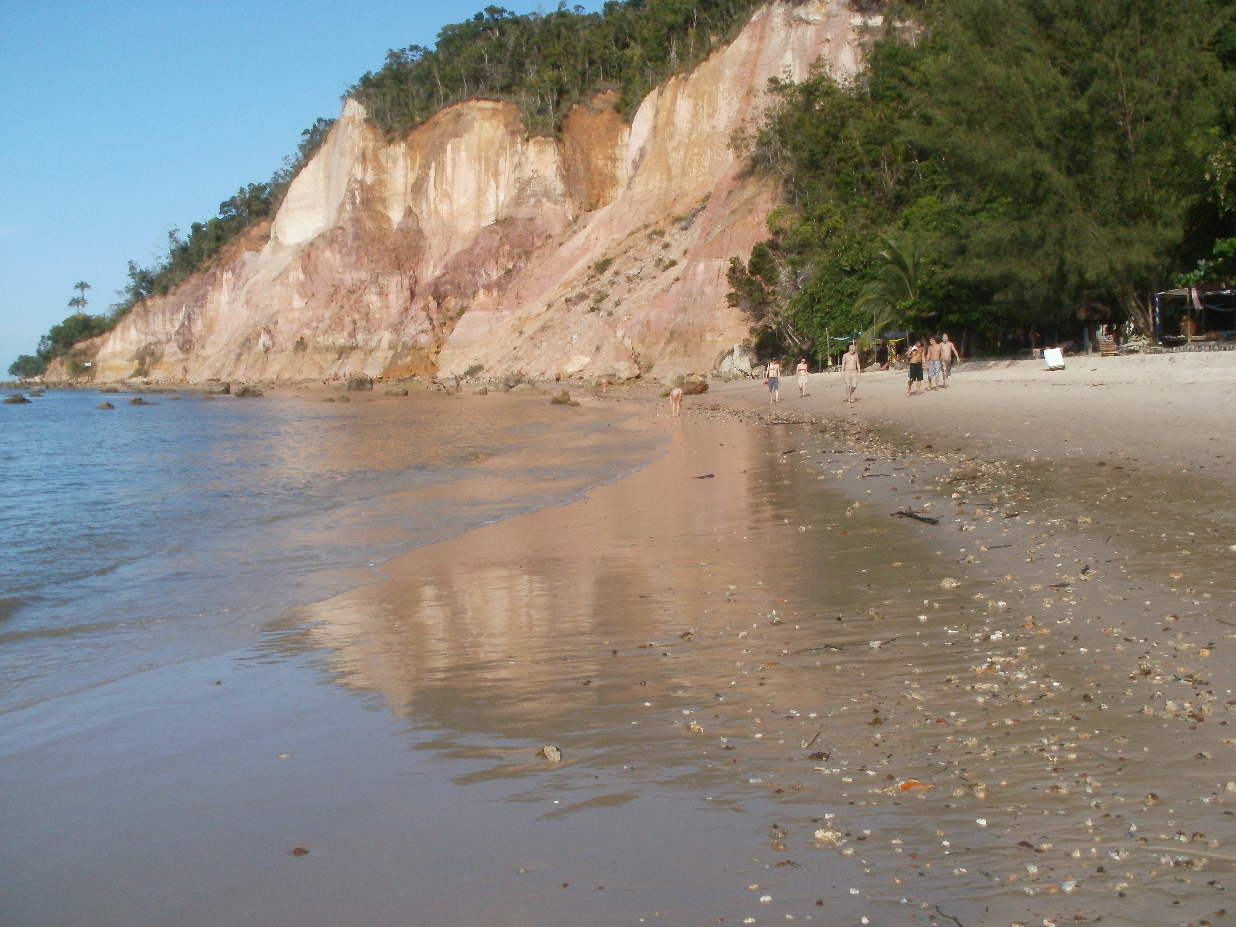
Ilha de Boipeba () is an island in the Cairu municipality in Brazil, near the Ilha de Tinharé and part of the Cairu Archipelago. It is surrounded on the east by the Atlantic Ocean and on the west by the Rio de l'Enfer estuary. It is a popular tourist destination due to its scenic beaches and rainforest, which makes up the majority of the island's economy along with fishing. The island covers 88 square kilometers and had a population of 3,256 in 2010. There are four villages: Velha Boipeba, São Sebastião, Moreré, and Monte Alegre. Its beaches are Praia da Boca da Barra, Praia de Tassimirim, Praia da Cueira, Praia de Moreré, Praia de Bainema, Praia da Cova da Onça, and Praia da Ponta dos Castelhanos. Ilha de Boipeba was first settled in 1537 by Jesuits from Portugal, making it one of the oldest settled places in the state of Bahia. The Church of Divino Espírito Santo, built in 1610, is its most important monument. The name ''Boipeba'' comes from the word "M'boi pewa" (liter ... [...More Info...] [...Related Items...] OR: [Wikipedia] [Google] [Baidu] |
Morro De São Paulo Airport
Morro de São Paulo Airport is the airport serving Cairu, Brazil, located in the district of Morro de São Paulo. Airlines and destinations Access The airport is located from downtown Cairu and from Morro de São Paulo. See also *List of airports in Brazil This is a list of airports in Brazil, sorted by location. The National Civil Aviation Agency of Brazil lists on March 10, 2022, 491 public and 2,677 private aerodromes in Brazil. __TOC__ Airports Airport names shown in bold indicate that th ... References External links * * * {{Brazil topics Airports in Bahia ... [...More Info...] [...Related Items...] OR: [Wikipedia] [Google] [Baidu] |
Fonte Grande Of Morro De São Paulo
The Fonte Grande of Morro de São Paulo ( pt, Fonte Grande de Morro de São Paulo) is a Baroque-style fountain on Tinharé Island, Cairu, Bahia, Brazil. It dates to 1746 and was constructed by , viceroy of Brazil, to supply water to a prison, soldiers, and residents. The fountain is located to the southeast of the settlement of Morro de São Paulo, and was the most advanced water supply system in colonial Brazil. It was listed as a historic structure by the National Institute of Historic and Artistic Heritage in 1943. History André de Melo e Castro (1668-1753), viceroy of Brazil, built the three-spouted fountain to serve a local prison, soldiers on the Island of Tinharé, and resident. The fountain may have been built on the site of a smaller, earlier fountain discovered by Simao Barreto in the 17th century as part of the construction of Church of Our Lady of Luz (''Igreja de Nossa Senhora da Luz''). Dom Pedro II, during a tour of Morro de Sao Paulo in 1859, recorded the exis ... [...More Info...] [...Related Items...] OR: [Wikipedia] [Google] [Baidu] |
Caminhos Ecológicos Da Boa Esperança Environmental Protection Area
The Caminhos Ecológicos da Boa Esperança Environmental Protection Area ( pt, Área de Proteção Ambiental Caminhos Ecológicos da Boa Esperança) is an environmental protection area in the state of Bahia, Brazil. Location The Caminhos Ecológicos da Boa Esperança Environmental Protection Area (APA) covers parts of the municipalities of Ubaíra, Jiquiriçá, Teolândia, Wenceslau Guimarães, Nilo Peçanha, Taperoá, Cairu and Valença. It has an estimated area of . It covers an area to the south of Salvador along the Atlantic Coast, extending inland and including the Wenceslau Guimarães Ecological Station. It adjoins the Baía de Camamu Environmental Protection Area to the south. Environment The APA is in the Atlantic Forest biome. Vegetation includes ''restinga'' and mangroves along the coast and rainforest in the interior, rising to montane forest. Fauna includes a wide range of mammals, birds, reptiles and so on, including endangered species such as the southern tama ... [...More Info...] [...Related Items...] OR: [Wikipedia] [Google] [Baidu] |
List Of Municipalities In Bahia
This is a list of the municipalities in the state of Bahia (BA), located in the Northeast Region of Brazil. Bahia is divided into 417 municipalities, which are grouped into 32 microregions, which are grouped into 7 mesoregions. See also *Geography of Brazil *List of cities in Brazil {{South America topic, List of cities in Bahia Bahia ( , , ; meaning "bay") is one of the 26 Federative units of Brazil, states of Brazil, located in the Northeast Region, Brazil, Northeast Region of the country. It is the fourth-largest Brazilian state by population (after São Paulo (sta ... * ... [...More Info...] [...Related Items...] OR: [Wikipedia] [Google] [Baidu] |
Morro De São Paulo
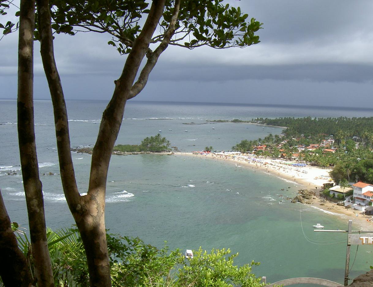
Morro de São Paulo (translation: St. Paul's Hill) is one of 5 villages of the island of Tinharé in the municipality of Cairu, located in the state of Bahia, Brazil. The main beaches of the Morro de São Paulo are located on east side of the island . They are: Primeira Praia, Segunda Praia, Terceira Praia, Quarta Praia and Quinta Praia (also known as Praia do Encanto). The settlement was home to a large Tumpinamba population prior to the arrival of the Portuguese. A Portuguese colony was established as early as 1535. The settlement is a site of large-scale tourism, and has three registered historic sites. History Martim Afonso de Sousa, landed in 1531 and baptized this island "Tynharéa" and the Bahian accent soon transformed that name to "Tinharé". In 1535 the village of Morro de São Paulo was founded in the extreme north of the island by Francisco Romero and the local population. Morro de Sao Paulo was the site of patrols and attacks by German submarines between 1942 and ... [...More Info...] [...Related Items...] OR: [Wikipedia] [Google] [Baidu] |
Ilha De Tinharé
Ilha de Tinharé (Tinharé Island) is an island located in the municipality of Cairu, on the coast of Brazil Brazil ( pt, Brasil; ), officially the Federative Republic of Brazil (Portuguese: ), is the largest country in both South America and Latin America. At and with over 217 million people, Brazil is the world's fifth-largest country by area .... The town of Tinharé is accessible via catamaran or boat from the river that passes through the municipality of Valença. Atlantic islands of Brazil {{Bahia-geo-stub ... [...More Info...] [...Related Items...] OR: [Wikipedia] [Google] [Baidu] |
Bahia
Bahia ( , , ; meaning "bay") is one of the 26 Federative units of Brazil, states of Brazil, located in the Northeast Region, Brazil, Northeast Region of the country. It is the fourth-largest Brazilian state by population (after São Paulo (state), São Paulo, Minas Gerais, and Rio de Janeiro (state), Rio de Janeiro) and the 5th-largest by area. Bahia's capital is the city of Salvador, Bahia, Salvador (formerly known as "Cidade do São Salvador da Bahia de Todos os Santos", literally "City of the Saint Savior of the Bay of All the Saints"), on a Spit (landform), spit of land separating the Bay of All Saints from the Atlantic. Once a monarchial stronghold dominated by Agriculture in Brazil, agricultural, Slavery in Brazil, slaving, and ranching interests, Bahia is now a predominantly Working class, working-class industrial and agricultural state. The state is home to 7% of the Brazilian population and produces 4.2% of the country's GDP. Name The name of the state derives from the ... [...More Info...] [...Related Items...] OR: [Wikipedia] [Google] [Baidu] |
Historic Center Of Cairu
History (derived ) is the systematic study and the documentation of the human activity. The time period of event before the invention of writing systems is considered prehistory. "History" is an umbrella term comprising past events as well as the memory, discovery, collection, organization, presentation, and interpretation of these events. Historians seek knowledge of the past using historical sources such as written documents, oral accounts, art and material artifacts, and ecological markers. History is not complete and still has debatable mysteries. History is also an academic discipline which uses narrative to describe, examine, question, and analyze past events, and investigate their patterns of cause and effect. Historians often debate which narrative best explains an event, as well as the significance of different causes and effects. Historians also debate the nature of history as an end in itself, as well as its usefulness to give perspective on the problems of the p ... [...More Info...] [...Related Items...] OR: [Wikipedia] [Google] [Baidu] |
1755 Lisbon Earthquake
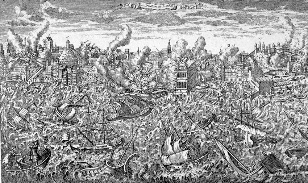
The 1755 Lisbon earthquake, also known as the Great Lisbon earthquake, impacted Portugal, the Iberian Peninsula, and Northwest Africa on the morning of Saturday, 1 November, Feast of All Saints, at around 09:40 local time. In combination with subsequent fires and a tsunami, the earthquake almost completely destroyed Lisbon and adjoining areas. Seismologists estimate the Lisbon earthquake had a magnitude of 7.7 or greater on the moment magnitude scale, with its epicenter in the Atlantic Ocean about west-southwest of Cape St. Vincent and about southwest of Lisbon. Chronologically, it was the third known large scale earthquake to hit the city (following those of 1321 and 1531). Estimates place the death toll in Lisbon at between 12,000 and 50,000 people, making it one of the deadliest earthquakes in history. The earthquake accentuated political tensions in Portugal and profoundly disrupted the Portuguese Empire. The event was widely discussed and dwelt upon by European ... [...More Info...] [...Related Items...] OR: [Wikipedia] [Google] [Baidu] |


.jpg)
