|
Cabeça Fundão
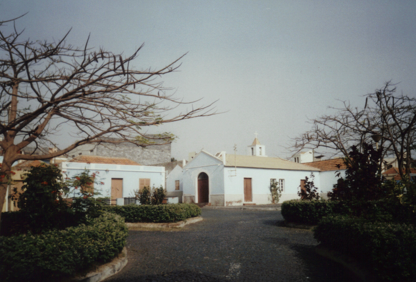
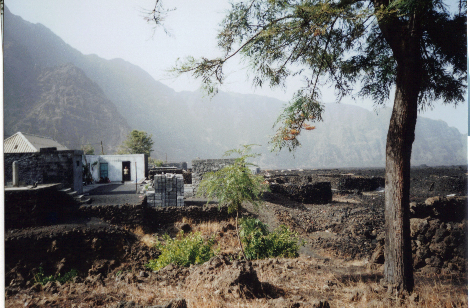
Cabeça Fundão is a settlement in the southern part of the island of Fogo, Cape Verde and sits on the foot of the mountain rim of Bordeira. It is situated 16 km east of the island capital São Filipe. In 2010 its population was 177. The village is located on the road from Achada Furna to Chã das Caldeiras (EN3-FG05). Its elevation is about 1,570 meters. Cabeça Fundão lies directly south of the Fogo Natural Park. See also *List of villages and settlements in Cape Verde This is a list of villages and smaller settlements in Cape Verde: Boa Vista * Bofarreira * Cabeça dos Tarrafes * Curral Velho - abandoned settlement * Espingueira - abandoned settlement * Estância de Baixo * Fundo das Figueiras * João Ga ... References {{DEFAULTSORT:Cabeca Fundao Villages and settlements in Fogo, Cape Verde Santa Catarina do Fogo ... [...More Info...] [...Related Items...] OR: [Wikipedia] [Google] [Baidu] |
Fogo, Cape Verde
Fogo (Portuguese for "fire") is an island in the Sotavento group of Cape Verde. Its population is 35,837 (2015),Cabo Verde, Statistical Yearbook 2015 Instituto Nacional de Estatística with an area of 476 km2. It reaches the highest altitude of all the islands in Cape Verde, rising to at the summit of its active volcano, |
Cape Verde
, national_anthem = () , official_languages = Portuguese , national_languages = Cape Verdean Creole , capital = Praia , coordinates = , largest_city = capital , demonym = Cape Verdean or Cabo Verdean , ethnic_groups_year = 2017 , government_type = Unitary semi-presidential republic , leader_title1 = President , leader_name1 = José Maria Neves , leader_title2 = Prime Minister , leader_name2 = Ulisses Correia e Silva , legislature = National Assembly , area_rank = 166th , area_km2 = 4033 , area_sq_mi = 1,557 , percent_water = negligible , population_census = 561,901 , population_census_rank = 172nd , population_census_year = 2021 , population_density_km2 = 123.7 , population_density_sq_mi = 325.0 , population_density_rank = 89th , GDP_PPP ... [...More Info...] [...Related Items...] OR: [Wikipedia] [Google] [Baidu] |
São Filipe, Cape Verde
São Filipe (Portuguese for "Saint Philip") is a cityCabo Verde, Statistical Yearbook 2015 Instituto Nacional de Estatística, p. 32-33 on the west coast of the island of Fogo, . It is the capital of the island, and the seat of the São Filipe Municipality. The island's a ... [...More Info...] [...Related Items...] OR: [Wikipedia] [Google] [Baidu] |
Achada Furna
Achada Furna is a settlement in the southern part of the island of Fogo, Cape Verde. It is situated 15 km east of the island capital São Filipe. At the 2010 census its population was 495. Its elevation is about 870 meters. Nearby places include Cabeça Fundão to the north, Figueira Pavão to the east, Fonte Aleixo to the south and Monte Largo to the west. Climate Its climate is cooler than the low-lying areas of the island. The average temperature is . Average rainfall is 366 millimeters, the highest is 149 mm in September and the lowest is without a single precipitation between the months of March and May. See also *List of villages and settlements in Cape Verde This is a list of villages and smaller settlements in Cape Verde: Boa Vista * Bofarreira * Cabeça dos Tarrafes * Curral Velho - abandoned settlement * Espingueira - abandoned settlement * Estância de Baixo * Fundo das Figueiras * João ... References {{Fogo Villages and settlements i ... [...More Info...] [...Related Items...] OR: [Wikipedia] [Google] [Baidu] |
Chã Das Caldeiras
Chã das Caldeiras (“Plain of the Calderas”) is a small community of approximately 700 inhabitants in the crater of the volcano Pico do Fogo on the island of Fogo, Cape Verde. The village consists of two main neighborhoods: Portela and Bangaeira, founded in 1920 and 1917, respectively.Parc Naturel de Fogo – Chã das Caldeiras Tentative list Unesco World Heritage sites At an elevation of about 1,700 meters, it is the highest village in Cape Verde. It is part of the municipality of . The main organizing body in the village is the ''Associação dos Agricultores de Chã'' (Chã Farmers Association), an agricultural coop ... [...More Info...] [...Related Items...] OR: [Wikipedia] [Google] [Baidu] |
Fogo Natural Park
Fogo Natural Park ( pt, Parque Natural do Fogo), on the island of Fogo, Cape Verde, Fogo, is one of ten "natural parks" in the country of Cape Verde.Parques Naturais Áreas protegidas Cabo Verde The protected area is ,Resolução nº 36/2016 Estratégia e Plano Nacional de Negócios das Áreas Protegidas which is 17.8% of the total area of the island. 50% of the park lies within the municipality Santa Catarina do Fogo, 28% in Mosteiros, Cape Verde (municipality), municipality of Mosteiros and 22% in São Filipe, Cape Verde (municipality), São Filipe. The natural park is situated in the interior of the island, and covers the ... [...More Info...] [...Related Items...] OR: [Wikipedia] [Google] [Baidu] |
Road To Caldera In Fogo & Pico De Fogo, 2010 12
A road is a linear way for the conveyance of traffic that mostly has an improved surface for use by vehicles (motorized and non-motorized) and pedestrians. Unlike streets, the main function of roads is transportation. There are many types of roads, including parkways, avenues, controlled-access highways (freeways, motorways, and expressways), tollways, interstates, highways, thoroughfares, and local roads. The primary features of roads include lanes, sidewalks (pavement), roadways (carriageways), medians, shoulders, verges, bike paths (cycle paths), and shared-use paths. Definitions Historically many roads were simply recognizable routes without any formal construction or some maintenance. The Organization for Economic Co-operation and Development (OECD) defines a road as "a line of communication (travelled way) using a stabilized base other than rails or air strips open to public traffic, primarily for the use of road motor vehicles running on their own wheels", whic ... [...More Info...] [...Related Items...] OR: [Wikipedia] [Google] [Baidu] |
List Of Villages And Settlements In Cape Verde
This is a list of villages and smaller settlements in Cape Verde: Boa Vista * Bofarreira * Cabeça dos Tarrafes * Curral Velho - abandoned settlement * Espingueira - abandoned settlement * Estância de Baixo * Fundo das Figueiras * João Galego * Povoação Velha * Prazeres - abandoned settlement Brava * Cachaço * Campo Baixo * Cova Joana * Cova Rodela * Fajã de Água * João da Noly * Lem * Mato * Mato Grande * Nossa Senhora do Monte * Santa Bárbara * Tantum * Tomé Barraz * Vinagre Fogo * Achada Furna * Achada Grande * Atalaia * Cabeça Fundão * Campanas Baixo * Chã das Caldeiras * Corvo * Curral Grande * Estância Roque * Fajãzinha * Feijoal * Figueira Pavão * Fonte Aleixo * Galinheiro * As Hortas * Lagariça * Lomba * Miguel Gonçalves * Monte Grande * Patim * Ponta Verde * Relva * Ribeira do Ilhéu * Salto * Santo António * São Filipe * São Jorge * Tinteira * Vicente Dias Maio * Alcatraz * Barreiro * Calheta * Cascabulho * Figueir ... [...More Info...] [...Related Items...] OR: [Wikipedia] [Google] [Baidu] |
Villages And Settlements In Fogo, Cape Verde
A village is a clustered human settlement or community, larger than a hamlet but smaller than a town (although the word is often used to describe both hamlets and smaller towns), with a population typically ranging from a few hundred to a few thousand. Though villages are often located in rural areas, the term urban village is also applied to certain urban neighborhoods. Villages are normally permanent, with fixed dwellings; however, transient villages can occur. Further, the dwellings of a village are fairly close to one another, not scattered broadly over the landscape, as a dispersed settlement. In the past, villages were a usual form of community for societies that practice subsistence agriculture, and also for some non-agricultural societies. In Great Britain, a hamlet earned the right to be called a village when it built a church. [...More Info...] [...Related Items...] OR: [Wikipedia] [Google] [Baidu] |


