|
Wabasha County, Minnesota
Wabasha County is a county in the U.S. state of Minnesota. As of the 2020 census, the population was 21,387. Its county seat is Wabasha. Wabasha County is part of the Rochester Metropolitan Statistical Area. History The recently organized Minnesota Territory legislature created Wabasha County on October 27, 1849, one of nine original counties in the territory. An area on the Mississippi River's west bank, originally called Cratte's Landing, had grown into a town named Wabasha, then a city, and when the legislature created the county west of the river around this city, Wabasha was designated the county seat. The city had been named for three successive chiefs of Mississippi bands of Dakota Indians. Wabasha County's area was reduced in 1853 when sections were partitioned off to create Fillmore, Goodhue, and Rice counties. More area was partitioned off in 1854 to create Winona County, and another part in 1855 to create Olmsted County. The county boundaries have remained ... [...More Info...] [...Related Items...] OR: [Wikipedia] [Google] [Baidu] |
Wabasha, Minnesota
Wabasha is a city and the county seat of Wabasha County, Minnesota, United States. The population was 2,559 at the time of the 2020 census. It is on the Mississippi River, near its confluence with the Zumbro River. Name Wabasha is named after the Mdewakanton Dakota mixed-blood (with Anishinaabe) chiefs Wapi-sha, or red leaf (''wáȟpe šá'' - leaf red), father (1718–1806), son (1768–1855), and grandson (±1816–1876) of the same name. The second, Wabishaw the son, signed the 1830 USA treaty with the "Confederated Tribes of the Sacs and Foxes; the Medawah-Kanton, Wahpacoota, Wahpeton and Sissetong Bands or Tribes of Sioux; the Omahas, Ioways, Ottoes and Missourias" in Prairie du Chien. The grandson, Wabasha III (±1816–1876), signed the 1851 and 1858 treaties that ceded the southern half of what is now the state of Minnesota to the United States, beginning the removal of his band to the Minnesota River, then removal from Minnesota to Crow Creek Reservation in Dakot ... [...More Info...] [...Related Items...] OR: [Wikipedia] [Google] [Baidu] |
Whitewater River (Minnesota)
The Whitewater River is a U.S. Geological Survey. National Hydrography Dataset high-resolution flowline dataThe National Map accessed October 4, 2012 tributary of the Upper Mississippi River which flows through the Driftless Area of Minnesota, reaching its mouth in Wabasha County at the community of Weaver opposite Buffalo, Wisconsin. The nearest towns are Altura, Saint Charles, and Elba. The region hosts endangered native dry oak savannas, semiforested areas that seem to have been dependent on fire for their well-being. The main stem of the Whitewater River is formed by the confluence of the North Fork Whitewater River and Middle Fork Whitewater River at Elba, and is joined by the South Fork Whitewater River, just downstream. The North Fork flows through Wabasha, Olmsted, and Winona counties, with a "channel length of 47 km" (c. 30 miles). The upper branches of the Whitewater River system including the portion that flows through Whitewater State Park are designated trout s ... [...More Info...] [...Related Items...] OR: [Wikipedia] [Google] [Baidu] |
Buffalo County, Wisconsin
Buffalo County is a County (United States), county located in the U.S. state of Wisconsin. As of the 2020 United States census, 2020 census, the population was 13,317. Its county seat is Alma, Wisconsin, Alma. The county was created in 1853 and organized the following year. The county is considered a high-farming concentration county by the U.S. Department of Agriculture, meaning at least 20 percent of its earnings came from agriculture. History Buffalo County, founded in 1853, is named for the Buffalo River (Wisconsin), Buffalo River, which flows from Strum, Wisconsin, Strum to Alma, where it empties into the Mississippi River. The Buffalo River obtained its name from the French voyager Father Louis Hennepin, who named it ''Riviere des Boeufs'' in 1680. The first permanent settlement was established in 1839, located in what is now Fountain City, Wisconsin, Fountain City. This settlement was originally named Holmes' Landing after a family who traded with the Sioux and Ojibwe pe ... [...More Info...] [...Related Items...] OR: [Wikipedia] [Google] [Baidu] |
Pepin County, Wisconsin
Pepin County ( ) is a county in the U.S. state of Wisconsin. As of the 2020 census, the population was 7,318, making it the fourth-least populous county in Wisconsin; it is also the smallest county in Wisconsin by area. Its county seat is Durand. Pepin County is the birthplace of Laura Ingalls Wilder, the author of the ''Little House on the Prairie'' children's books. History Pepin County was formed in the year 1858 from portions of neighboring Dunn County. Both the town of Pepin (originally named North Pepin in 1856), and the village of Pepin were named after Lake Pepin, a broadening of the Mississippi River between Pepin County and the Counties of Goodhue and Wabasha in the state of Minnesota. The lake itself is likely named for one or more of the Pepin families from the French Canadian city of Trois-Rivières in Quebec, Canada. Several Pepins appear in the early records, including the senior figure Guillaume dit Tranchemontagne and his descendants Pierre and Jean Pe ... [...More Info...] [...Related Items...] OR: [Wikipedia] [Google] [Baidu] |
Minnesota State Highway 247
Minnesota State Highway 247 (MN 247) is a highway in southeast Minnesota, which runs from its intersection with U.S. Highway 63 in Farmington Township, north of Rochester; and continues east to its eastern terminus at its intersection with State Highway 42 in the city of Plainview. Route description Highway 247 serves as an east–west route between Farmington Township, the unincorporated community of Potsdam, and the city of Plainview. In the city of Plainview, Highway 247 follows ''West Broadway'', which is also the main street of Plainview. The route is legally defined as Route 247 in the Minnesota Statutes. History Highway 247 was authorized on July 1, 1949. At the time it was marked, the highway was only paved in Potsdam and Plainview. The remainder of the route was paved in the mid-1950s. Major intersections References External links * {{commons category-inline, Minnesota State Highway 247Highway 247 at the Unofficial Minnesota Highways ... [...More Info...] [...Related Items...] OR: [Wikipedia] [Google] [Baidu] |
Minnesota State Highway 74
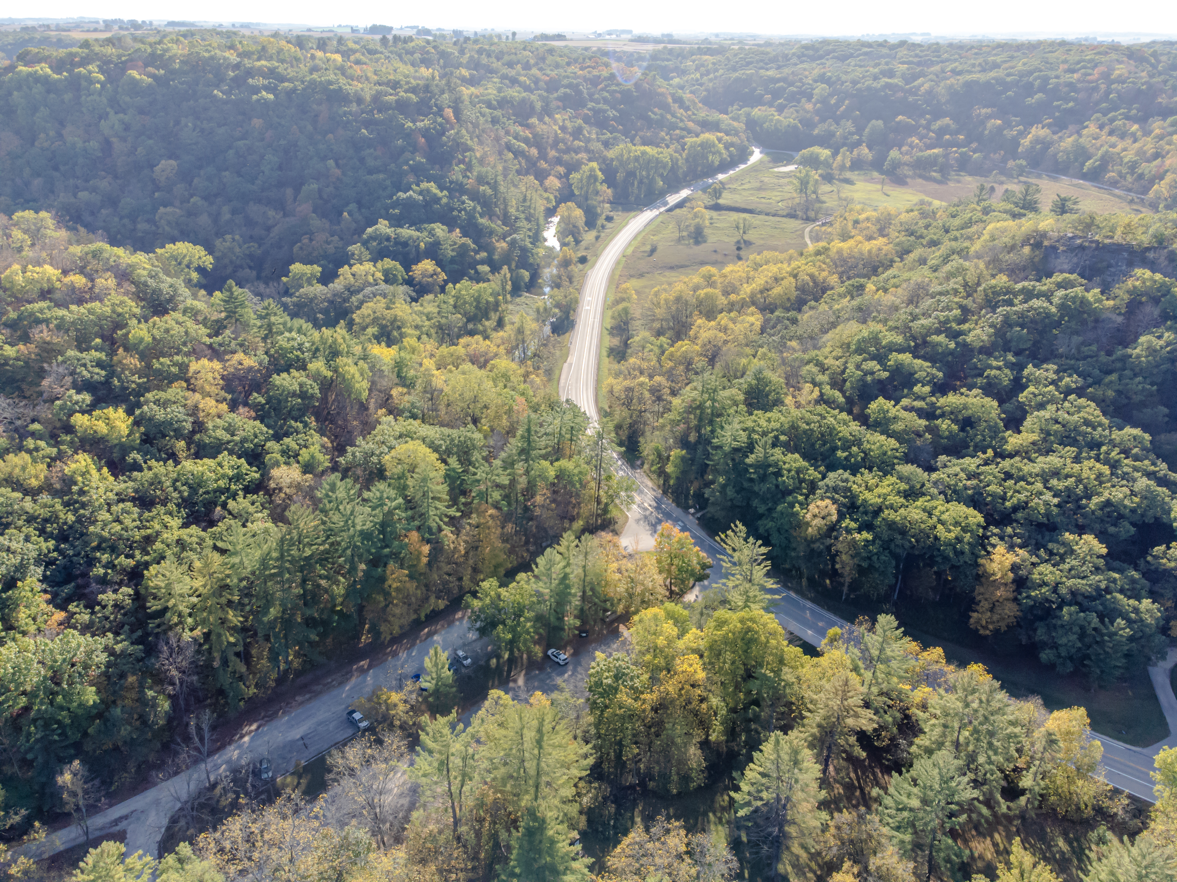
Minnesota State Highway 74 (MN 74) is a highway in southeast Minnesota that runs from its Intersection (road), intersection with U.S. Route 52 in Minnesota, U.S. Highway 52 and Minnesota State Highway 30, State Highway 30 in Chatfield, Minnesota, Chatfield and continues north to its northern terminus at its intersection with U.S. Route 61 in Minnesota, U.S. Highway 61 at Weaver, Minnesota, Weaver along the Mississippi River. It is the only remaining road in the List of Minnesota state highways, state highway system that is still partially Road surface, unpaved. Route description State Highway 74 serves as a north–south route in southeast Minnesota between Chatfield, Minnesota, Chatfield, St. Charles, Minnesota, St. Charles, Elba, Minnesota, Elba, and Weaver, Minnesota, Weaver. It is legally defined as Legislative Route 74 in the Minnesota Statutes. Highway 74 begins at its Intersection (road), intersection with U.S. Route 52 in Minnesota, U.S. 52 and Minnesota State ... [...More Info...] [...Related Items...] OR: [Wikipedia] [Google] [Baidu] |
Minnesota State Highway 60
Trunk Highway 60 (MN 60) is a highway in southern Minnesota, which runs from Iowa Highway 60 at the Iowa state line (at Bigelow) and continues east-northeast to its eastern terminus at the Wisconsin state line (at Wabasha), where the route becomes Wisconsin Highway 25 upon crossing the Mississippi River. Highway 60 is the only state highway in Minnesota which runs from one border to another. The route runs in a general southwest-to-northeast direction. Its western half forms a large portion of the four-lane expressway connecting Sioux City and the Twin Cities. Route description State Highway 60 serves as an east–west marked route in southern Minnesota between Worthington, Windom, St. James, Mankato, Faribault, Zumbrota, and Wabasha. Highway 60 runs concurrently with U.S. Highway 59 south of and into Worthington; with U.S. Highway 71 in Windom; with State Highway 4 and State Highway 30 near St. James; with State Highway 15 near Madelia; and with ... [...More Info...] [...Related Items...] OR: [Wikipedia] [Google] [Baidu] |
MN-60
Trunk Highway 60 (MN 60) is a highway in southern Minnesota, which runs from Iowa Highway 60 at the Iowa state line (at Bigelow, Minnesota, Bigelow) and continues east-northeast to its eastern terminus at the Wisconsin state line (at Wabasha, Minnesota, Wabasha), where the route becomes Wisconsin Highway 25 upon crossing the Mississippi River. Highway 60 is the only state highway in Minnesota which runs from one border to another. The route runs in a general southwest-to-northeast direction. Its western half forms a large portion of the four-lane expressway connecting Sioux City, Iowa, Sioux City and the Twin Cities. Route description State Highway 60 serves as an east–west marked route in southern Minnesota between Worthington, Minnesota, Worthington, Windom, Minnesota, Windom, St. James, Minnesota, St. James, Mankato, Minnesota, Mankato, Faribault, Minnesota, Faribault, Zumbrota, Minnesota, Zumbrota, and Wabasha, Minnesota, Wabasha. Highway 60 runs Concurrency ( ... [...More Info...] [...Related Items...] OR: [Wikipedia] [Google] [Baidu] |
Minnesota State Highway 42
Minnesota State Highway 42 (MN 42) is a highway in southeast Minnesota, which runs from its interchange with Interstate 90 near Eyota and continues north and northeast to its northern terminus at its intersection with U.S. Highway 61 in Kellogg. Route description State Highway 42 serves as a north–south route between Eyota, Elgin, Plainview, and Kellogg in southeast Minnesota. The route is also known as ''Wabasha Street'' in Plainview and ''2nd Avenue'' in Elgin. Highway 42 passes through the Richard J. Dorer State Forest between Plainview and Kellogg in Wabasha County. Carley State Park is located four miles south of the junction Junction may refer to: Arts and entertainment * ''Junction'' (2012 film), an American film * ''Junction'' (2024 film), an American film * ''Jjunction'', a 2002 Indian film * ''Junction'' (album), a 1976 album by Andrew Cyrille * Junction (E ... of Highway 42 and Wabasha County Road 4 at Plainview. The park entrance i ... [...More Info...] [...Related Items...] OR: [Wikipedia] [Google] [Baidu] |
MN-42
Minnesota's 4th congressional district covers nearly all of Ramsey County, Minnesota, Ramsey County and part of Washington County, Minnesota, Washington County. It includes all of St. Paul, Minnesota, St. Paul and most of its northern and eastern suburbs, including Woodbury, Blaine, Roseville, and Maplewood. The district is solidly Minnesota Democratic-Farmer-Labor Party, Democratic, with a CPVI of D+18. It is currently represented by Betty McCollum of the Minnesota Democratic-Farmer-Labor Party (DFL). The DFL has held the seat without interruption since 1949 and all but one term (1947–1949) since the merger of the Democratic and Farmer-Labor Parties. One of the most diverse congressional districts in Minnesota, the 4th district has the second-largest immigrant population of Minnesota's congressional districts, at 15% of the population. The largest countries of origin are Laos, Thailand, Myanmar, Mexico, India, Ethiopia, and Somalia, with immigrant populations largely concen ... [...More Info...] [...Related Items...] OR: [Wikipedia] [Google] [Baidu] |


