|
Sixth Avenue
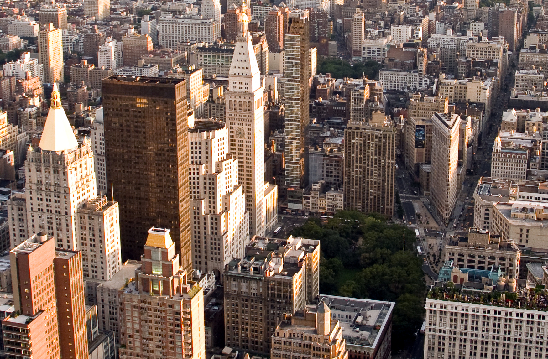
Sixth Avenue – also known as Avenue of the Americas, although this name is seldom used by New Yorkers, p.24 – is a major thoroughfare in New York City's borough of Manhattan, on which traffic runs northbound, or "uptown". It is commercial for much of its length. Sixth Avenue begins four blocks below Canal Street, at Franklin Street in TriBeCa, where the northbound Church Street divides into Sixth Avenue to the left and the local continuation of Church Street to the right, which then ends at Canal Street. From this beginning, Sixth Avenue traverses SoHo and Greenwich Village, roughly divides Chelsea from the Flatiron District and NoMad, passes through the Garment District and skirts the edge of the Theater District while passing through Midtown Manhattan. Sixth Avenue's northern end is at Central Park South, adjacent to the Artists' Gate entrance to Central Park via Center Drive. Historically, Sixth Avenue was also the name of the road that continued north of Central ... [...More Info...] [...Related Items...] OR: [Wikipedia] [Google] [Baidu] |
Church Street (Manhattan)
Church Street and Trinity Place form a single north–south roadway in Lower Manhattan, New York City. Its northern end is at Canal Street and its southern end is at Morris Street, where Trinity Place merges with Greenwich Street. The dividing point is Liberty Street. All traffic is northbound. Description Trinity Place branches off Greenwich Street at Morris Street, running uptown to the northeast, passing west of Trinity Church, the Trinity and United States Realty Buildings, and Zuccotti Park. At Liberty Street it becomes Church Street, which forms the eastern boundary of the World Trade Center to Vesey Street. At Franklin Street, a few blocks south of Canal Street, Avenue of the Americas (Sixth Avenue) branches off. Trinity Place, Church Street, and Avenue of the Americas form a continuous northbound through-route from Lower Manhattan to Central Park. Church Street is named after Trinity Church, a historic Gothic-style parish church on Broadway at Wall Street. ... [...More Info...] [...Related Items...] OR: [Wikipedia] [Google] [Baidu] |
Houston Street
Houston Street ( ) is a major east–west thoroughfare in Lower Manhattan in New York City. It runs the full width of the island of Manhattan, from FDR Drive along the East River in the east to the West Side Highway along the Hudson River in the west. The street is divided into west and east sections by Broadway. Houston Street generally serves as the boundary between neighborhoods on the East Side of Manhattan— Alphabet City, the East Village, NoHo, Greenwich Village, and the West Village to the north, and the Lower East Side, most of the Bowery, Nolita, and SoHo to the south. The numeric street-naming grid in Manhattan, created as part of the Commissioners' Plan of 1811, begins immediately north of Houston Street with 1st Street at Avenue A. The street's name is pronounced "", in contrast to the city of Houston, Texas, whose name is pronounced "". The street was named for William Houstoun, while the city was named for Sam Houston. Description At its east en ... [...More Info...] [...Related Items...] OR: [Wikipedia] [Google] [Baidu] |
Lenox Avenue
Lenox Avenue – also named Malcolm X Boulevard; both names are officially recognized – is the primary north–south route through Harlem in the upper portion of the New York City borough of Manhattan. This two-way street runs from Farmers' Gate at Central Park North ( 110th Street) to 147th Street. Its traffic is figuratively described as "Harlem's heartbeat" by Langston Hughes in his poem ''Juke Box Love Song''. The IRT Lenox Avenue Line runs under the entire length of the street, serving the New York City Subway's . From 119th Street to 123rd Street, Lenox Avenue is part of the Mount Morris Park Historic District, designated by the New York City Landmarks Preservation Commission in 1971. History Originally a part of Sixth Avenue, the segment north of Central Park was renamed in late 1887 for philanthropist James Lenox. In 1987, it was co-named Malcolm X Boulevard, in honor of the slain civil rights leader. The avenue was the heart of Harlem during the Harlem ... [...More Info...] [...Related Items...] OR: [Wikipedia] [Google] [Baidu] |
Central Park South
59th Street is a crosstown street in the New York City borough of Manhattan, running from York Avenue and Sutton Place on the East Side of Manhattan to the West Side Highway on the West Side. The three-block portion between Columbus Circle and Grand Army Plaza is known as Central Park South, since it forms the southern border of Central Park. The street is mostly continuous, except between Ninth Avenue/ Columbus Avenue and Columbus Circle, where the Time Warner Center is located. While Central Park South is a bidirectional street, most of 59th Street carries one-way traffic. 59th Street forms the border between Midtown Manhattan and Upper Manhattan. North of 59th Street, the neighborhoods of the Upper West Side and Upper East Side continue on either side of Central Park. On the West Side, Manhattan's numbered avenues are renamed north of 59th Street: Eighth Avenue (at Columbus Circle) becomes Central Park West; Ninth Avenue is renamed Columbus Avenue; Tenth Avenue is renamed ... [...More Info...] [...Related Items...] OR: [Wikipedia] [Google] [Baidu] |
Theater District, New York
New York City's Theater District (sometimes spelled Theatre District, and officially zoned as the "Theater Subdistrict") is an area and neighborhood in Midtown Manhattan where most Broadway theaters are located, as well as many other theaters, movie theaters, restaurants, hotels, and other places of entertainment. It is bounded by West 40th Street on the south, West 54th Street on the north, Sixth Avenue on the east and Eighth Avenue on the west, and includes Times Square. The Great White Way is the name given to the section of Broadway which runs through the Theater District. It also contains recording studios, record label offices, theatrical agencies, television studios, restaurants, movie theaters, Duffy Square, Shubert Alley, the Brill Building, and Madame Tussauds New York. Boundaries The City of New York defines the subdistrict for zoning purposes to extend from 40th Street to 57th Street and from Sixth Avenue to Eighth Avenue, with an additional area west of Eighth ... [...More Info...] [...Related Items...] OR: [Wikipedia] [Google] [Baidu] |
Garment District, New York City
The Garment District, also known as the Garment Center, the Fashion District, or the Fashion Center, is a neighborhood located in the borough of Manhattan in New York City. The dense concentration of fashion-related uses give the neighborhood its name. The neighborhood, less than , is generally considered to lie between Fifth Avenue and Ninth Avenue, from 34th to 42nd Streets. The neighborhood is home to many of New York City's showrooms and to numerous major fashion labels, and caters to all aspects of the fashion process from design and production to wholesale selling. The Garment District has been known since the early 20th century as the center for fashion manufacturing and fashion design in the United States, and even the world. Geography By the late 1930s, the Garment District was broadly surrounded by Sixth Avenue to the east, 25th Street to the south, Ninth Avenue to the west, and 42nd Street to the north. The southern portion, between 25th and 30th Streets, comprise ... [...More Info...] [...Related Items...] OR: [Wikipedia] [Google] [Baidu] |
NoMad
A nomad is a member of a community without fixed habitation who regularly moves to and from the same areas. Such groups include hunter-gatherers, pastoral nomads (owning livestock), tinkers and trader nomads. In the twentieth century, the population of nomadic pastoral tribes slowly decreased, reaching an estimated 30–40 million nomads in the world . Nomadic hunting and gathering—following seasonally available wild plants and game—is by far the oldest human subsistence method. Pastoralists raise herds of domesticated livestock, driving or accompanying them in patterns that normally avoid depleting pastures beyond their ability to recover. Nomadism is also a lifestyle adapted to infertile regions such as steppe, tundra, or ice and sand, where mobility is the most efficient strategy for exploiting scarce resources. For example, many groups living in the tundra are reindeer herders and are semi-nomadic, following forage for their animals. Sometimes also described as " ... [...More Info...] [...Related Items...] OR: [Wikipedia] [Google] [Baidu] |
Flatiron District
The Flatiron District is a neighborhood in the New York City borough of Manhattan, named after the Flatiron Building at 23rd Street, Broadway and Fifth Avenue. Generally, the Flatiron District is bounded by 14th Street, Union Square and Greenwich Village to the south; the Avenue of the Americas (Sixth Avenue) and Chelsea to the west; 23rd Street and Madison Square (or NoMad) to the north; and Park Avenue South and Gramercy Park to the east. Broadway cuts through the middle of the district, and Madison Avenue begins at 23rd Street and runs north. At the north (uptown) end of the district is Madison Square Park, which was completely renovated in 2001. The Flatiron District encompasses within its boundaries the Ladies' Mile Historic District and the birthplace of Theodore Roosevelt, a National Historic Site. The Flatiron District was also the birthplace of Silicon Alley, a metonym for New York's high technology sector, which has since spread beyond the area. The Flatiron ... [...More Info...] [...Related Items...] OR: [Wikipedia] [Google] [Baidu] |
Chelsea, Manhattan
Chelsea is a neighborhood on the West Side of the borough of Manhattan in New York City. The area's boundaries are roughly 14th Street to the south, the Hudson River and West Street to the west, and Sixth Avenue to the east, with its northern boundary variously described as near the upper 20sRegier, Hilda. "Chelsea (i)" in , pp.234-235 or 34th Street, the next major crosstown street to the north.Navarro, Mireya"In Chelsea, a Great Wealth Divide", ''The New York Times'', October 23, 2015. Accessed October 23, 2015. "Today's Chelsea, the swath west of Sixth Avenue between 14th and 34th Streets, could be the poster neighborhood for what Mayor Bill de Blasio calls the tale of two cities." To the northwest of Chelsea is the neighborhood of Hell's Kitchen, as well as Hudson Yards; to the northeast are the Garment District and the remainder of Midtown South; to the east are NoMad and the Flatiron District; to the southwest is the Meatpacking District; and to the south and ... [...More Info...] [...Related Items...] OR: [Wikipedia] [Google] [Baidu] |


