|
Shawfield F.C.
Shawfield Football Club was a Scottish football team that competed in the Junior set-up and won the Scottish Junior Cup in 1946–47. There are also a number of references to them being called Shawfield Juniors. History Shawfield was founded in 1918 and disbanded in 1960. Their home ground was Rosebery Park, located in the Oatlands area of Glasgow – this is close to, but not within, the Shawfield district of the town of Rutherglen which includes Shawfield Stadium. The club's first season in the Glasgow Junior League was in 1921–22. They remained a mid-table finishing side through five seasons in that league and four in its successor competition, the Scottish Intermediate League. In 1931–32, the first season of the next reorganisation — the '' Central Junior League'' — Shawfield won the championship, beating Yoker Athletic in the deciding match. In 1937, they were overall runners-up to Arthurlie, but in 1944 they finished dead last, only improving by one place the ... [...More Info...] [...Related Items...] OR: [Wikipedia] [Google] [Baidu] |
Rosebery Park
Rosebery Park was a football ground in the Oatlands area of Glasgow, Scotland. It was the home of Shawfield F.C. from 1918 to 1960, before being acquired by Glasgow Corporation as a venue for schools' football matches. The discovery that the site was contaminated led to the ground becoming derelict in the 1990s, and it was subsequently demolished. History Rosebery Park was named after the former Prime Minister, the 5th Earl of Rosebery. Located on the south-west side of Toryglen Street near Polmadie Road, it was the home of Shawfield from 1918 to 1960. Pollok also sometimes used the ground in the late 1920s whilst they were without a permanent ground. Following the demise of Shawfield, the Glasgow Corporation Education Committee arranged to buy the ground in 1961 in order to provide a venue for the schools' football competitions they organised. After being refurbished at a total cost of £14,000, the ground was reopened for schools' matches in April 1963. Proposals to stage sp ... [...More Info...] [...Related Items...] OR: [Wikipedia] [Google] [Baidu] |
Clydebank F
Clydebank ( gd, Bruach Chluaidh) is a town in West Dunbartonshire, Scotland. Situated on the north bank of the River Clyde, it borders the village of Old Kilpatrick (with Bowling, West Dunbartonshire, Bowling and Milton, West Dunbartonshire, Milton beyond) to the west, and the Yoker and Drumchapel areas of the adjacent Glasgow, City of Glasgow immediately to the east. Depending on the definition of the town's boundaries, the suburban areas of Duntocher, Faifley and Hardgate either surround Clydebank to the north, or are its northern outskirts, with the Kilpatrick Hills beyond. Shires of Scotland, Historically part of Dunbartonshire and founded as a police burgh on 18 November 1886, Clydebank is part of the registration County of Dumbarton, the Dunbartonshire Lord Lieutenant, Crown Lieutenancy area, and the wider urban area of Greater Glasgow. History Early origins Clydebank is located within the historical boundaries of the ancient Kingdom of Strathclyde, the Mormaerdom of Lenno ... [...More Info...] [...Related Items...] OR: [Wikipedia] [Google] [Baidu] |
Parkhead F
Parkhead ( sco, Pairkheid) is a district in the East End of Glasgow. Its name comes from a small weaving hamlet at the meeting place of the Great Eastern Road (now the Gallowgate and Tollcross Road) and Westmuir Street. Glasgow's Eastern Necropolis cemetery was laid out in the area in 1847 beside the Gallowgate. History The area flourished with the discovery of coal in 1837 and grew into an industrial centre. In 1897 William Beardmore and Company became famous with the production of high grade steel and castings at the local ''Parkhead Forge'', founded about 1837 and extended between 1884 and 1914. After years of decline, the massive plant was closed in 1976, and in 1986 the construction of the first phase of The Forge Shopping Centre began on the site. The shopping centre opened in the autumn of 1988, and in 1994 an indoor market was added adjacent to it. The final element, a retail park, was completed in three stages between 1996 and 2002. Parkhead Cross is a major road ju ... [...More Info...] [...Related Items...] OR: [Wikipedia] [Google] [Baidu] |
Bridgeton Waverley F
{{geodis ...
Bridgeton may refer to: Scotland *Bridgeton, Glasgow South Africa *Bridgeton, Western Cape United States *Bridgeton, Indiana *Bridgeton Township, Michigan *Bridgeton, Missouri *Bridgeton, North Carolina * Bridgeton, New Jersey *Bridgeton, Portland, Oregon, a neighborhood in Portland, Oregon *Bridgeton Township, Pennsylvania See also *Bridgton (other) *Bridgetown (other) *MV Bridgeton *Bridgerton ''Bridgerton'' is an American historical- romance streaming television series created by Chris Van Dusen for Netflix. Based on the book series by Julia Quinn, it is Shondaland's first scripted show for Netflix. It revolves around the epony ... [...More Info...] [...Related Items...] OR: [Wikipedia] [Google] [Baidu] |
Pollok F
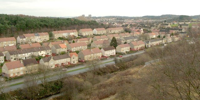
Pollok ( gd, Pollag, lit=a pool, sco, Powk) is a large housing estate on the south-western side of the city of Glasgow, Scotland. The estate was built either side of World War II to house families from the overcrowded inner city. Housing 30,000 at its peak, its population has since declined due to the replacement of substandard housing with lower-density accommodation. The main features of the area are the nearby Pollok Country Park, where the Burrell Collection is now housed, the ruins of Crookston Castle (within the north part of residential Pollok) which Mary, Queen of Scots once visited, and the Silverburn Centre, one of Glasgow's major indoor retail complexes. Location The country park and the White Cart Water which flows through it form the northern and eastern boundary of the district, with Corkerhill and Cardonald the closest northern suburbs. Recent developments in the late 20th and early 21st century have created an adjoining neighbourhood to the west of Pollok at ... [...More Info...] [...Related Items...] OR: [Wikipedia] [Google] [Baidu] |
Public Housing In The United Kingdom
Public housing in the United Kingdom, also known as council estates, council housing, or social housing, provided the majority of rented accommodation until 2011 when the number of households in private rental housing surpassed the number in social housing. Houses and flats built for public or social housing use are built by or for local authorities and known as council houses, though since the 1980s the role of non-profit housing associations became more important and subsequently the term "social housing" became more widely used, as technically council housing only refers to housing owned by a local authority, though the terms are largely used interchangeably. Before 1865, housing for the poor was provided solely by the private sector. Council houses were built on council estates, known as schemes in Scotland, where other amenities, like schools and shops, were often also provided. From the 1950s, blocks of flats and three-or-four-storey blocks of maisonettes were widely built, ... [...More Info...] [...Related Items...] OR: [Wikipedia] [Google] [Baidu] |
Pollok
Pollok ( gd, Pollag, lit=a pool, sco, Powk) is a large housing estate on the south-western side of the city of Glasgow, Scotland. The estate was built either side of World War II to house families from the overcrowded inner city. Housing 30,000 at its peak, its population has since declined due to the replacement of substandard housing with lower-density accommodation. The main features of the area are the nearby Pollok Country Park, where the Burrell Collection is now housed, the ruins of Crookston Castle (within the north part of residential Pollok) which Mary, Queen of Scots once visited, and the Silverburn Centre, one of Glasgow's major indoor retail complexes. Location The country park and the White Cart Water which flows through it form the northern and eastern boundary of the district, with Corkerhill and Cardonald the closest northern suburbs. Recent developments in the late 20th and early 21st century have created an adjoining neighbourhood to the west of Pollok at C ... [...More Info...] [...Related Items...] OR: [Wikipedia] [Google] [Baidu] |
Castlemilk
Castlemilk ( gd, Caisteal Mheilc) is a district of Glasgow, Scotland. It lies to the far south of the city centre, adjacent to the Croftfoot and Simshill residential areas within the city to the north-west, the town of Rutherglen - neighbourhoods of Spittal to the north-east and Fernhill to the east, Linn Park and its golf course to the west, and the separate village of Carmunnock further south across countryside. The area was developed by the Glasgow Corporation as a peripheral housing scheme in the 1950s to accommodate 34,000 people from inner-city slum areas such as the Gorbals. The new residents were provided with open spaces, a clean environment and indoor toilets and bathrooms. The modern development grew around Castlemilk House, a stately old mansion built around Cassilton Tower, which was started in 1460 on the site of a 13th-century castle, and was demolished in December 1969. The population had dropped from 37,000 in 1971 to roughly half that number in 1991. Howev ... [...More Info...] [...Related Items...] OR: [Wikipedia] [Google] [Baidu] |
Polmadie
Polmadie (; gd, Poll Mac Dè, lit=Son of God pool) is a primarily industrial area of Glasgow in Scotland. Situated south of the River Clyde, Polmadie is close to residential neighbourhoods including Govanhill (to the west) and Toryglen (south-east), with Oatlands and another large industrial zone at Shawfield to the north on the opposite side of major railway lines and the M74 motorway, Junction 1A of which serves the area. For over 50 years, the most prominent landmarks within Polmadie were the -high twin chimneys of a now disused waste incinerator plant operated by Glasgow City Council. This was replaced by a 'Recycling and Renewable Energy Centre' on the same site operated by Viridor with a less conspicuous stack. Also located in the area is Alstom's Polmadie Depot, a large railway maintenance facility for Avanti West Coast which is the most northerly train stabling and maintenance area on the West Coast Main Line (WCML), since the line runs through Polmadie on its final ... [...More Info...] [...Related Items...] OR: [Wikipedia] [Google] [Baidu] |
Gorbals
The Gorbals is an area in the city of Glasgow, Scotland, on the south bank of the River Clyde. By the late 19th century, it had become densely populated; rural migrants and immigrants were attracted by the new industries and employment opportunities of Glasgow. At its peak, during the 1930s, the wider Gorbals district (which includes the directly adjoined localities of Laurieston and Hutchesontown) had swollen in population to an estimated 90,000 residents. Along with its relatively small size, this gave the area a very high population density of around 40,000/km². Redevelopment after WWII has taken many turns, and the area's population is substantially smaller today. Meaning of placename The name is first documented in the 15th and 16th centuries as ''Gorbaldis'', and its etymology is unclear. It may be related to the Ecclesiastical Latin word ('sheaf'), found in the Scottish Gaelic term ('tenth sheaf'), a tithe of corn given to a parish rector. The taking of was a right ... [...More Info...] [...Related Items...] OR: [Wikipedia] [Google] [Baidu] |
Hutchesontown
Hutchesontown is an inner-city area in Glasgow, Scotland. Mostly residential, it is situated directly south of the River Clyde and forms part of the wider historic Gorbals district, which is covered by the Southside Central ward under Glasgow City Council. The area is linked to Glasgow Green public park on the north side of the river by St. Andrew's Suspension Bridge and King's Bridge. At its north-western edge, Albert Bridge is the closest crossing point towards Glasgow city centre. In McNeill Street, Hutchesontown has one of Glasgow's original Carnegie libraries, deftly designed by the Inverness-born architect James Robert Rhind. James Stokes, recipient of the Victoria Cross, was from the area. Comprehensive Development Area Following the Second World War, Hutchesontown was declared a Comprehensive Development Area (CDA) in 1957, in the aftermath of the Bruce Report. [...More Info...] [...Related Items...] OR: [Wikipedia] [Google] [Baidu] |
Overspill Estate
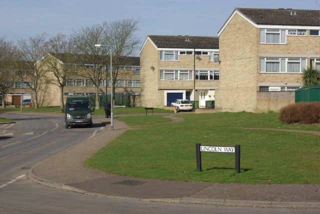
An overspill estate is a housing estate planned and built for the housing of excess population in urban areas, both from the natural increase of population and often in order to rehouse people from decaying inner city areas, usually as part of the process of slum clearance. They were created on the outskirts of most large British towns and during most of the 20th century, with new towns being an alternative approach outside London after World War II. The objective of this was to bring more economic activity to these smaller communities, whilst relieving pressure on overpopulated areas of major cities. The Town Development Act 1952 encouraged the expansion of neighbouring urban areas rather than the creation of satellite communities. The authorities wished to divert people living in poor conditions within highly populous cities to better conditions on the outskirts of these cities. Overspill not only involves moving people to a new area, but requires industry and employment to follow ... [...More Info...] [...Related Items...] OR: [Wikipedia] [Google] [Baidu] |

_-_geograph.org.uk_-_562738.jpg)


.jpg)


