|
San Javier, Murcia
San Javier () is a small town and municipality in the autonomous community and province of Murcia in southeastern Spain. The municipality is situated at the northern end of Murcia's Mediterranean coastline, the Costa Cálida. History There is little trace in the historical and archaeological record of early human habitation in the municipality itself. There is, however, evidence of prehistoric human presence at several nearby locations, including Cabezo Gordo hill in Torre-Pacheco and the salty coastal lagoon, the Mar Menor. San Javier was prized for its climate in Roman Hispania, and for the Mar Menor, where a salt industry developed. Traces of Roman and Carthaginian presence remain. A major Roman road, the '' Via Augusta'', passes through the area and there are several underwater sites where, among other artefacts, pots and amphorae have been found. In Al-Andalus, during Islamic rule in the Iberian Peninsula, while there was little Arab or Berber presence in th ... [...More Info...] [...Related Items...] OR: [Wikipedia] [Google] [Baidu] |
Municipalities Of Spain
The municipality ( es, municipio, , ca, municipi, gl, concello, eu, udalerria, ast, conceyu)In other languages of Spain: * Catalan/Valencian (), sing. ''municipi''. * Galician () or (), sing. ''municipio''/''bisbarra''. * Basque (), sing. ''udalerria''. * Asturian (), sing. ''conceyu''. is the basic local administrative division in Spain together with the province. Organisation Each municipality forms part of a province which in turn forms part or the whole of an autonomous community (17 in total plus Ceuta and Melilla): some autonomous communities also group municipalities into entities known as '' comarcas'' (districts) or '' mancomunidades'' (commonwealths). There are a total of 8,131 municipalities in Spain, including the autonomous cities of Ceuta and Melilla. In the Principality of Asturias, municipalities are officially named ''concejos'' (councils). The average population of a municipality is about 5,300, but this figure masks a huge range: the most po ... [...More Info...] [...Related Items...] OR: [Wikipedia] [Google] [Baidu] |
Via Augusta
The ''Via Augusta'' (also known as the ''Via Herculea'' or ''Via Exterior'') was the longest and busiest of the major roads built by the Romans in ancient Hispania (the Iberian Peninsula). According to historian Pierre Sillières, who has supervised excavation of Roman sites in Spain to identify the exact route followed by the Via Augusta, it was more a system of roads than a single road. Approximately long, the Via Augusta was built to link Spain with Italy, running from the interior city of ''Gades'' (Cádiz) to the Pyrenees Mountains along inland valleys parallel to the coast of the Mediterranean Sea. As the main axis of the road network in Roman Hispania, it appears in ancient sources such as the itinerary inscribed on the Vicarello Cups as well in as the Antonine Itinerary. The highway was named after the emperor Augustus, who ordered reconstruction of the previously existing ''Via Herculea'' (or ''Via Heraklea''), which ran from the Pyrenees to ''Carthago Nova'', and ... [...More Info...] [...Related Items...] OR: [Wikipedia] [Google] [Baidu] |
Military Aerodrome
An air base (sometimes referred to as a military air base, military airfield, military airport, air station, naval air station, air force station, or air force base) is an aerodrome used as a military base by a military force for the operation of military aircraft. Air base facilities An air base typically has some facilities similar to a civilian airport—for example, air traffic control and firefighting. Some military aerodromes have passenger facilities; for example RAF Brize Norton in England has a terminal used by passengers for the Royal Air Force's flights. A number of military air bases also have a civil enclave for commercial passenger flights, e.g. Beijing Nanyuan Airport (China), Chandigarh Airport (India), Ibaraki Airport (Japan), Burlington International Airport (USA), Sheikh Ul-Alam International Airport Srinagar (India), Taipei Songshan Airport (Taiwan). Some air bases have revetments, hardened aircraft shelters, or even underground hangars, to protect airc ... [...More Info...] [...Related Items...] OR: [Wikipedia] [Google] [Baidu] |
AEMET
The State Meteorological Agency (, AEMET) is a state agency of the Government of Spain responsible for providing weather forecast, warnings of hazardous weather and assisting the administrations in such matters. The AEMET is part of the Secretariat of State for Environment of the Ministry for the Ecological Transition and is headquartered in the University City, Madrid. The agency was known as Central Institute of Meteorology from 1887 to 1978 and National Institute of Meteorology from 1978 to 2008 when it adopted its current name. The AEMET performs its task through a collection of data from its network of centers. The agency has centers distributed through the regions and it has offices in almost every airport and air force base. In addition, there are synoptic observatories spread throughout the Spanish geography. It represents Spain in international meteorological institutions, such as the World Meteorological Organization (WMO), the European Organisation for the Exploitat ... [...More Info...] [...Related Items...] OR: [Wikipedia] [Google] [Baidu] |
La Manga Del Mar Menor
La Manga (), or La Manga del Mar Menor (meaning "The Sandbar of the Minor Sea") is a seaside spit of Mar Menor in the Region of Murcia, Spain. The strip is 21 km long and 100 metres wide (average), separating the Mediterranean Sea from the Mar Menor (Minor Sea) lagoon, from Cabo de Palos to the Punta del Mojón. Historically, it was known by the Romans as ''Palus'' and later by the Moors as ''Al Buhayrat Al Qsarand''. In the 17th century its name changed to ''Mar Chico'', meaning "small sea" and later as El Mar Menor. Originally, it was a bay opening into the Mediterranean; at either end, volcanic reefs gradually held back the sand and sediment that was dragged along by the sea currents to form a sandy column of dunes and rock vegetation and long beaches in contact with two seas. La Manga sandbar is cut off by natural channels that keep the two seas in contact with each other; the so-called ''golas'' allow water from the Mediterranean into the lake. As such, the spac ... [...More Info...] [...Related Items...] OR: [Wikipedia] [Google] [Baidu] |
Santiago De La Ribera
San Javier () is a small town and municipality in the autonomous community and province of Murcia in southeastern Spain. The municipality is situated at the northern end of Murcia's Mediterranean coastline, the Costa Cálida. History There is little trace in the historical and archaeological record of early human habitation in the municipality itself. There is, however, evidence of prehistoric human presence at several nearby locations, including Cabezo Gordo hill in Torre-Pacheco and the salty coastal lagoon, the Mar Menor. San Javier was prized for its climate in Roman Hispania, and for the Mar Menor, where a salt industry developed. Traces of Roman and Carthaginian presence remain. A major Roman road, the ''Via Augusta'', passes through the area and there are several underwater sites where, among other artefacts, pots and amphorae have been found. In Al-Andalus, during Islamic rule in the Iberian Peninsula, while there was little Arab or Berber presence in the terr ... [...More Info...] [...Related Items...] OR: [Wikipedia] [Google] [Baidu] |
Oran
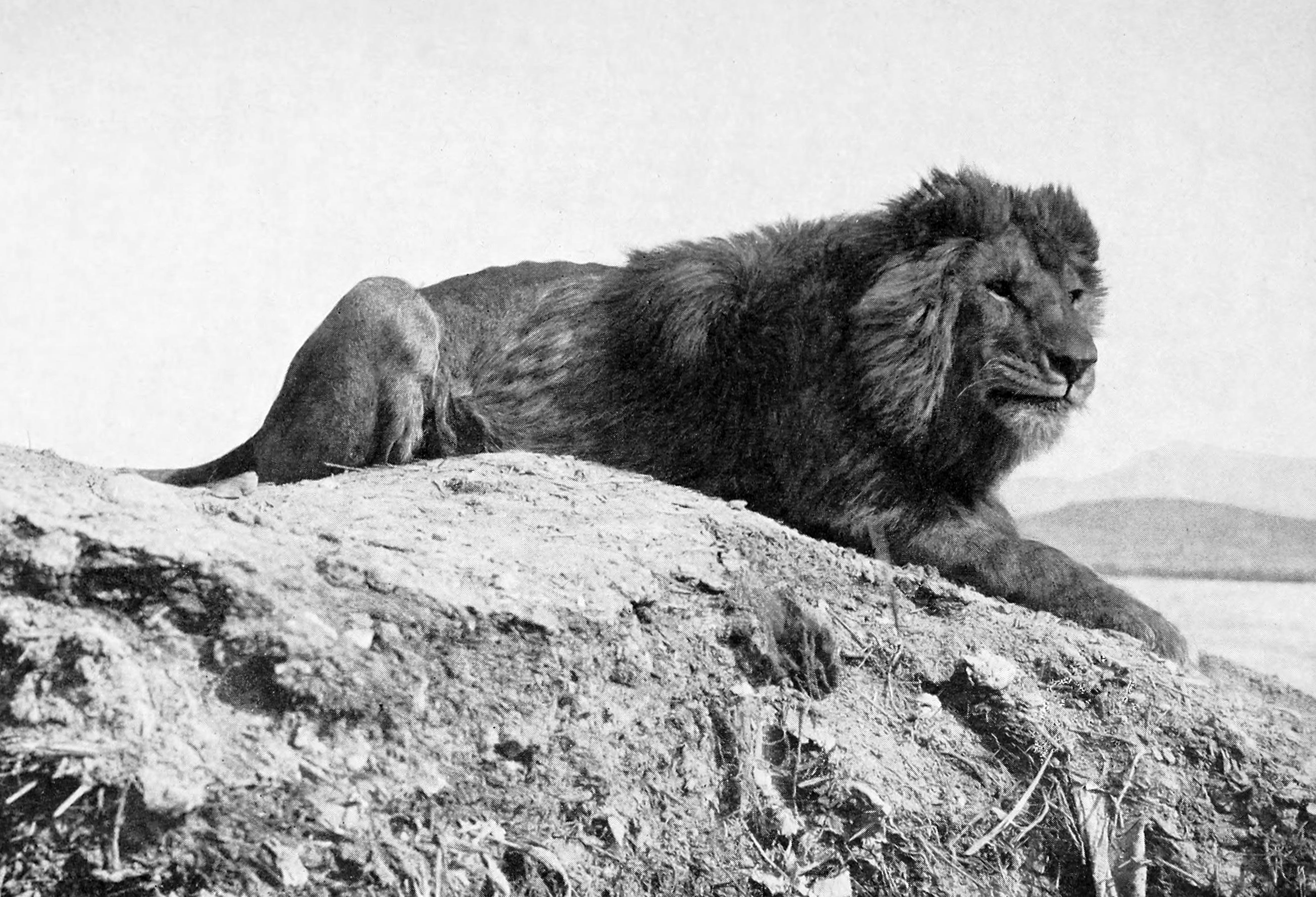
Oran ( ar, وَهران, Wahrān) is a major coastal city located in the north-west of Algeria. It is considered the second most important city of Algeria after the capital Algiers, due to its population and commercial, industrial, and cultural importance. It is west-south-west from Algiers. The total population of the city was 803,329 in 2008, while the metropolitan area has a population of approximately 1,500,000 making it the second-largest city in Algeria. Etymology The word ''Wahran'' comes from the Berber expression ''wa - iharan'' (place of lions). A locally popular legend tells that in the period around AD 900, there were sightings of Barbary lions in the area. The last two lions were killed on a mountain near Oran, and it became known as ''la montagne des lions'' ("The Mountain of Lions"). Two giant lion statues stand in front of Oran's city hall, symbolizing the city. History Overview During the Roman Empire, a small settlement called ''Unica Colonia'' existed in ... [...More Info...] [...Related Items...] OR: [Wikipedia] [Google] [Baidu] |
La Unión, Murcia
La Unión is situated in the Region of Murcia in the southeast of Spain. It has an area of 24.6 km², and had a population of 19,907 on 1 January 2018. It has an elevation of 86 m. Its average annual temperature is 17 °C. It has balmy winters. The sun shines 320 days per year. La Unión is situated in one of the sunniest areas in Europe; this kind of climate makes possible the many leisure activities, popular fiestas, sports, and cultural activities that are held in the town. The town is linked by a regular train to Cartagena which allows views of the past industrial heritage of the area (lead, alum and silver mining) and the more modern occupations of agriculture and tourism. La Unión lies within the built-up area of Cartagena and is surrounded on all landward sides by the City of Cartagena. The rich mines of La Union provided most of the silver and lead needed by the Late Roman Republic, as it was studied by the archaeologist Eulalia Sintas Martínez. Geography T ... [...More Info...] [...Related Items...] OR: [Wikipedia] [Google] [Baidu] |
Taifa
The ''taifas'' (singular ''taifa'', from ar, طائفة ''ṭā'ifa'', plural طوائف ''ṭawā'if'', a party, band or faction) were the independent Muslim principalities and kingdoms of the Iberian Peninsula (modern Portugal and Spain), referred to by Muslims as al-Andalus, that emerged from the decline and fall of the Umayyad Caliphate of Córdoba between 1009 and 1031. They were a recurring feature of al-Andalus history. The ''taifas'' were eventually incorporated by the Almoravid dynasty in the late 11th century and, on its collapse, many ''taifas'' re-appeared only to be incorporated by the Almohad Caliphate. The fall of the Almohads resulted in a flourishing of the ''taifas'', and this was the case despite constant warfare with Christian kingdoms. Taifa kings were wary of calling themselves “kings,” so they took the title of ''hajib'', presenting themselves as representatives for a temporarily absent caliph. The ''taifa'' courts were renowned centres of cultural ... [...More Info...] [...Related Items...] OR: [Wikipedia] [Google] [Baidu] |
Alfonso X Of Castile
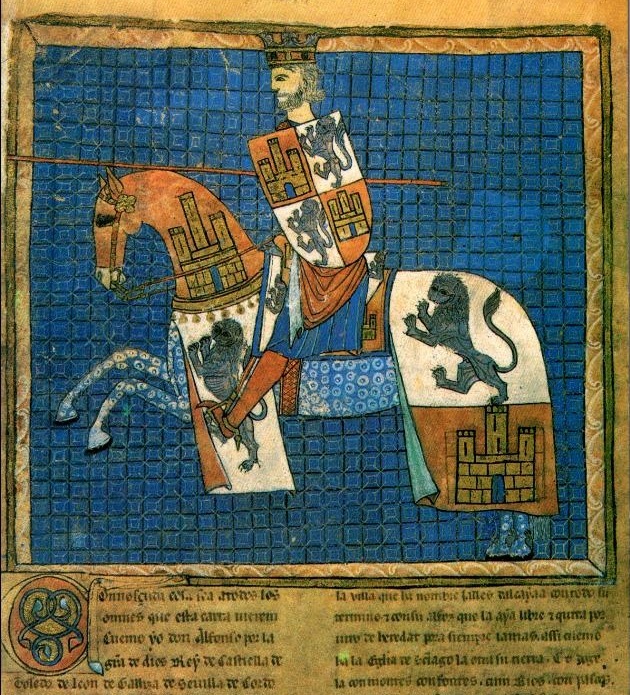
Alfonso X (also known as the Wise, es, el Sabio; 23 November 1221 – 4 April 1284) was King of Castile, León and Kingdom of Galicia, Galicia from 30 May 1252 until his death in 1284. During the April 1257 Imperial election, election of 1257, a dissident faction chose him to be king of Germany on 1 April. He renounced his claim to Germany in 1275, and in creating an alliance with the Kingdom of England in 1254, his claim on the Duchy of Gascony as well. Alfonso X fostered the development of a cosmopolitan court that encouraged learning. Jews, Muslims, and Christians were encouraged to have prominent roles in his court. As a result of his encouraging the translation of works from Arabic and Latin into the vernacular of Castile, many intellectual changes took place, including the encouragement of the use of Castilian language, Castilian as a primary language of higher learning, science, and law. Alfonso was a prolific author of Galician-Portuguese lyric, Galician poetry, such a ... [...More Info...] [...Related Items...] OR: [Wikipedia] [Google] [Baidu] |


