|
Salem, Virginia
Salem is an independent city in the U.S. commonwealth of Virginia. As of the 2020 census, the population was 25,346. It is the county seat of Roanoke County, although the two are separate jurisdictions. The Bureau of Economic Analysis combines the city of Salem with Roanoke County, which surrounds both Salem and the neighboring City of Roanoke, for statistical purposes. Salem has its own courthouse and sheriff's office, but shares a jail with Roanoke County, which is located in the Roanoke County Courthouse complex in Salem. The Roanoke County Sheriff's Office and Roanoke County Department of Social Services are also located within Salem, though the county administrative offices are located in unincorporated Cave Spring. Roanoke College is located in the city. Salem is also the home to a minor league baseball team, the Salem Red Sox. History The earliest history of Salem exists as archaeological evidence of Native American tribes from as far back as 8000 B.C. until th ... [...More Info...] [...Related Items...] OR: [Wikipedia] [Google] [Baidu] |
Salem, Page County, Virginia
Salem, Page County is an unincorporated community in Page County, in the U.S. state of Virginia. The John Beaver House was listed on the National Register of Historic Places The National Register of Historic Places (NRHP) is the United States federal government's official list of districts, sites, buildings, structures and objects deemed worthy of preservation for their historical significance or "great artist ... in 1979. References * Unincorporated communities in Virginia Unincorporated communities in Page County, Virginia {{PageCountyVA-geo-stub ... [...More Info...] [...Related Items...] OR: [Wikipedia] [Google] [Baidu] |
County Seat
A county seat is an administrative center, seat of government, or capital city of a county or civil parish. The term is in use in Canada, China, Hungary, Romania, Taiwan, and the United States. The equivalent term shire town is used in the US state of Vermont and in some other English-speaking jurisdictions. County towns have a similar function in the Republic of Ireland and the United Kingdom, as well as historically in Jamaica. Function In most of the United States, counties are the political subdivisions of a state. The city, town, or populated place that houses county government is known as the seat of its respective county. Generally, the county legislature, county courthouse, sheriff's department headquarters, hall of records, jail and correctional facility are located in the county seat, though some functions (such as highway maintenance, which usually requires a large garage for vehicles, along with asphalt and salt storage facilities) may also be located or conduct ... [...More Info...] [...Related Items...] OR: [Wikipedia] [Google] [Baidu] |
Interstate 81
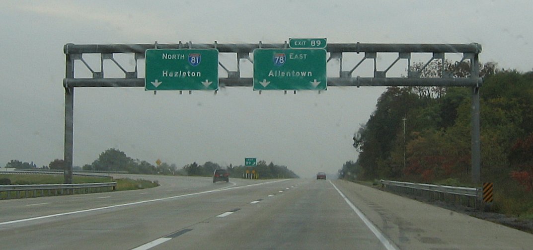
Interstate 81 (I-81) is a north–south (physically northeast–southwest) Interstate Highway in the eastern part of the United States. Its southern terminus is at I-40 in Dandridge, Tennessee; its northern terminus is on Wellesley Island, New York at the Canadian border, where the Thousand Islands Bridge connects it to Highway 137 and ultimately to Highway 401, the main Ontario freeway connecting Detroit via Toronto to Montreal. The major metropolitan areas along the route of I-81 include the Tri-Cities of Tennessee; Roanoke in Virginia; Harrisburg and the Wyoming Valley in Pennsylvania; and Syracuse in New York. I-81 largely traces the paths created down the length of the Appalachian Mountains through the Great Appalachian Valley by migrating animals, indigenous peoples, and early settlers. It also follows a major corridor for troop movements during the Civil War. These trails and roadways gradually evolved into US Route 11 (US 11); I-81 parall ... [...More Info...] [...Related Items...] OR: [Wikipedia] [Google] [Baidu] |
US-11
{{Infobox road , country=USA , type=US , route=11 , map={{maplink, frame=yes, plain=yes, frame-align=center, frame-width=290, frame-height=330, type=line, from=U.S. Route 11.map , map_custom=yes , map_notes=US 11 in red, US 11E in blue, US 11W in magenta , length_mi=1645 , length_ref={{cite web , url=http://sp.route.transportation.org/Pages/U.S.RouteNumberDatabase(Dec2009).aspx , title=U.S. Route Number Database , date=December 2009 , publisher=American Association of State Highway and Transportation Officials , access-date=December 6, 2016 , url-status=live , archive-url=https://web.archive.org/web/20180404173146/http://sp.route.transportation.org/Pages/U.S.RouteNumberDatabase(Dec2009).aspx , archive-date=April 4, 2018 , established={{start date, 1926, 11, 11{{{cite map , author1= Bureau of Public Roads , author2= American Association of State Highway Officials , date= November 11, 1926 , title= United States System of Highways Adopted for Uniform Marking by the American Associati ... [...More Info...] [...Related Items...] OR: [Wikipedia] [Google] [Baidu] |
Roanoke County
Roanoke County ( ) is a county located in the U.S. state of the Commonwealth of Virginia. As of the 2020 census, the population was 96,929. Its county seat is Salem, but the county administrative offices are located in the unincorporated Cave Spring area of the county. Roanoke County is part of the Roanoke, Virginia Metropolitan Statistical Area and located within the Roanoke Region of Virginia. The independent cities of Roanoke and Salem (incorporated as such in 1884 and 1968 respectively) are located within the boundaries of Roanoke County, but are not a part of the county. The town of Vinton is the only municipality within the county. While significant areas of the county are rural and mountainous, most residents live in the suburbs near Roanoke and Salem in the Roanoke Valley. History The county was established by an act of the Virginia Legislature on March 30, 1838, from the southern part of Botetourt County. It was named for the Roanoke River, which in turn was ... [...More Info...] [...Related Items...] OR: [Wikipedia] [Google] [Baidu] |
Andrew Lewis (soldier)
Andrew Lewis (October 9, 1720 – September 26, 1781) was an Irish-born American pioneer, surveyor, military officer and politician in Colonial Virginia and during the American Revolutionary War. A colonel of militia during the French and Indian War, and brigadier general in the American Revolutionary War, his most famous victory was the Battle of Point Pleasant in Dunmore's War in 1774, although he also drove Lord Dunmore's forces from Norfolk and Gwynn's Island in 1776. He also helped found Liberty Hall (later Washington and Lee University) in 1776. Early and family life Lewis was born in County Donegal, Ireland, to Col. John Lewis (d. 1762) and his wife Margaret Lynn. In 1732 John Lewis, having killed his landlord in an altercation, fled to Virginia with his sons Andrew and Thomas. They became among the first settlers in then vast western Augusta County, John Lewis having received a large land grant before emigrating. Andrew Lewis received a basic education and learned th ... [...More Info...] [...Related Items...] OR: [Wikipedia] [Google] [Baidu] |
Tutelo People
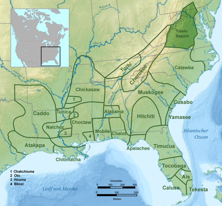
The Tutelo (also Totero, Totteroy, Tutera; Yesan in Tutelo) were Native American people living above the Fall Line in present-day Virginia and West Virginia. They spoke a Siouan dialect of the Tutelo language thought to be similar to that of their neighbors, the Monacan and Manahoac nations. Under pressure from English settlers and Seneca Iroquois, they joined with other Virginia Siouan tribes in the late 17th century and became collectively known as the Nahyssan. By 1740, they had largely left Virginia and migrated north to seek protection from their former Iroquois opponents. They were adopted by the Cayuga tribe of New York in 1753. Ultimately, their descendants migrated into Canada. Name The English name ''Tutelo'' comes from the Algonquian variant of the name that the Iroquois used for all the Virginia Siouan tribes: Toderochrone(many variant spellings). The Tutelo autonym (name for themselves) was Yesañ, Yesáh, Yesáng, Yesą, Yesan, Yesah, or Yesang. This may also be c ... [...More Info...] [...Related Items...] OR: [Wikipedia] [Google] [Baidu] |
Siouan Languages
Siouan or Siouan–Catawban is a language family of North America that is located primarily in the Great Plains, Ohio and Mississippi valleys and southeastern North America with a few other languages in the east. Name Authors who call the entire family ''Siouan'' distinguish the two branches as '' Western Siouan'' and ''Eastern Siouan'' or as ''Siouan-proper'' and ''Catawban''. Others restrict the name "Siouan" to the western branch and use the name ''Siouan–Catawban'' for the entire family. Generally, however, the name "Siouan" is used without distinction. Family division Siouan languages can be grouped into the Western Siouan languages and Catawban languages. The Western Siouan languages can be divided into Missouri River languages (such as Crow and Hidatsa), Mandan, Mississippi River languages (such as Dakotan, Chiwere-Winnebago, and Dhegihan languages), and Ohio Valley Siouan branches. The Catawban languages consist only of Catawban and Woccon. Proto-Siouan Pr ... [...More Info...] [...Related Items...] OR: [Wikipedia] [Google] [Baidu] |
Salem Red Sox
The Salem Red Sox are a Minor League Baseball affiliate of the Boston Red Sox of Major League Baseball (MLB), based in Salem, an independent city adjacent to Roanoke, Virginia. The team competes at the Single-A level in the Carolina League. Home games are played at Haley Toyota Field at Salem Memorial Ballpark, a 6,300-seat facility opened in 1995. The team first played in 1955, and then from 1957 to 1967, in the Appalachian League, initially at the now-defunct Class D level and then at the Rookie level starting in 1963. From 1968 through 2020, the team competed in the Carolina League, initially Class A and then Class A-Advanced starting in 1990. Prior to adopting the Red Sox name in 2009, the team was known as the Salem Avalanche from 1995 through 2008, when it was affiliated with the Colorado Rockies (1995–2002) and Houston Astros (2003–2008). Prior to 1995, the franchise played under several other names and affiliations. History The franchise debuted in 1955 and was ... [...More Info...] [...Related Items...] OR: [Wikipedia] [Google] [Baidu] |
Roanoke College
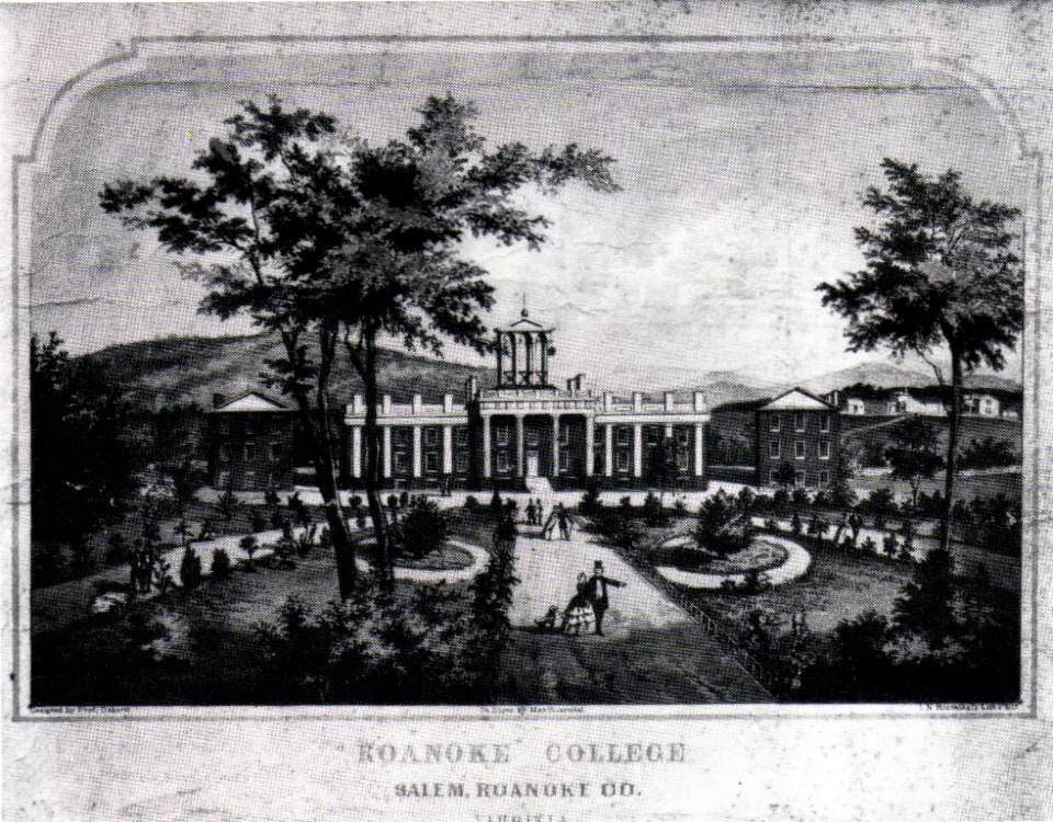
Roanoke College is a private liberal arts college in Salem, Virginia. It has approximately 2,000 students who represent approximately 40 states and 30 countries. The college offers 35 majors, 57 minors and concentrations, and pre-professional programs. Roanoke awards bachelor's degrees in arts, science, and business administration and is one of 280 colleges with a chapter of the Phi Beta Kappa honor society. Roanoke is an NCAA Division III school competing in the Old Dominion Athletic Conference. The college fields varsity teams in eleven men's and ten women's sports. Roanoke's athletic nickname is Maroons and the mascot is Rooney, a maroon-tailed hawk. History Early years A boys' preparatory school was founded by Lutheran pastors David F. Bittle and Christopher C. Baughmann. Originally located in Augusta County near Staunton, the school was named Virginia Institute until chartered on January 30, 1845, as Virginia Collegiate Institute. In 1847, the institute moved to Sal ... [...More Info...] [...Related Items...] OR: [Wikipedia] [Google] [Baidu] |
Cave Spring, Virginia
Cave Spring is a census-designated place (CDP) in Roanoke County, Virginia, United States. The population was 26,755 at the 2020 census. Cave Spring covers much of the area known locally as "Southwest County" which has the most affluent suburbs of Roanoke. It is part of the Roanoke Metropolitan Statistical Area. Roanoke County's administrative offices are located in Cave Spring, though the independent city of Salem is officially the county seat. The United States Postal Service considers most of the Cave Spring area to be unincorporated Roanoke City. Geography Cave Spring is located at (37.233170, −80.006252). According to the United States Census Bureau, the CDP has a total area of 11.8 square miles (30.6 km2), all of it land. Demographics As of the census of 2000, there were 24,941 people, 10,997 households, and 7,082 families residing in the CDP. The population density was 2,108.1 people per square mile (814.0/km2). There were 11,556 housing units at an a ... [...More Info...] [...Related Items...] OR: [Wikipedia] [Google] [Baidu] |


