|
Queanbeyan–Palerang Regional Council
Queanbeyan–Palerang Regional Council is a local government area located in the Southern Tablelands region of New South Wales, Australia. The council was formed on 12 May 2016 through a merger of the City of Queanbeyan and Palerang Council. The council has an area of and lies between the eastern boundary of the Australian Capital Territory and the coastal escarpment on both sides of the Great Dividing Range. At the m it had a population of 63,304. At the time of its establishment the council had an estimated population of . Towns and localities The Queanbeyan urban area contains the following localities The balance of the Queanbeyan–Palerang Regional Council area contains the towns of: It also contains the following localities: Demographics The population for the predecessor councils was estimated in 2015 as: * in City of Queanbeyan and * in Palerang Council Council Queanbeyan–Palerang Regional Council comprises eleven Councillors elected proportionally in a sing ... [...More Info...] [...Related Items...] OR: [Wikipedia] [Google] [Baidu] |
Australian Labor Party
The Australian Labor Party (ALP), also simply known as Labor, is the major centre-left political party in Australia, one of two major parties in Australian politics, along with the centre-right Liberal Party of Australia. The party forms the federal government since being elected in the 2022 election. The ALP is a federal party, with political branches in each state and territory. They are currently in government in Victoria, Queensland, Western Australia, South Australia, the Australian Capital Territory, and the Northern Territory. They are currently in opposition in New South Wales and Tasmania. It is the oldest political party in Australia, being established on 8 May 1901 at Parliament House, Melbourne, the meeting place of the first federal Parliament. The ALP was not founded as a federal party until after the first sitting of the Australian parliament in 1901. It is regarded as descended from labour parties founded in the various Australian colonies by the emerging la ... [...More Info...] [...Related Items...] OR: [Wikipedia] [Google] [Baidu] |
Palerang Council
The Palerang Council was a local government area located in the Southern Tablelands region of New South Wales, Australia. On 12 May 2016 the Minister for Local Government announced dissolution of the Palerang Council with immediate effect. Together with Queanbeyan City the combined council areas were merged to establish the Queanbeyan-Palerang Regional Council. Both councils had opposed the amalgamation. Elections for the new Council area were held in September 2017. The former mayor of Queanbeyan City Council was appointed by the New South Wales Government as administrator until that date. The last mayor of the Palerang Council was Cr. Pete Harrison, an independent politician. Municipal history Originally known as the Eastern Capital City Regional Council, Palerang was proclaimed on 11 February 2004 when Tallaganda Shire was amalgamated with most of Yarrowlumla Shire and small parts of Cooma-Monaro Shire, Gunning Shire and Mulwaree Shire. A 2015 review of local government ... [...More Info...] [...Related Items...] OR: [Wikipedia] [Google] [Baidu] |
The Ridgeway, New South Wales
The Ridgeway is a suburb just outside of Queanbeyan, New South Wales, Australia. People commonly mistake it for being a part of Queanbeyan, but it is part of the Queanbeyan-Palerang region, not the city of Queanbeyan. It is located on a ridge to the east of the central business district (CBD) on the Kings Highway. When it was established it was part of the Yarrowlumla Shire Yarrowlumla Shire was a local government area in New South Wales, which surrounded the Australian Capital Territory until February 2004, when it was divided between Palerang Council, Yass Valley Council, Queanbeyan City Council, Tumut Shire and .... At the , it had a population of 162. References Queanbeyan Southern Tablelands {{SouthernTablelands-geo-stub ... [...More Info...] [...Related Items...] OR: [Wikipedia] [Google] [Baidu] |
Queanbeyan
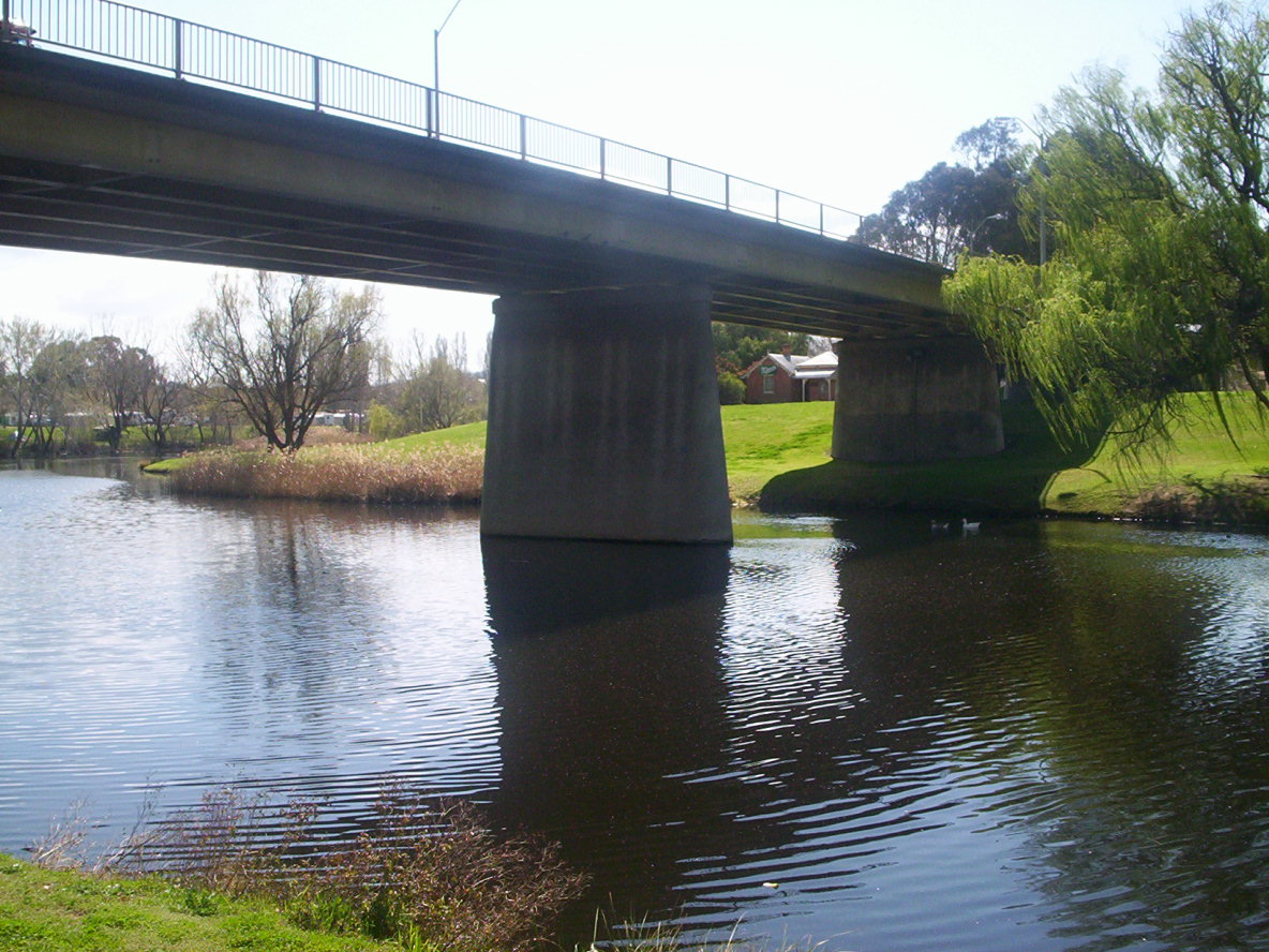
Queanbeyan ( ) is a city in the south-eastern region of New South Wales, Australia, located adjacent to the Australian Capital Territory in the Southern Tablelands region. Located on the Queanbeyan River, the city is the council seat of the Queanbeyan-Palerang Regional Council. At the , the Queanbeyan part of the Canberra–Queanbeyan built-up area had a population of 37,511. Queanbeyan's economy is based on light construction, manufacturing, service, retail and agriculture. Canberra, Australia's capital, is located to the west, and Queanbeyan is a commuter town. The word ''Queanbeyan'' is the anglicised form of ''Quinbean'', an Aboriginal word meaning ''"clear waters"''. History The first inhabitants of Queanbeyan are Ngambri peoples of the Walgalu Nation, the meeting place of two rivers was known by the local Indigenous population as Quinbean, which is the name of our Historical Journal. The traditional owners, the Ngambri, in ancestral times: Before white man’s arriv ... [...More Info...] [...Related Items...] OR: [Wikipedia] [Google] [Baidu] |
Queanbeyan West
Queanbeyan West is a suburb of Queanbeyan, New South Wales, Australia. Queanbeyan West is located west of the central business district (CBD) and also borders the Australian Capital Territory, it is located south of Crestwood and Canberra Avenue Canberra Avenue is a major road in Canberra, Australian Capital Territory. It is the primary link between the nation's capital and the city of Queanbeyan, New South Wales which lies on the Territory's eastern border. The route also passes his ... and west of Tharwa Road. At the , it had a population of 3,146. References Queanbeyan {{SouthernTablelands-geo-stub ... [...More Info...] [...Related Items...] OR: [Wikipedia] [Google] [Baidu] |
Queanbeyan East
Queanbeyan East is a suburb of Queanbeyan in New South Wales, Australia. It is on the north eastern side of the Queanbeyan River, with the river forming its western boundary. At the , it had a population of 4,240. Geography The suburb is a mixed residential and industrial zone, incorporating Queanbeyan's (and one of the region's largest) manufacturing and general industrial hubs along the eastern length of Yass Road. East Queanbeyan is predominantly residential however, featuring a mix of high density units and free standing homes. In recent years a number of new mini housing estates have been completed (or are under construction), adding significantly to the population, and providing new housing stock. Additionally a new high density residential complex has been completed adjacent to the Queanbeyan River. The Goulburn-Bombala railway passes from east to west through the north of the suburb. Amenities The suburb contains a small general shopping strip, consisting of ... [...More Info...] [...Related Items...] OR: [Wikipedia] [Google] [Baidu] |
Karabar
Karabar is a suburb of Queanbeyan, New South Wales. It is at the southern part of the developed area of Queanbeyan—-bordering the suburbs of Queanbeyan East, Jerrabomberra, Googong and Queanbeyan. The eastern border of the suburb is defined by the Queanbeyan River. As well as a shopping centre it contains netball courts, several ovals and public high and primary schools. It is dominated by Mount Jerrabomberra, which overlooks the suburb. At the , Karabar had a population of 8,517 people. The Karabar High School and Distance Education Centre is a state public high school for years 7 to 12, located in Karabar. The distance education centre serves students who are unable to attend school because of geographic isolation, illness, vocational talent, religious and other reasons, in the southern part of NSW as well as Australians living overseas and students from smaller private and state high schools that are unable to offer specialist subjects such as languages, extension mathematic ... [...More Info...] [...Related Items...] OR: [Wikipedia] [Google] [Baidu] |
Jerrabomberra
Jerrabomberra is a suburb of Queanbeyan in south eastern New South Wales, Australia. Jerrabomberra consists of three sections, The Park, The Heights, and Lakeview. The Park and the Heights are divided by Edwin Land Parkway. At the , it had 9,601 people, up from 9,508 in 2016, 9,420 in 2011, and 8,747 in 2006. Jerrabomberra is derived from the local Aboriginal place name meaning "boy frightened by storm". "Jerrabomberra", an area of what was then called the Limestone Plains, was purchased by John Palmer in 1827, and settled the following year. John Palmer had been a purser on the "Sirius" in the First Fleet. The area was brought to his attention because he was a brother-in-law of Robert Campbell at " Duntroon", a property about nine miles (14 km) to the north east. His property served as a centre for the Anglican Church until nearby Queanbeyan (then known by its original Aboriginal, non-Anglicised name Quinbean) was developed. The Palmer family held the property u ... [...More Info...] [...Related Items...] OR: [Wikipedia] [Google] [Baidu] |
Greenleigh
Greenleigh is an acreage estate to the east of the City of Queanbeyan in New South Wales, Australia. It was formerly known as Dodsworth. At the , Greenleigh had a population of 676. Greenleigh has the highest house prices and rates in Queanbeyan Queanbeyan ( ) is a city in the south-eastern region of New South Wales, Australia, located adjacent to the Australian Capital Territory in the Southern Tablelands region. Located on the Queanbeyan River, the city is the council seat of the .... References {{authority control Queanbeyan ... [...More Info...] [...Related Items...] OR: [Wikipedia] [Google] [Baidu] |
Googong
Googong is a locality located within the Queanbeyan–Palerang Regional Council government area, south of the Queanbeyan Central Business District (CBD). Googong contains the township of Googong and the developed areas of Fernleigh Park, Little Burra and Mount Campbell Estate. It borders Jerrabomberra and Karabar on the north and Environa on the west. It is about 10 kilometres (6.2 mi) south of the Queanbeyan central business district. Its citizens tend to utilize the infrastructure of neighboring Canberra. History Googong is situated in Ngunnawal and Ngambri traditional Aboriginal country. Five Aboriginal groups have identified custodial connections to the area. The area also has had European farmers and settlers since the mid-1800s. It is named after one of the largest farming properties in the area, although the meaning and origins of the word Googong remain obscure. The first part of the original stone homestead was built in 1845 and was first occupied by Alexander ... [...More Info...] [...Related Items...] OR: [Wikipedia] [Google] [Baidu] |
Environa
Environa is a suburb and locality of Queanbeyan, located in the Queanbeyan–Palerang Regional Council, in New South Wales, Australia, west of Jerrabomberra Creek and nearby the New South Wales and Australian Capital Territory border. The suburb was historically designated as a planned community that subsequently did not come to fruition, however, Environa has since been allocated as part of the South Jerrabomerra development of Queanbeyan for proposed development, including the proposed developments of Tralee and Poplars. History The land itself was originally a subdivision of the grazing property known as Hill Station. It lies just east of the Queanbeyan-Cooma railway line as it goes past the industrial estate of Hume, ACT. Henry Ferdinand Halloran, an enterprising realtor bought the property at auction in 1924 and began planning the future city. Halloran emphasised the future promise of the region, with the closest freehold (Torrens title) land to the federal territory. ... [...More Info...] [...Related Items...] OR: [Wikipedia] [Google] [Baidu] |
Crestwood, Queanbeyan, New South Wales
Crestwood is a suburb of Queanbeyan, New South Wales, Australia. Crestwood is located west of the central business district (CBD) to the west of Ross Road and the north of Canberra Avenue and also borders the Australian Capital Territory The Australian Capital Territory (commonly abbreviated as ACT), known as the Federal Capital Territory (FCT) until 1938, is a landlocked federal territory of Australia containing the national capital Canberra and some surrounding townships. .... At the , it had a population of 4,936. References Localities in New South Wales Queanbeyan {{SouthernTablelands-geo-stub ... [...More Info...] [...Related Items...] OR: [Wikipedia] [Google] [Baidu] |


