|
Peleliu
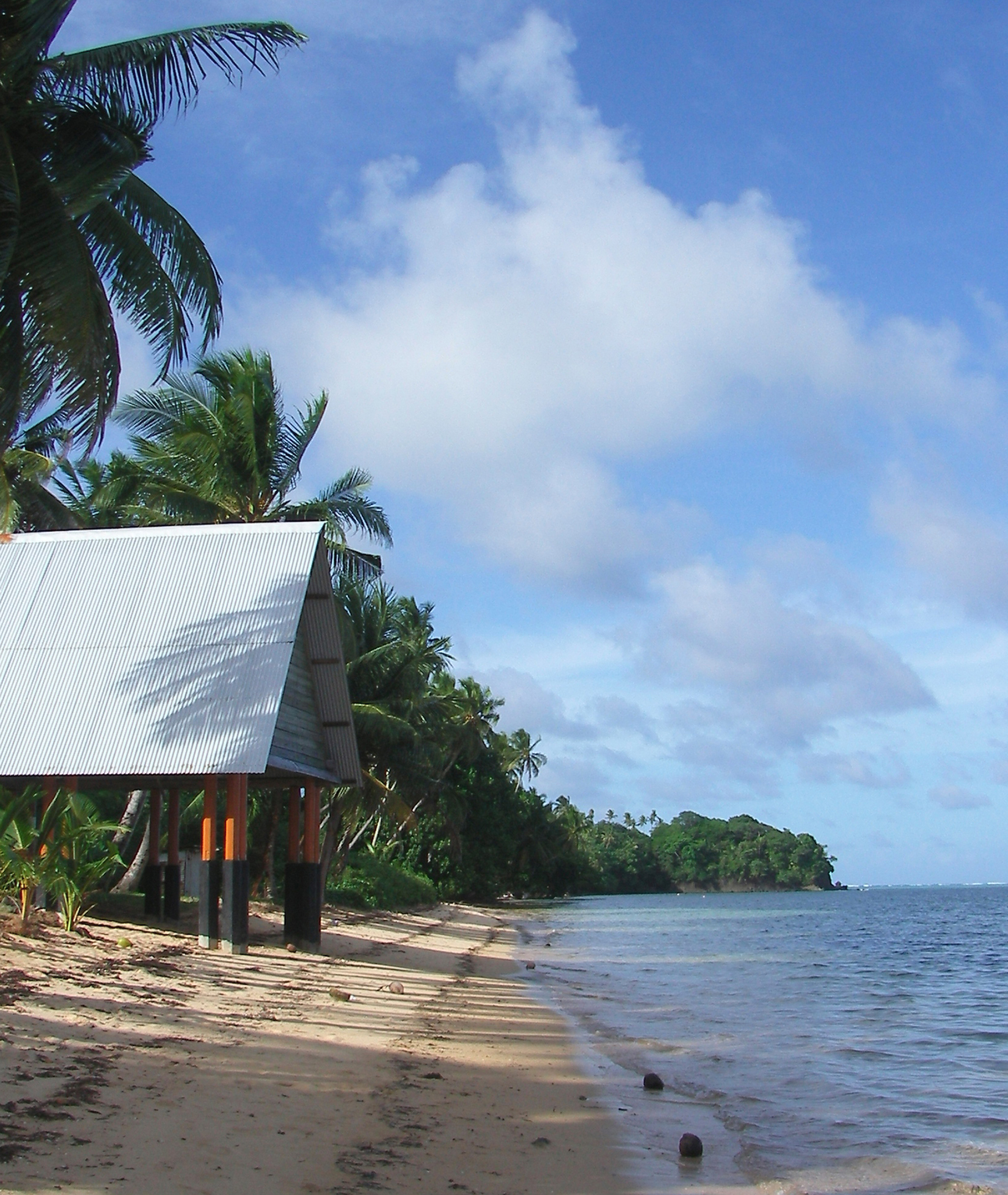
Peleliu (or Beliliou) is an island in the island nation of Palau. Peleliu, along with two small islands to its northeast, forms one of the sixteen states of Palau. The island is notable as the location of the Battle of Peleliu in World War II. History Beliliou was traditionally divided into five villages. Teliu is located on the southwest coast bordered on the north by Ngerkeiukl on the west coast, Ngesias in the central portion of the island, and Ngerdelolk on the east coast. Ngerchol occupies the northern part of the island on the west side of Bloody Nose Ridge. Most of the surface remains of the traditional villages have been obliterated. However, the locations of the villages and the locations of features within the villages, including odesongel, are known and preserved in the oral tradition. These traditional features are important symbols giving identity to families, clans and regions. The lagoon and adjacent rock islands are important resource areas, and probably were int ... [...More Info...] [...Related Items...] OR: [Wikipedia] [Google] [Baidu] |
Battle Of Peleliu
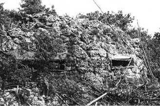
The Battle of Peleliu, codenamed Operation Stalemate II by the US military, was fought between the United States and Japan during the Mariana and Palau Islands campaign of World War II, from September 15 to November 27, 1944, on the island of Peleliu. US Marines of the 1st Marine Division and then soldiers of the US Army's 81st Infantry Division, fought to capture an airfield on the small coral island of Peleliu. The battle was part of a larger offensive campaign known as Operation Forager, which ran from June to November 1944 in the Pacific Theater. Major General William Rupertus, the commander of the 1st Marine Division, predicted that the island would be secured within four days. However, after repeated Imperial Japanese Army defeats in previous island campaigns, Japan had developed new island-defense tactics and well-crafted fortifications, which allowed stiff resistance and extended the battle to more than two months. The heavily-outnumbered Japanese defenders put up su ... [...More Info...] [...Related Items...] OR: [Wikipedia] [Google] [Baidu] |
Palau
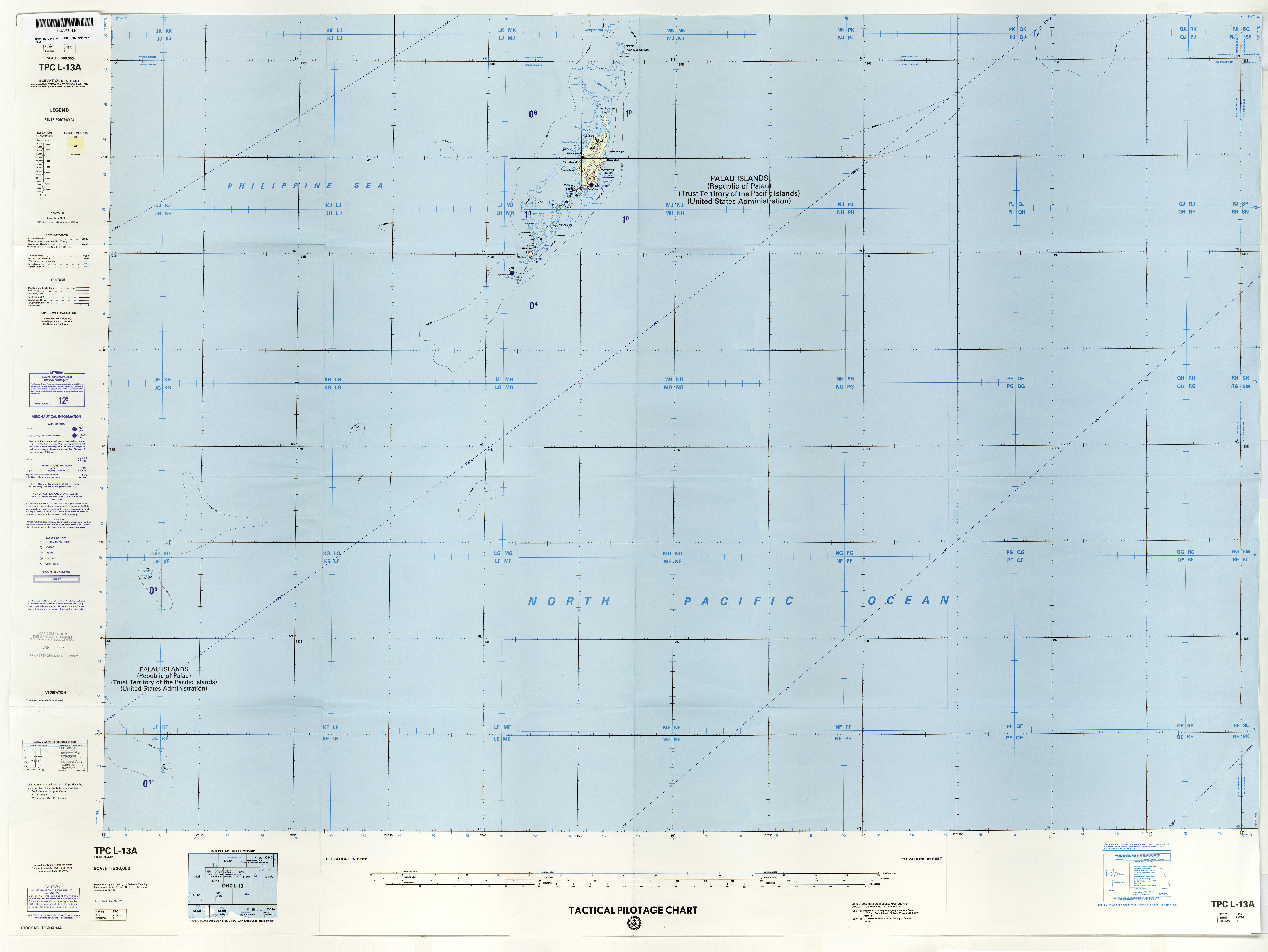
Palau,, officially the Republic of Palau and historically ''Belau'', ''Palaos'' or ''Pelew'', is an island country and microstate in the western Pacific. The nation has approximately 340 islands and connects the western chain of the Caroline Islands with parts of the Federated States of Micronesia. It has a total area of . The most populous island is Koror, home to the country's most populous city of the same name. The capital Ngerulmud is located on the nearby island of Babeldaob, in Melekeok State. Palau shares maritime boundaries with international waters to the north, the Federated States of Micronesia to the east, Indonesia to the south, and the Philippines to the northwest. The country was originally settled approximately 3,000 years ago by migrants from Maritime Southeast Asia. Palau was first drawn on a European map by the Czech missionary Paul Klein based on a description given by a group of Palauans shipwrecked on the Philippine coast on Samar. Palau islands ... [...More Info...] [...Related Items...] OR: [Wikipedia] [Google] [Baidu] |
Temmy Shmull
Temmy Shmull is a Palauan politician. He worked in the government as a foreign service officer and later became an advisor to Thomas Remengesau Sr. in 1985. He then became the Chief of Staff of President Kuniwo Nakamura before becoming Minister of State of Palau from 2001-2009 under Thomas Remengesau Jr Thomas may refer to: People * List of people with given name Thomas * Thomas (name) * Thomas (surname) * Saint Thomas (other) * Thomas Aquinas (1225–1274) Italian Dominican friar, philosopher, and Doctor of the Church * Thomas the Ap .... He has been the Governor of Peleliu since January 2013. References Living people Governors of Peleliu People from Peleliu Year of birth missing (living people) {{Palau-politician-stub ... [...More Info...] [...Related Items...] OR: [Wikipedia] [Google] [Baidu] |
States Of Palau
Palau is divided into sixteen administrative regions, called states. Palau has a high ratio of government offices to citizens, with 16 states and both a tribal chiefdom and elected legislature in each state, for 20,000 people.''Patterson, Carolyn Bennett, et al. "At the Birth of Nations: In the Far Pacific." National Geographic Magazine, October 1986 page 493. National Geographic Virtual Library, Accessed 17 May 2018.'' "The westernmost among the emerging nations of the Pacific, the Republic of Palau (or Belau), population more than 15,000, is divided into 16 separate states, each with its own governor, lieutenant governor, and legislature. Most state populations are very small, and one wonders if anyone has time for anything but government, American style and democratic though it may be. An example is Peleliu, the tragic island where more than 13,000 Americans and Japanese died during less than three months of fighting, often hand to hand, in the autumn of 1944. Pat and I went t ... [...More Info...] [...Related Items...] OR: [Wikipedia] [Google] [Baidu] |
Kloulklubed
Kloulklubed, also spelled Klouklubed, is the main settlement on the Palau island of Peleliu. It is situated at the northern end of the island, located near Imelchol Village and Koska. The village was a centre of Japanese operations during World War II, and the remains of the Japanese communications centre is still standing in the village. A monument to the Battle of Peleliu is also located in the village. Kloulklubed's other notable feature is the gravesites of Palau's first president and first Chief Justice, Haruo Remeliik and Mamoru Nakamura. Remeliik was assassinated in 1985, while Nakamura died of a heart attack in 1992. Both were natives of Peleliu, and their graves are located close to the centre of the village, near the Governor's office. See also * List of cities, towns and villages in Palau References Sources * {{Palau-geo-stub Peleliu Populated places in Palau ... [...More Info...] [...Related Items...] OR: [Wikipedia] [Google] [Baidu] |
Angaur
, or in Palauan, is an island and state in the island nation of Palau. History Angaur was traditionally divided among some eight clans. Traditional features within clan areas represent important symbols giving identity to families, clans and regions . These features include a variety of stone platforms with historical and traditional importance. Traditional cemeteries are frequently located in or around some of these stone platforms. The large quantities of shell recovered from archaeological sites gives evidence for an intensive exploitation of the limited lagoon surrounding the island and for collecting and fishing outside of the reef as well. On the island, the localized areas of soil were intensively used for garden plots. The first sighting of Angaur, Babeldaob, Koror, and Peleliu recorded by Westerners was by the Spanish expedition of Ruy López de Villalobos at the end of January 1543. They were then charted as ''Los Arrecifes'' (The Reefs in Spanish). In November and ... [...More Info...] [...Related Items...] OR: [Wikipedia] [Google] [Baidu] |
Koror
Koror is the state comprising the main commercial centre of the Republic of Palau. It consists of several islands, the most prominent being Koror Island (also ''Oreor Island''). It is Palau’s most populous state. History In the oral tradition of Palau, Koror is one of the children of Milad, and thus occupies an important position in traditional belief. In addition, Koror is the home of the clan of the Ibedul, the high chief of Palau. Several traditional villages in Koror span the volcanic and rock island portions. Many of the stone platforms , odesongel, serve as clan cemeteries, and other stone features serve as shrines. The lagoon is an important resource area, and was probably intensively exploited prehistorically. The first sighting of Koror, Babeldaob, and Peleliu recorded by Westerners was by the Spanish expedition of Ruy López de Villalobos at the end of January, 1543. They were then charted as ''Los Arrecifes'' (The Reefs in Spanish). In November and December 1710 ... [...More Info...] [...Related Items...] OR: [Wikipedia] [Google] [Baidu] |
Defense In Depth
Defence in depth (also known as deep defence or elastic defence) is a military strategy that seeks to delay rather than prevent the advance of an attacker, buying time and causing additional casualties by yielding space. Rather than defeating an attacker with a single, strong defensive line, defence in depth relies on the tendency of an attack to lose momentum over time or as it covers a larger area. A defender can thus yield lightly defended territory in an effort to stress an attacker's logistics or spread out a numerically superior attacking force. Once an attacker has lost momentum or is forced to spread out to pacify a large area, defensive counter-attacks can be mounted on the attacker's weak points, with the goal being to cause attrition or drive the attacker back to its original starting position. Strategy A conventional defence strategy would concentrate all military resources at a front line, which, if breached by an attacker, would leave the remaining defenders in d ... [...More Info...] [...Related Items...] OR: [Wikipedia] [Google] [Baidu] |
United States Marine Corps
The United States Marine Corps (USMC), also referred to as the United States Marines, is the maritime land force service branch of the United States Armed Forces responsible for conducting expeditionary and amphibious operations through combined arms, implementing its own infantry, artillery, aerial, and special operations forces. The U.S. Marine Corps is one of the eight uniformed services of the United States. The Marine Corps has been part of the U.S. Department of the Navy since 30 June 1834 with its sister service, the United States Navy. The USMC operates installations on land and aboard sea-going amphibious warfare ships around the world. Additionally, several of the Marines' tactical aviation squadrons, primarily Marine Fighter Attack squadrons, are also embedded in Navy carrier air wings and operate from the aircraft carriers. The history of the Marine Corps began when two battalions of Continental Marines were formed on 10 November 1775 in Philadelphia as ... [...More Info...] [...Related Items...] OR: [Wikipedia] [Google] [Baidu] |
Ngercheu
Ngercheu, or Carp Island, is an island located within the nation of Palau, specifically within the state of Peleliu. Ngercheu is located 5 km northwest of the main island of Peleliu. Ngercheu is roughly 1 km2, star-shaped, and densely forested. The Carp Island Resort is located on the island and caters to an Asian tourist base. References Islands of Palau {{Palau-geo-stub ... [...More Info...] [...Related Items...] OR: [Wikipedia] [Google] [Baidu] |
Babeldaob
Babeldaob (also Babelthuap) is the largest island in the island nation of the Republic of Palau. It is in the western Caroline Islands, and the second largest island (after Guam) in the Micronesia region of Oceania. Palau's capital, Ngerulmud, is located on Babeldaob, in Melekeok State. Babeldaob is one of the most underdeveloped populated islands in the Pacific Ocean. The area of Babeldaob, , makes up over 70% of the land area of the entire Republic of Palau. It has about 30% of the country's population, with about 6,000 people living on it. Geography Babeldaob is located northeast of Koror Island, and its northern portion contains the site of the new national capital, Ngerulmud. The southern end of the island is in Airai State, Palau's second-most populous state. The Airai Airport on the island is the nation's principal airport. The Koror-Babeldaob Bridge links Babeldaob Island at Airai to Koror Island. Unlike most of the islands of Palau, Babeldaob is mountainous. It conta ... [...More Info...] [...Related Items...] OR: [Wikipedia] [Google] [Baidu] |
Imperial Japanese Army
The was the official ground-based armed force of the Empire of Japan from 1868 to 1945. It was controlled by the Imperial Japanese Army General Staff Office and the Ministry of the Army, both of which were nominally subordinate to the Emperor of Japan as supreme commander of the army and the Imperial Japanese Navy. Later an Inspectorate General of Aviation became the third agency with oversight of the army. During wartime or national emergencies, the nominal command functions of the emperor would be centralized in an Imperial General Headquarters (IGHQ), an ad hoc body consisting of the chief and vice chief of the Army General Staff, the Minister of the Army, the chief and vice chief of the Naval General Staff, the Inspector General of Aviation, and the Inspector General of Military Training. History Origins (1868–1871) In the mid-19th century, Japan had no unified national army and the country was made up of feudal domains (''han'') with the Tokugawa shogunate (''bakufu ... [...More Info...] [...Related Items...] OR: [Wikipedia] [Google] [Baidu] |

.jpg)


