|
Okhtyrka
Okhtyrka ( uk, Охти́рка, ) is a city located in the Sumy Oblast (province) of Ukraine. It is administratively incorporated as a city of oblast significance. The city has also served as the administrative center of the smaller Okhtyrka Raion since 1975, although it does not belong to the raion itself. Okhtyrka was once home to Hussars and Cossacks. It was also once a regional seat of the Sloboda Ukraine imperial region and of the Ukrainian SSR. Since the discovery of oil and gas in 1961, Okhtyrka has become the "oil capital of Ukraine." It is home to Okhtyrka air base and historical and religious places of interest. The villages of Velyke Ozero (274 inhabitants), Zaluzhany (28 inhabitants), Prystan (7 inhabitants), and Koziatyn (6 inhabitants) belong to the Okhtyrka city administration which is designated into a separate subdivision of the Sumy Oblast. Population * 1867: 17,411 * 1900: 25,965 * 2001: 50,400 * 2021: 47,216 Name According to the most probable etymol ... [...More Info...] [...Related Items...] OR: [Wikipedia] [Google] [Baidu] |
Okhtyrka Raion
Okhtyrka Raion ( uk, Охтирський район) is a raion in Sumy Oblast in Central Ukraine. The administrative center of the raion is the town of Okhtyrka. Population: On 18 July 2020, as part of the administrative reform of Ukraine, the number of raions of Sumy Oblast was reduced to five, and the area of Okhtyrka Raion was significantly expanded. The January 2020 estimate of the raion population was References Raions of Sumy Oblast 1923 establishments in Ukraine {{Sumy-geo-stub ... [...More Info...] [...Related Items...] OR: [Wikipedia] [Google] [Baidu] |
Okhtyrka (air Base)
Okhtyrka was a military aviation training air base in Ukraine located 8 km east of Okhtyrka city in Sumy Oblast. Operated by the Soviet Air Forces and then the Ukrainian Air Force The Ukrainian Air Force ( uk, Пові́тряні си́ли Збро́йних сил Украї́ни) is the air force of Ukraine and one of the five branches of the Armed Forces of Ukraine. Its headquarters are in the city of Vinnytsia. W ..., it was home to the 809th Aviation Training Regiment, flying 102 L-39C aircraft. The base ceased operations in 2004. References *http://www.weathergraphics.com/tim/russia/Akhtyrka.htm Tim Vasquez, Russian Airfields Soviet Air Force bases Ukrainian airbases {{Sumy-geo-stub ... [...More Info...] [...Related Items...] OR: [Wikipedia] [Google] [Baidu] |
Sumy Oblast
Sumy Oblast ( uk, Сумська́ о́бласть, translit=Sumska oblast; also referred to as Sumshchyna – uk, Су́мщина) is an oblast (province) in the northeastern part of Ukraine. Population: The oblast was created in its most recent form, from the merging of raions from Kharkiv Oblast, Chernihiv Oblast, and Poltava Oblast in 1939 by the Presidium of the Supreme Soviet of the Soviet Union. The administrative center of the oblast is the city of Sumy. Other important cities within the oblast include Konotop, Okhtyrka, Romny, and Shostka. The oblast has a heavy mix of agriculture and industry, with over 600 industrial locations. Importantly, seven rivers pass through the oblast. Geography The Sumy Oblast is situated in the northeastern part of Ukraine. It is situated on a border of two historical regions of Ukraine — Cossack Hetmanate (annexed by Russia in the 18th century as Little Russia, previously known as Severia) and Sloboda Ukraine. Elevation is 110 ... [...More Info...] [...Related Items...] OR: [Wikipedia] [Google] [Baidu] |
Sloboda Ukraine
Sloboda Ukraine (literally: Borderland of free frontier guards; uk, Слобідська Україна, Slobidska Ukraina), or Slobozhanshchyna ( uk, Слобожанщина, Slobozhanshchyna, ), is a historical region, now located in Northeastern Ukraine and Southwestern Russia. It developed and flourished in the 17th and 18th centuries on the southwestern frontier of the Tsardom of Russia. In 1765, it was converted into the Sloboda Ukraine Governorate. Etymology The name derives from the term '' sloboda'' for a colonial settlement free of tax obligations, and the word ''ukraine'' in its original sense of "borderland". The etymology of the word Ukraine is seen this way among Russian, Ukrainian and Western historians such as Orest Subtelny, Paul Magocsi, Omeljan Pritsak, Mykhailo Hrushevskyi, Ivan Ohiyenko, Petro TolochkoТолочко П. П. «От Руси к Украине» («Від Русі до України»). 1997 and others. It is supported by the Encyclopedia of ... [...More Info...] [...Related Items...] OR: [Wikipedia] [Google] [Baidu] |
Vorskla River
The Vorskla (; ) is a river that runs from Belgorod Oblast in Russia southwards into northeastern Ukraine, where it joins the Dnieper. It has a length of , and a basin area of . Right tributaries of the river include the and Boromlia, and left tributaries Merla, |
Raions Of Ukraine
Raions of Ukraine (often translated as "districts"; Ukrainian: ра́йон, tr. ''raion''; plural: райо́ни, tr. ''raiony'') are the second level of administrative division in Ukraine, below the oblast. Raions were created in a 1922 administrative reform of the Soviet Union, to which Ukraine, as the Ukrainian Soviet Socialist Republic, belonged. On 17 July 2020, the Verkhovna Rada (Ukraine's parliament) approved an administrative reform to merge most of the 490 raions, along with the "cities of regional significance", which were previously outside the raions, into just 136 reformed raions. Most tasks of the raions (education, healthcare, sport facilities, culture, and social welfare) were taken over by new hromadas, the subdivisions of raions. [...More Info...] [...Related Items...] OR: [Wikipedia] [Google] [Baidu] |
City Of Regional Significance (Ukraine)
City of regional significance ( uk, місто обласного значення, ''misto oblasnoho znachennia'') in Ukraine was a type of second-level administrative division or municipality, the other type being raions (districts). In the first-level division of oblasts, they were referred to as ''cities of oblast significance''; in the first-level autonomous republic of Crimea, they were ''cities of republican significance''. The designation was created with the introduction of oblasts in 1932. It was abolished in a 2020 reform that merged raions together and integrated the city municipalities into them. Such city municipality was complex and usually combined the city proper and adjacent populated places. The city of regional (oblast) significance was governed by a city council known as ''mis'krada'', which was chaired by a mayor. There were instances where a municipality might have included only the city alone (city proper), while in others instances a municipality might ha ... [...More Info...] [...Related Items...] OR: [Wikipedia] [Google] [Baidu] |
Treaty Of Polyanovka
The Treaty of Polyanovka ( pl, Polanów, also known as the ''Peace of Polyanovka / Polanów'') was a peace treaty signed on 14 June 1634 between the Polish–Lithuanian Commonwealth and the Tsardom of Russia in the village of Semlevo located near the Polyanovka river between Vyazma and Dorogobuzh. The accord was signed in the aftermath of the Smolensk War. The negotiations began on 30 April after the failure of the Polish-Lithuanian siege of Belaya. Overall, the agreement confirmed the pre-war status quo, with Russia paying a large war indemnity (20,000 rubles in gold) for Władysław IV agreeing to surrender his claim to the Russian throne and return the royal insignia to Russia. Władysław, despite holding an upper hand, was trying to bring Russia into an anti-Sweden alliance; hence in a gesture of goodwill he agreed to give the Russians the border town of Serpeysk and nearby territories. However, the alliance never came through, as the Polish-Lithuanian Sejm, unwilling to ... [...More Info...] [...Related Items...] OR: [Wikipedia] [Google] [Baidu] |
Crown Of Poland
The Crown of the Kingdom of Poland ( pl, Korona Królestwa Polskiego; Latin: ''Corona Regni Poloniae''), known also as the Polish Crown, is the common name for the historic Late Middle Ages territorial possessions of the King of Poland, including the Kingdom of Poland proper. The Polish Crown was at the helm of the Polish–Lithuanian Commonwealth from 1569 to 1795. Major political events The Kingdom of Poland has been traditionally dated back to c. 966, when Mieszko I and his pagan Slavic realm joined Christian Europe (Baptism of Poland), establishing the state of Poland, a process started by his Polan Piast dynasty ancestors. His oldest son and successor, Prince Bolesław I Chrobry, Duke of Poland, became the first crowned King of Poland in 1025. Union of Krewo The Union of Krewo was a set of prenuptial agreements made in the Kreva Castle on August 13, 1385. Once Jogaila confirmed the prenuptial agreements on August 14, 1385, Poland and Lithuania formed a personal uni ... [...More Info...] [...Related Items...] OR: [Wikipedia] [Google] [Baidu] |
Right-bank Ukraine
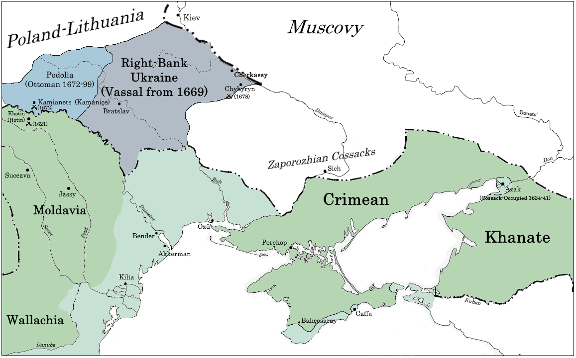
Right-bank Ukraine ( uk , Правобережна Україна, ''Pravoberezhna Ukrayina''; russian: Правобережная Украина, ''Pravoberezhnaya Ukraina''; pl, Prawobrzeżna Ukraina, sk, Pravobrežná Ukrajina, hu, Jobb parti Ukrajna) is a historical and territorial name for a part of modern Ukraine on the right (west) bank of the Dnieper River, corresponding to the modern-day oblasts of Vinnytsia, Zhytomyr, Kirovohrad, as well as the western parts of Kyiv and Cherkasy. It was separated from the left bank during the Ruin. Right-bank Ukraine is bordered by the historical regions of Volhynia and Podolia to the west, Moldavia to the southwest, Yedisan and Zaporizhzhia to the south, left-bank Ukraine to the east, and Polesia to the north. Main cities of the region include Cherkasy, Kropyvnytskyi, Bila Tserkva, Zhytomyr and Oleksandriia. History The history of right- and left-bank Ukraine is closely associated with the Khmelnytsky Uprising of 1648–57. The ... [...More Info...] [...Related Items...] OR: [Wikipedia] [Google] [Baidu] |
Oblasts Of Ukraine
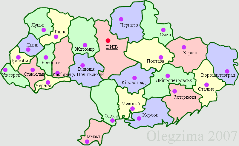
An oblast ( uk, о́бласть; ) in Ukraine, often called a region or province, is the main type of first-level administrative division of the country. Ukraine's territory is divided into 24 oblasts, as well as one autonomous republic, Crimea, and two cities with special status, Kyiv and Sevastopol. Ukraine is a unitary state, thus the oblasts do not have much legal scope of competence other than that which is established in the Ukrainian Constitution and by law. Articles 140–146 of Chapter XI of the constitution deal directly with local authorities and their competency. Oblasts are subdivided into raions (districts), each oblast having from 3 to 10 raions following the July 2020 reform. General characteristics In Ukraine, the term ''oblast'' denotes a primary administrative division. Under the Russian Empire and into the 1920s, Ukraine was divided between several governorates. The term ''oblast'' was introduced in 1932 by Soviet authorities when the Ukrainian SSR was ... [...More Info...] [...Related Items...] OR: [Wikipedia] [Google] [Baidu] |


