|
Marquette County, Wisconsin
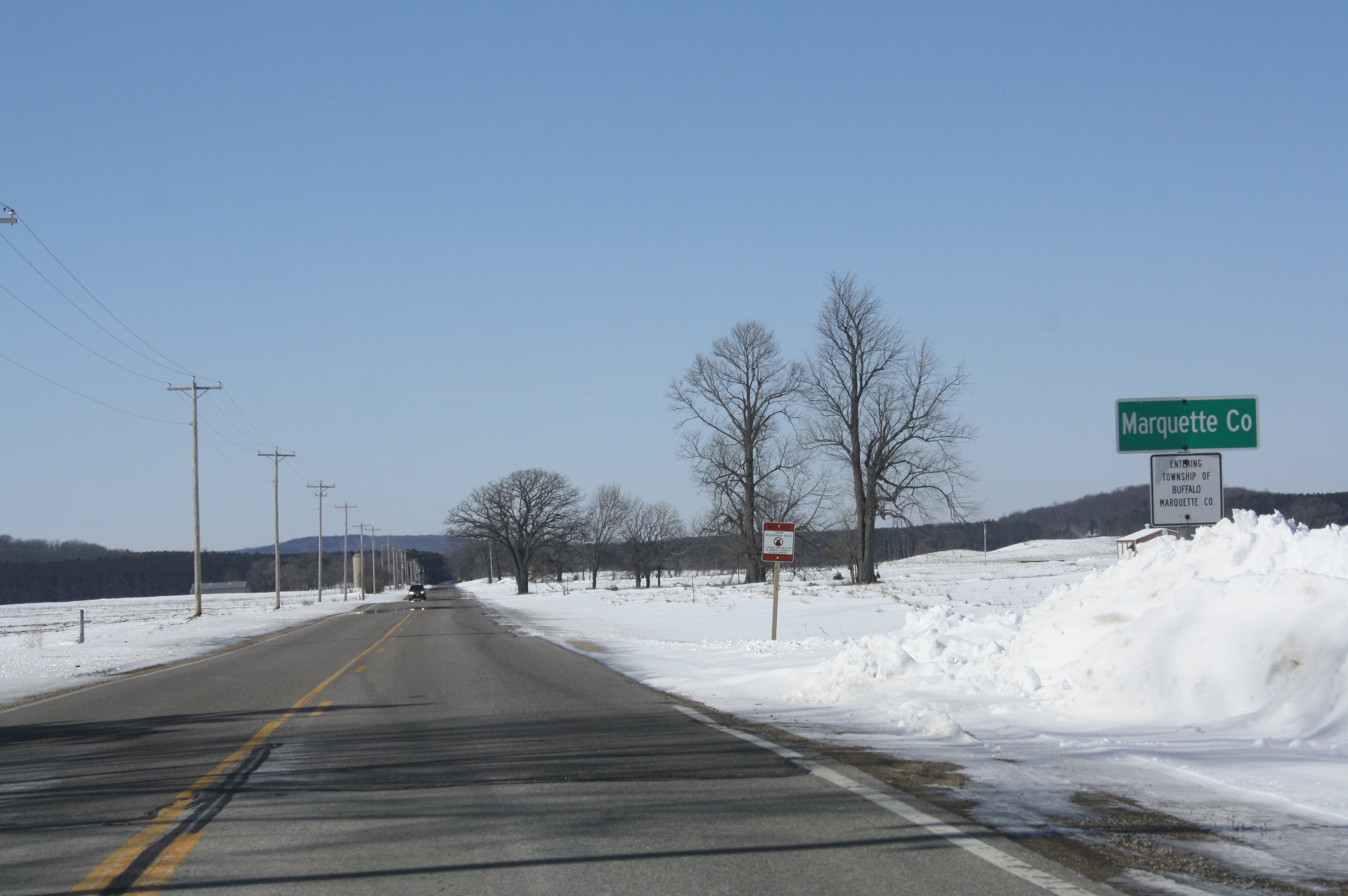
Marquette County is a county located in the U.S. state of Wisconsin. As of the 2020 census, the population was 15,592. Its county seat is Montello. The county was created in 1836 from the Wisconsin Territory and organized in 1848. Geography According to the U.S. Census Bureau, the county has a total area of , of which is land and (1.9%) is water. The Mecan River, Buffalo Lake, and Puckaway Lake lie within Marquette County. The highest altitude in the county is a rocky area known as Mt. Shaw. Major highways * Interstate 39 * U.S. Highway 51 * Highway 22 (Wisconsin) * Highway 23 (Wisconsin) * Highway 73 (Wisconsin) * Highway 82 (Wisconsin) Railroads *Union Pacific Buses *List of intercity bus stops in Wisconsin Adjacent counties * Waushara County - north * Green Lake County - east * Columbia County - south * Adams County - west National protected area * Fox River National Wildlife Refuge Demographics 2020 census As of the census of 2020, the population was ... [...More Info...] [...Related Items...] OR: [Wikipedia] [Google] [Baidu] |
Marquette County Courthouse And Marquette County Sheriff's Office And Jail
The Marquette County Courthouse and Marquette County Sheriff's Office and Jail is located in Montello, Wisconsin. In 1982, the site was added to the National Register of Historic Places. Description The current courthouse was constructed in 1918 to replace the original that had been built in 1863. It was built out of stone and brick. The sheriff's office and jail is located behind the courthouse. References {{commonscat, Marquette County Courthouse (Wisconsin) Courthouses on the National Register of Historic Places in Wisconsin Jails on the National Register of Historic Places in Wisconsin Buildings and structures in Marquette County, Wisconsin Beaux-Arts architecture in Wisconsin Government buildings completed in 1918 National Register of Historic Places in Marquette County, Wisconsin Government buildings in Wisconsin County courthouses in Wisconsin Jails in Wisconsin ... [...More Info...] [...Related Items...] OR: [Wikipedia] [Google] [Baidu] |
WIS 73
State Trunk Highway 73 (often called Highway 73, STH-73 or WIS 73) is a state highway in the central part of the US state of Wisconsin that runs mostly north–south from Ingram to near Edgerton. The exception is in Wood and Adams counties, where this highway runs east–west. It is one of the longer Wisconsin state highways. Route description WIS 73 starts in Dane County at an interchange with Interstate 39 (I-39), I-90 (exit 160), US Highway 51 (US 51) north of the city of Edgerton. Also near this junction, WIS 106 meets WIS 73 east of Albion. WIS 73 heads north where it meets US 12 and US 18. WIS 73 continues north and heads to Deerfield. About north of Deerfield, it meets I-94 at exit 250, and continues north another four miles to Marshall where it has a brief overlap with WIS 19. It continues north about to the city of Columbus. Just before it goes under an overpass of US 151, it cro ... [...More Info...] [...Related Items...] OR: [Wikipedia] [Google] [Baidu] |
White (U
White is the lightest color and is achromatic (having no hue). It is the color of objects such as snow, chalk, and milk, and is the opposite of black. White objects fully reflect and scatter all the visible wavelengths of light. White on television and computer screens is created by a mixture of red, blue, and green light. The color white can be given with white pigments, especially titanium dioxide. In ancient Egypt and ancient Rome, priestesses wore white as a symbol of purity, and Romans wore white togas as symbols of citizenship. In the Middle Ages and Renaissance a white unicorn symbolized chastity, and a white lamb sacrifice and purity. It was the royal color of the kings of France, and of the monarchist movement that opposed the Bolsheviks during the Russian Civil War (1917–1922). Greek and Roman temples were faced with white marble, and beginning in the 18th century, with the advent of neoclassical architecture, white became the most common color of new churches ... [...More Info...] [...Related Items...] OR: [Wikipedia] [Google] [Baidu] |
Population Density
Population density (in agriculture: standing stock or plant density) is a measurement of population per unit land area. It is mostly applied to humans, but sometimes to other living organisms too. It is a key geographical term.Matt RosenberPopulation Density Geography.about.com. March 2, 2011. Retrieved on December 10, 2011. In simple terms, population density refers to the number of people living in an area per square kilometre, or other unit of land area. Biological population densities Population density is population divided by total land area, sometimes including seas and oceans, as appropriate. Low densities may cause an extinction vortex and further reduce fertility. This is called the Allee effect after the scientist who identified it. Examples of the causes of reduced fertility in low population densities are * Increased problems with locating sexual mates * Increased inbreeding Human densities Population density is the number of people per unit of area, usuall ... [...More Info...] [...Related Items...] OR: [Wikipedia] [Google] [Baidu] |
2020 United States Census
The United States census of 2020 was the twenty-fourth decennial United States census. Census Day, the reference day used for the census, was April 1, 2020. Other than a pilot study during the 2000 census, this was the first U.S. census to offer options to respond online or by phone, in addition to the paper response form used for previous censuses. The census was taken during the COVID-19 pandemic, which affected its administration. The census recorded a resident population of 331,449,281 in the fifty states and the District of Columbia, an increase of 7.4 percent, or 22,703,743, over the preceding decade. The growth rate was the second-lowest ever recorded, and the net increase was the sixth highest in history. This was the first census where the ten most populous states each surpassed 10 million residents as well as the first census where the ten most populous cities each surpassed 1 million residents. Background As required by the United States Constitution, the U.S. cens ... [...More Info...] [...Related Items...] OR: [Wikipedia] [Google] [Baidu] |
Fox River National Wildlife Refuge
Fox River National Wildlife Refuge, managed by staff at Horicon National Wildlife Refuge, encompasses of wetland and upland habitat along the Fox River in the Town of Buffalo, in Marquette County, Wisconsin. Refuge staff restores, enhances, and preserves the oak savanna upland and sedge meadow wetland habitats historically found in extensive areas along the Fox River. Staff manage the wildlife populations that use these habitats, with special emphasis on those species dependent upon large expanses of natural marsh, such as the greater sandhill crane. Other management objectives include protecting the habitats of any Federal or State endangered or threatened species within the refuge, such as the state threatened Blanding's turtle Blanding's turtle (''Emydoidea blandingii'') is a semi-aquatic turtle of the family Emydidae. This species is native to central and eastern parts of Canada and the United States. It is considered to be an endangered species throughout much of i . ... [...More Info...] [...Related Items...] OR: [Wikipedia] [Google] [Baidu] |
Adams County, Wisconsin
Adams County is a county in the U.S. state of Wisconsin. As of the 2020 census, the population was 20,654. Its county seat is Friendship. The county was created in 1848 and organized in 1853. Sources differ as to whether its name is in honor of the second President of the United States, John Adams, or his son, the sixth President, John Quincy Adams. History The founders of Adams County were from upstate New York. These people were "Yankee" settlers, that is to say they were descended from the English Separatists who settled New England in the 1600s. They were part of a wave of New England farmers who headed west into what was then the wilds of the Northwest Territory during the early 1800s. Most of them arrived as a result of the completion of the Erie Canal and the end of the Black Hawk War. They got to what is now Adams County by sailing up the Wisconsin River from the Mississippi River on small barges which they constructed themselves out of materials obtained from the su ... [...More Info...] [...Related Items...] OR: [Wikipedia] [Google] [Baidu] |
Columbia County, Wisconsin
Columbia County is a county located in the U.S. state of Wisconsin. As of the 2020 census, the population was 58,490. Its county seat and largest city is Portage. The county was created in 1846 as part of Wisconsin Territory. Columbia County is part of the Madison, WI Metropolitan Statistical Area as well as the Madison- Janesville- Beloit, WI Combined Statistical Area. Geography According to the U.S. Census Bureau, the county has a total area of , of which is land and (3.8%) is water. The county's highest point is in the Baraboo Range, near Durward's Glen at 1,480 feet above sea level. Major highways * Interstate 39 * Interstate 90 * Interstate 94 * U.S. Highway 51 * U.S. Highway 151 * Highway 13 * Highway 16 * Highway 22 * Highway 23 * Highway 33 * Highway 44 * Highway 60 * Highway 73 * Highway 78 * Highway 89 * Highway 113 * Highway 127 * Highway 146 * Highway 188 Railroads *Amtrak *Wisconsin and Southern Railroad *Canadian Pacific *Union ... [...More Info...] [...Related Items...] OR: [Wikipedia] [Google] [Baidu] |
Green Lake County, Wisconsin
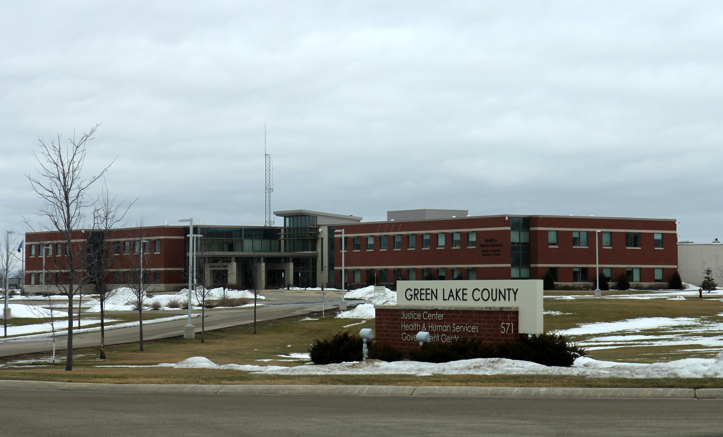
Green Lake County is a county located in the U.S. state of Wisconsin. As of the 2020 census, the population was 19,018. Its county seat is Green Lake. In 2020, the center of population of Wisconsin was located in Green Lake County, near the city of Markesan. Geography According to the U.S. Census Bureau, the county has a total area of , of which are land and (8.1%) are covered by water. It is the third-smallest county in Wisconsin by total area. Major highways * Highway 23 (Wisconsin) * Highway 44 (Wisconsin) * Highway 49 (Wisconsin) * Highway 73 (Wisconsin) * Highway 91 (Wisconsin) Railroads *Union Pacific *Wisconsin and Southern Railroad Buses *List of intercity bus stops in Wisconsin Adjacent counties * Waushara County – north * Winnebago County – northeast * Fond du Lac County – east * Dodge County – southeast * Columbia County – southwest * Marquette County – west Demographics 2020 census As of the census of 2020, the population was 1 ... [...More Info...] [...Related Items...] OR: [Wikipedia] [Google] [Baidu] |
Waushara County, Wisconsin
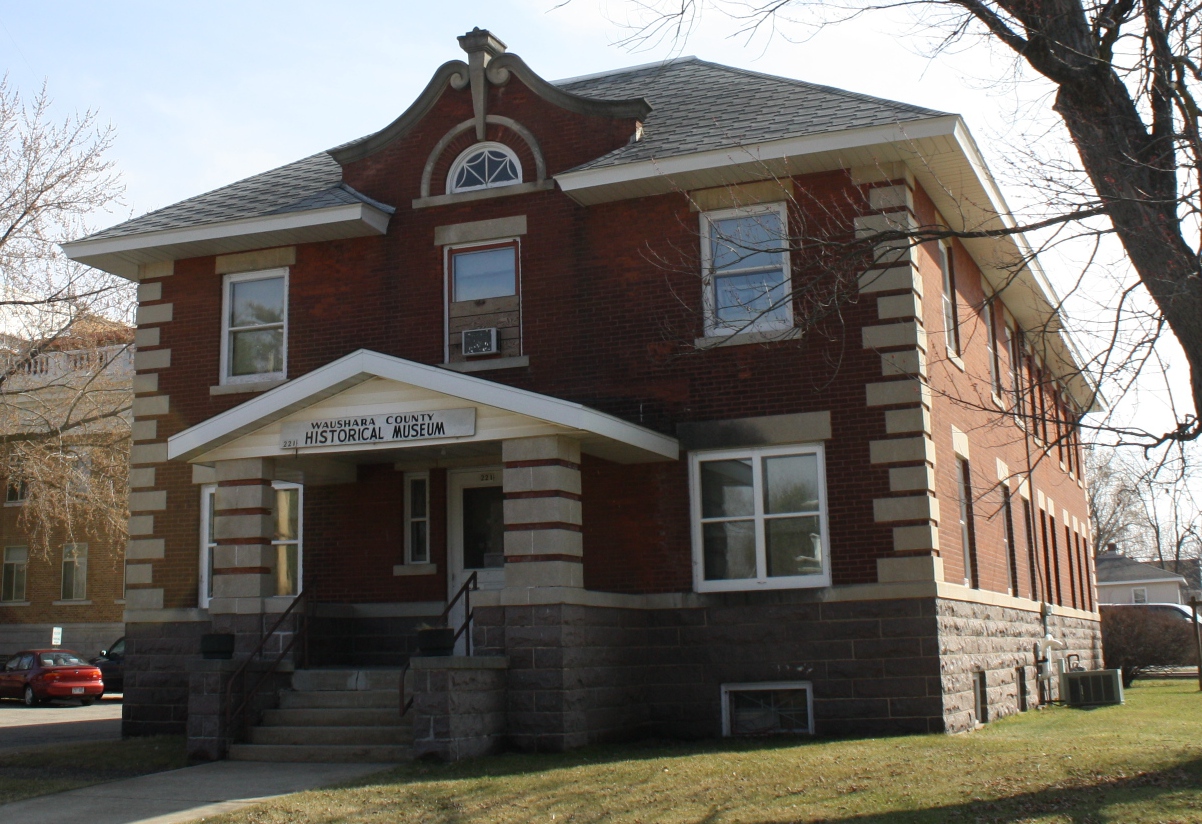
Waushara County is a county located in the U.S. state of Wisconsin. As of the 2020 census, the population was 24,520. Its county seat is Wautoma. Waushara County is located in central Wisconsin, about north of Madison. History Waushara County was established by an act of the Wisconsin Legislature on February 15, 1851. It originally consisted of a single organized Town of Waushara. In 1852 the county achieved full organization. The county seat was first located at Sacramento and was relocated to Wautoma in 1854 after a bitter fight between proponents of the two places. The name is of Ho-Chunk origin and is believed to mean "good land". Geography According to the U.S. Census Bureau, the county has a total area of , of which is land and (1.8%) is water. Major highways * Interstate 39 * U.S. Highway 51 * Highway 21 (Wisconsin) * Highway 22 (Wisconsin) * Highway 49 (Wisconsin) * Highway 73 (Wisconsin) Buses *List of intercity bus stops in Wisconsin Airports * Waut ... [...More Info...] [...Related Items...] OR: [Wikipedia] [Google] [Baidu] |
List Of Intercity Bus Stops In Wisconsin
The following is a list of presently operating intercity bus stops in Wisconsin with regular service. The list excludes charter buses, local transit buses, paratransit systems, and trolleybus systems. The following companies provide intercity bus service in Wisconsin as of September 2022: * Amtrak Thruway * Badger Bus * Flixbus * Greyhound Lines * Indian Trails * Jefferson Lines * Lamers Bus Lines * Megabus * Tornado Bus Company * Van Galder Bus Company * Wisconsin Coach Lines Stops This is the list of 71 active intercity bus stops serving 54 cities in Wisconsin. This list does not include stops that are served only by commuter buses and not intercity buses. This list also does not include Tornado Bus Company stops, due to the difficulty of acquiring information on routes and stop locations. Notes The following intercity bus stops in Illinois and Minnesota connect with local transit systems which operate in Wisconsin. Former See also * List of Amtrak statio ... [...More Info...] [...Related Items...] OR: [Wikipedia] [Google] [Baidu] |
Union Pacific
The Union Pacific Railroad , legally Union Pacific Railroad Company and often called simply Union Pacific, is a freight-hauling railroad that operates 8,300 locomotives over routes in 23 U.S. states west of Chicago and New Orleans. Union Pacific is the second largest railroad in the United States after BNSF, with which it shares a duopoly on transcontinental freight rail lines in the Western, Midwestern and Southern United States. Founded in 1862, the original Union Pacific Rail Road was part of the first transcontinental railroad project, later known as the Overland Route. Over the next century, UP absorbed the Missouri Pacific Railroad, the Chicago and North Western Transportation Company, the Western Pacific Railroad, the Missouri–Kansas–Texas Railroad and the Chicago, Rock Island and Pacific Railroad. In 1996, the Union Pacific merged with Southern Pacific Transportation Company, itself a giant system that was absorbed by the Denver and Rio Grande Western Railroad. ... [...More Info...] [...Related Items...] OR: [Wikipedia] [Google] [Baidu] |


