|
Marion, Massachusetts
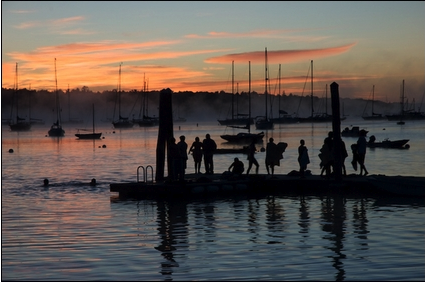
Marion is a town in Plymouth County, Massachusetts, United States. The population was 5,347 at the 2020 census. For geographic and demographic information on the village of Marion Center, please see the article Marion Center, Massachusetts. History Marion was first settled in 1679 as "Sippican", a district of Rochester, Massachusetts. The name, which also lends itself to the river which passes through the north of town and the harbor at the heart of town, was the Wampanoag name for the local tribe. The town was mostly known for its many local sea captains and sailors whose homes were in town, although there were also some small shipbuilding operations on the harbor as well. By the late 1840s, however, tensions between the village of Mattapoisett and the town led to a battle which sought to redraw the town lines and effectively take over Sippican Village. This caused the villagers to form a committee, which went to Boston to petition for incorporation as its own town. Thus, ... [...More Info...] [...Related Items...] OR: [Wikipedia] [Google] [Baidu] |
List Of Sovereign States
The following is a list providing an overview of sovereign states around the world with information on their status and recognition of their sovereignty. The 206 listed states can be divided into three categories based on membership within the United Nations System: 193 UN member states, 2 UN General Assembly non-member observer states, and 11 other states. The ''sovereignty dispute'' column indicates states having undisputed sovereignty (188 states, of which there are 187 UN member states and 1 UN General Assembly non-member observer state), states having disputed sovereignty (16 states, of which there are 6 UN member states, 1 UN General Assembly non-member observer state, and 9 de facto states), and states having a special political status (2 states, both in free association with New Zealand). Compiling a list such as this can be a complicated and controversial process, as there is no definition that is binding on all the members of the community of nations concerni ... [...More Info...] [...Related Items...] OR: [Wikipedia] [Google] [Baidu] |
Wampanoag People
The Wampanoag , also rendered Wôpanâak, are an Indigenous people of the Northeastern Woodlands based in southeastern Massachusetts and historically parts of eastern Rhode Island,Salwen, "Indians of Southern New England and Long Island," p. 171. Their territory included the islands of Martha's Vineyard and Nantucket. Today there are two federally recognized Wampanoag tribes: * Mashpee Wampanoag Tribe * Wampanoag Tribe of Gay Head (Aquinnah). The Wampanoag language was a dialect of Masschusett, a Southern New England Algonquian language. At the time of their first contact with the English in the 17th century, they were a large confederation of at least 24 recorded tribes. Their population numbered in the thousands; 3,000 Wampanoag lived on Martha's Vineyard alone. From 1615 to 1619, the Wampanoag suffered an epidemic, long suspected to be smallpox. Modern research, however, has suggested that it may have been leptospirosis, a bacterial infection that can develop into Weil's ... [...More Info...] [...Related Items...] OR: [Wikipedia] [Google] [Baidu] |
Census
A census is the procedure of systematically acquiring, recording and calculating information about the members of a given population. This term is used mostly in connection with national population and housing censuses; other common censuses include censuses of agriculture, traditional culture, business, supplies, and traffic censuses. The United Nations (UN) defines the essential features of population and housing censuses as "individual enumeration, universality within a defined territory, simultaneity and defined periodicity", and recommends that population censuses be taken at least every ten years. UN recommendations also cover census topics to be collected, official definitions, classifications and other useful information to co-ordinate international practices. The UN's Food and Agriculture Organization (FAO), in turn, defines the census of agriculture as "a statistical operation for collecting, processing and disseminating data on the structure of agriculture, covering th ... [...More Info...] [...Related Items...] OR: [Wikipedia] [Google] [Baidu] |
Population Estimates Program
The Population Estimates Program (PEP) is a program of the U.S. Census Bureau that publishes annual population estimates and estimates of birth, death, and international migration rates for people in the United States. In addition to publishing those aggregate estimates for the entire country, the program also publishes those yearly estimates by age, sex, race, and Hispanic origin at the national, state, county and city and town level. By doing so, the Population Estimates Program provides up-to-date information on how the size and distribution of the US population has changed each year since the most recent 10-year US Census. The estimates produced by the Population Estimates Program are used in determining how federal funds should be allocated throughout the United States. The annual population estimates are also used as controls for the American Community Survey and the Current population survey (US), which in turn measure diverse demographic Demography () is the stati ... [...More Info...] [...Related Items...] OR: [Wikipedia] [Google] [Baidu] |
Weweantic River
The Weweantic River is a U.S. Geological Survey. National Hydrography Dataset high-resolution flowline dataThe National Map accessed April 1, 2011 river in southeastern Massachusetts. Its name means "crooked" or "wandering stream" in the Wampanoag language. The river arises in wetlands in Carver, meanders generally south through swampy birch and maple forests in Middleborough and Rochester, and drains into a Buzzards Bay estuary in Wareham near the mouth of the Sippican River. Its watershed covers approximately , with many cranberry bogs in its upper reaches. Although the river has historically abounded in fish and shellfish, it currently has no significant herring population due to dam obstruction below Horseshoe Pond, and is closed to shellfish harvesting due to bacterial contamination. References Save Buzzards BayEnvironmental Protection Agency* List of place names of Native American origin in New England The region of New England in the United States has numerous place ... [...More Info...] [...Related Items...] OR: [Wikipedia] [Google] [Baidu] |
Providence, Rhode Island
Providence is the capital and most populous city of the U.S. state of Rhode Island. One of the oldest cities in New England, it was founded in 1636 by Roger Williams, a Reformed Baptist theologian and religious exile from the Massachusetts Bay Colony. He named the area in honor of "God's merciful Providence" which he believed was responsible for revealing such a haven for him and his followers. The city developed as a busy port as it is situated at the mouth of the Providence River in Providence County, at the head of Narragansett Bay. Providence was one of the first cities in the country to industrialize and became noted for its textile manufacturing and subsequent machine tool, jewelry, and silverware industries. Today, the city of Providence is home to eight hospitals and List of colleges and universities in Rhode Island#Institutions, eight institutions of higher learning which have shifted the city's economy into service industries, though it still retains some manufacturin ... [...More Info...] [...Related Items...] OR: [Wikipedia] [Google] [Baidu] |
New Bedford, Massachusetts
New Bedford (Massachusett language, Massachusett: ) is a city in Bristol County, Massachusetts, Bristol County, Massachusetts. It is located on the Acushnet River in what is known as the South Coast (Massachusetts), South Coast region. Up through the 17th century, the area was the territory of the Wampanoag Native American people. English colonists bought the land on which New Bedford would later be built from the Wampanoag in 1652, and the original colonial settlement that would later become the city was founded by English Quakers in the late 17th century. The town of New Bedford itself was officially incorporated in 1787. During the first half of the 19th century, New Bedford was one of the world's most important whaling ports. At its economic height during this period, New Bedford was the wealthiest city in the world per capita. New Bedford was also a Abolitionism in New Bedford, Massachusetts, center of abolitionism at this time. The city attracted many freed or escaped Afric ... [...More Info...] [...Related Items...] OR: [Wikipedia] [Google] [Baidu] |
Cape Cod Canal
The Cape Cod Canal is an artificial waterway in the U.S. state of Massachusetts connecting Cape Cod Bay in the north to Buzzards Bay in the south, and is part of the Atlantic Intracoastal Waterway. The approximately canal traverses the neck of land joining Cape Cod to the state's mainland. It mostly follows tidal rivers widened to and deepened to at mean low water, shaving off the journey around the Cape for its approximately 14,000 annual users. Most of the canal is located in the town of Bourne, but its northeastern terminus is in Sandwich. Scusset Beach State Reservation lies near the canal's north entrance, and the Massachusetts Maritime Academy is near its south. A swift-running current changes direction every six hours and can reach during the receding ebb tide. The waterway is maintained by the United States Army Corps of Engineers and has no toll fees. It is spanned by the Cape Cod Canal Railroad Bridge, the Bourne Bridge, and the Sagamore Bridge. Traffic lights ... [...More Info...] [...Related Items...] OR: [Wikipedia] [Google] [Baidu] |
Wareham, Massachusetts
Wareham ( ) is a town in Plymouth County, Massachusetts, United States. As of the 2020 census, the town had a population of 23,303. History Wareham was first settled in 1678 by Europeans as part of the towns of Plymouth, Massachusetts, Plymouth and Rochester, Massachusetts, Rochester. It was officially incorporated in 1739 and named after the town of Wareham, Dorset, Wareham in England. Because of its geography, Wareham's early industry revolved around shipbuilding and the related industries. It also served as a resort town, with many smaller resorts scattered around the town, especially in Onset. Like Sandwich, Massachusetts, Sandwich, its waterways, especially Buttermilk Bay, were considered as possible pathways for the Cape Cod Canal. Although the canal proper goes through Bourne, Massachusetts, Bourne and Sandwich, the southern approach to Buzzards Bay, Massachusetts, Buzzards Bay passes just south of the peninsulas that make up the topography of the town. Wareham is home ... [...More Info...] [...Related Items...] OR: [Wikipedia] [Google] [Baidu] |
Buzzards Bay
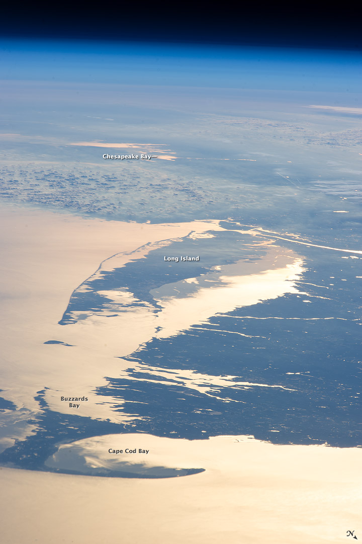
Buzzards Bay is a bay of the Atlantic Ocean adjacent to the U.S. state of Massachusetts. It is approximately 28 miles (45 kilometers) long by 8 miles (12 kilometers) wide. It is a popular destination for fishing, boating, and tourism. Since 1914, Buzzards Bay has been connected to Cape Cod Bay by the Cape Cod Canal. In 1988, under the Clean Water Act, the Environmental Protection Agency and the Commonwealth of Massachusetts designated Buzzards Bay to the National Estuary Program, as "an estuary of national significance" that is threatened by pollution, land development, or overuse. Geography It is surrounded by the Elizabeth Islands on the south, by Cape Cod on the east, and the southern coasts of Bristol and Plymouth counties in Massachusetts to the northwest. To the southwest, the bay is connected to Rhode Island Sound. The city of New Bedford, Massachusetts is a historically significant port on Buzzards Bay; it was the world's most successful whaling port during the ... [...More Info...] [...Related Items...] OR: [Wikipedia] [Google] [Baidu] |


%2C_1834_map.jpg)

