|
Leverett, Massachusetts
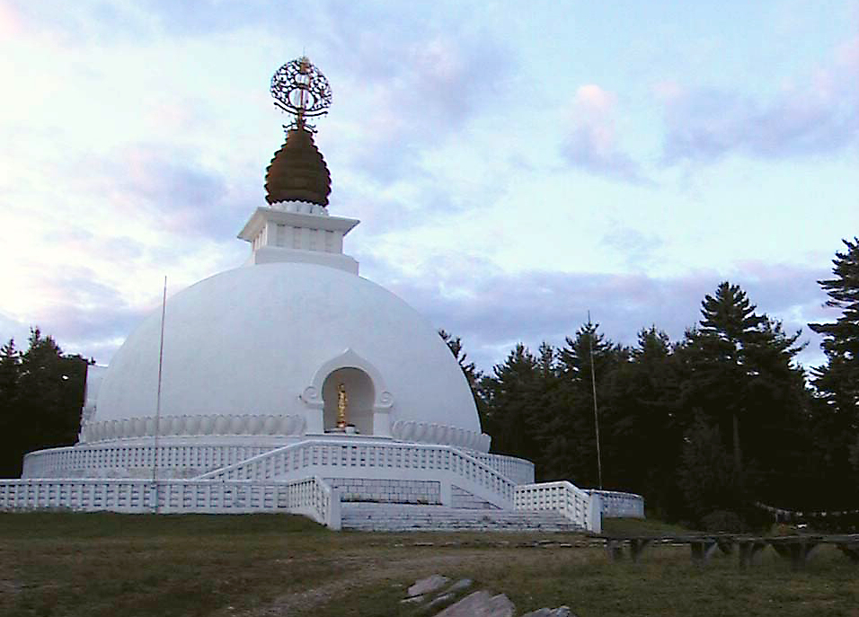
Leverett is a town in Franklin County, Massachusetts, United States. The population was 1,865 as of the 2020 census. It is part of the Springfield, Massachusetts Metropolitan Statistical Area. History The Town of Leverett is located on the traditional lands of the Pennacook and the Pocomtuc Nations. Leverett is one of the southernmost towns of Franklin County, located west of Shutesbury and Wendell, east of Sunderland, south of Montague, and north of Amherst. Leverett was originally part of Sunderland (named Swampfield at that time). The first non-indigenous settlement was established in 1750, and the settlers officially petitioned Sunderland to become their own town in 1774. The town was named for John Leverett, the twentieth Governor of the Massachusetts Bay Colony. In 1985, a Buddhist monastic order called Nipponzan Myohoji erected a large monument in Leverett. This structure, known as the New England Peace Pagoda, is considered the first of its kind in North America ... [...More Info...] [...Related Items...] OR: [Wikipedia] [Google] [Baidu] |
New England Peace Pagoda
The New England Peace Pagoda is a peace pagoda located in Leverett, Massachusetts. It was the first Nipponzan-Myōhōji peace pagoda to be built in the United States. History The peace pagoda is tied to Buddhism's Nichiren tradition, and more specifically to the Nipponzan-Myōhōji order, which was founded in 1917 by Nichidatsu Fujii. In response to the atomic bombings of Hiroshima and Nagasaki, Fujii began constructing pagodas around the world to encourage peace in 1947. In 1982, the order held a series of peace walks to New York City to the United Nations special session on disarmament. One of the peace walks passed through western Massachusetts, and the area was identified as a potential site for a peace pagoda. The pagoda was completed in 1986, featuring a 100-foot-high dome and several statues of the Buddha, carved by Sri Lankan artisans. The site also contains a reflecting pool and rock garden. Peter Gregory, a religion professor at nearby Smith College, said that plans ... [...More Info...] [...Related Items...] OR: [Wikipedia] [Google] [Baidu] |
Sunderland, Massachusetts
Sunderland is a town A town is a human settlement. Towns are generally larger than villages and smaller than cities, though the criteria to distinguish between them vary considerably in different parts of the world. Origin and use The word "town" shares an ori ... in Franklin County, Massachusetts, Franklin County, Massachusetts, United States, part of the Pioneer Valley. The population was 3,663 at the 2020 United States Census, 2020 census. It is part of the Springfield, Massachusetts Springfield metropolitan area, Massachusetts, Metropolitan Statistical Area. Sunderland was first settled in 1713 and was officially incorporated in 1718. It was first known as Swampfield, a name which is now honored by Swampfield Road, but the name was changed to attract more residents. It was renamed in honor of Charles Spencer, 3rd Earl of Sunderland, Charles Spencer, the Earl of Sunderland. Historically, the land was largely used for farming. Before the incorporation of Leverett, Massa ... [...More Info...] [...Related Items...] OR: [Wikipedia] [Google] [Baidu] |
Leverett Center
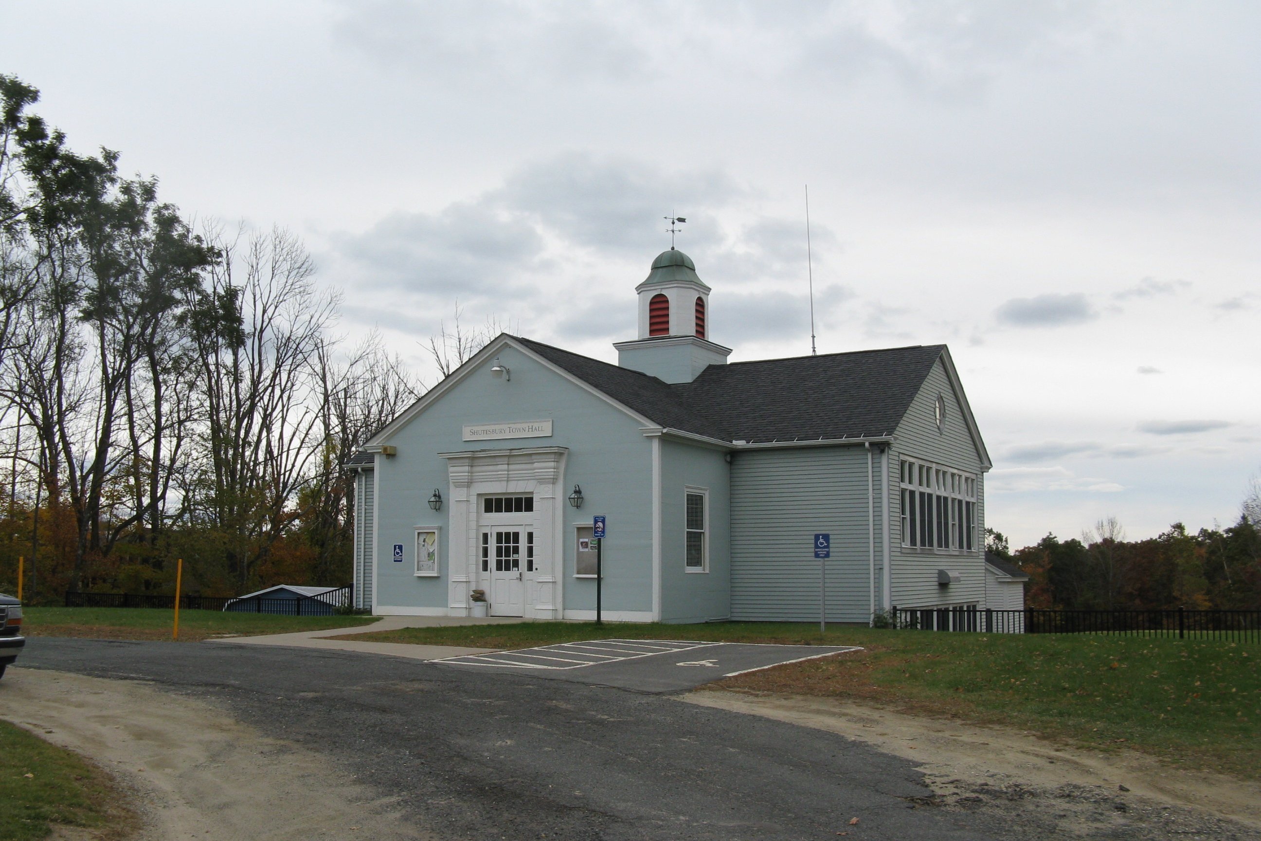
The Leverett Center Historic District is an expansive historic district encompassing the historic heart of the rural community of Leverett in eastern Franklin County, Massachusetts. The district is focused on a two-mile stretch of Depot and Montague Roads, at whose center is the civic heart of the town. It includes the 1838 Greek Revival First Congregational Church, the town hall, whose present form was achieved in 1895 by raising the 1845 construction and building a first floor underneath it, and the Colonial Revival Field Memorial Library (1916). It also includes a town pound (a stone-walled pen for stray livestock) built c. 1822, and a number of 18th century residences. The district was listed on the National Register of Historic Places in 2008. Leverett was first settled in the late 17th century as part of Sunderland, and was separately incorporated in 1774. Its town center, located at the junction of Depot, Montague, and Shutesbury Roads, arose by the placement there ... [...More Info...] [...Related Items...] OR: [Wikipedia] [Google] [Baidu] |
Shutesbury, Massachusetts
Shutesbury is a New England town, town in Franklin County, Massachusetts, Franklin County, Massachusetts, United States. The population was 1,717 at the 2020 United States Census, 2020 census. It is part of the Springfield, Massachusetts Springfield metropolitan area, Massachusetts, Metropolitan Statistical Area. History For at least 2,000 years, Nipmuc towns along the Towanucksett and Quinneticut Rivers called the area covering what are now South Shutesbury, NE Amherst and parts of Pelham "Sanakkamak", meaning "difficult land", according to the Indian Land Archives of Springfield (1660–1835), now housed at Cornell University. According to the same archives (pages 31–33), the land was named Sanakkamak "on accord of its many ponds, swamps, and streams" leading to steep slopes of Kunckquatchu (Mt. Toby) and Quaquatchu (Brushy Mountain). The northern parts of Shutesbury, as well as parts of Belchertown and Pelham along the former Swift River (now Quabbin Reservoir), were calle ... [...More Info...] [...Related Items...] OR: [Wikipedia] [Google] [Baidu] |
Wendell, Massachusetts
Wendell is a town in Franklin County, Massachusetts, United States. The population was 924 at the 2020 census. It is part of the Springfield, Massachusetts Metropolitan Statistical Area. History Wendell was first settled in 1754 and was officially incorporated in 1781. It was named after Judge Oliver Wendell of Boston. The town center has been listed as a historic district on the National Register of Historic Places. On July 11, 2006, a strong F2 tornado moved through town, starting near Wickett Pond, traveling about ', and ending about a half mile east of New Salem Road. The path varied in width from . The tornado knocked down trees, including an old maple tree, whose falling damaged gravestones in a historic cemetery in Wendell Center. While trees were downed and some structures damaged, no one was injured. Geography According to the United States Census Bureau, the town has a total area of , of which is land and , or 1.15%, is water. The town has two post offices. One ... [...More Info...] [...Related Items...] OR: [Wikipedia] [Google] [Baidu] |
Montague, Massachusetts
Montague is a town in Franklin County, Massachusetts, United States. The population was 8,580 at the 2020 census. It is part of the Springfield, Massachusetts metropolitan statistical area. The villages of Montague Center, Montague City, Lake Pleasant, Millers Falls, and Turners Falls are located in the town of Montague; Turners Falls, comprising over half the population of the town and its main business district, is sometimes used as a metonym for the entire town of Montague. History Originally inhabited by the Pocomtuc tribe, the area was known as ''Peskeompskut''. Montague was first settled by Europeans in 1715 and was incorporated in 1754. The town has five villages within it: Montague Center, Montague City, Turners Falls, Millers Falls, and Lake Pleasant. Montague Center was the original European settlement and was originally a part of the town of Sunderland. Lake Pleasant was a prominent spiritualist campground. Turners Falls was a planned mill community (similar to ... [...More Info...] [...Related Items...] OR: [Wikipedia] [Google] [Baidu] |
Hampshire County, Massachusetts
Hampshire County is a historical and judicial county located in the U.S. state of Massachusetts. Following the dissolution of the county government in 1999, county affairs were managed by the Hampshire Council of Governments, which itself ceased operations in 2019, due to a "fundamentally flawed, unsustainable operational model". As of the 2020 census, the population was 162,308. Its most populous municipality is Amherst, its largest town in terms of landmass is Belchertown, and its traditional county seat is Northampton. The county is named after the county Hampshire, in England. Hampshire County is part of the Springfield, MA Metropolitan Statistical Area. Together with Hampden County, Hampshire County municipalities belong to the Pioneer Valley Planning Commission. History Hampshire County was constituted in 1662 from previously unorganized territory comprising the entire western part of Massachusetts Bay Colony. It included the original towns of Springfield, Northampt ... [...More Info...] [...Related Items...] OR: [Wikipedia] [Google] [Baidu] |
Rattlesnake Gutter
Rattlesnake Gutter is a scenic boulder filled chasm, 3/4 mile long and 1/8 mile wide, located in Leverett, Massachusetts. The origins of the gutter are uncertain, but theories include: * A subglacial meltwater channel * A tear at the site of an old geologic fault. * A spillway for a temporary proglacial lake. An important ecological habitat, the property is under conservation stewardship. The Metacomet-Monadnock Trail The Metacomet-Monadnock Trail (M&M Trail) is a hiking trail that traverses the Metacomet Ridge of the Pioneer Valley region of Massachusetts and the central uplands of Massachusetts and southern New Hampshire. Although less than from Boston and ... passes near the gutter. Recreation This chasm is along a short section of the Metacomet-Monadnock Trail just south of the Leverett COOP near Shutesbury Road. References * http://www.science.smith.edu/departments/Geology/5Cgeology/Students/Abstracts01/Greenwood.pdf Landforms of Franklin County, Massachuset ... [...More Info...] [...Related Items...] OR: [Wikipedia] [Google] [Baidu] |
Mount Toby
Mount Toby, , is the highest summit of a sprawling collection of mostly wooded hills and knolls that rise from a distinct plateau-like upland in the towns of Sunderland and Leverett, Massachusetts, just east of the Connecticut River. This mountain mass, part of the Metacomet Ridge geology, is oval shaped and roughly three miles by two miles wide. Although three of the subordinate peaks have names of their own (Roaring Mountain, Ox Hill, Bull Hill), none of them are noteworthy on their own, and the designation “Mount Toby” is most often used (locally and formally) to describe the entire geologic mass."Mount Toby Ecosystem.” The Mount Toby Partnership. University of Massachusetts Amherst. PDF webfile, cited November 30, 2007. [...More Info...] [...Related Items...] OR: [Wikipedia] [Google] [Baidu] |
Connecticut River
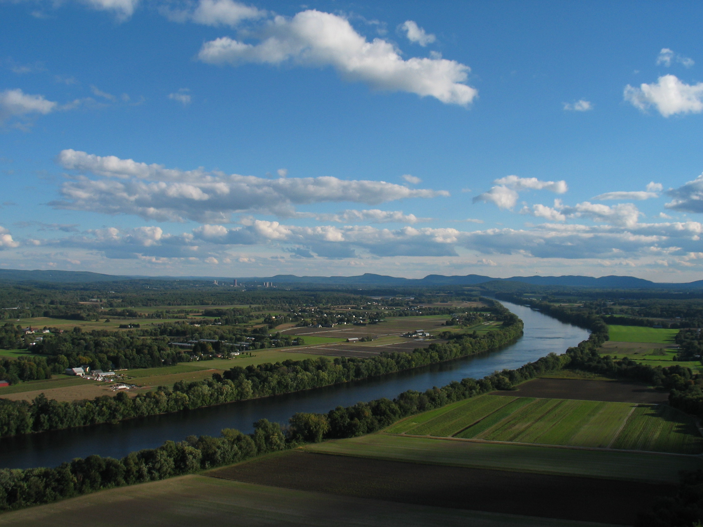
The Connecticut River is the longest river in the New England region of the United States, flowing roughly southward for through four states. It rises 300 yards (270 m) south of the U.S. border with Quebec, Canada, and discharges at Long Island Sound. Its watershed encompasses , covering parts of five U.S. states and one Canadian province, via 148 tributaries, 38 of which are major rivers. It produces 70% of Long Island Sound's fresh water, discharging at per second. The Connecticut River Valley is home to some of the northeastern United States' most productive farmland, as well as the Hartford–Springfield Knowledge Corridor, a metropolitan region of approximately two million people surrounding Springfield, Massachusetts, and Hartford, Connecticut. History The word "Connecticut" is a corruption of the Mohegan word ''quinetucket'', which means "beside the long, tidal river". The word came into English during the early 1600s to name the river, which was also called simply "Th ... [...More Info...] [...Related Items...] OR: [Wikipedia] [Google] [Baidu] |
Pioneer Valley
The Pioneer Valley is the colloquial and promotional name for the portion of the Connecticut River Valley that is in Massachusetts in the United States. It is generally taken to comprise the three counties of Hampden, Hampshire, and Franklin. The lower Pioneer Valley corresponds to the Springfield, Massachusetts metropolitan area, the region's urban center, and the seat of Hampden County. The upper Pioneer Valley region includes the smaller cities of Northampton and Greenfield, the county seats of Hampshire and Franklin counties, respectively. Historically the northern part of the Valley was an agricultural region, known for growing Connecticut shade tobacco and other specialty crops like Hadley asparagus; however, since the late 19th century its economy has become increasingly a knowledge economy, due to the prominence of the Five Colleges in Hampshire County. Similarly the Springfield- Chicopee-Holyoke economies transformed from volume producers of goods such as pa ... [...More Info...] [...Related Items...] OR: [Wikipedia] [Google] [Baidu] |
Rattlesnake Falls
Rattlesnakes are venomous snakes that form the genera '' Crotalus'' and '' Sistrurus'' of the subfamily Crotalinae (the pit vipers). All rattlesnakes are vipers. Rattlesnakes are predators that live in a wide array of habitats, hunting small animals such as birds and rodents. Rattlesnakes receive their name from the rattle located at the end of their tails, which makes a loud rattling noise when vibrated that deters predators or serves as a warning to passers-by. Rattlesnakes are the leading contributor to snakebite injuries in North America, but rarely bite unless provoked or threatened; if treated promptly, the bites are seldom fatal. The 36 known species of rattlesnakes have between 65 and 70 subspecies, all native to the Americas, ranging from British Columbia through Ontario in southern Canada, to central Argentina. The largest rattlesnake, the eastern diamondback, can measure up to in length. Rattlesnakes are preyed upon by hawks, weasels, king snakes, and a variety o ... [...More Info...] [...Related Items...] OR: [Wikipedia] [Google] [Baidu] |


.jpg)