|
Lake Balboa, Los Angeles
Lake Balboa is a neighborhood in the San Fernando Valley region of Los Angeles, California. The area was previously part of Van Nuys. Map . ''Lake Balboa Neighborhood Council''. Retrieved on December 6, 2008. Population The 2000 U.S. census counted 24,328 residents in the 3.13-square-mile Lake Balboa neighborhood—or 7,754 people per square mile, about an average population density for the city. In 2008, the city estimated that the population had increased to 26,195. In 2000 the median age for residents was 35, considered average for city and county neighborhoods, but the percentage of residents aged 35 to 49 was among the county's highest.[...More Info...] [...Related Items...] OR: [Wikipedia] [Google] [Baidu] |
Neighborhoods Of Los Angeles
This is a list of notable districts and neighborhoods within the city of Los Angeles, Los Angeles, California, present and past. It includes residential and commercial areas and business-improvement districts, but does not include sales subdivisions or sales tracts. The guiding precept is Wikipedia:Notability (geographic features)#Geographic regions, areas and places. AE * Adams-Normandie, Los Angeles, Adams-Normandie * Alsace, California, Alsace * Angelino Heights, Los Angeles, Angelino Heights''The Thomas Guide: Los Angeles County'', Rand McNally (2004), pages N and O * Angeles Mesa, Los Angeles, Angeles Mesa * Angelus Vista, Los Angeles, Angelus Vista * Arleta, Los Angeles, ArletaNeighborhoods , Mapping L.A., ''Los Angeles Times'' * Arlington Heights, Los Angeles, Arlington Heights * Arts Di ... [...More Info...] [...Related Items...] OR: [Wikipedia] [Google] [Baidu] |
Victory Boulevard (Los Angeles)
Victory Boulevard is a major east-west arterial road that runs traversing the entire length of the San Fernando Valley in Los Angeles County, Southern California, United States. Geography Victory Boulevard is approximately 25 miles (40 km) long, and is notable for several reasons. Victory Boulevard is the street where one will find the West Valley's major malls at Fallbrook Center and Westfield Topanga, through the Warner Center business district, along a section of the Metro G Line and by three of its stations, past Pierce College, through the Sepulveda Basin Recreation Center with Lake Balboa, Pedlow Skate Park and golf courses, then through the communities of Van Nuys, Valley Glen and North Hollywood in the center of the valley, crossing the Tujunga Wash, and continuing past Valhalla Memorial Park Cemetery with its Portal of the Folded Wing, through Burbank's entertainment district, passing the Nickelodeon studios at Olive Avenue, then veering southeast to its ea ... [...More Info...] [...Related Items...] OR: [Wikipedia] [Google] [Baidu] |
Los Angeles Fire Department
The Los Angeles Fire Department (LAFD or LA City Fire) provides emergency medical services, fire cause determination, fire prevention, fire suppression, hazardous materials mitigation, and technical rescue services to the city of Los Angeles, California, United States. The LAFD is responsible for approximately 4 million people who live in the agency's jurisdiction. The Los Angeles Fire Department was founded in 1886 and is one of the largest municipal fire departments in the United States, after the New York City Fire Department and the Chicago Fire Department. The department may be unofficially referred to as the ''Los Angeles City Fire Department'' or "LA City Fire" to distinguish it from the Los Angeles County Fire Department which serves the county and whose name may directly confuse people, as the county seat is the city. Another possible reason is that the city and the unincorporated county are often bordering each other and thus the two appear to be serving the sa ... [...More Info...] [...Related Items...] OR: [Wikipedia] [Google] [Baidu] |
Los Angeles City Council District 12
Los Angeles City Council District 12 is one of the 15 districts of the Los Angeles City Council. It encompasses the northwestern and western section of the San Fernando Valley, in the city of Los Angeles. It is represented by John Lee. On August 14, 2019 candidate John Lee claimed victory as the results showed him with a sizable lead over his opponent. Los Angeles City Council elections are nonpartisan. Lee is the only Independent on the 15-member council, his predecessors, Smith and Englander were Republicans. With Lee, the City Council includes two Asian Americans (the other being Councilmember Nithya Raman), the most in its history. __TOC__ Politics Geography Modern The district covers the northwestern San Fernando Valley communities of * Chatsworth, * Granada Hills * Northridge * Porter Ranch * West Hills *Sherwood Forest *and parts of North Hills, and Reseda. Seofficial city map outlining District 12. Historic From 1925 to 1964 the district occupied the s ... [...More Info...] [...Related Items...] OR: [Wikipedia] [Google] [Baidu] |
Los Angeles City Council District 6
Los Angeles City Council District 6 is one of the 15 districts of the Los Angeles City Council, covering much of the central and eastern San Fernando Valley. The seat is currently vacant due to the resignation of Nury Martinez on October 12, 2022. Geography Present-day district The 6th Council District includes the neighborhoods of North Hollywood, Sun Valley, Van Nuys, Lake Balboa, Panorama City, Pacoima and Arleta. For all neighborhoods represented in the district, see the officiaCity of Los Angeles map of District 6 Historical locations A new city charter effective in 1925 replaced the former " at large" voting system for a nine-member council with a district system with a 15-member council. Each district was to be approximately equal in population, based upon the voting in the previous gubernatorial election; thus redistricting was done every four years. (At present, redistricting is done every ten years, based upon the preceding U.S. census results.) The numbering s ... [...More Info...] [...Related Items...] OR: [Wikipedia] [Google] [Baidu] |
Orange Line (Los Angeles Metro)
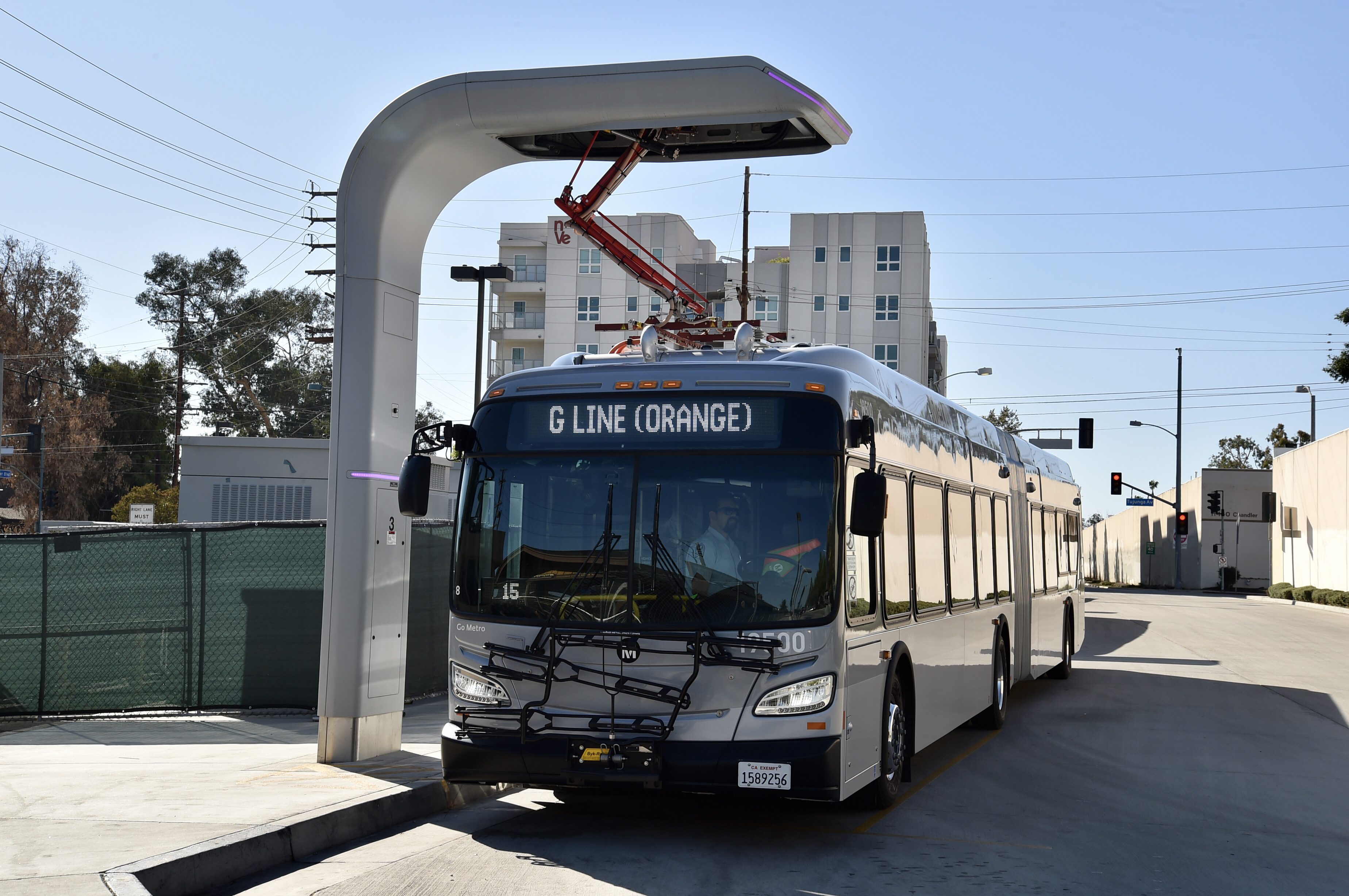
The G Line (formerly the Orange Line) is a bus rapid transit line in Los Angeles, California, operated by the Los Angeles County Metropolitan Transportation Authority (Metro). It operates between and stations in the San Fernando Valley. The G Line uses a dedicated, exclusive right-of-way for the entirety of its route with 17 stations located at approximately intervals; fares are paid via TAP cards at vending machines on station platforms before boarding to improve performance. It is one of the two lines in the Metro Busway system. The line, which opened on October 29, 2005, follows part of the Southern Pacific Railroad's former Burbank Branch Line which provided passenger rail service from 1904 to 1920; it was subsequently used by Pacific Electric streetcars from 1911 to 1952. At North Hollywood station, the G Line connects with the B Line subway which offers service to Downtown Los Angeles via Hollywood. The Metro Orange Line bicycle path runs alongside part of the ro ... [...More Info...] [...Related Items...] OR: [Wikipedia] [Google] [Baidu] |
Orange Line Bikeway
The Orange Line Bikeway is a cycle route in Los Angeles County, California that runs and “spans the lengths of the San Fernando Valley’s major communities” from Chatsworth to North Hollywood, “connecting such places as Pierce College, the Sepulveda Basin Recreation Area, the Van Nuys Government Center and Valley College.” The Orange Line Bikeway's “seventeen-point-nine miles of exclusive, smooth, and lush active mobility glory” runs alongside the G Line bus rapid transit route. The Orange Line Bikeway is one of two major bicycle routes in Los Angeles that share dedicated rights-of-way with mass transit, the other being the Expo Line Bikeway in west L.A. The Class I off-street bike path section of the Bikeway runs from Chatsworth station to approximately Valley College station. The section on Chandler Boulevard is a Class II on-street bike lane (beginning on the west between Coldwater Canyon and Fulton Avenue, near the Ethel Avenue crossing, and cont ... [...More Info...] [...Related Items...] OR: [Wikipedia] [Google] [Baidu] |
Woodley Park (Los Angeles, California)
Woodley Park is a recreation area managed by the City of Los Angeles and located along Woodley Avenue between Victory and Burbank Boulevards in the Lake Balboa neighborhood of Los Angeles, California. The area is located within the large Sepulveda Basin Recreation Area in the central San Fernando Valley. The Tillman Water Reclamation Plant is adjacent to the park and surrounded by The Japanese Garden, a large Japanese garden open to the public. Recreation * Picnic areas * Archery club and archer training grounds, some who have become world and Olympic champions in the late 1990s and early 2000s Cricket Woodley Park has five cricket grounds in the Leo Magnus Cricket Complex, and draws many of the best cricket players in the Los Angeles area. On many weekends, Woodley Park hosts a number of games of cricket being played by expats of Britain and Commonwealth counties, and British influenced countries, including India, Pakistan, Sri Lanka, Australia, South Africa, New Zeala ... [...More Info...] [...Related Items...] OR: [Wikipedia] [Google] [Baidu] |
Tillman Water Reclamation Plant
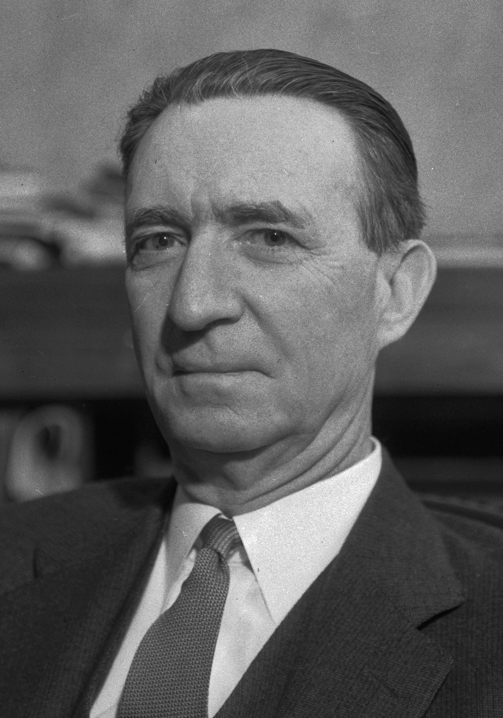
The Donald C. Tillman Water Reclamation Plant is a water reclamation plant located in Van Nuys, Los Angeles, California, United States. The plant was conceived of, designed and constructed by the City of Los Angeles' Bureau of Engineering. The Administration Building was designed by California architect Anthony J. Lumsden. It is home to The Japanese Garden, which has been used as a backdrop in films and television, including '' Dead Heat'', '' Matlock'', '' Knight Rider'', '' Bio-Dome'', '' Twins'', and Starfleet Academy from ''Star Trek ''Star Trek'' is an American science fiction media franchise created by Gene Roddenberry, which began with the eponymous 1960s television series and quickly became a worldwide pop-culture phenomenon. The franchise has expanded into vari ...''. The facility treats and reclaims wastewater by removing it from the sewer system and reducing the need for large sewer pipes downstream from the plant. The treated water is discharged to th ... [...More Info...] [...Related Items...] OR: [Wikipedia] [Google] [Baidu] |
Japanese Garden
are traditional gardens whose designs are accompanied by Japanese aesthetics and philosophical ideas, avoid artificial ornamentation, and highlight the natural landscape. Plants and worn, aged materials are generally used by Japanese garden designers to suggest a natural landscape, and to express the fragility of existence as well as time's unstoppable advance. Ancient Japanese art inspired past garden designers. Water is an important feature of many gardens, as are rocks and often gravel. Despite there being many attractive Japanese flowering plants, herbaceous flowers generally play much less of a role in Japanese gardens than in the West, though seasonally flowering shrubs and trees are important, all the more dramatic because of the contrast with the usual predominant green. Evergreen plants are "the bones of the garden" in Japan. Though a natural-seeming appearance is the aim, Japanese gardeners often shape their plants, including trees, with great rigour. Japanese literatur ... [...More Info...] [...Related Items...] OR: [Wikipedia] [Google] [Baidu] |
The Japanese Garden
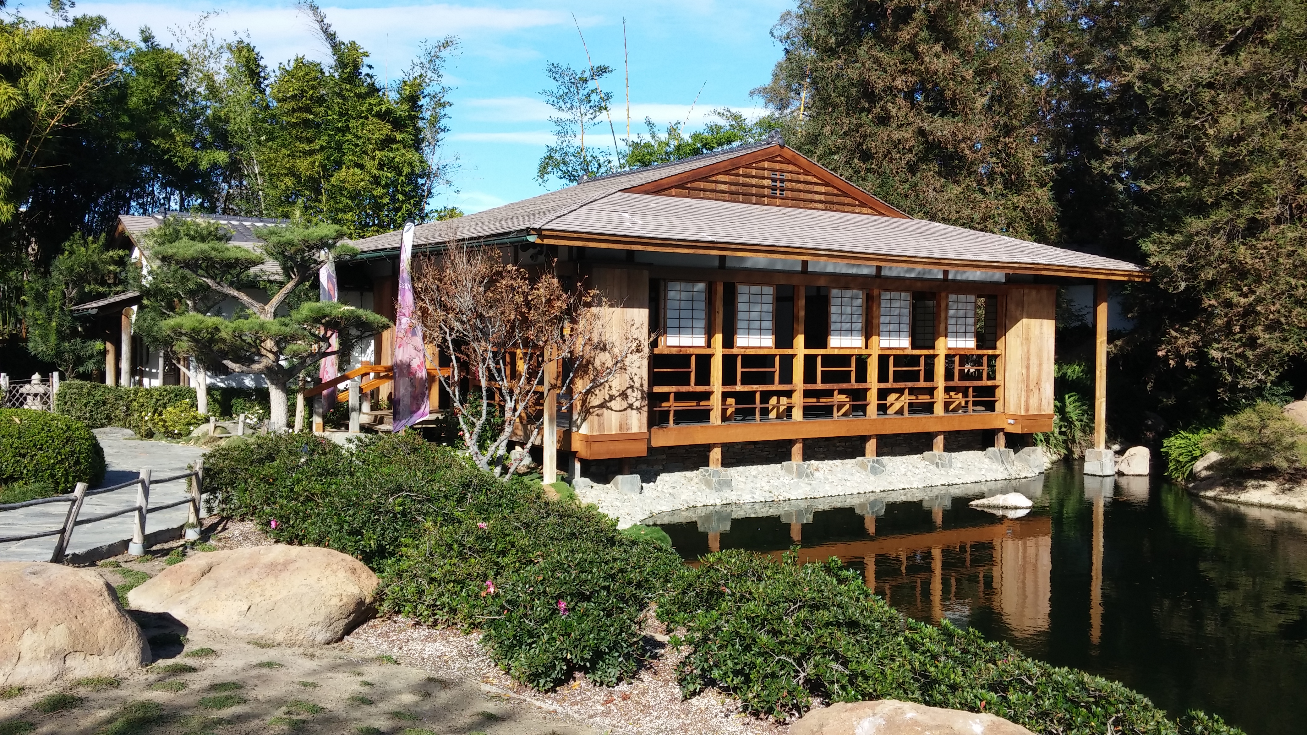
The Japanese Garden is a public Japanese garden in Los Angeles, located in the Lake Balboa district in the central San Fernando Valley, adjacent to the Van Nuys and Encino neighborhoods. It is specifically on the grounds of the Tillman Water Reclamation Plant adjacent to Woodley Park, in the Sepulveda Basin Recreation Area.Thejapanesegarden.com: The Japanese Garden . accessed 28 June 2016. The garden's Japanese name is ''Suihō-en'' (水芳園) meaning "garden of water and fragrance." The idea of having a Japanese Garden adjacent to a water reclamation plant was conceived by Donald C. Tillman. The garden's purpose was to demonstrate a positive use of reclaimed water, in what is usually considered a de ... [...More Info...] [...Related Items...] OR: [Wikipedia] [Google] [Baidu] |
Anthony C
Anthony or Antony is a masculine given name, derived from the '' Antonii'', a ''gens'' ( Roman family name) to which Mark Antony (''Marcus Antonius'') belonged. According to Plutarch, the Antonii gens were Heracleidae, being descendants of Anton, a son of Heracles. Anthony is an English name that is in use in many countries. It has been among the top 100 most popular male baby names in the United States since the late 19th century and has been among the top 100 male baby names between 1998 and 2018 in many countries including Canada, Australia, England, Ireland and Scotland. Equivalents include ''Antonio'' in Italian, Spanish, Portuguese and Maltese; ''Αντώνιος'' in Greek; ''António'' or ''Antônio'' in Portuguese; ''Antoni'' in Catalan, Polish, and Slovene; '' Anton'' in Dutch, Galician, German, Icelandic, Romanian, Russian, and Scandinavian languages; ''Antoine'' in French; '' Antal'' in Hungarian; and ''Antun'' or ''Ante'' in Croatian. The usual abbreviated for ... [...More Info...] [...Related Items...] OR: [Wikipedia] [Google] [Baidu] |


