|
Kuršumlija
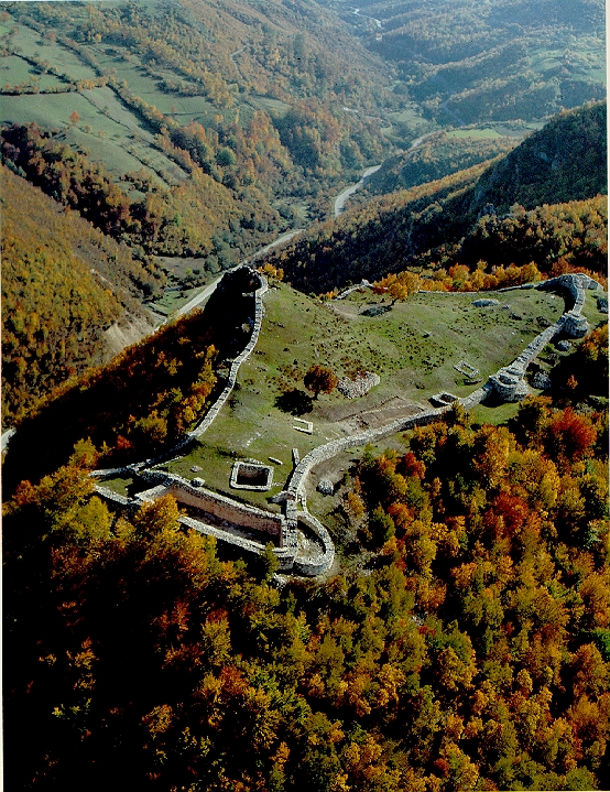
Kuršumlija ( sr-Cyrl, Куршумлија, ) is a town and municipality located in the Toplica District of the southern Serbia. It is situated near the rivers Toplica, Kosanica and Banjska, southeast of Mount Kopaonik and northwest of Mount Radan. As of 2011, the town has 13,306 inhabitants, while municipality has 19,213. Geography Kuršumlija sits on the area of and administratively is in Toplica District. Its borders the municipalities of Brus, Blace, Prokuplje, Medveđa, Podujevo, and Leposavić. Its southwest border (105 km) is within the disputed territory of Kosovo. History The Romans established the Ad Fines military outpost in the 3rd century AD. There are also remains of churches from the Byzantine period. The Serbian principality of Rascia expanded from this region. Stefan Nemanja, a Serbian lord (župan), and the founder of Nemanjić dynasty, built his residence here, as well as the two monasteries of St Nicolas and the Holy Mother of God (before 1168) ... [...More Info...] [...Related Items...] OR: [Wikipedia] [Google] [Baidu] |
Stefan Nemanja
Stefan Nemanja (Serbian Cyrillic: , ; – 13 February 1199) was the Grand Prince ( Veliki Župan) of the Serbian Grand Principality (also known as Raška, lat. ) from 1166 to 1196. A member of the Vukanović dynasty, Nemanja founded the Nemanjić dynasty, and is remembered for his contributions to Serbian culture and history, founding what would evolve into the Serbian Empire, as well as the national church. According to the Serbian Academy of Sciences and Arts, Nemanja is also among the most remarkable Serbs for his literary contributions and altruistic attributes. In 1196, after three decades of warfare and negotiations, including the Third Norman invasion of the Balkans (1185–1186) which consolidated Serbia while distinguishing it from both Western and Byzantine spheres of influence, Nemanja abdicated in favour of his middle son Stefan Nemanjić, who later became the first King of Serbia. Nemanja ultimately went to Mount Athos, where he became a monk and took the name o ... [...More Info...] [...Related Items...] OR: [Wikipedia] [Google] [Baidu] |
Radan (mountain)
Radan (Serbian Cyrillic: Радан) is a mountain in southern Serbia, near the town of Kuršumlija. Its highest peak, Šopot, has an elevation of 1,408 meters above sea level. Radan separates the valleys of the Toplica and Jablanica rivers. It is well covered with deciduous and evergreen forests. The best known spot on Radan is the Devil's Town – a peculiar rock formation consisting of hundreds of mushroom-like posts, located on its southern slopes. Near the Devil's Town there are ruins of Ivanova kula – city of Ivan Kosančić, medieval military commander. Justiniana Prima (''Caričin grad''), a Byzantine city from the 6th century, is located on the southeast of the mountain, near Lebane. In summer 2010, Radan attracted media attention because of a " magnetic hill" located on a road near the village of Ivanje. After initial sensationalist articles about "anti-gravity", it soon turned out that it is just an optical illusion. Still, the hill is seen as an opportunity f ... [...More Info...] [...Related Items...] OR: [Wikipedia] [Google] [Baidu] |
Prokuplje
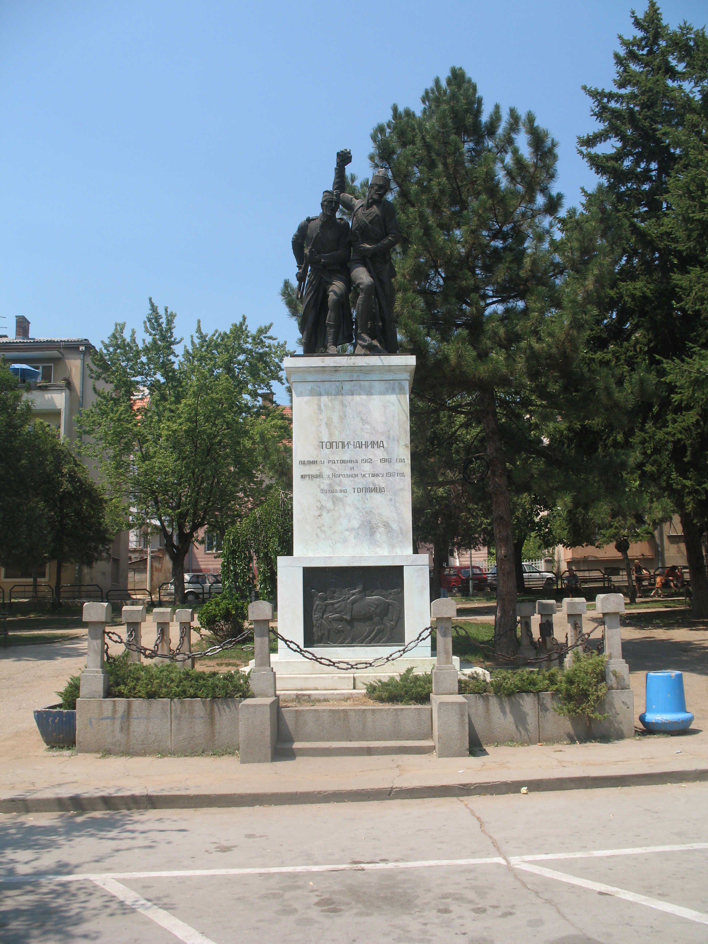
Prokuplje ( sr-cyrl, Прокупље, ) is a city and the administrative center of the Toplica District in southern Serbia. According to 2011 census, the city urban area has a population of 27,333 inhabitants, while the administrative area has 44,419 inhabitants. Prokuplje is one of the Roman sites of Serbia. The town was known as Ürgüp during Ottoman rule and was incorporated into the Kingdom of Serbia in 1878. Geography Prokuplje is located between municipalities of Blace, Kuršumlija, Bojnik, Žitorađa, Merošina, Aleksinac, and Kruševac. Climate Prokuplje has an warm-summer mediterranean climate (Köppen climate classification: ''Cwb'') that's close to a humid subtropical climate (Köppen climate classification: ''Cfa''). History and archaeology Neolithic and Copper Age The traces of early settlements can be found at Neolithic sites such as Macina (near Zitni Potok), Kavolak west of Prokuplje (village Donja Trnava) and settlements on the south slopes of Jast ... [...More Info...] [...Related Items...] OR: [Wikipedia] [Google] [Baidu] |
Kosanica
The Kosanica () is a river in southern Serbia. It is a southern, right tributary of the Toplica near Kuršumlija Kuršumlija ( sr-Cyrl, Куршумлија, ) is a town and municipality located in the Toplica District of the Southern Serbia (Geographical Region), southern Serbia. It is situated near the rivers Toplica River, Toplica, Kosanica and Banjska, .... The river is 34 km long and gives its name to the area it flows through, which constitutes with the south part of Kuršumlija municipality in south Serbia. Rivers of Serbia {{Serbia-river-stub ... [...More Info...] [...Related Items...] OR: [Wikipedia] [Google] [Baidu] |
Grand Principality Of Raška
Grand Principality of Serbia ( sr, Великожупанска Србија, Velikožupanska Srbija), or Rascia ( sr, Рашка, Raška), was a medieval Serbs, Serbian state that existed from the second half of the 11th century up until 1217, when it was transformed into the Kingdom of Serbia (medieval), Kingdom of Serbia. Initially, the Grand Principality of Serbia emerged in the historical region of Raška (region), Raška ( sr-Cyrl, Рашка; la, Rascia), and gradually expanded, during the 12th century, encompassing various neighboring regions, including territories of modern Montenegro, Herzegovina, and southern Dalmatia. It was founded by Grand Prince Vukan I of Serbia, Vukan, who initially ( 1082) served as regional governor of Raška, appointed by King Constantine Bodin. During Byzantine-Serbian wars ( 1090) Vukan gained prominence and became self-governing ruler in inner Serbian regions. He founded the Vukanović dynasty, that ruled the Grand Principality. Through dip ... [...More Info...] [...Related Items...] OR: [Wikipedia] [Google] [Baidu] |
List Of Cities In Serbia
, plural: ) is elected through popular vote, elected by their citizens in local elections. Also, the presidents of the municipalities are often referred to as "mayors" in everyday usage. There are 29 cities (, singular: ), each having an assembly and budget of its own. As with a municipality, the territory of a city is composed of a city proper and surrounding villages (e.g. the territory of the City of Subotica is composed of the Subotica town and surrounding villages). The capital Belgrade is the only city on the level of a district. All other cities are on the municipality level and are part of a district. ;City municipalities The city may or may not be divided into ''city municipalities''. Five cities (Belgrade, Niš, Požarevac, Vranje and Užice) comprise several city municipalities. Competences of cities and city municipalities are divided. The city municipalities of these six cities also have their assemblies and other prerogatives. The largest city municipality by number ... [...More Info...] [...Related Items...] OR: [Wikipedia] [Google] [Baidu] |
Municipalities And Cities Of Serbia
The municipalities and cities ( sr, општине и градови, opštine i gradovi) are the second level administrative subdivisions of Serbia. The country is divided into 145 municipalities ( sr-Latn, opštine, singular: ; 38 in Southern and Eastern Serbia, 42 in Šumadija and Western Serbia, 37 in Vojvodina and 28 in Kosovo and Metohija) and 29 cities (Serbian Latin: , singular: ; 9 in Southern and Eastern Serbia, 10 in Šumadija and Western Serbia, 8 in Vojvodina and one in Kosovo and Metohija), forming the basic level of local government. Municipalities and cities are the administrative units of Serbia, and they form 29 districts in groups, except the City of Belgrade which is not part of any district. A city may and may not be divided into city municipalities ( sr-Latn, gradske opštine, singular: ) depending on their size. Currently, there are six cities in Serbia with ''city municipalities'': Belgrade, Novi Sad, Niš, Požarevac, Užice and Vranje comprise several ... [...More Info...] [...Related Items...] OR: [Wikipedia] [Google] [Baidu] |
Toplica River
The Toplica ( sr-Cyrl, Топлица, ) is a river in southern Serbia. The river is 130 km long and gives its name to the region it flows through, which constitutes most of the modern Toplica District of Serbia. Upper course The Toplica originates under the name of ''Duboka'' from the eastern slopes of the Kopaonik mountain, just south of the highest peak, Pančićev vrh. It flows to the southeast, on the western slopes of the Lepa Gora mountain, next to the villages of Merćez, Selova, Žuč, Miljeviće and Dankoviće. At the monastery of Mačkovac, it reaches the northern side of the Radan mountain and turns to the east. This is also where the Toplica receives from the right its major tributary, Kosanica. Near the mouth are located city of Kuršumlija and medieval ruins of "Marina kula" (''The tower of Mara''), and this is where Toplica region begins. Toplica region The region is very fertile, especially for grains, fruits and grapes (famous ''prokupačko vino'', wine ... [...More Info...] [...Related Items...] OR: [Wikipedia] [Google] [Baidu] |
Vehicle Registration Plates Of Serbia
Vehicle registration plates of Serbia are issued using a two-letter region code, followed by three or four-digit numeric and a two-letter alpha license code, separated by a hyphen (e.g., BG 123-AA or BG 1234-AA). Overview The regional code and the license code are separated by the Serbian cross shield and a Cyrillic letter combination for the region below. A blue field is placed along the left side edge, as in European Union countries, bearing the ISO 3166-1 alpha-3 country code for Serbia (SRB). License numeric code contains combination of three digits (0-9), while two letter alpha code is made of combination of letters using Serbian Latin alphabet order, with addition of letters X, Y and W. The standard dimensions of a Serbian license plates are 520.5 × 112.9 mm. Issuance of current license plates started on 1 January 2011 and they were used alongside the old ones during the transitional period until the end of 2011. Regular license plates Following are the licens ... [...More Info...] [...Related Items...] OR: [Wikipedia] [Google] [Baidu] |
Telephone Numbers In Serbia
Regulation of the telephone numbers in Serbia is under the responsibility of the Regulatory Agency of Electronic Communication and Mail Services (RATEL), independent from the government. The country calling code of Serbia is +381. The country has an open telephone numbering plan, with most numbers consisting of a 2- or 3-digit calling code and a 6-7 digits of customer number. Overview The country calling code of Serbia is +381. Serbia and Montenegro received the code of +381 following the breakup of the Socialist Federal Republic of Yugoslavia in 1992 (which had +38 as country code). Montenegro switched to +382 after its independence in 2006, so +381 is now used only by Serbia. An example for calling telephones in Belgrade, Serbia is as follows: *xxx xx xx (within Belgrade) *011 xxx xx xx (within Serbia) *+381 11 xxx xx xx (outside Serbia) The international call prefix depends on the country being called from: for example, 00 for most European countries and 011 from North A ... [...More Info...] [...Related Items...] OR: [Wikipedia] [Google] [Baidu] |
Medveđa
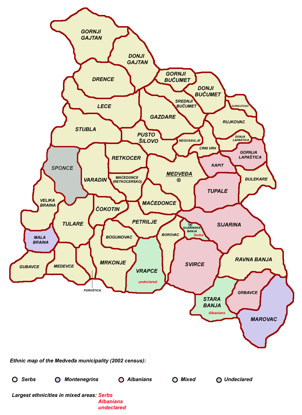
Medveđa ( sr-cyr, Медвеђа, ; sq, Medvegja, ) is a town and municipality located in the Jablanica District of southern Serbia. According to the 2011 census, the town has a population of 2,848 inhabitants, while the municipality has 7,438 inhabitants. Etymology The name is derived from the Serbian word ''medved'' (медвед), "bear", hence meaning "the place of the bears". History During the Roman period, there was a town (''mansia'') with the name Idimum located in the cadastral area of the modern town. Architectural debris dating to the 4th century AD lay at various locations of the town, as it was a transitory zone of Upper Moesia; travel and postal stations are among the finds. Toponyms such as ''Arbanaška'' and ''Đjake'' shows an Albanian presence in the Toplica and Southern Morava regions (located north-east of contemporary Kosovo) before the expulsion of Albanians during 1877–1878 period. The rural parts of Jablanica valley and adjoining semi-mountainous ... [...More Info...] [...Related Items...] OR: [Wikipedia] [Google] [Baidu] |
Toplica District
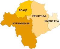
The Toplica District ( sr, Топлички округ, Toplički okrug, ) is an administrative district in southern Serbia, named after the river Toplica. With a population of 91,754, it has the smallest population of all Serbian districts. Its administrative center is the city of Prokuplje. Municipalities It encompasses the city of Prokuplje and three municipalities: * Blace * Kuršumlija * Žitorađa Demographics According to the last official census done in 2011, Toplica District has 91,754 inhabitants. Most of its population is of Serb ethnicity (93.46%) while 50.02% of the municipality’s population is urban. Ethnic composition of the municipality: See also * Administrative divisions of Serbia * Districts of Serbia An ''okrug'' is one of the first-level administrative divisions of Serbia, corresponding to a "district" in many other countries (Serbia also has two autonomous provinces at a higher level than districts). The term ''okrug'' (pl. ''okruzi)'' ... ... [...More Info...] [...Related Items...] OR: [Wikipedia] [Google] [Baidu] |


