|
Kasaoka, Okayama
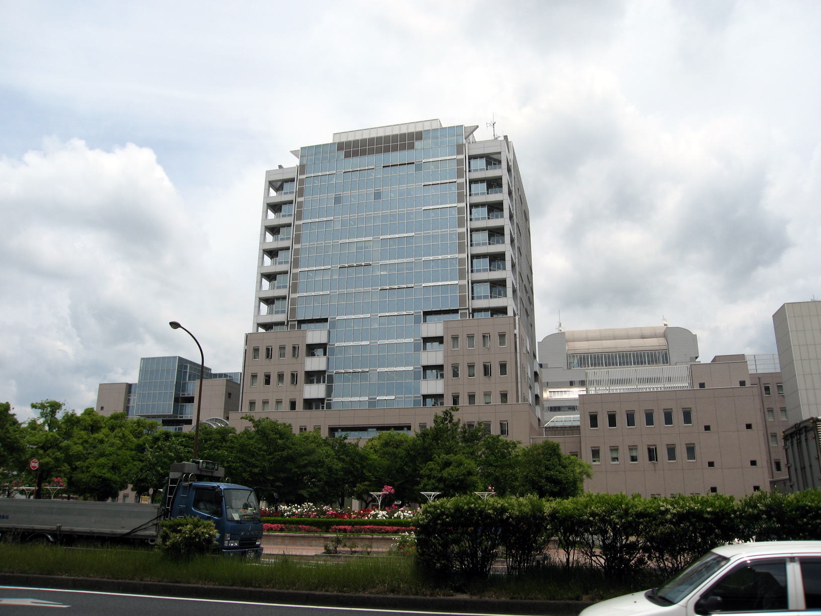
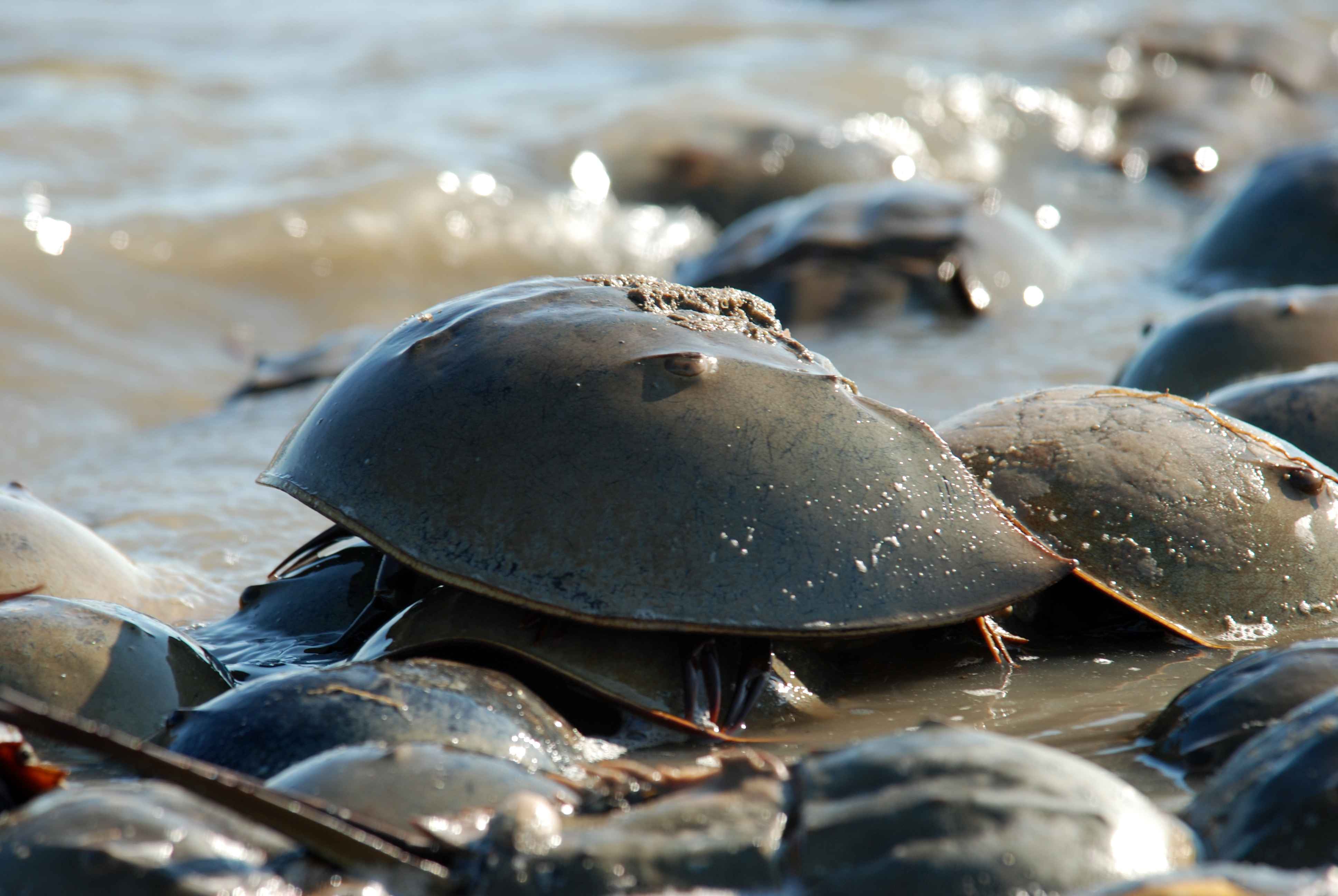
is a Cities of Japan, city located in Okayama Prefecture, Japan. , the city had an estimated population of 45,404 in 21,987 households and a population density of . The total area of the city is . The municipal district also includes 31 outlying islands including seven inhabited islands in the Kasaoka Islands archipelago in the Seto Inland Sea. Geography Kasaoka is in the far southwestern corner of Okayama Prefecture, bordered by the Seto Inland Sea to the south and Hiroshima Prefecture to the west. It is mostly hilly and mountainous in the north, and consists of flat land reclamation, reclaimed land in the south. Urbanization is very diffuse, with the main urban concentration at the former port town of Kasaoka, with numerous hamlets scattered widely in narrow valley-shaped plains mostly in the central and northern areas. The tidal flats in the south are noted for endangered horseshoe crabs and the sea area between Kōnoshima and Nishi-Oshima has been designated as a national ... [...More Info...] [...Related Items...] OR: [Wikipedia] [Google] [Baidu] |
Cities Of Japan
A is a local Public administration, administrative unit in Japan. Cities are ranked on the same level as and , with the difference that they are not a component of . Like other contemporary administrative units, they are defined by the Local Autonomy Law of 1947. City status Article 8 of the Local Autonomy Law sets the following conditions for a municipality to be designated as a city: *Population must generally be 50,000 or greater (原則として人口5万人以上) *At least 60% of households must be established in a central urban area (中心市街地の戸数が全戸数の6割以上) *At least 60% of households must be employed in commerce, industry or other urban occupations (商工業等の都市的業態に従事する世帯人口が全人口の6割以上) *Any other conditions set by prefectural ordinance must be satisfied (他に当該都道府県の条例で定める要件を満たしていること) The designation is approved by the prefectural governor and t ... [...More Info...] [...Related Items...] OR: [Wikipedia] [Google] [Baidu] |
Population Density
Population density (in agriculture: Standing stock (other), standing stock or plant density) is a measurement of population per unit land area. It is mostly applied to humans, but sometimes to other living organisms too. It is a key geographical term.Matt RosenberPopulation Density Geography.about.com. March 2, 2011. Retrieved on December 10, 2011. Biological population densities Population density is population divided by total land area, sometimes including seas and oceans, as appropriate. Low densities may cause an extinction vortex and further reduce fertility. This is called the Allee effect after the scientist who identified it. Examples of the causes of reduced fertility in low population densities are: * Increased problems with locating sexual mates * Increased inbreeding Human densities Population density is the number of people per unit of area, usually transcribed as "per square kilometre" or square mile, and which may include or exclude, for example, ar ... [...More Info...] [...Related Items...] OR: [Wikipedia] [Google] [Baidu] |
Japan Meteorological Agency
The Japan Meteorological Agency (JMA; ''気象庁, Kishō-chō'') is a division of the Ministry of Land, Infrastructure, Transport and Tourism dedicated to the Scientific, scientific observation and research of natural phenomena. Headquartered in Minato, Tokyo the government agency, agency collects data on meteorology, hydrology, seismology, volcanology, and other related fields. The JMA is responsible for collecting and disseminating weather data and Forecasting, forecasts to the public, as well as providing specialized information for aviation and Marine weather forecasting, marine sectors. Additionally, the JMA issues warnings for volcanic eruptions and is integral to the nationwide Earthquake Early Warning (Japan), Earthquake Early Warning (EEW) system. As one of the Regional Specialized Meteorological Centers designated by the World Meteorological Organization (WMO), the JMA also Forecasting, forecasts, Tropical cyclone naming, names, and distributes warnings for tropical ... [...More Info...] [...Related Items...] OR: [Wikipedia] [Google] [Baidu] |
Humid Subtropical Climate
A humid subtropical climate is a subtropical -temperate climate type, characterized by long and hot summers, and cool to mild winters. These climates normally lie on the southeast side of all continents (except Antarctica), generally between latitudes 25° and 40° and are located poleward from adjacent tropical climates, and equatorward from either humid continental (in North America and Asia) or oceanic climates (in other continents). It is also known as warm temperate climate in some climate classifications. Under the Köppen climate classification, ''Cfa'' and ''Cwa'' climates are either described as humid subtropical climates or warm temperate climates. This climate features mean temperature in the coldest month between (or ) and and mean temperature in the warmest month or higher. However, while some climatologists have opted to describe this climate type as a "humid subtropical climate", Köppen himself never used this term. The humid subtropical climate classific ... [...More Info...] [...Related Items...] OR: [Wikipedia] [Google] [Baidu] |
Yakage, Okayama
270px, Yakage Town Hall is a town located in Oda District, Okayama Prefecture, Japan. , the town had an estimated population of 13,418 in 5445 households and a population density of 150 persons per km². The total area of the town is . Geography Yakage is located in southwestern Okayama. About half of the town's area(in the north) is occupied by hills and mountains; most of the population is concentrated in the plains in the south. Neighbouring municipalities Okayama Prefecture * Asakuchi * Ibara * Kasaoka * Kurashiki * Sōja Climate Yakage has a Humid subtropical climate (Köppen ''Cfa'') characterized by warm summers and cool winters with moderate snowfall. The average annual temperature in Yakage is 15.6 °C. The average annual rainfall is 1493 mm with September as the wettest month. The temperatures are highest on average in January, at around 27.1 °C, and lowest in January, at around 4.9 °C. Demography Per Japanese census data, the population ... [...More Info...] [...Related Items...] OR: [Wikipedia] [Google] [Baidu] |
Ibara, Okayama
is a city located in Okayama Prefecture, Japan. , the city had an estimated population of 37,835 in 16,677 households and a population density of 160 persons per km2. The total area of the city is . Geography Ibara is located in west-central Okayama Prefecture. The Oda River, a tributary of the Takahashi River, flows from north to south from Hiroshima Prefecture, and changes its flow eastward in the center of the city. It forms a basin sandwiched between mountains and hills to the north and south, which is where the main urban concentration of the city is located. The northern part of the city has numerous hamlets villages spread out on a limestone karst plateau at an elevation of 400 to 500 meters. Adjoining municipalities Hiroshima Prefecture * Fukiyama * Jinsekikōgen Okayama Prefecture * Kasaoka *Sōja *Takahashi * Yakage Climate Ibara has a humid subtropical climate (Köppen climate classification ''Cfa'') with very warm summers and cool winters. The average annual temp ... [...More Info...] [...Related Items...] OR: [Wikipedia] [Google] [Baidu] |
Asakuchi, Okayama
270px, Konkokyo Headquarters Central Worship Hall 270px, Aerial view of Asakuchi city center is a city located in Okayama Prefecture, Japan. , the city had an estimated population of 33,322 in 14,409 households and a population density of 500 persons per km2. The total area of the city is . The headquarters of the Konkokyo religion is in Asakuchi. Geography Asakuchi is in the southwestern Okayama Prefecture, bordered by the Seto Inland Sea to the south. It is mostly hilly, with Mount Yosho and Mount Chikurinji in the north, Mount Abe in the northwest, and Mount Ryuo in the center. The southern part of the city is close to the Mizushima industrial area (approximately 10 km kilometers and the Fukuyama industrial area (approximately 20 kilometers). Adjoining municipalities Okayama Prefecture * Kasaoka *Kurashiki * Satoshō * Yakage Climate Asakuchi has a humid subtropical climate (Köppen climate classification ''Cfa'') with very warm summers and cool winters. The average annual ... [...More Info...] [...Related Items...] OR: [Wikipedia] [Google] [Baidu] |
Fukuyama, Hiroshima
is a city in Hiroshima Prefecture, Japan. , the city had an estimated population of 459,160 in 214259 households and a population density of 890 persons per km2. The total area of the city is . After Hiroshima, it is the largest city in Hiroshima Prefecture. The city's symbol is the rose and it holds an annual Rose Festival in the month of May. The official mascot of Fukuyama is an anthropomorphic rose child by the name of Rola. Geography Fukuyama City is located in southeastern Hiroshima Prefecture. The center of the city is located in the Fukuyama Plain, which has been built by land reclamation projects since the Edo period, and the delta area that spreads out at the mouth of the Ashida River, which flows north and south through the city. The southern end of the city faces the Seto Inland Sea, and the northern mountainous area, which is the southern end of the so-called 'Jinseki Plateau', at the southwestern end of the Kibi Plateau with an elevation of 400 to 500 meters in ... [...More Info...] [...Related Items...] OR: [Wikipedia] [Google] [Baidu] |
Horseshoe Crab
Horseshoe crabs are arthropods of the family Limulidae and the only surviving xiphosurans. Despite their name, they are not true crabs or even crustaceans; they are chelicerates, more closely related to arachnids like spiders, ticks, and scorpions. The body of a horseshoe crab is divided into three main parts: the cephalothorax, abdomen, and telson. The largest of these, the cephalothorax, houses most of the animal's eyes, limbs, and internal organs. It is also where the animal gets its name, as its shape somewhat resembles that of a horseshoe. Horseshoe crabs have been described as "living fossils", having changed little since they first appeared in the Triassic. Only four species of horseshoe crab are extant today. Most are marine, though the mangrove horseshoe crab is often found in brackish water, and the Atlantic horseshoe crab is resident in brackish estuarine ecosystems such as the Delaware and Chesapeake bays. Additionally, certain extinct species transitioned t ... [...More Info...] [...Related Items...] OR: [Wikipedia] [Google] [Baidu] |
Tidal Flat
Mudflats or mud flats, also known as tidal flats or, in Ireland, slob or slobs, are coastal wetlands that form in intertidal areas where sediments have been deposited by tides or rivers. A global analysis published in 2019 suggested that tidal flat ecosystems are as extensive globally as mangroves, covering at least of the Earth's surface. / They are found in sheltered areas such as bays, bayous, lagoons, and estuaries; they are also seen in freshwater lakes and salty lakes (or inland seas) alike, wherein many rivers and creeks end. Mudflats may be viewed geologically as exposed layers of bay mud, resulting from deposition of estuarine silts, clays and aquatic animal detritus. Most of the sediment within a mudflat is within the intertidal zone, and thus the flat is submerged and exposed approximately twice daily. A recent global remote sensing analysis estimated that approximately 50% of the global extent of tidal flats occurs within eight countries (Indonesia, China, Aus ... [...More Info...] [...Related Items...] OR: [Wikipedia] [Google] [Baidu] |


