|
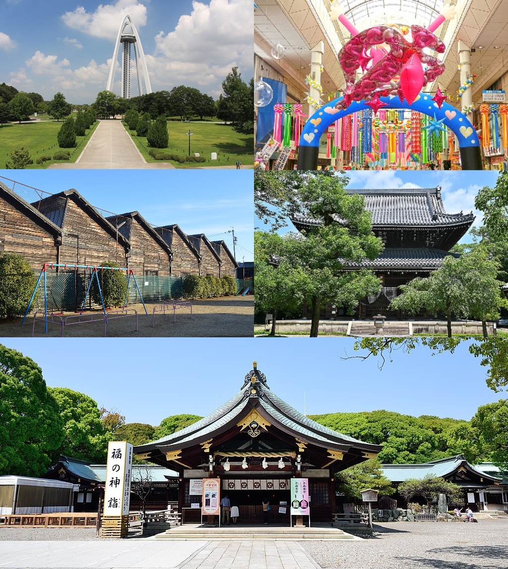
Inazawa
is a city located in Aichi Prefecture, Japan. , the city had an estimated population of 135,580 in 54,999 households, and a population density of . The total area of the city was . Geography Inazawa is located in the flatlands of far western Aichi Prefecture, bordering Gifu Prefecture on the west. Both the Kiso River and the Gojō River flow through the city. Climate The city has a climate characterized by hot and humid summers, and relatively mild winters (Köppen climate classification ''Cfa''). The average annual temperature in Inazawa is . The average annual rainfall is with September as the wettest month. The temperatures are highest on average in August, at around , and lowest in January, at around . Demographics Per Japanese census data, the population of Inazawa has been relatively steady over the past 30 years. Surrounding municipalities ;Aichi Prefecture *Ichinomiya *Aisai *Kiyosu * Ama ;Gifu Prefecture * Hashima *Kaizu History Ancient history Inazawa is the locati ... [...More Info...] [...Related Items...] OR: [Wikipedia] [Google] [Baidu] |
Aichi Prefecture
is a prefecture of Japan located in the Chūbu region of Honshū. Aichi Prefecture has a population of 7,552,873 () and a geographic area of with a population density of . Aichi Prefecture borders Mie Prefecture to the west, Gifu Prefecture and Nagano Prefecture to the north, and Shizuoka Prefecture to the east. Overview Nagoya is the capital and largest city of Aichi Prefecture, and the fourth-largest city in Japan, with other major cities including Toyota, Okazaki, and Ichinomiya. Aichi Prefecture and Nagoya form the core of the Chūkyō metropolitan area, the third-largest metropolitan area in Japan and one of the largest metropolitan areas in the world. Aichi Prefecture is located on Japan's Pacific Ocean coast and forms part of the Tōkai region, a subregion of the Chūbu region and Kansai region. Aichi Prefecture is home to the Toyota Motor Corporation. Aichi Prefecture had many locations with the Higashiyama Zoo and Botanical Gardens, The Chubu Centrair Internat ... [...More Info...] [...Related Items...] OR: [Wikipedia] [Google] [Baidu] |
Ichinomiya, Aichi
is a city located in Aichi Prefecture, Japan. The city is sometimes called Owarichinomiya to avoid confusion with other municipalities of the same name, including Ichinomiya (now part of the city of Toyokawa), Ichinomiya in Chiba Prefecture. , the city had an estimated population of 379,654 in 161,434 households, and a population density of 3,336 persons per km². The total area of the city was . Geography Ichinomiya is situated in western Aichi Prefecture, bordered by Gifu Prefecture to the west. The Kiso River and the Gojō River both flow through the city. Climate The city has a climate characterized by hot and humid summers, and relatively mild winters (Köppen climate classification ''Cfa''). The average annual temperature in Ichinomiya is 15.6 °C. The average annual rainfall is 1833 mm with September as the wettest month. The temperatures are highest on average in August, at around 28.1 °C, and lowest in January, at around 4.2 °C. Demographics Per J ... [...More Info...] [...Related Items...] OR: [Wikipedia] [Google] [Baidu] |
Aisai, Aichi
is a city located in Aichi Prefecture, Japan. , the city had an estimated population of 61,320 in 23,451 households, and a population density of 919 persons per km². The total area of the city is . Aisai is a member of the World Health Organization’s Alliance for Healthy Cities (AFHC). Geography Aisai is located in the coastal flatlands of far western Aichi Prefecture, bordering Gifu Prefecture on the west. It has a short border with Mie Prefecture to the southwest. The Kiso River and the Nagara River pass through the city. Climate The city has a climate characterized by hot and humid summers, and relatively mild winters (Köppen climate classification ''Cfa''). The average annual temperature in Aisai is . The average annual rainfall is with September as the wettest month. The temperatures are highest on average in August, at around , and lowest in January, at around . Demographics Per Japanese census data, the population of Aisai has been relatively steady over the past 30 ... [...More Info...] [...Related Items...] OR: [Wikipedia] [Google] [Baidu] |
Hashima, Gifu
is a city located in Gifu, Japan. , the city had an estimated population of 67,909 in 26,327 households, and a population density of 1300 persons per km2, in 26,367 households. The total area of the city is . Geography Hashima is located in the Nōbi Plain of southwest Gifu Prefecture, with the Kiso River to the east and the Nagara River to the west. Much of the city area is low-lying and subject to frequent flooding. Climate The city has a climate characterized by characterized by hot and humid summers, and mild winters (Köppen climate classification ''Cfa''). The average annual temperature in Hashima is 15.5 °C. The average annual rainfall is 1849 mm with September as the wettest month. The temperatures are highest on average in August, at around 27.8 °C, and lowest in January, at around 4.1 °C. Neighbouring municipalities *Gifu Prefecture **Gifu **Ōgaki **Kaizu ** Anpachi ** Wanouchi ** Kasamatsu *Aichi Prefecture **Ichinomiya **Inazawa Demographic ... [...More Info...] [...Related Items...] OR: [Wikipedia] [Google] [Baidu] |
Kaizu, Gifu
Kiso Sansen Park Center is a city located in Gifu, Japan. , the city had an estimated population of 34,960, and a population density of 310 persons per km2, in 12,167 households. The total area of the city was . Most of the city is located at sea level and is well known for levees surrounding the area. Geography Kaizu is located in the extreme southwest corner of Gifu Prefecture. Levees are the most visible feature surrounding the city. To the west of the city is the border of Gifu and Mie prefectures, where the Yōrō Mountains run from north-to-south and the three major rivers of the Nōbi Plain (the Ibi, Nagara, and Kiso rivers) merge. The Tsuya, Ōgure, and Ōe rivers also flow through the city. Climate The city has a climate characterized by characterized by hot and humid summers, and mild winters (Köppen climate classification ''Cfa''). The average annual temperature in Kaizu is 15.4 °C. The average annual rainfall is 1773 mm with September as the wettes ... [...More Info...] [...Related Items...] OR: [Wikipedia] [Google] [Baidu] |
Gojō River
The flows through Gifu and Aichi prefectures in Japan. It empties into the Shin River, which is part of the Shōnai River system. Geography The ''sakura'' on the banks of the river in Ōguchi, Konan, and Iwakura are Japan's Top 100 ''sakura'' list. River communities ; Gifu Prefecture : Tajimi ; Aichi Prefecture : Inuyama, Ōguchi, Konan, Ichinomiya, Iwakura, Komaki, Kitanagoya, Ichinomiya, Inazawa, Kiyosu is a city in Aichi Prefecture, Japan. , the city had an estimated population of 69,687 in 29,477 households, and a population density of 4,017 persons per km². The total area of the city is . Geography Kiyosu is located in far western Aichi P ..., Ama References Rivers of Gifu Prefecture Rivers of Aichi Prefecture Rivers of Japan {{Japan-river-stub ... [...More Info...] [...Related Items...] OR: [Wikipedia] [Google] [Baidu] |
Ama, Aichi
is a city located in Aichi Prefecture, Japan. , the city had an estimated population of 87,651 in 36,997 households, and a population density of 3,188 persons per km². The total area of the city was .Ama City official home page Ama is a member of the ’s (AFHC). Geography Ama is located in the far west of Aichi Prefecture in the middle of the |
Owari Province
was a province of Japan in the area that today forms the western half of Aichi Prefecture, including the modern city of Nagoya. The province was created in 646. Owari bordered on Mikawa, Mino, and Ise Provinces. Owari and Mino provinces were separated by the Sakai River, which means "border river." The province's abbreviated name was . Owari is classified as one of the provinces of the Tōkaidō. Under the ''Engishiki'' classification system, Owari was ranked as a "superior country" (上国) and a "near country" (近国), in relation to its distance from the capital. History Owari is mentioned in records of the Nara period, including the ''Kujiki'', although the area has been settled since at least the Japanese Paleolithic period, as evidenced by numerous remains found by archaeologists. Early records mention a powerful “Owari clan”, vaguely related to, or allied with the Yamato clan, who built massive kofun burial mounds in several locations within the province, from ... [...More Info...] [...Related Items...] OR: [Wikipedia] [Google] [Baidu] |
Minoji
The was a highway in Japan during the Edo period. It was a secondary route, ranked below the Edo Five Routes in importance, and connected Miya-juku on the Tōkaidō with Tarui-juku on the Nakasendō.Hiroshige - Kisokaido Road . Hiroshige.org. Accessed December 8, 2007. The road received much use before and after the in 1600. , the leader of the eastern armies, traveled the Minoji from Okoshi (modern-day |
Kiyosu, Aichi
is a city in Aichi Prefecture, Japan. , the city had an estimated population of 69,687 in 29,477 households, and a population density of 4,017 persons per km². The total area of the city is . Geography Kiyosu is located in far western Aichi Prefecture, in the western portion of the Nōbi Plain on the Shōnai River. It is bordered by the Nagoya metropolis to the east. Most of the city has an altitude of under 10 meters above sea level. Climate The city has a climate characterized by hot and humid summers, and relatively mild winters (Köppen climate classification ''Cfa''). The average annual temperature in Kiyosu is 15.8 °C. The average annual rainfall is 1688 mm with September as the wettest month. The temperatures are highest on average in August, at around 28.1 °C, and lowest in January, at around 4.4 °C. Demographics Per Japanese census data, the population of Kiyosu has grown steadily over the past 60 years. Surrounding municipalities ;Aichi Prefect ... [...More Info...] [...Related Items...] OR: [Wikipedia] [Google] [Baidu] |
Owari Onkunitama Jinja , a token-moving game
{{Disambig ...
Owari may refer to: * The Owari Mandarin orange, a widely cultivated fruit of Japanese origin * Additional Japan-related topics: ** Owari House, a branch family of the Tokugawa clan that ruled Japan during the Edo era ** Owari Province, a former region in Japan ** Owari Domain, a feudal domain of Japan in the Edo period * Owari or oware Oware is an abstract strategy game among the mancala family of board games (pit and pebble games) played worldwide with slight variations as to the layout of the game, number of players and strategy of play. Its origin is uncertain but it is wide ... [...More Info...] [...Related Items...] OR: [Wikipedia] [Google] [Baidu] |
Shinto Shrine
A is a structure whose main purpose is to house ("enshrine") one or more ''kami'', the deities of the Shinto religion. Overview Structurally, a Shinto shrine typically comprises several buildings. The '' honden''Also called (本殿, meaning: "main hall") is where a shrine's patron ''kami'' is/are enshrined.Iwanami Japanese dictionary The ''honden'' may be absent in cases where a shrine stands on or near a sacred mountain, tree, or other object which can be worshipped directly or in cases where a shrine possesses either an altar-like structure, called a ''himorogi,'' or an object believed to be capable of attracting spirits, called a ''yorishiro,'' which can also serve as direct bonds to a ''kami''. There may be a and other structures as well. Although only one word ("shrine") is used in English, in Japanese, Shinto shrines may carry any one of many different, non-equivalent names like ''gongen'', ''-gū'', ''jinja'', ''jingū'', ''mori'', ''myōjin'', ''-sha'', ''taisha ... [...More Info...] [...Related Items...] OR: [Wikipedia] [Google] [Baidu] |


.jpg)


