|
Hiawatha National Forest
Hiawatha National Forest is a National Forest in the Upper Peninsula of the state of Michigan in the United States. Commercial logging is conducted in some areas. The United States Forest Service administers this National Forest; it is physically divided into two subunits, commonly called the Eastside and Westside . Etymology According to the forest service, it was "named after the Mohawk chief, Hiawatha, who brought about the confederation known as the Five Nations of the Iroquois. He was also the hero of Longfellow's poem, 'Hiawatha'." Geography In descending order of land area it lies in parts of Chippewa, Delta, Mackinac, Alger, Schoolcraft, and Marquette counties. Chippewa and Mackinac counties are in the East Unit, whereas the rest are in the West Unit. The smaller East Unit contains about 44% of the forest's area, whereas the larger West Unit has about 56%. Forest headquarters are located in Gladstone, Michigan. East Unit ranger district offices are located in Sa ... [...More Info...] [...Related Items...] OR: [Wikipedia] [Google] [Baidu] |
Alger County, Michigan
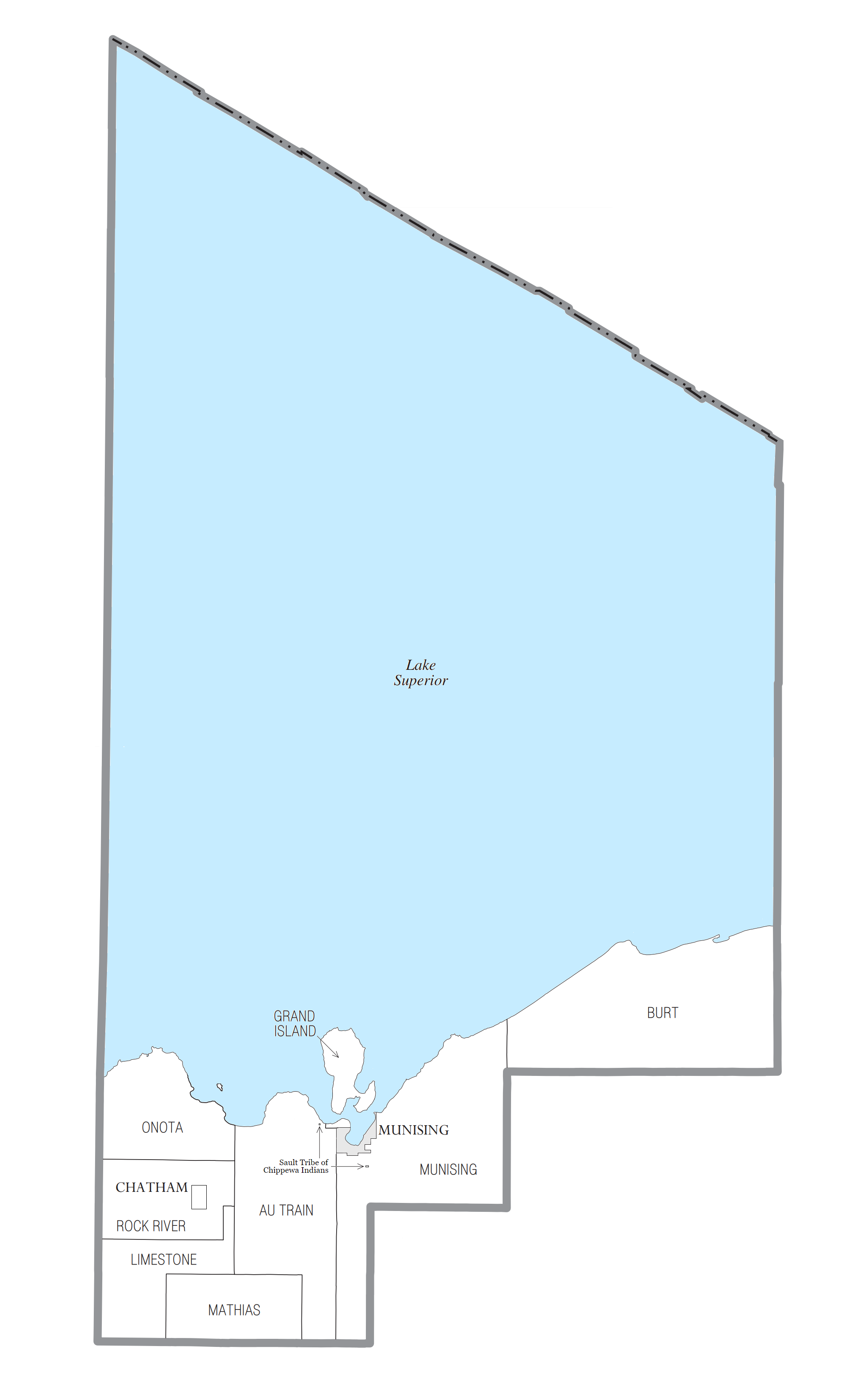
Alger County ( ) is a county in the Upper Peninsula of the U.S. state of Michigan. As of the 2020 Census, the population was 8,842. Its county seat is Munising. The Pictured Rocks National Lakeshore is located within the county. History Alger County was detached from Schoolcraft County, set off and organized in 1885. The county was named for lumber baron Russell Alexander Alger, who was elected as a Michigan Governor, and US Senator, and appointed as US Secretary of War during the William McKinley Presidential administration. ''See also'', List of Michigan county name etymologies, List of Michigan counties, and List of abolished U.S. counties. Geography According to the U.S. Census Bureau, the county has a total area of , of which is land and (82%) is water. It is the second-largest county in Michigan by total area, mainly because of Lake Superior on the north side of the county. Highways * * * * * * * * * * * * * * , passes through Pictured Rocks National ... [...More Info...] [...Related Items...] OR: [Wikipedia] [Google] [Baidu] |
Gladstone, Michigan
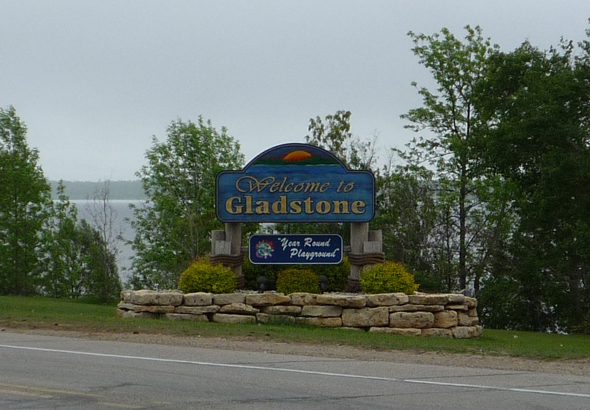
Gladstone is a city in Delta County in the Upper Peninsula of the U.S. state of Michigan. First settled in 1877, Gladstone's original name was Minnewasca. The population was 4,973 at the 2010 census. U.S. Highways 2 and 41 run concurrently through the city, connecting with Escanaba, nine miles (14 km) to the south. US 41 runs north to Marquette and US 2 runs east to Manistique and St. Ignace. M-35 runs northwest to Gwinn and merges with US 2/US 41 south to Escanaba. History First Inhabitants The first people to occupy the Upper Peninsula of Michigan were Algonquin speaking peoples. Gladstone was first settled by European descendants in 1859 when the Hamilton Corporation of Fayette began using it as a shipping point for selling and transporting of their iron ore. The town was originally named Minnewasca by the Soo Line Railroad, the Ojibwa name meaning "white water." When the name was filed with the county and Secretary of State in Lansing, Senator W. D. Washbu ... [...More Info...] [...Related Items...] OR: [Wikipedia] [Google] [Baidu] |
Mackinac Wilderness
The Mackinac Wilderness is a unit within the Hiawatha National Forest. It is located in Mackinac County, Michigan. The wilderness is accessible from M-123, which borders the unit. The nearest town is Moran, Michigan. Description Like the rest of the Hiawatha Forest, the Mackinac Wilderness was logged starting about 1880 and ending about 1910. The typical method of logging was to clear-cut all marketable timber and leave the discarded ''slashings'' on the forest floor. A severe forest fire was almost inevitable, followed by severe erosion and the creation of a ''second-growth'' forest that differed from the previous old-growth forest in many ways. Today, the Mackinac Wilderness is a roadless unit within the managed Hiawatha Forest. Much of the wilderness consists of wetlands alongside the Carp River, a natural trout stream listed as a National Wild and Scenic River, and the unit's wilderness designation helps protect part of the river's drainage. The wilderness is also a ... [...More Info...] [...Related Items...] OR: [Wikipedia] [Google] [Baidu] |
Horseshoe Bay Wilderness
The Horseshoe Bay Wilderness is a wilderness area in the U.S. state of Michigan. It borders ''Horseshoe Bay'', a shallow bay that is part of the extreme northwest corner of Lake Huron adjacent to the Straits of Mackinac. The wilderness area is overseen by the United States Forest Service as part of the Hiawatha National Forest. Description When the water level of Lake Huron receded after the most recent ice age, many rolling areas of former lakeshore and lake bottomland became riparian wetlands along the lake's edge. The Horseshoe Bay Wilderness is one of these wetlands. It is forested, and characterized by trees that can tolerate humid and damp conditions, such as the paper birch and the Northern whitecedar. The shore of Horseshoe Bay, and the slow-moving tributaries that drain from the wetland into the bay, offer good ground for fish spawning, and the adjacent area of Lake Huron is rich in fish of all kinds. Fish-eating waterfowl, such as the great blue heron, are often seen here ... [...More Info...] [...Related Items...] OR: [Wikipedia] [Google] [Baidu] |
Delirium Wilderness
Delirium Wilderness is a wilderness area in Chippewa County, within the Hiawatha National Forest in the U.S. state of Michigan.Delirium Wilderness - Hiawatha National ForestDelirium Wilderness - Wilderness.net The wilderness is forested and flat-to-rolling, with its lower reaches often characterized as a swamp. Elevations range from 590 to 890 feet (180 to 270 m). Sculpted by |
Big Island Lake Wilderness
Big Island Lake Wilderness is a remote protected area in the Munising Ranger District of the Hiawatha National Forest in the Upper Peninsula in the state of Michigan in the United States. The wilderness area is located about one-half mile (0.8 km) northwest of the community of Steuben, Michigan, Steuben and northwest of Manistique, Michigan, Manistique and about southeast of Munising, Michigan, Munising in Schoolcraft County, Michigan, Schoolcraft County. The area is roughly bordered by County Road 437 on the south and County Road 445 on the west. The northeast boundary is Forest Road 2303 and the southern boundary is the Manistique and Lake Superior Railroad, abandoned railroad grade—Haywire Grade - Forest Road 8109. References [...More Info...] [...Related Items...] OR: [Wikipedia] [Google] [Baidu] |
Wilderness Area
Wilderness or wildlands (usually in the plural), are natural environments on Earth that have not been significantly modified by human activity or any nonurbanized land not under extensive agricultural cultivation. The term has traditionally referred to terrestrial environments, though growing attention is being placed on marine wilderness. Recent maps of wilderness suggest it covers roughly one quarter of Earth's terrestrial surface, but is being rapidly degraded by human activity. Even less wilderness remains in the ocean, with only 13.2% free from intense human activity. Some governments establish protection for wilderness areas by law to not only preserve what already exists, but also to promote and advance a natural expression and development. These can be set up in preserves, conservation preserves, national forests, national parks and even in urban areas along rivers, gulches or otherwise undeveloped areas. Often these areas are considered important for the survival of c ... [...More Info...] [...Related Items...] OR: [Wikipedia] [Google] [Baidu] |
Civilian Conservation Corps
The Civilian Conservation Corps (CCC) was a voluntary government work relief program that ran from 1933 to 1942 in the United States for unemployed, unmarried men ages 18–25 and eventually expanded to ages 17–28. The CCC was a major part of President Franklin D. Roosevelt's New Deal that supplied manual labor jobs related to the conservation and development of natural resources in rural lands owned by federal, state, and local governments. The CCC was designed to supply jobs for young men and to relieve families who had difficulty finding jobs during the Great Depression in the United States Robert Fechner was the first director of this agency, succeeded by James McEntee following Fechner's death. The largest enrollment at any one time was 300,000. Through the course of its nine years in operation, three million young men took part in the CCC, which provided them with shelter, clothing, and food, together with a wage of $30 (equivalent to $1000 in 2021) per month ($25 of ... [...More Info...] [...Related Items...] OR: [Wikipedia] [Google] [Baidu] |
Theodore Roosevelt
Theodore Roosevelt Jr. ( ; October 27, 1858 – January 6, 1919), often referred to as Teddy or by his initials, T. R., was an American politician, statesman, soldier, conservationist, naturalist, historian, and writer who served as the 26th president of the United States from 1901 to 1909. He previously served as the 25th vice president of the United States, vice president under President William McKinley from March to September 1901 and as the 33rd governor of New York from 1899 to 1900. Assuming the presidency after Assassination of William McKinley, McKinley's assassination, Roosevelt emerged as a leader of the History of the Republican Party (United States), Republican Party and became a driving force for United States antitrust law, anti-trust and Progressive Era, Progressive policies. A sickly child with debilitating asthma, he overcame his health problems as he grew by embracing The Strenuous Life, a strenuous lifestyle. Roosevelt integrated his exuberant personalit ... [...More Info...] [...Related Items...] OR: [Wikipedia] [Google] [Baidu] |
Marquette National Forest
Marquette National Forest was established by the U.S. Forest Service in Chippewa County, Michigan on February 10, 1909, with . On July 1, 1915, the entire forest was transferred to Michigan National Forest and the name was discontinued. On February 12, 1931, Marquette was re-established in Chippewa and Mackinac counties with , changing its name back from Michigan. On February 9, 1962, the entire forest was transferred to Hiawatha National Forest and the name was re-discontinued. What was Marquette National Forest currently comprises the East Unit of Hiawatha National Forest. References External linksForest History Society (from the |
Rapid River, Michigan
Rapid River is an unincorporated community in Masonville Township, Delta County in the U.S. state of Michigan. It is situated on the northern end of the Little Bay de Noc between the mouths of the Tacoosh and Rapid rivers with the mouth of the Whitefish River just to the east. U.S. Highway 2 (US 2) passes through Rapid River and joins with US 41 just west of town; the two then run concurrently from Rapid River south to Escanaba. The Rapid River ZIP code is 49878 and also serves areas in the nearby townships in Delta County of Baldwin, Bay de Noc, Brampton, Ensign, Garden, Maple Ridge, Masonville, and Nahma. It also serves a small area in Mathias Township in Alger County The community was first named Rapid Siding as a stop on the Minneapolis, St. Paul and Sault Ste. Marie Railroad, and subsequently renamed for the nearby river. The name was recorded as Rapid River when the community was platted in 1887. The community never incorporated as a village. One s ... [...More Info...] [...Related Items...] OR: [Wikipedia] [Google] [Baidu] |


