|
Hallingdal
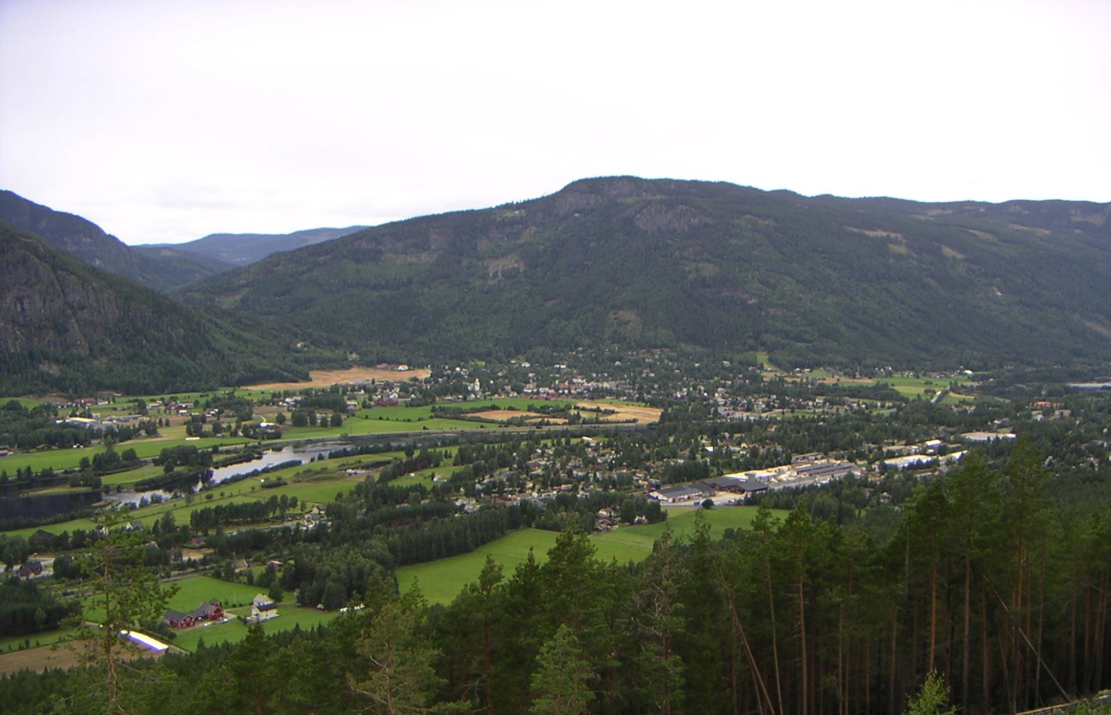
Hallingdal ( en, Halling Valley) is a valley as well as a traditional district located in the traditional and electoral district Buskerud in Viken county in Norway. It consists of six municipalities: Flå, Nes, Gol, Hemsedal, Ål and Hol. Hallingdal is one of the major valleys of eastern Norway, on an area of 5,830 square kilometers. Hallingdal lies in the northern part of the county of Buskerud. The valley stretches from Gulsvik by Lake Krøderen to the border with Hordaland and Sogn og Fjordane. Central to the geography is relatively flat mountain area which lies above sea level. The valley is V-shaped and is drained by the Hallingdal River which originates in the western parts of Hardangervidda and flows eastwards later southwards through Hallingdal. Etymology The Old Norse form of the name was ''Haddingjadalr''. The first recorded case beginning with ''Hall-'' is from 1443. The first element seems to be the genitive case of the name of the people ''Haddingjar'' or of th ... [...More Info...] [...Related Items...] OR: [Wikipedia] [Google] [Baidu] |
Nes, Buskerud
Nesbyen is a Municipalities of Norway, municipality in Viken (county), Viken Counties of Norway, county, Norway. It is part of the Districts of Norway, traditional region of Hallingdal. The administrative centre of the municipality is the village of Nesbyen. The parish of ''Næs'' was established as a municipality on 1 January 1838 (see formannskapsdistrikt). The area of Flå was separated from Nes on 1 January 1905 to become a separate municipality. General information Name The municipality (originally the parish) is named after the old ''Nes'' farm (Old Norse: ''Nes''—now the village of Nesbyen), since the first church was built there. The name is identical with the word ''nes'' which means ''headland''. Prior to 1889, the name was spelled ''"Næs"''. Coat-of-arms The Coat of arms, coat-of-arms is from modern times. They were granted on 29 June 1979. The arms show a yellow-gold triangle pointing to the left on a red background. This represents a sandy peninsula or h ... [...More Info...] [...Related Items...] OR: [Wikipedia] [Google] [Baidu] |
Nesbyen
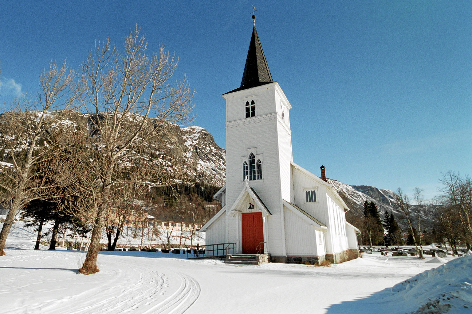
Nesbyen is a town and the administrative center in Nesbyen municipality in the county of Viken, Norway. Nesbyen is located in the traditional district of Hallingdal. Summary Nesbyen has a population of about 3,500 inhabitants. It is located on the Bergen Line railroad which runs between Oslo and Bergen. Nesbyen Station was opened in 1907 when the Bergen Railway was opened to Gulsvik. Nesbyen is located on Norwegian National Road 7. Gamle Nes is the oldest part of Nesbyen. Nesbyen was an early administrative center for Hallingdal. Most buildings in Gamle Nes date to before 1900. Nesbyen is surrounded by mountains on several sides, with good roads to most mountain areas. Hallingnatten is the municipality's highest point, 1,314 meters above sea level. Hallingdal Museum, founded in 1899 and one of the oldest open air museums in Norway, is headquartered in Nesbyen. The Hallingdal Museum organization has professional, administrative, and operational responsibility for the muse ... [...More Info...] [...Related Items...] OR: [Wikipedia] [Google] [Baidu] |
Buskerud
Buskerud () is a former county and a current electoral district in Norway, bordering Akershus, Oslo, Oppland, Sogn og Fjordane, Hordaland, Telemark and Vestfold. The region extends from the Oslofjord and Drammensfjorden in the southeast to Hardangervidda mountain range in the northwest. The county administration was in modern times located in Drammen. Buskerud was merged with Akershus and Østfold into the newly created Viken County on 1 January 2020. On the 23 February 2022 Viken County Council voted in a 49 against 38 decision to submit an application to the Norwegian government for a county demerger. Etymology The county was named after the old manor Buskerud ( non, Biskupsruð) (Biskopsrøysa) located on the west side of the Drammen River in Åmot, Modum municipality. The first element is the genitive case of ', 'bishop' (referring to the Bishop of Hamar), the last element is ' n 'clearing, farm'. The farm was one of the largest in Buskerud, and the original name of the farm ... [...More Info...] [...Related Items...] OR: [Wikipedia] [Google] [Baidu] |
Flå
Flå is a municipality in Viken county, Norway. The administrative centre of the municipality is the village of Flå. The municipality of Flå was established when it was separated from the municipality of Nes on 1 January 1905. The municipality lies at the most southeasterly point in the valley and traditional region of Hallingdal. General information Name The Old Norse form of the name was ''Flóða sokn'' (''sokn'' means parish). This is the plural genitive case of ''flœð'' meaning "flood" (probably because flooding has been a problem for many farms in the river valley). Prior to 1921, the name was written ''"Flaa"''. Coat-of-arms The coat-of-arms is from modern times. They were granted on 1 March 1985. The arms show a black bear on a gray/silver background. This was chosen because there used to be many bears in the Vassfaret area. Prior to 1985, the municipality used a logo with a bear walking through the area. History Ancient routes went to Vestlandet through Va ... [...More Info...] [...Related Items...] OR: [Wikipedia] [Google] [Baidu] |
Gulsvik
Gulsvik is a village in the municipality of Flå in Buskerud, Norway. It is located in Hallingdal at the north end of Lake Krøderen. The center of the village lies at Gulsvik Rail Station. Bergensbanen railway terminated at Gulsvik Station from 1908 until the line was completed in 1909. With its location at the top of Lake Krøderen, Gulsvik was a key port on the lake. When the ferry over Lake Krøderen was established, Gulsvik became the natural port on the northern side, with accommodations for tourism. Hallingporten is a 65 m long tunnel on Norwegian National Road 7 (''Riksvei 7'') just north of Gulsvik. The tunnel has a distinctive shape. The reason for this is that the current road tunnel has been added where there was previously a tog tunnel. The Hallingporten upper level is thus the old tog tunnel. There were skirmishes here in April 1940 during the Fighting in Hallingdal. The name Gulsvik is connected to the original farm of Gulsvik. The Gulsvik farm was known from t ... [...More Info...] [...Related Items...] OR: [Wikipedia] [Google] [Baidu] |
Hemsedal
Hemsedal is a municipality in Viken county, Norway. It is part of the traditional region of Hallingdal. The administrative centre of the municipality is the village of Trøym. Hemsedal lies on the Norwegian National Road 52 (Rv 52). Hemsedal is located northwest of Oslo and from Bergen. In 1897, Hemsedal was separated from the municipality of Gol to become a municipality of its own. General information Name The Old Norse form of the name was ''Hemsudalr''. The second element is ''dalr'', which means "dale" or "valley"; the first element is usually taken as the genitive case of the river name ''Hemsa'' (now Hemsil) of unknown derivation, although Sophus Bugge believed that it might derive from the Old Norse ''hemsa'', ''hefnsa'' or ''hofn'', meaning "going to pasture". The Norwegian word ''hems'' ("bed built in a small loft room") is named after the valley of Hemsedal. Coat-of-arms The coat-of-arms is from modern times. The arms were granted on 2 October 1992 and were de ... [...More Info...] [...Related Items...] OR: [Wikipedia] [Google] [Baidu] |
Gol, Norway
is a municipality in Buskerud in Viken county, Norway. It is part of the traditional region of Hallingdal. The administrative center of the municipality is the village of Gol which is also the population center. Gol was established as a municipality on 1 January 1838 (see formannskapsdistrikt). The area of Hemsedal was separated from Gol in 1897 to become a separate municipality. The municipality of Gol is bordered to the north by the municipality of Nord-Aurdal (in Oppland county), to the east by Sør-Aurdal (in Oppland county), to the south by Nes, and to the west by Ål and Hemsedal. General information Name The Old Norse form of the name was ''Gǫrð''. This is probably an old river name (for the lower part of Hemsil river). The name of the river maybe derived from the word ''garðr'' m 'fence; border' - and the meaning is then 'the border river'. Coat-of-arms The coat-of-arms is from modern times. They were granted on 13 September 1985. The arms are gold with three ... [...More Info...] [...Related Items...] OR: [Wikipedia] [Google] [Baidu] |
Krøderen (lake)
Krøderen (also Krøderfjorden) is a lake in the municipality of Krødsherad in Buskerud, Norway. Summary The lake stretches about north from the village of Krøderen in Krødsherad on its southern end and reaches north to the village of Gulsvik in Flå municipalities of Norway, municipality in the valley of Hallingdal. The lake has a surface area of 42.88 km² and a depth of 119 meters. The primary river flowing into it is Hallingdalselva to the north. Its outlet is via the Snarumselva at the south end of the lake. Snarumselva flows into the Drammen River by Geithus in Modum. At Noresund, along Norwegian National Road 7 (Rv7), there is a bridge over the lake. Krøderen is only about wide at a point. Sole Hotel (''Sole Hotell Krødsherad'') is located along the national road between Krøderfjorden and Norefjell. Sole Hotel was originally a former doctor's home dating back to the beginning of the 1900s. In 1966, the facility opened as Norway's first conference hotel. ... [...More Info...] [...Related Items...] OR: [Wikipedia] [Google] [Baidu] |
Counties Of Norway
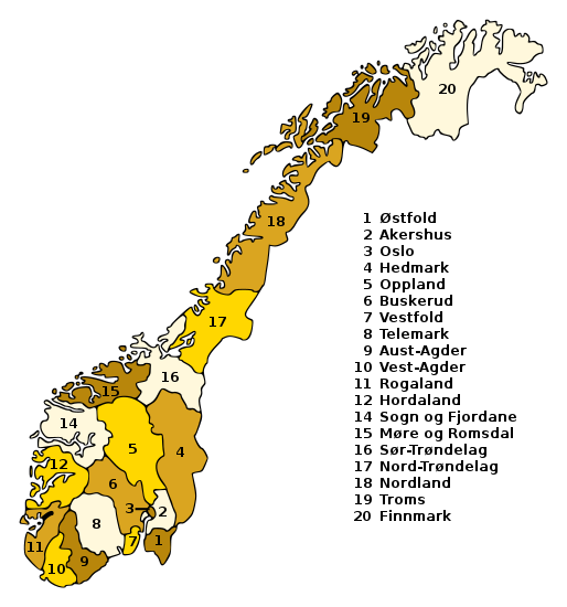
Norway is divided into 11 administrative regions, called counties (singular no, fylke, plural nb, fylker; nn, fylke from Old Norse: ''fylki'' from the word "folk", sme, fylka, sma, fylhke, smj, fylkka, fkv, fylkki) which until 1918 were known as '' amter''. The counties form the first-level administrative divisions of Norway and are further subdivided into 356 municipalities (''kommune'', pl. ''kommuner'' / ''kommunar''). The island territories of Svalbard and Jan Mayen are outside the county division and ruled directly at the national level. The capital Oslo is both a county and a municipality. In 2017, the Solberg government decided to abolish some of the counties and to merge them with other counties to form larger ones, reducing the number of counties from 19 to 11, which was implemented on 1 January 2020. This sparked popular opposition, with some calling for the reform to be reversed. The Storting voted to partly undo the reform on 14 June 2022, w ... [...More Info...] [...Related Items...] OR: [Wikipedia] [Google] [Baidu] |
Vestlandet
Western Norway ( nb, Vestlandet, Vest-Norge; nn, Vest-Noreg) is the region along the Atlantic coast of southern Norway. It consists of the counties Rogaland, Vestland, and Møre og Romsdal. The region has no official or political-administrative function. The region has a population of approximately 1.4 million people. The largest city is Bergen and the second-largest is Stavanger. Historically the regions of Agder, Vest-Telemark, Hallingdal, Valdres, and northern parts of Gudbrandsdal have been included in Western Norway. Western Norway, as well as other parts of historical regions of Norway, shares a common history with Denmark, the Faroe Islands and Iceland and to a lesser extent the Netherlands and Britain. For example, the Icelandic horse is a close relative of the Fjord horse and both the Faroese and Icelandic languages are based on the Old West Norse. In early Norse times, people from Western Norway became settlers at the Western Isles in the Northern Atlantic, so ... [...More Info...] [...Related Items...] OR: [Wikipedia] [Google] [Baidu] |
Valdres
Valdres () is a traditional district in central, southern Norway, situated between the districts of Gudbrandsdalen and Hallingdal. The region of Valdres consists of the six municipalities of Nord-Aurdal, Sør-Aurdal, Øystre Slidre, Vestre Slidre, Vang and Etnedal. Valdres has about 18,000 inhabitants and is known for its excellent trout fishing and the local dialect. Its main road is E16 and Fylkesveg 51. Valdres is located approximately midway between Oslo and Bergen. The valley is protected to the west and north by the Jotunheimen mountains and the Valdresflye plateau and to the south by the Gol mountain ridge (''Golsfjellet''). The main rivers are Begna and Etna. Historically, Valdres has had an agricultural economy, but tourism has grown in prominence in later years. Beitostølen, a highly developed tourist area for winter tourists and who have hosted FIS Cross-Country World Cup multiple times is located in Valdres. Etymology The name of the district comes from the Old ... [...More Info...] [...Related Items...] OR: [Wikipedia] [Google] [Baidu] |
Districts Of Norway
The country of Norway is historically divided into a number of districts. Many districts have deep historical roots, and only partially coincide with today's administrative units of counties and municipalities. The districts are defined by geographical features, often valleys, mountain ranges, fjords, plains, or coastlines, or combinations of the above. Many such regions were petty kingdoms up to the early Viking Age. Regional identity A high percentage of Norwegians identify themselves more by the district they live in or come from, than the formal administrative unit(s) whose jurisdiction they fall under. A significant reason for this is that the districts, through their strong geographical limits, have historically delineated the region(s) within which one could travel without too much trouble or expenditure of time and money (on foot or skis, by horse/ox-drawn cart or sleigh or dog sled, or by one's own small rowing or sail boat). Thus, dialects and regional commonality in f ... [...More Info...] [...Related Items...] OR: [Wikipedia] [Google] [Baidu] |


