|
Geography Of Iran
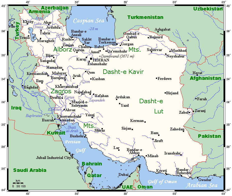
Geographically, the country of Iran is located in West Asia and the bodies of water the nation borders are the Caspian Sea, Persian Gulf (Persian Gulf), and Gulf of Oman. Topographically, it is predominantly located on the Iranian plateau, Iranian/Persian plateau, Its mountains have impacted both the political and the economic history of the country for several centuries. The mountains enclose several broad drainage basin, basins, on which major agricultural and urban settlements are located. Until the 20th century, when major Transport in Iran, highways and railroads were constructed through the mountains to connect the population centers, these basins tended to be relatively isolated from one another. Typically, one major town has dominated each basin, and there were complex economic relationships between the town and the hundreds of villages that surrounded it. In the higher elevations of the mountains rimming the basins, tribally organized groups practiced transhumance, mo ... [...More Info...] [...Related Items...] OR: [Wikipedia] [Google] [Baidu] |
