|
Earthquakes In Guatemala
Earthquakes are relatively frequent occurrences in Guatemala. The country lies in a major fault zone known as the Motagua and Chixoy-Polochic fault complex, which cuts across Guatemala and forms the tectonic boundary between the Caribbean Plate and the North American Plate. In addition, along Guatemala's western coast line, the Cocos plate pushes against the Caribbean Plate, forming a subduction zone known as the Middle America Trench located approximately 50 km off Guatemala's Pacific coast. This subduction zone led to the formation of the Central America Volcanic Arc, and is an important source of offshore earthquakes. Both these major tectonic processes have generated deformations within the Caribbean plate and produced secondary fault zones, like the Mixco, Jalpatagua, and Santa Catarina Pinula faults. The most destructive earthquake in recent Guatemalan history was the 1976 quake with a magnitude of 7.5 Mw and a hypocenter depth of just 5 km. This shallow-foc ... [...More Info...] [...Related Items...] OR: [Wikipedia] [Google] [Baidu] |
Hypocenter
In seismology, a hypocenter or hypocentre () is the point of origin of an earthquake or a subsurface nuclear explosion. A synonym is the focus of an earthquake. Earthquakes An earthquake's hypocenter is the position where the strain energy stored in the rock is first released, marking the point where the fault begins to rupture.''The hypocenter is the point within the earth where an earthquake rupture starts. The epicenter is the point directly above it at the surface of the Earth. Also commonly termed the focus.'' This occurs directly beneath the epicenter, at a distance known as the ''hypocentral depth'' or ''focal depth''. The focal depth can be calculated from measurements based on seismic wave phenomena. As with all wave phenomena in physics, there is uncertainty in such measurements that grows with the wavelength so the focal depth of the source of these long-wavelength (low frequency) waves is difficult to determine exactly. Very strong earthquakes radiate a large fr ... [...More Info...] [...Related Items...] OR: [Wikipedia] [Google] [Baidu] |
Santa María (volcano)
Santa María Volcano is a large active volcano in the western highlands of Guatemala, in the Quetzaltenango Department near the city of Quetzaltenango. The volcano was known as Gagxanul in the local K'iche' language, which means "Naked Volcano or Mountain", before the 16th century Spanish conquest of the region. The VEI-6 eruption of Santa María Volcano in 1902 was one of the three largest eruptions of the 20th century, after the 1912 Novarupta and 1991 Mount Pinatubo eruptions. It is also one of the five biggest eruptions of the past 200 (and most likely 300) years. Geological history Santa María Volcano is part of the Sierra Madre range of volcanoes, which extends along the western edge of Guatemala, separated from the Pacific Ocean by a broad plain. The volcanoes are formed by the subduction of the Cocos Plate under the Caribbean Plate, which led to the formation of the Central America Volcanic Arc. Eruptions at Santa María are estimated to have begun about 103 ka. Con ... [...More Info...] [...Related Items...] OR: [Wikipedia] [Google] [Baidu] |
Guatemala City
Guatemala City ( es, Ciudad de Guatemala), known locally as Guatemala or Guate, is the capital and largest city of Guatemala, and the most populous urban area in Central America. The city is located in the south-central part of the country, nestled in a mountain valley called Valle de la Ermita ( en, Hermitage Valley). The city is the capital of the Municipality of Guatemala and of the Guatemala Department. Guatemala City is the site of the Mayan city of Kaminaljuyu, founded around 1500 BC. Following the Spanish conquest, a new town was established, and in 1776 it was made capital of the Kingdom of Guatemala. In 1821, Guatemala City was the scene of the declaration of independence of Central America from Spain, after which it became the capital of the newly established United Provinces of Central America (later the Federal Republic of Central America). In 1847, Guatemala declared itself an independent republic, with Guatemala City as its capital. The city was originally located ... [...More Info...] [...Related Items...] OR: [Wikipedia] [Google] [Baidu] |
1902 Guatemala Earthquake
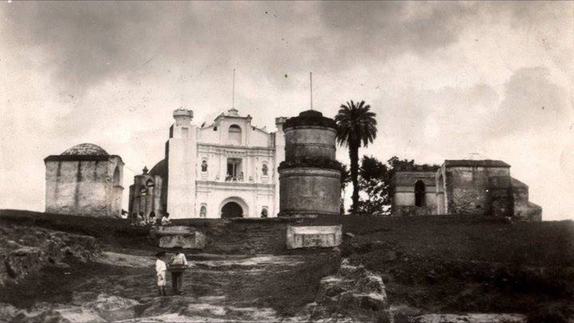
The 1902 Guatemala earthquake occurred on April 18 at 8:23 pm with a moment magnitude of 7.5 and a maximum Mercalli intensity of VIII (''Severe''). The rupture initiated at a depth of and the duration was 1 to 2 minutes. The foreshock and aftershock sequence of this incident were major. Before the main shock, there was an earthquake swarm which persisted for three months, and the tremors afterwards lasted for more than two weeks. With hindsight, it is clear that this swarm and the mainshock were clear indicators of the awakening of the long-dormant Vulcan Santa María located to the northwest, which led to the historic explosive eruption of 1902 which occurred 6 months later in October. A majority of churches in western Guatemala and eastern Chiapas were either severely devastated or abolished. The number of people killed was between 800 and 2,000. A strange occurrence of heavy rains, lightning, and thunder took place shortly before the earthquake. A few weeks before the ear ... [...More Info...] [...Related Items...] OR: [Wikipedia] [Google] [Baidu] |
Alta Verapaz
Alta Verapaz () is a Departments of Guatemala, department in the north central part of Guatemala. The capital and chief city of the department is Cobán. Verapaz is bordered to the north by Petén (department), El Petén, to the east by Izabal Department, Izabal, to the south by Zacapa (department), Zacapa, El Progreso Department, El Progreso, and Baja Verapaz, and to the west by El Quiché. Also in Alta Verapaz are the towns of Chisec, San Pedro Carchá and San Cristóbal Verapaz. History In Pre-Columbian times this area was part of the Maya civilization. When the Spanish Conquistadores came in the 1520s they conquered the central and southern highlands of Guatemala, but were driven back from this region by fierce native resistance. Unknown to the history books of this region, local oral history speaks of a former slave ship capsizing prior to the Spaniards arriving upon this area of Guatemala. The former African slaves moved inland, and joined forces with the local indig ... [...More Info...] [...Related Items...] OR: [Wikipedia] [Google] [Baidu] |
1816 Guatemala Earthquake
The 1816 Guatemala earthquake occurred at 15:30 UTC on 22 July. It had an estimated magnitude of 7.5 to 7.75 on the and a maximum perceived intensity of IX ''(Violent)'' on the Mercalli intensity scale. It was caused by movement on the Chixoy-Polochic Fault. The area affected by shaking up to intensity VII ''(Very strong)'' was at least 13,000 km2. At least 23 deaths were reported. The discovery of this earthquake 175 years after it occurred was based on study of historical documents, and is notable for showing that this portion of Guatemala, previously believed by many planners to be of low seismic risk, has experienced, and is at further risk of, very large earthquakes. See also * List of earthquakes in Guatemala * List of historical earthquakes Historical earthquakes is a list of significant earthquakes known to have occurred prior to the beginning of the 20th century. As the events listed here occurred before routine Seismometer, instrumental recordings, they rely ma ... [...More Info...] [...Related Items...] OR: [Wikipedia] [Google] [Baidu] |
1773 Guatemala Earthquake
The 1773 Guatemala earthquake struck Guatemala on July 29 at 15:45 local time. It had an estimated epicentral magnitude of 7.5 Mi. It was part of a sequence that started in May that year. There were two strong foreshocks on June 11 and the mainshock was followed by numerous aftershocks which lasted until December 1773. The series of all these earthquakes is also referred to as the Santa Marta earthquake(s) as it had started on the feast day of Saint Martha. With an intensity of approximately VII (''Very strong'') to VIII (''Severe'') on the Mercalli intensity scale, the Santa Marta earthquakes destroyed much of Santiago de los Caballeros de Guatemala (modern Antigua Guatemala), which was at that time the colonial capital of Central America. About 500–600 people died immediately and at least another 600 died from starvation and disease as a result of the earthquake. The event had significant impact on the number of religious personnel in the area, especially the Mercedarian Order, ... [...More Info...] [...Related Items...] OR: [Wikipedia] [Google] [Baidu] |
Quetzaltenango Department
Quetzaltenango is a department in the western highlands of Guatemala. The capital is the city of Quetzaltenango, the second largest city in Guatemala.Rouanet et al 1992, p.14. The department is divided up into 24 municipalities. The inhabitants include Spanish-speaking Ladinos and the K'iche' and Mam Maya groups, both with their own Maya language. The department consists of mountainous terrain, with its principal river being the Samalá River. the department is seismically active, suffering from both earthquakes and volcanic activity. Prior to the Spanish conquest the territory included in the modern department formed a part of the K'iche' Kingdom of Q'umarkaj. The kingdom was defeated by the Spanish under Pedro de Alvarado in a number of decisive battles fought near the city of Quetzaltenango, then known as Xelaju. In the 19th century the territory of the modern department was included in the short-lived Central American state of Los Altos. The department was created by decree ... [...More Info...] [...Related Items...] OR: [Wikipedia] [Google] [Baidu] |
Ostuncalco
San Juan Ostuncalco, is a town, with a population of 20,763 (2018 census), Population of cities & towns in Guatemala and a in the of . Beside Spanish, local people speak the . Mercedarian doctrine [...More Info...] [...Related Items...] OR: [Wikipedia] [Google] [Baidu] |
Antigua Guatemala
Antigua Guatemala (), commonly known as Antigua or La Antigua, is a city in the central highlands of Guatemala. The city was the capital of the Captaincy General of Guatemala from 1543 through 1773, with much of its Baroque-influenced architecture and layout dating from that period. These characteristics had it designated as a UNESCO World Heritage Site in 1979. Antigua Guatemala serves as the capital of the homonymous municipality and the Sacatepéquez Department. Population The city had a peak population of some 60,000 in the 1770s; the bulk of the population moved away in the late 18th century. Despite significant population growth in the late 20th century, the city had only reached half that number by the 1990s. At the time of the 2007 census, the city had 34,685 inhabitants. History ''Antigua Guatemala'' means "Old Guatemala" and was the third capital of Guatemala. The first capital of Guatemala was founded on the site of a Kakchikel-Maya city, now called Iximche ... [...More Info...] [...Related Items...] OR: [Wikipedia] [Google] [Baidu] |
1717 Guatemala Earthquake
The 1717 Guatemala earthquake struck colonial Guatemala on September 29 with an estimated moment magnitude of 7.4, and a Mercalli intensity of approximately IX (''Violent''). The earthquake essentially destroyed much of the architecture of Antigua Guatemala, which was the colonial capital of Central America at the time. Over 3,000 buildings were ruined including many temples and churches. Such was the effect of the disaster that the authorities considered moving the headquarters to a settlement which was less prone to natural disasters. Later earthquakes meant that after the 1773 earthquake the town had been moved three times. In 1776, after the Santa Marta earthquakes, the Spanish Crown finally ordered the capital to be moved to a safer location, in the es, Valle de la Ermita (Valley of the Shrine), where Guatemala City, the modern capital of Guatemala, now stands. See also * List of earthquakes in Guatemala * List of historical earthquakes Historical earthquakes is a li ... [...More Info...] [...Related Items...] OR: [Wikipedia] [Google] [Baidu] |


